
Archive · then and now
Photo memories
Kyiv in photographs — from the Chain Bridge and horse trams to Euromaidan and the city that held out in 2022. For many of them we found a modern photo taken from the same spot: drag the slider to compare.
Then and now
Drag the divider to compare the old and new photo.
-
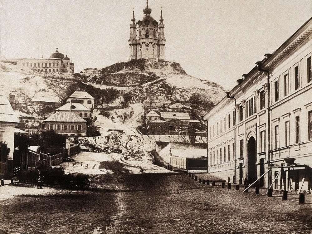
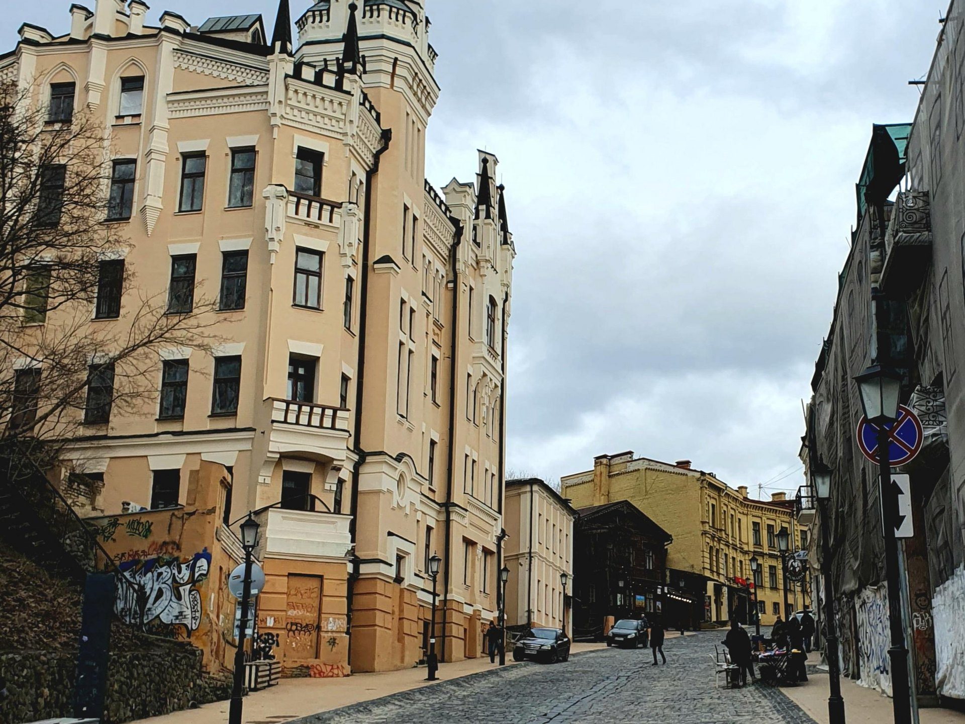
Andriivskyi UzvizSt Andrew's Church by Roger FentonOne of the earliest known photographs of Kyiv: St Andrew's Church above a snowy slope. British photographer Roger Fenton came here in 1852 to document the construction of Charles Vignoles' Chain Bridge. Rastrelli's church still stands, and the lane below it became Andriivskyi Uzviz. On the right, the view from Kontraktova Square in 2026: the slope below the church is now built up, and from Podil it rises above the rooftops.Archival photo: Роджер Фентон, 1852, Public domain · Wikimedia Commons
Modern photo: ОленаСугак, 2026, CC BY-SA 4.0 · Wikimedia Commons -
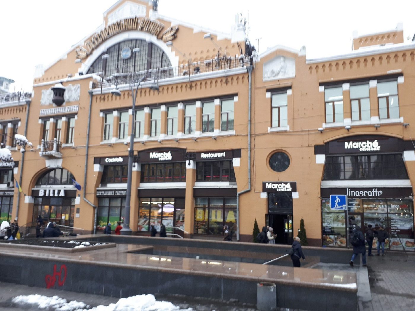
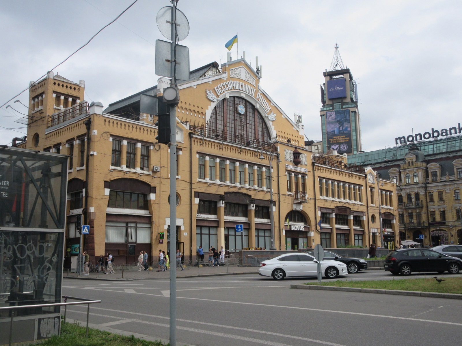
Bessarabska SquareBessarabka before the marketBessarabska Square in the 1860s: a vacant lot at the end of Khreshchatyk, with Krutyi Uzviz and the turn onto Kruhlouniversytetska Street lined with single-storey houses. Half a century later the Bessarabskyi covered market (1912) was built here, and the square became one of the busiest junctions in the city. On the right, the square in 2025 with the Bessarabskyi Market (1910–1912, architect Henryk Gay).Archival photo: невідомий автор, 1860–1870, Public domain · Wikimedia Commons
Modern photo: Віктор Полянко, 2025, CC BY-SA 4.0 · Wikimedia Commons -
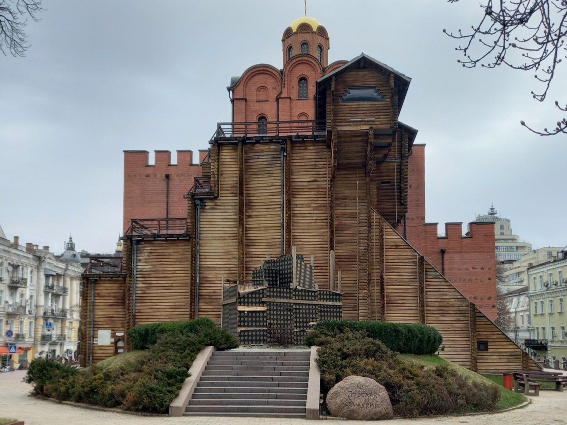
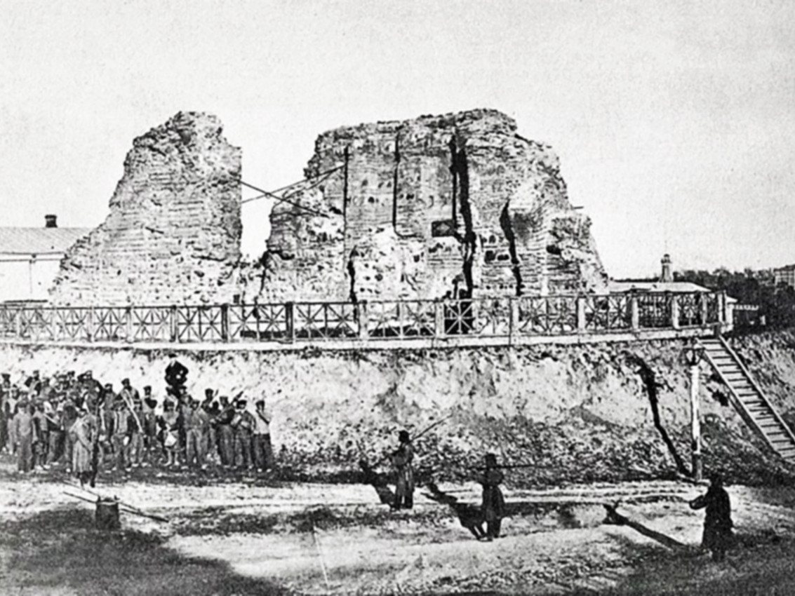
40-A Volodymyrska StreetRuins of the Golden GateThe ruins of the 11th-century Golden Gate: two masonry walls of the old passage on an earthen rampart behind a wooden fence, with a line of convicts drawn up nearby. The remains were cleared and buttressed in the 1830s, and in 1982 a museum pavilion was built over them, recreating the probable look of the gate tower with the Church of the Annunciation.Archival photo: невідомий автор, 1860-ті, CC BY 4.0 · Wikimedia Commons
Modern photo: Liliia2022, 2024, CC BY-SA 4.0 · Wikimedia Commons -
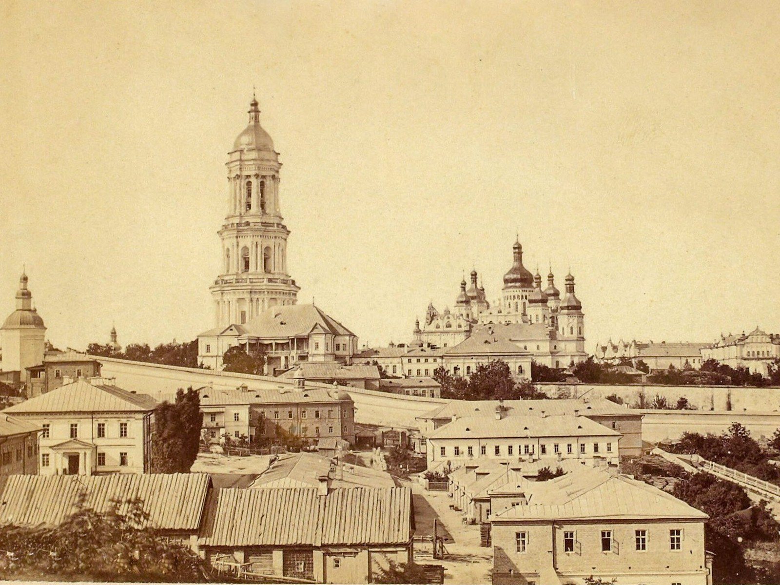
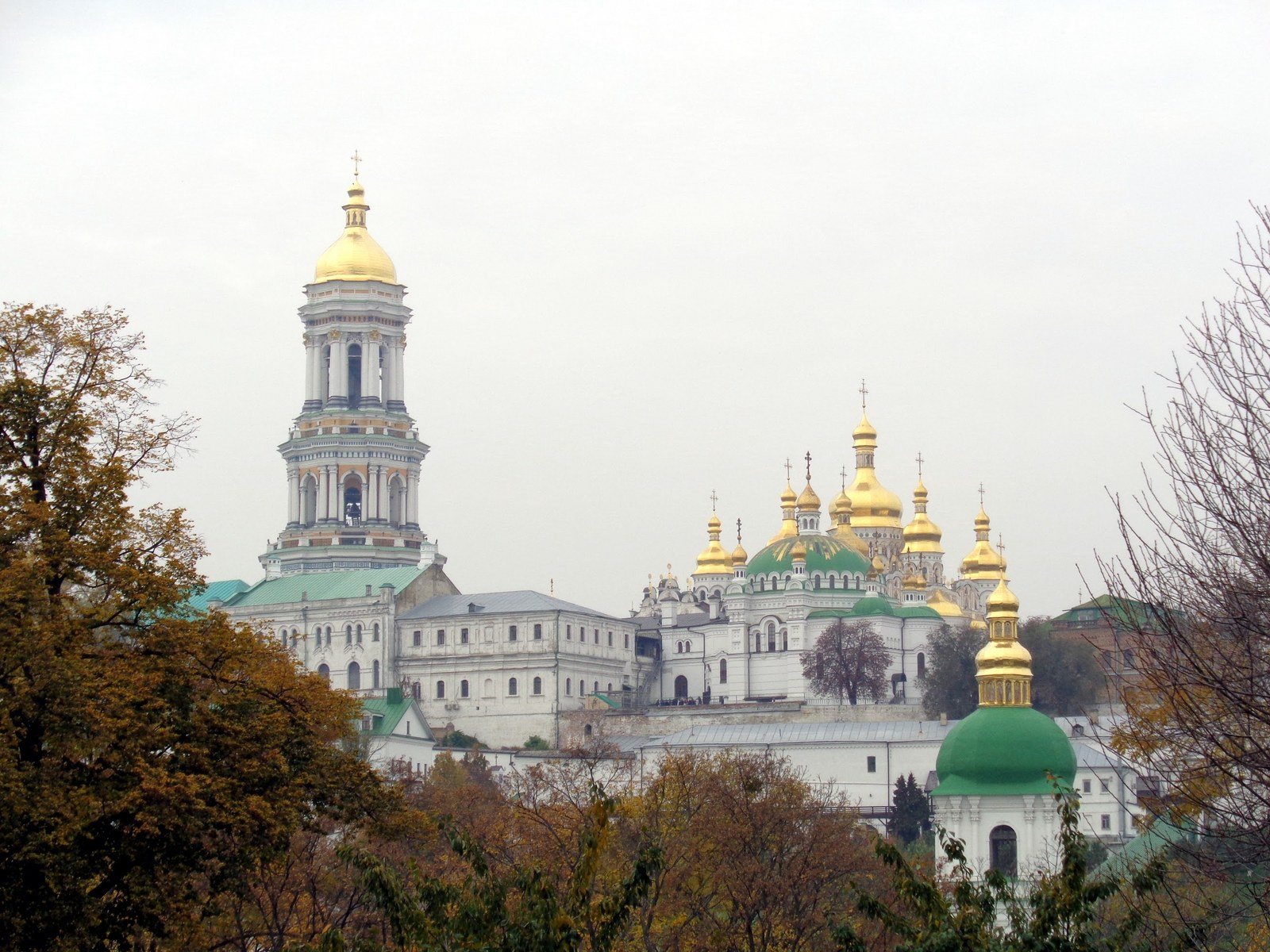
Lavrska Street, PecherskThe Lavra above PecherskThe Kyiv Pechersk Lavra photographed by Yosyp Kordysh: the Great Lavra Bell Tower, the Clock Tower and the domes of the Dormition Cathedral rise above the roofs of Pechersk. The cathedral was blown up on 3 November 1941 and rebuilt in 1998–2000. On the right, the Lavra in 2017: the rebuilt Dormition Cathedral again stands beside the bell tower, and trees have replaced the low Pechersk houses in the foreground.Archival photo: Йосип Кордиш, 1870–1890, Public domain · Wikimedia Commons
Modern photo: SnizhokAM, 2017, CC BY-SA 4.0 · Wikimedia Commons -
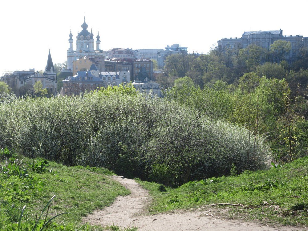
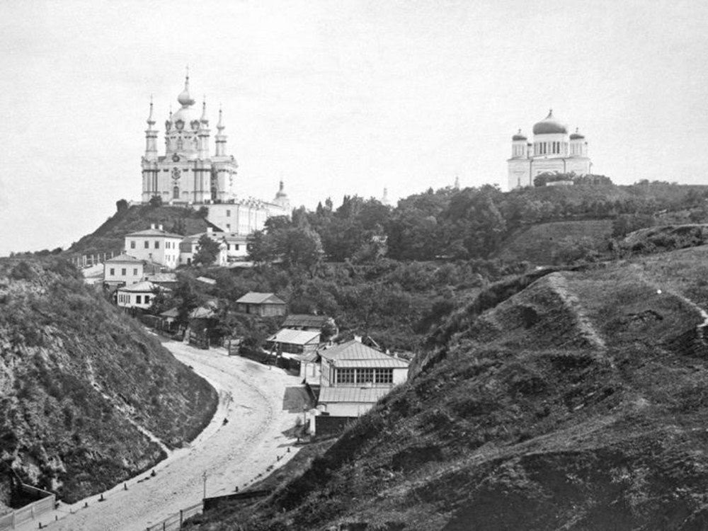
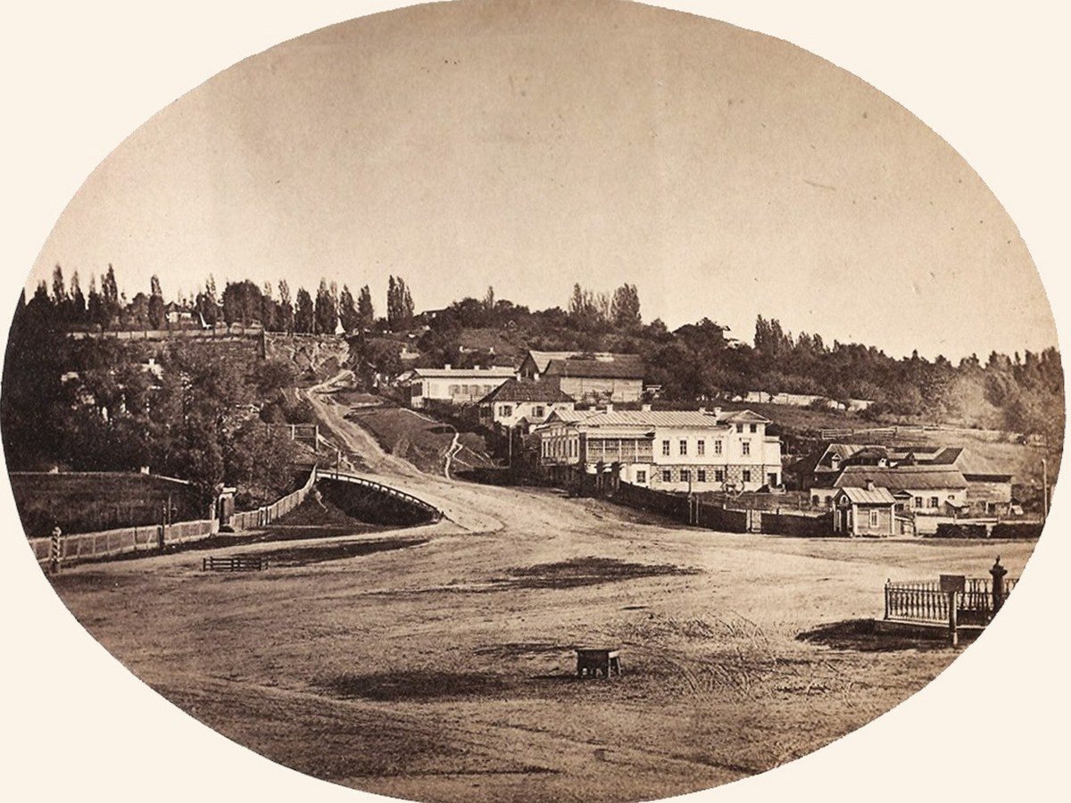
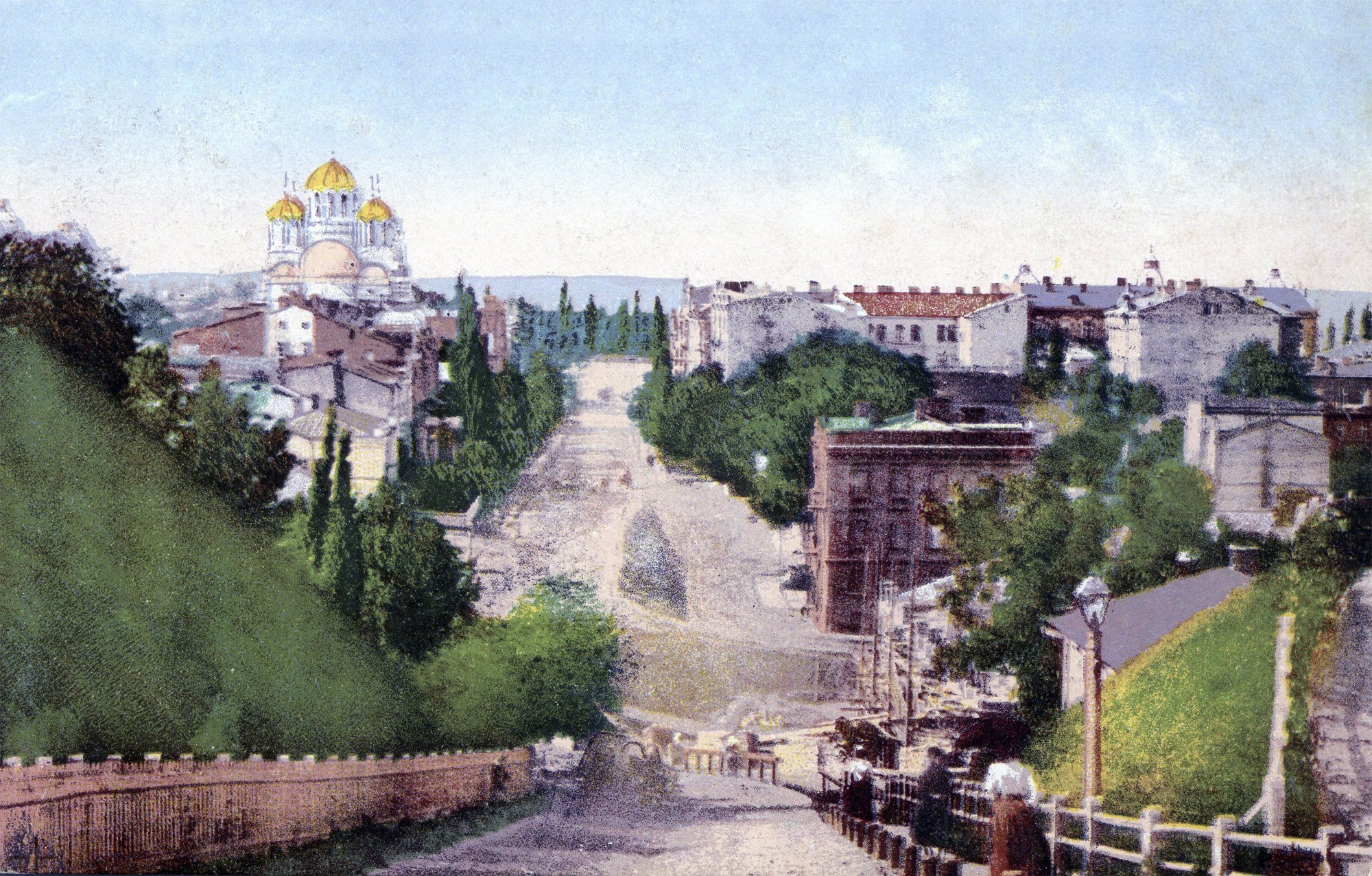
Andriivskyi Uzviz from Castle HillAndriivskyi Uzviz and the Church of the TithesAndriivskyi Uzviz in the 1870s: an unpaved road winds between the slopes of Andriivska and Castle Hills, with Rastrelli's St Andrew's Church above and Vasily Stasov's Church of the Tithes (1842) on the right. The Church of the Tithes was demolished in 1928; the National Museum of the History of Ukraine now stands beside its foundations, and from Castle Hill the descent itself is hidden by trees.Archival photo: невідомий автор, 1870-ті, Public domain · Wikimedia Commons
Modern photo: Віктор Полянко, 2024, CC BY-SA 4.0 · Wikimedia Commons -
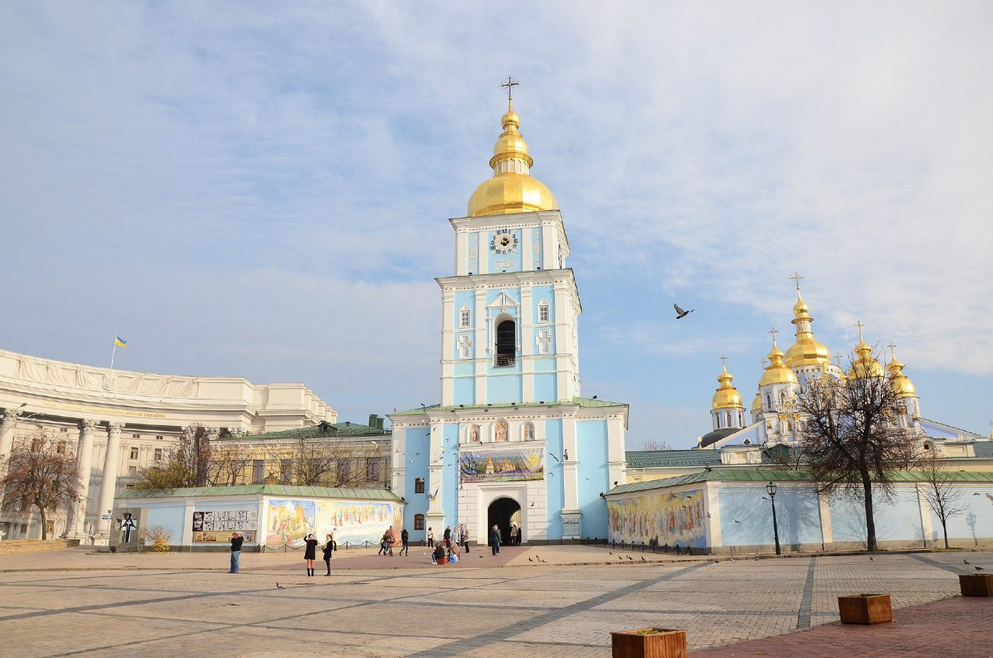
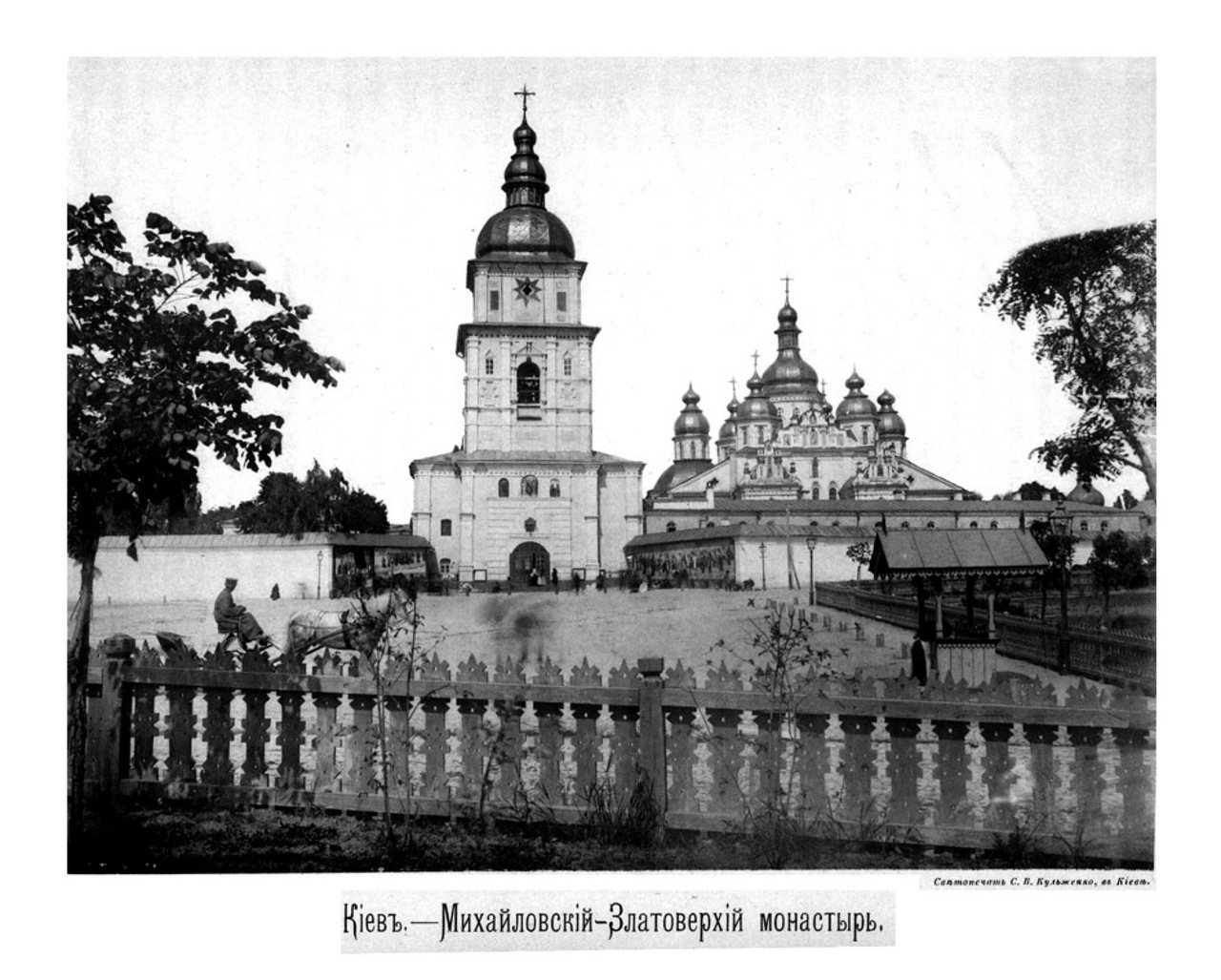
Mykhailivska SquareSt Michael's Golden-Domed before demolitionThe bell tower and cathedral of St Michael's Golden-Domed Monastery, photographed by Stefan Kulzhenko in 1888. The monastery was destroyed in the 1930s; the bell tower and cathedral were rebuilt in the late 1990s and early 2000s.Archival photo: С. В. Кульженко, 1888, Public domain · Wikimedia Commons
Modern photo: Andrey Butko, 2013, CC BY-SA 3.0 · Wikimedia Commons -
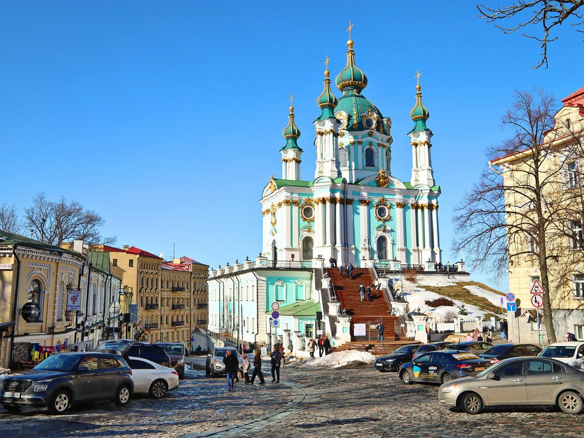
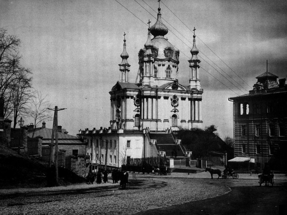
Andriivska Street / Andriivskyi UzvizSt Andrew's ChurchSt Andrew's Church, built in 1747–1762 to a design by Bartolomeo Rastrelli, in Stefan Kulzhenko's 1888 photograph. Cobbles, wooden poles and cabbies defined this part of town; today the church marks the top of Andriivskyi Uzviz, one of Kyiv's most visited streets.Archival photo: С. В. Кульженко, 1888, Public domain · Wikimedia Commons
Modern photo: Oleksandr Malyon, 2026, CC BY-SA 4.0 · Wikimedia Commons -
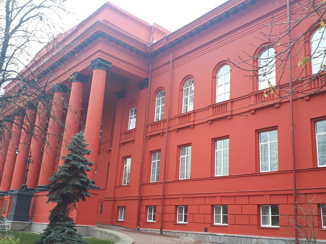
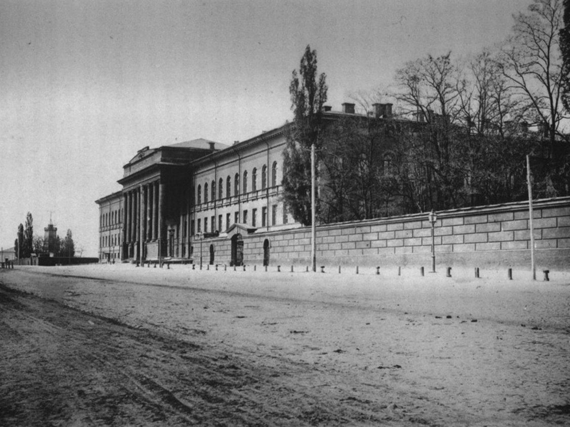
60 Volodymyrska StreetSt Volodymyr UniversityThe main building of St Volodymyr University (architect Vikentii Beretti, 1837–1843), seen from Volodymyrska Street in 1888, when the street was still unpaved and a high wall ran along the building. Today it is the Red Building of Taras Shevchenko National University of Kyiv.Archival photo: С. В. Кульженко, 1888, Public domain · Wikimedia Commons
Modern photo: Olga Loboda 0806, 2019, CC BY-SA 4.0 · Wikimedia Commons -
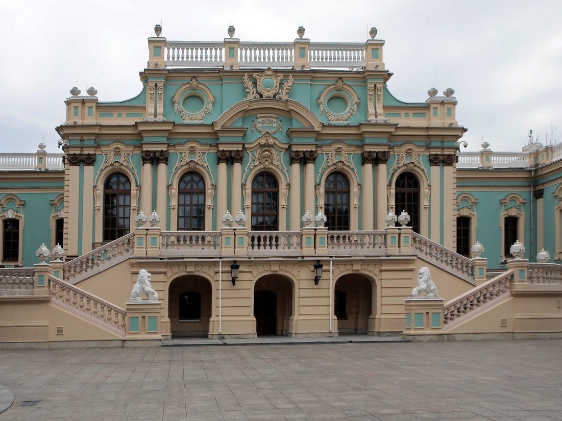
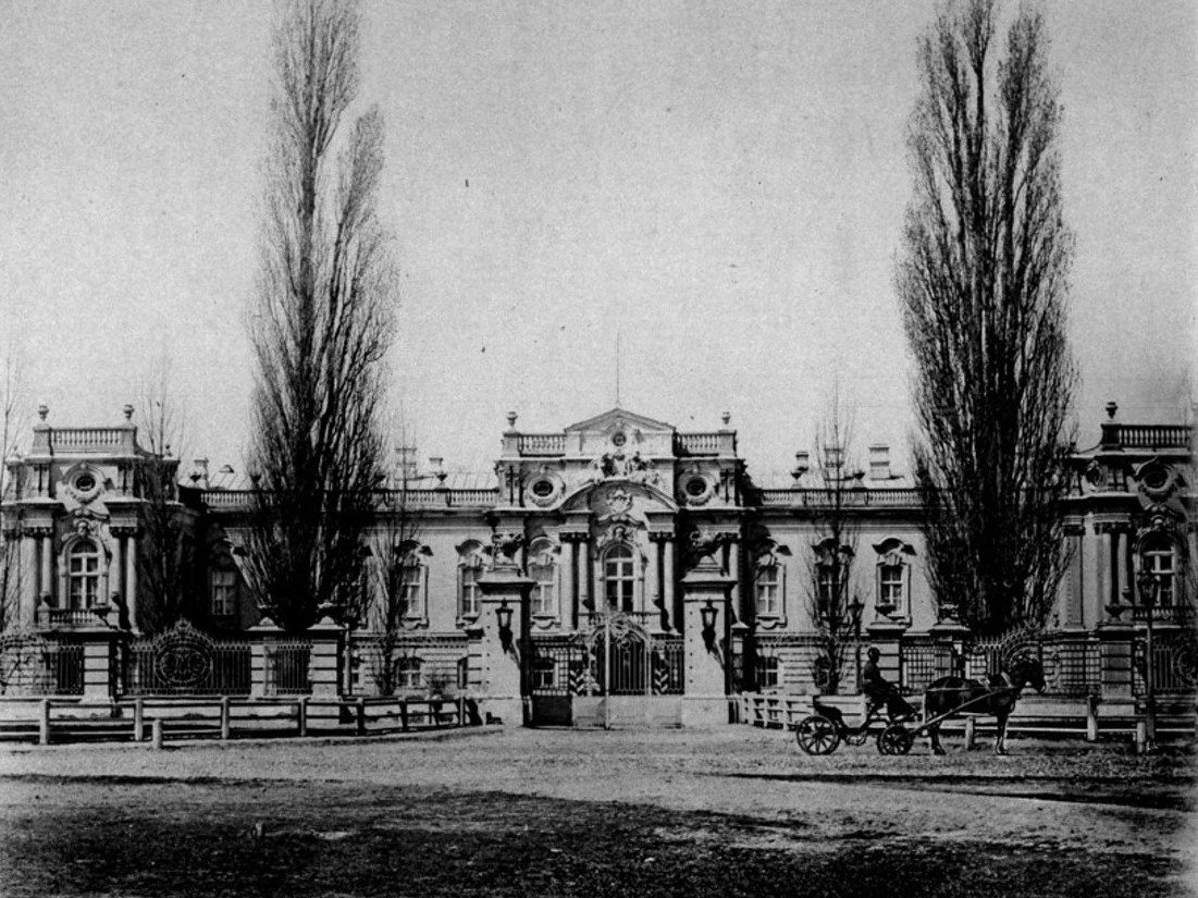
5a Mykhaila Hrushevskoho StreetThe Tsar's PalaceThe Tsar's (Mariinskyi) Palace, built in the 1740s–1750s to a design by Bartolomeo Rastrelli and restored in 1870 after a fire, photographed by Stefan Kulzhenko in 1888. It was named Mariinskyi after Empress Maria Alexandrovna. Today it is the ceremonial residence of the President of Ukraine.Archival photo: С. В. Кульженко, 1888, Public domain · Wikimedia Commons
Modern photo: Волтарс, 2025, CC BY-SA 4.0 · Wikimedia Commons -
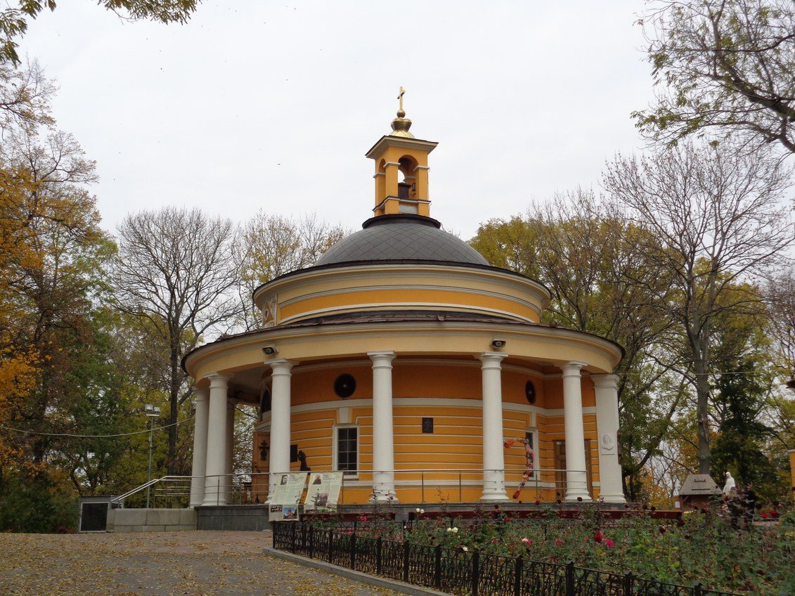
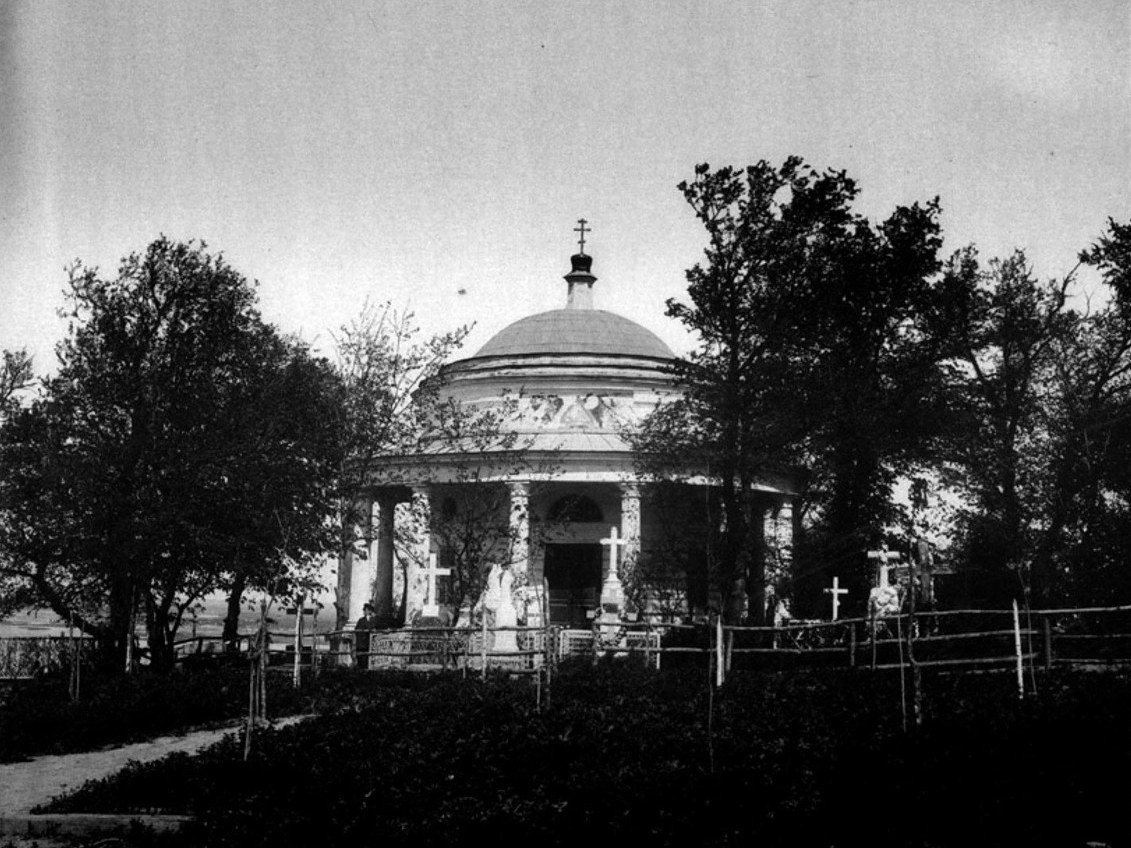
Askold's Grave ParkAskold's GraveThe rotunda church of St Nicholas at Askold's Grave (architect Andrii Melenskyi, 1810) among the crosses of the cemetery that existed here until the 1930s. In Soviet times the rotunda served as a pavilion; since the 1990s it has again been a church.Archival photo: С. В. Кульженко, 1888, Public domain · Wikimedia Commons
Modern photo: SnizhokAM, 2017, CC BY-SA 4.0 · Wikimedia Commons -
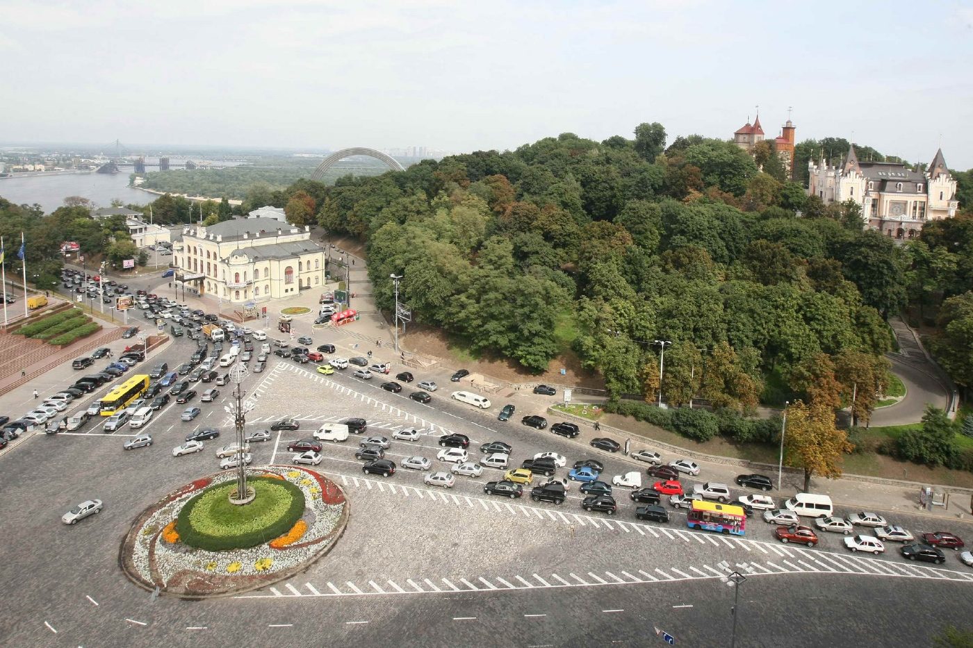
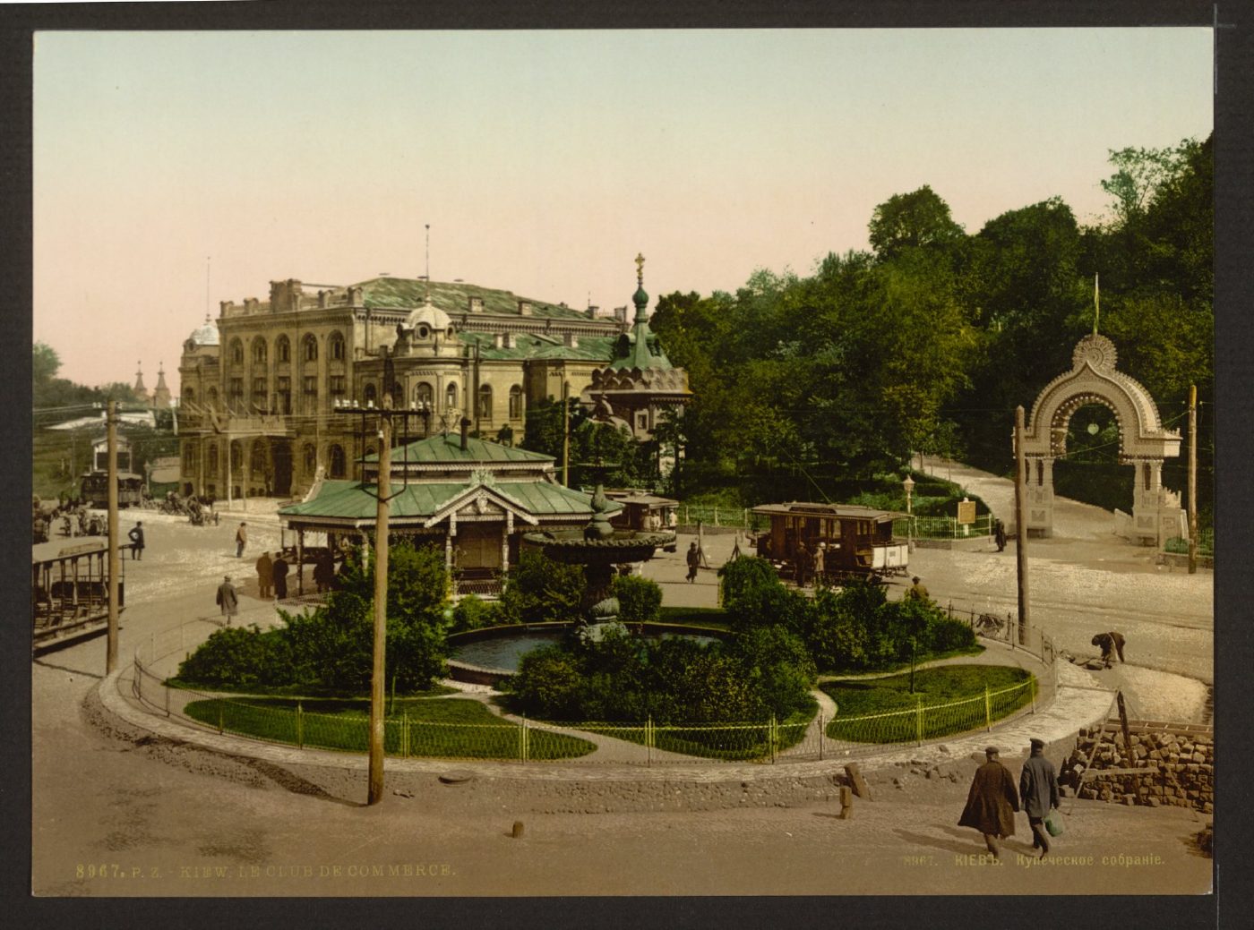
European Square, 2 Volodymyrskyi UzvizMerchants' Assembly and Tsarska SquareThe Merchants' Assembly building (now the National Philharmonic) and the entrance arch of the Merchants' Garden on an 1890s photochrom. Today this is European Square with a roundabout, and the hillside park is part of Volodymyrska Hill.Archival photo: невідомий автор, бл. 1890–1900, Public domain · Wikimedia Commons
Modern photo: Волтарс, 2009, CC BY-SA 4.0 · Wikimedia Commons -
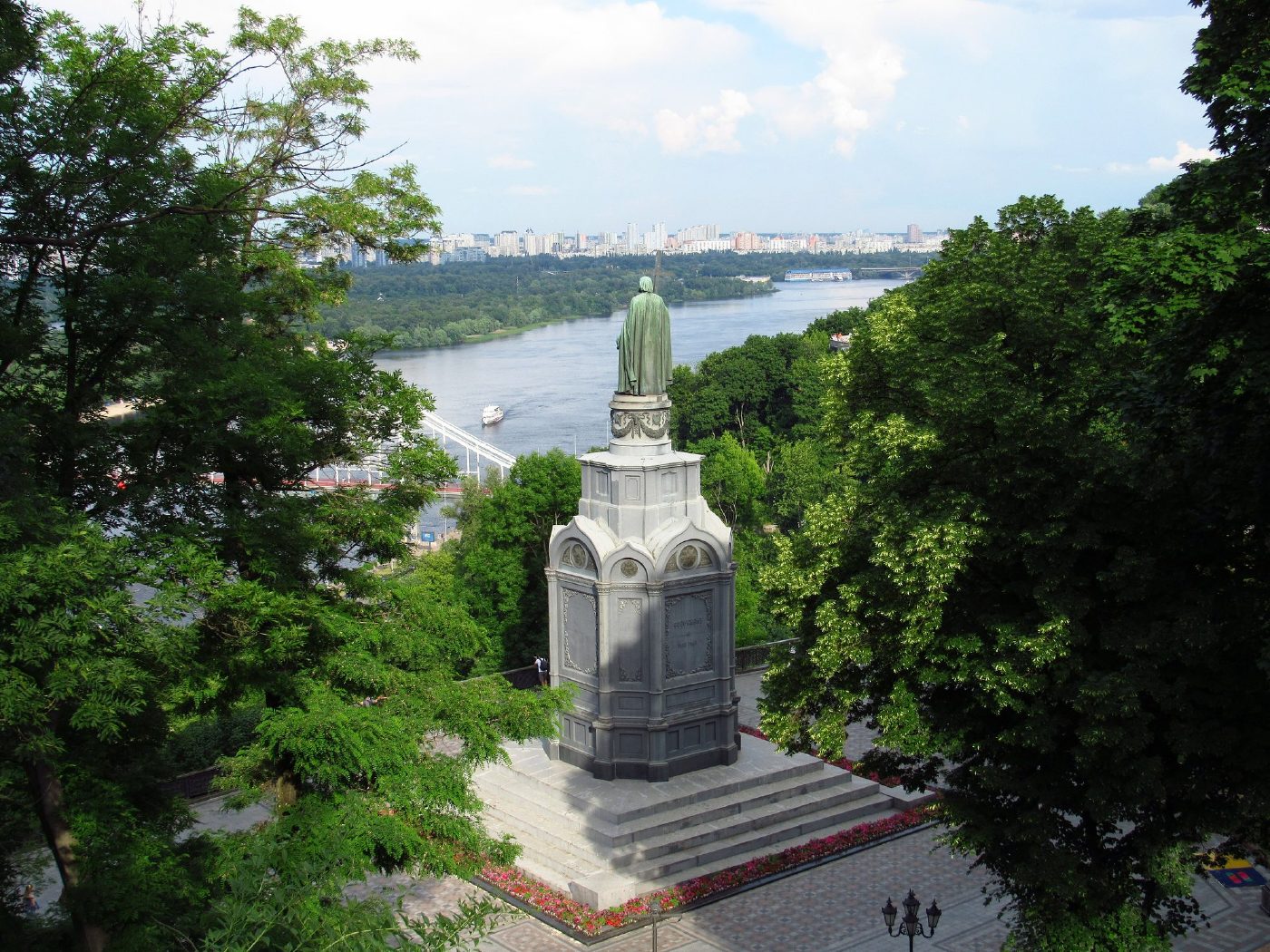
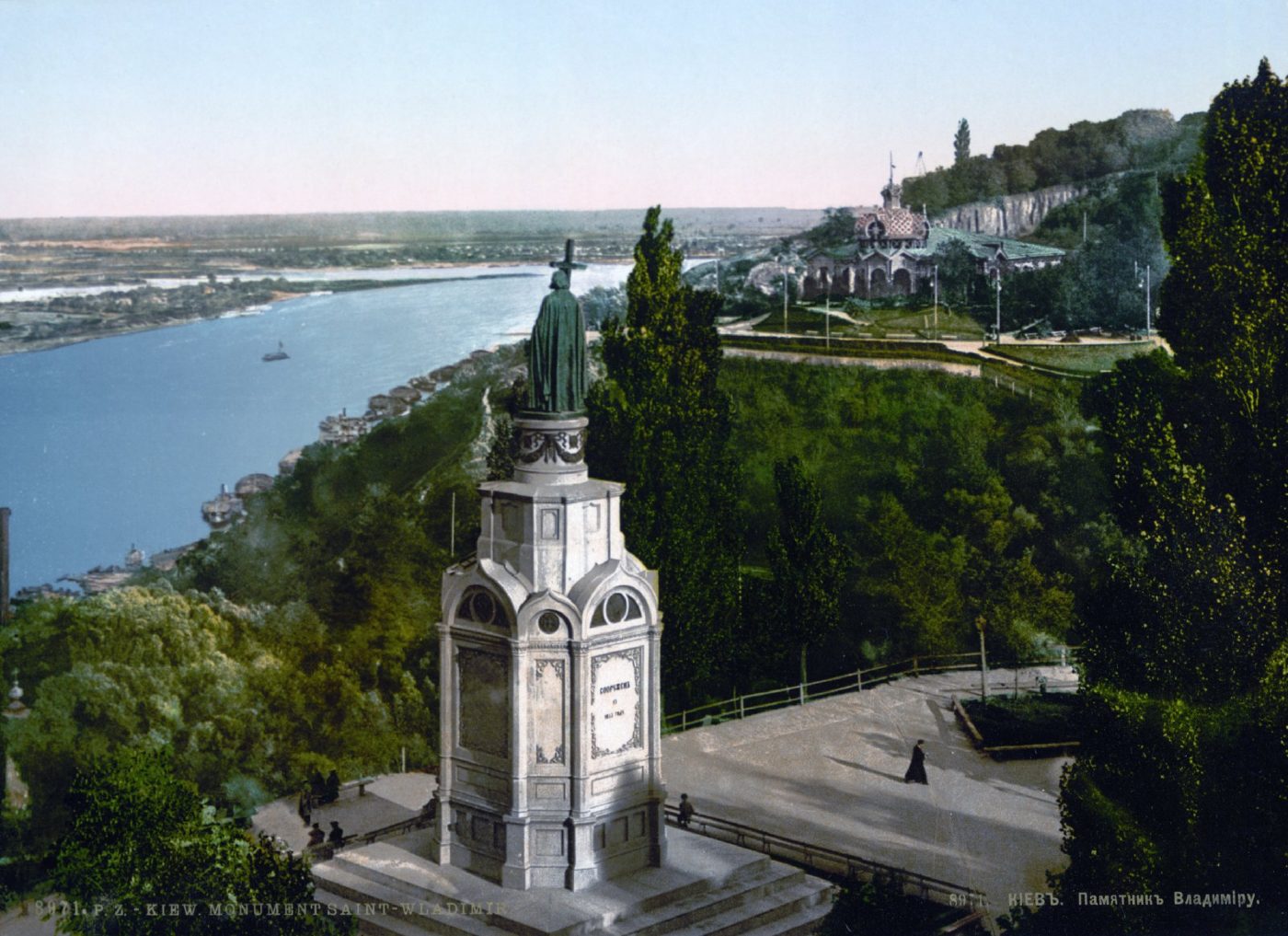
Volodymyrska HillVolodymyr Monument above the DniproThe monument to Prince Volodymyr (1853) on Volodymyrska Hill overlooking the Dnipro, on an 1890s photochrom. The monument still stands in the same place; high-rise districts are now visible on the Dnipro's left bank.Archival photo: невідомий автор, бл. 1890–1905, Public domain · Wikimedia Commons
Modern photo: Константинъ, 2021, CC BY-SA 4.0 · Wikimedia Commons -
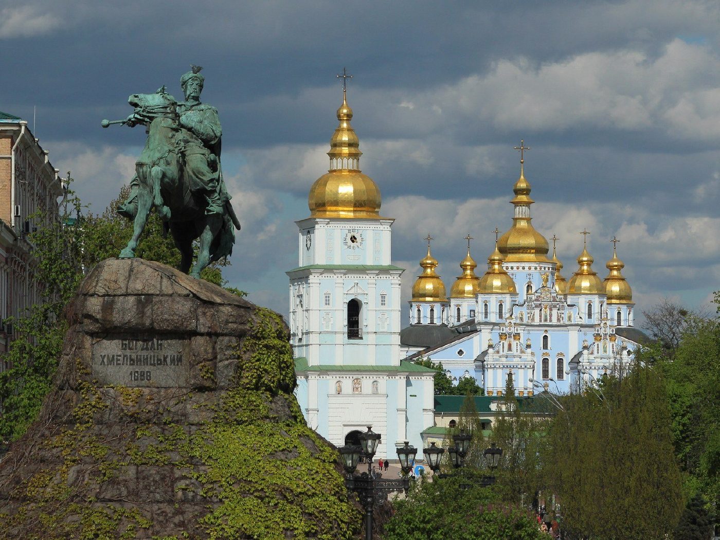
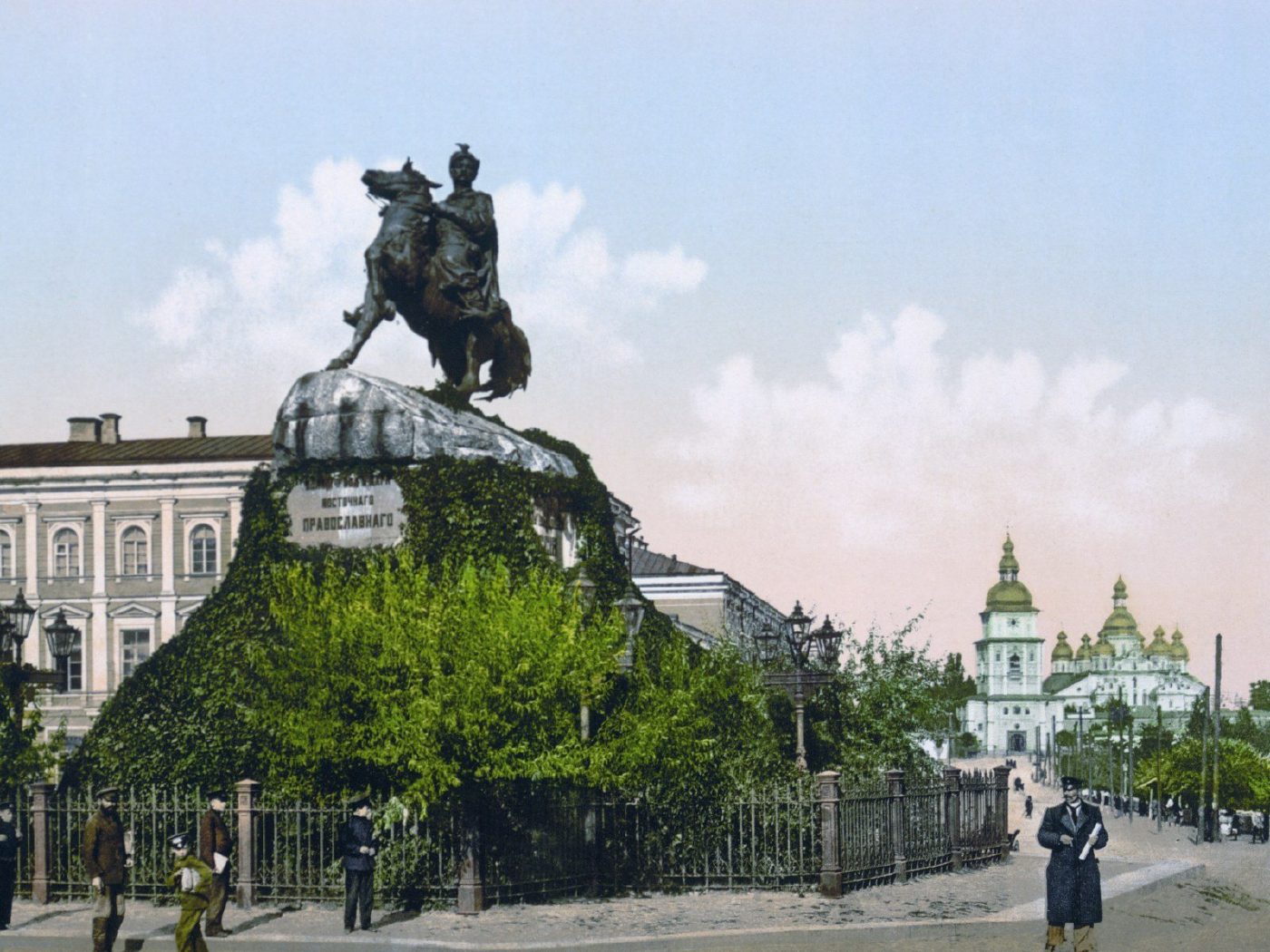
Sofiiska SquareBohdan Khmelnytsky MonumentMikhail Mikeshin's monument to Bohdan Khmelnytsky, unveiled in 1888, in an 1890s photochrom. In the background on the right is St Michael's Golden-Domed Cathedral, destroyed in the 1930s and rebuilt in the 1990s. The monument remains one of the symbols of Kyiv.Archival photo: невідомий автор, бл. 1890–1905, Public domain · Wikimedia Commons
Modern photo: Didkov, 2021, CC BY-SA 4.0 · Wikimedia Commons -
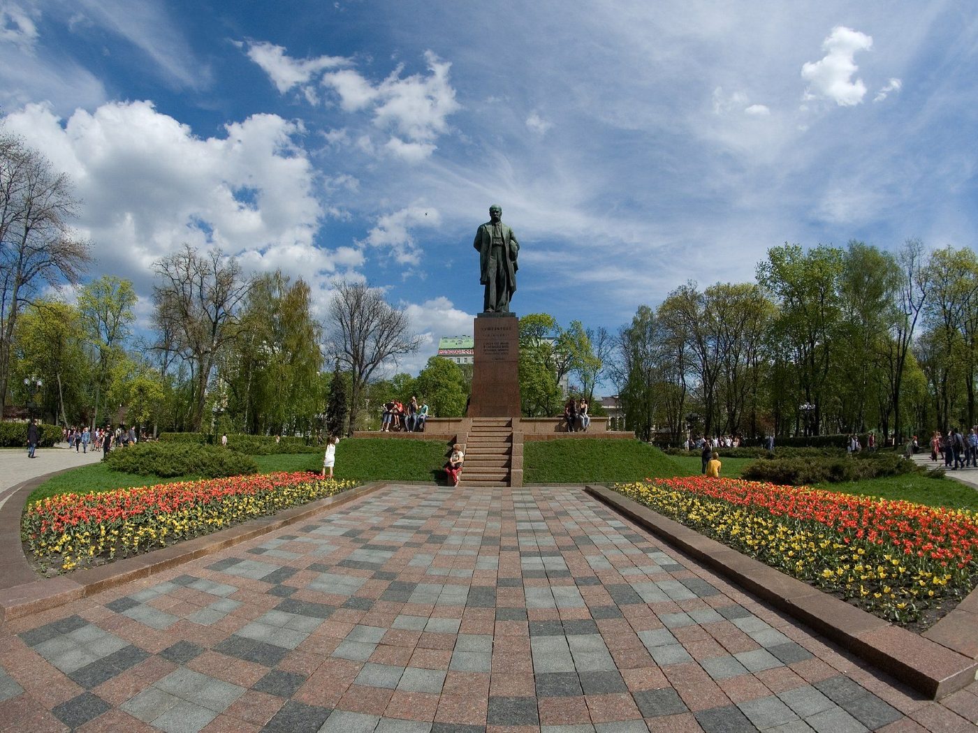
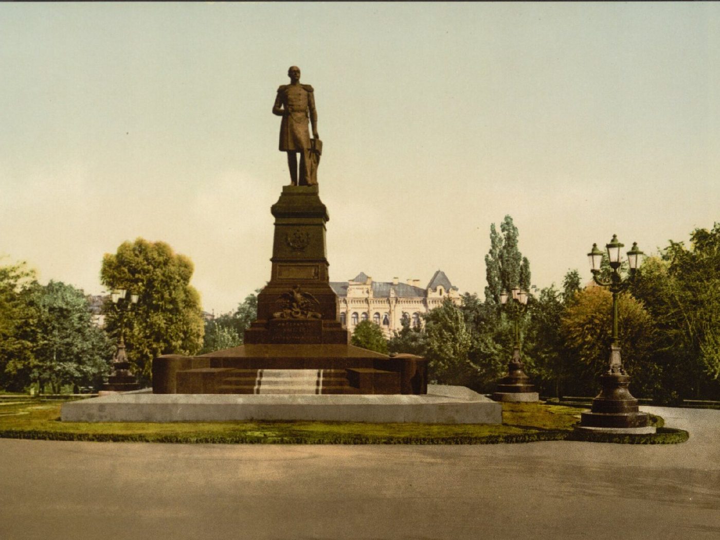
Shevchenko ParkMonument to Nicholas IThe monument to Emperor Nicholas I opposite St Volodymyr University, unveiled in 1896. It was dismantled in 1920, and in 1939 a monument to Taras Shevchenko was erected on the same spot in the square, now Shevchenko Park.Archival photo: невідомий автор LCCN 2001697435, бл. 1896–1900, Public domain · Wikimedia Commons
Modern photo: SergKh78, 2016, CC BY-SA 4.0 · Wikimedia Commons -
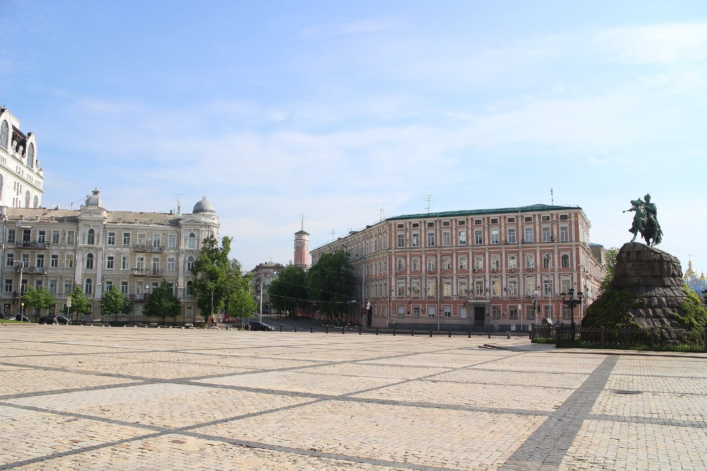
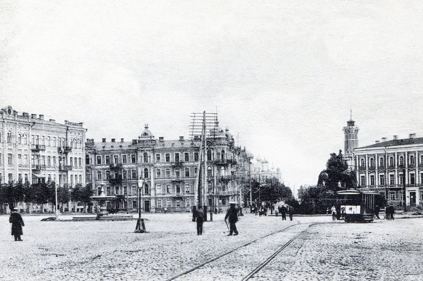
Sofiiska SquareSofiiska SquareSofiiska Square on a 1900s postcard, with the Bohdan Khmelnytsky monument on the right and tram tracks across the square. The monument still stands in the same place; the square is now paved and the tracks are gone.Archival photo: невідомий автор, 1900-ті, Public domain · Wikimedia Commons
Modern photo: Suicasmo, 2019, CC BY-SA 4.0 · Wikimedia Commons -
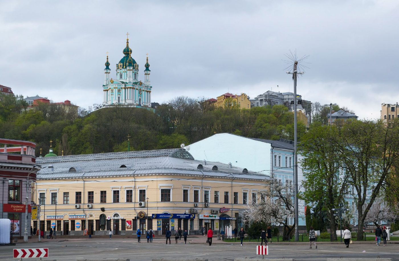
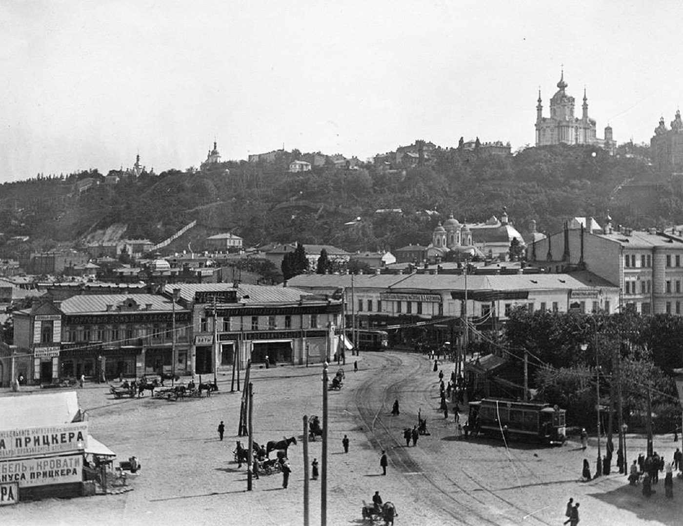
Kontraktova Square, PodilKontraktova SquareKontraktova Square in Podil in the early 20th century, with a tram, horse cabs, shops and St Andrew's Church on the hill. In the modern photo St Andrew's Church rises above the Hostynnyi Dvir arcade.Archival photo: невідомий автор, 1900-ті, Public domain · Wikimedia Commons
Modern photo: Lystopad, 2018, CC BY-SA 4.0 · Wikimedia Commons -
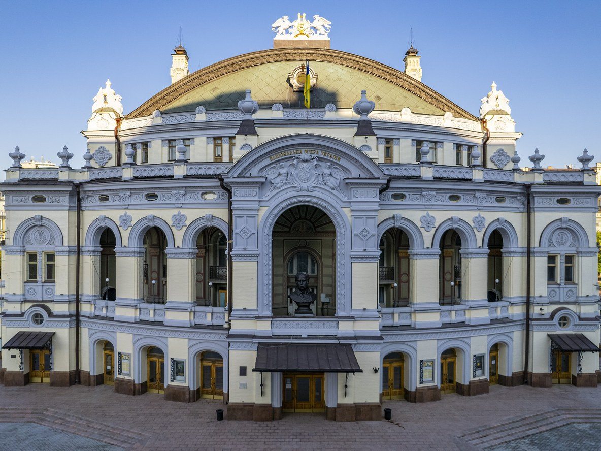
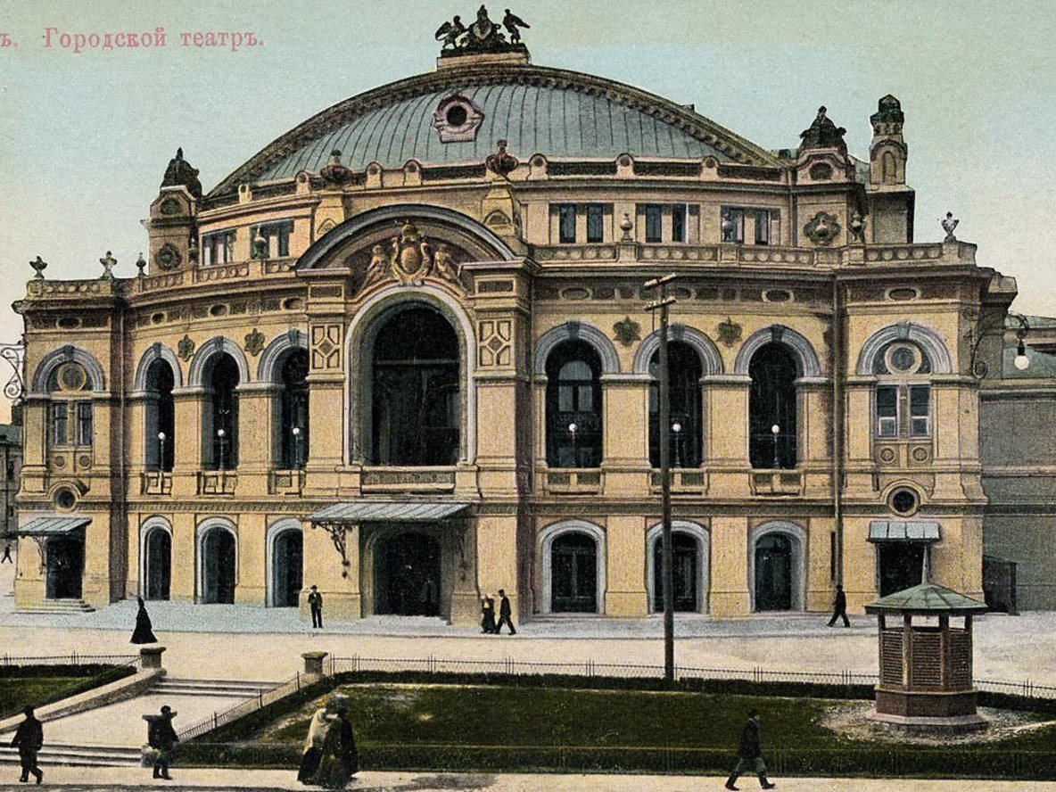
50 Volodymyrska StreetThe City TheatreThe City Theatre, built in 1897–1901 to a design by Viktor Schröter on the site of the old theatre that burned down in 1896. This postcard by the Swedish publisher Granbergs shows the building when it was still new. Today it houses the National Opera of Ukraine.Archival photo: невідомий автор, поч. 1900-х, Public domain · Wikimedia Commons
Modern photo: KyivMax, 2021, CC BY-SA 4.0 · Wikimedia Commons -
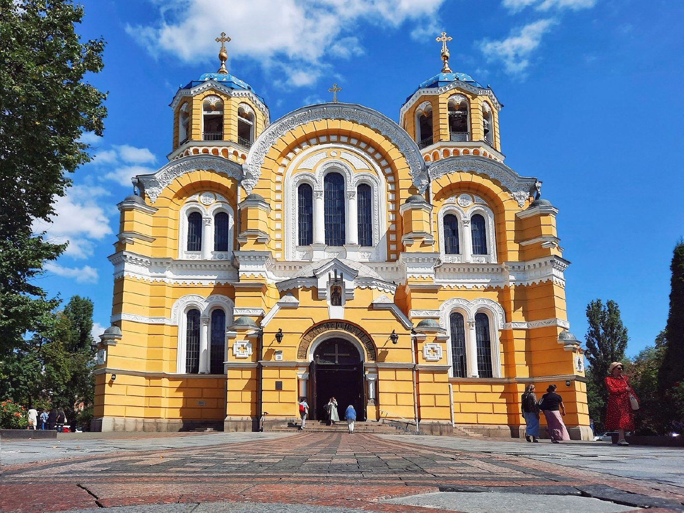
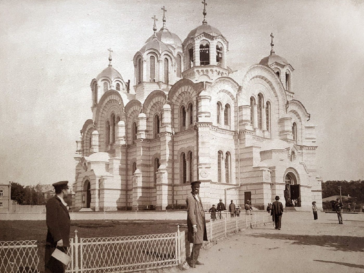
20 Tarasa Shevchenka BoulevardSt Volodymyr's CathedralSt Volodymyr's Cathedral (built 1862–1882, consecrated 1896) soon after the completion of its murals by Viktor Vasnetsov, Mikhail Nesterov and Mikhail Vrubel. In front is a low fence and an empty forecourt; today Tarasa Shevchenka Boulevard runs past with its traffic.Archival photo: невідомий автор, 1895–1910, Public domain · Wikimedia Commons
Modern photo: Taras Zolotavin, 2023, CC BY-SA 4.0 · Wikimedia Commons -
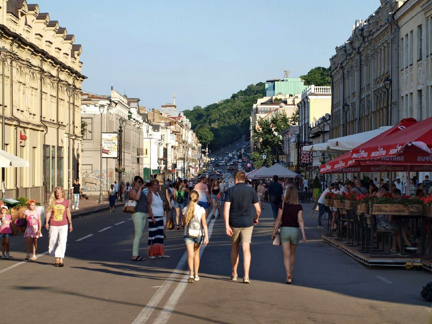
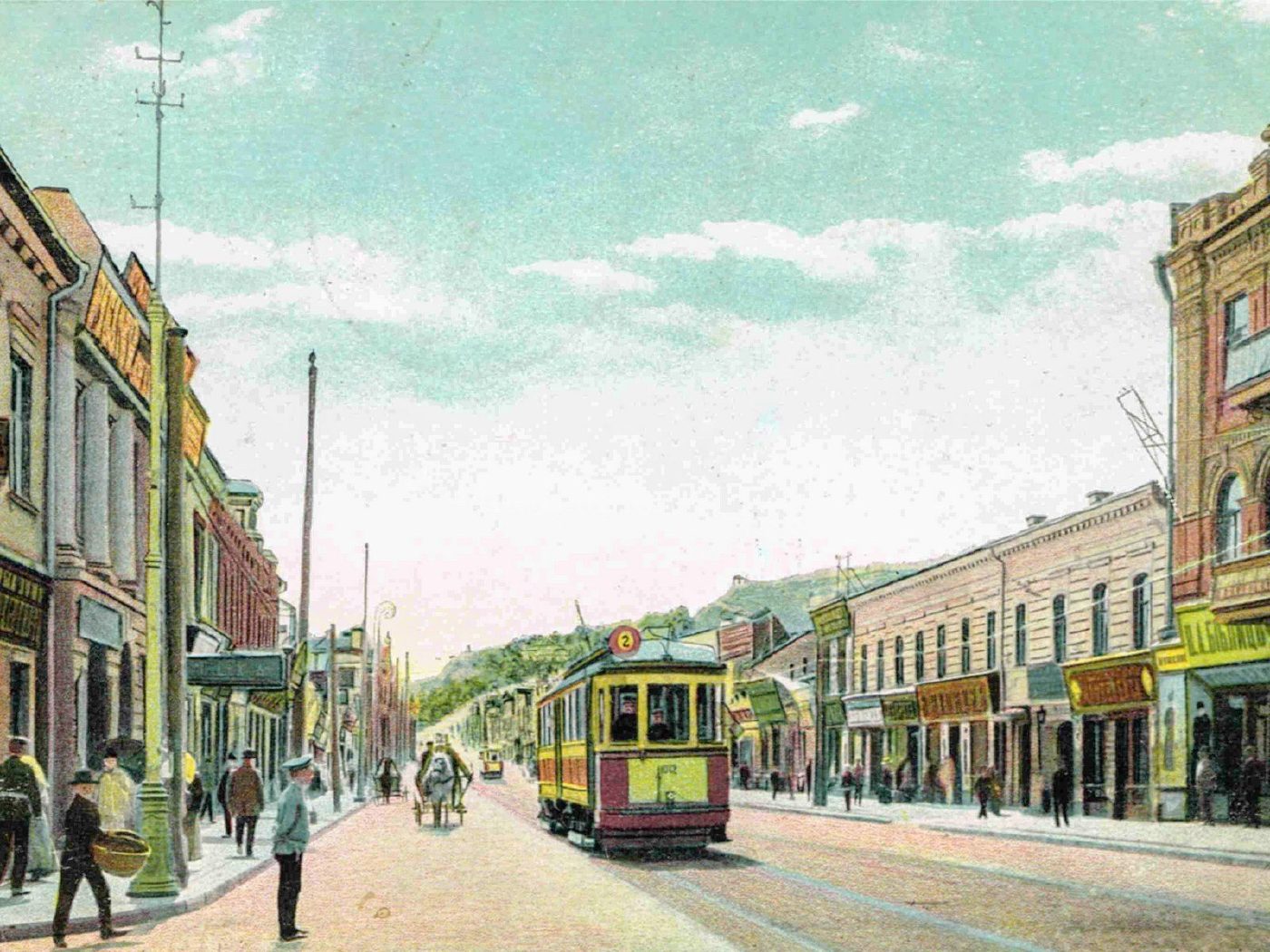
Petra Sahaidachnoho Street, PodilA tram on Oleksandrivska StreetPodil's Oleksandrivska Street (now Petra Sahaidachnoho Street) on a 1905 postcard: a tram, shop signs, No. 20/2 on the left and No. 37 on the right. It is still Podil's main shopping street, although trams no longer run along it.Archival photo: невідомий автор, 1905, Public domain · Wikimedia Commons
Modern photo: Mitte27, 2019, CC BY-SA 4.0 · Wikimedia Commons -
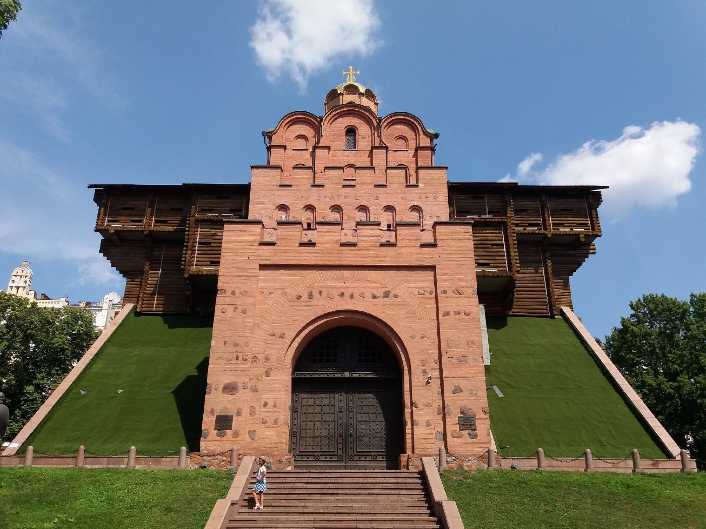
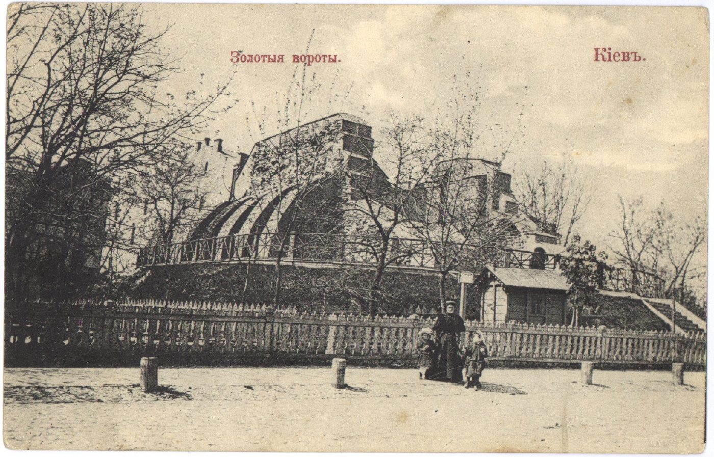
40-A Volodymyrska StreetGolden Gate before reconstructionThe ruins of the 11th-century Golden Gate behind a fence, on a 1910 postcard. In 1982 a pavilion recreating the look of the old gate was built over the ruins.Archival photo: невідомий видавець, 1910, Public domain · Wikimedia Commons
Modern photo: Kon v ant, 2019, CC BY-SA 4.0 · Wikimedia Commons -
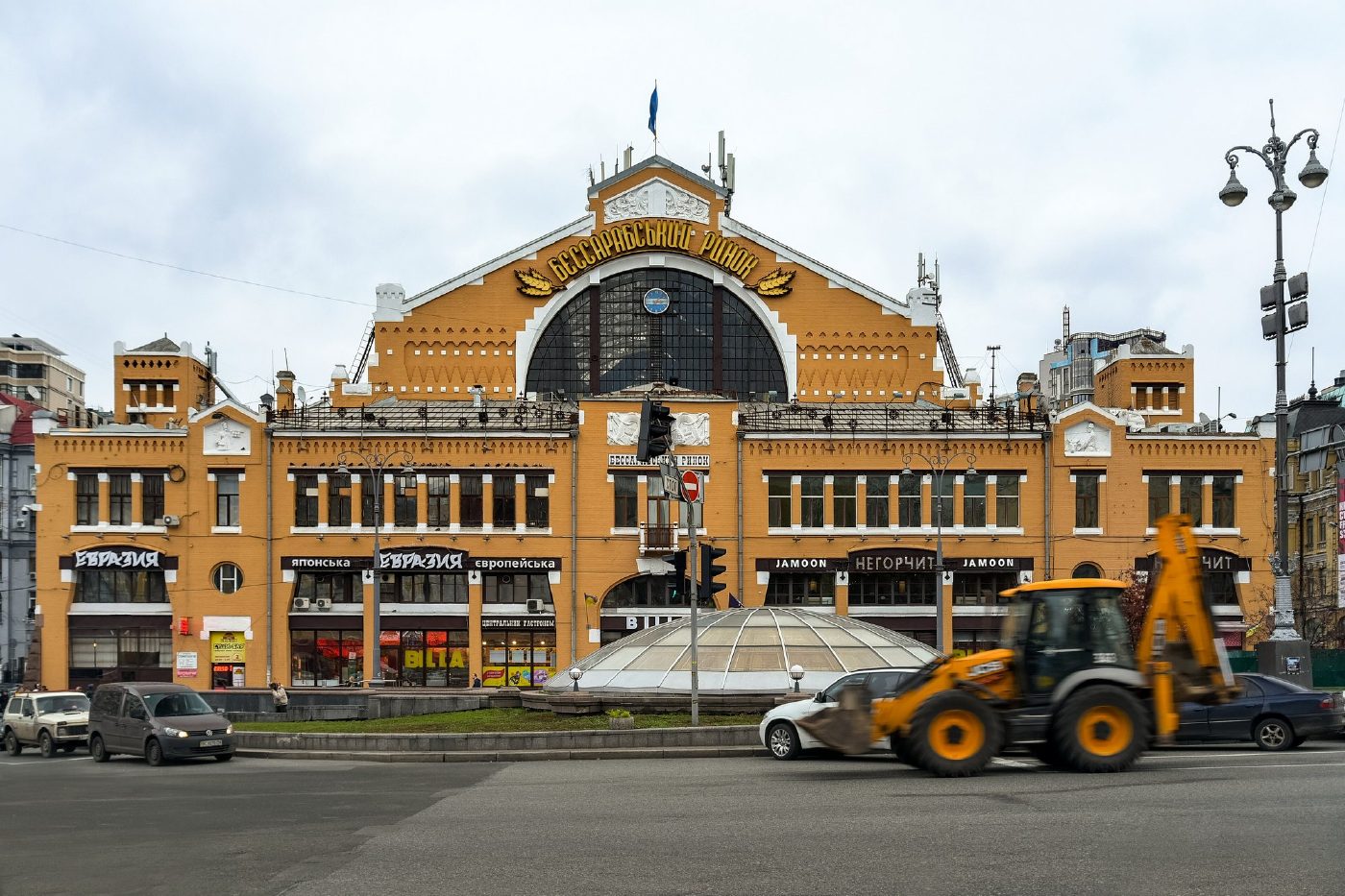
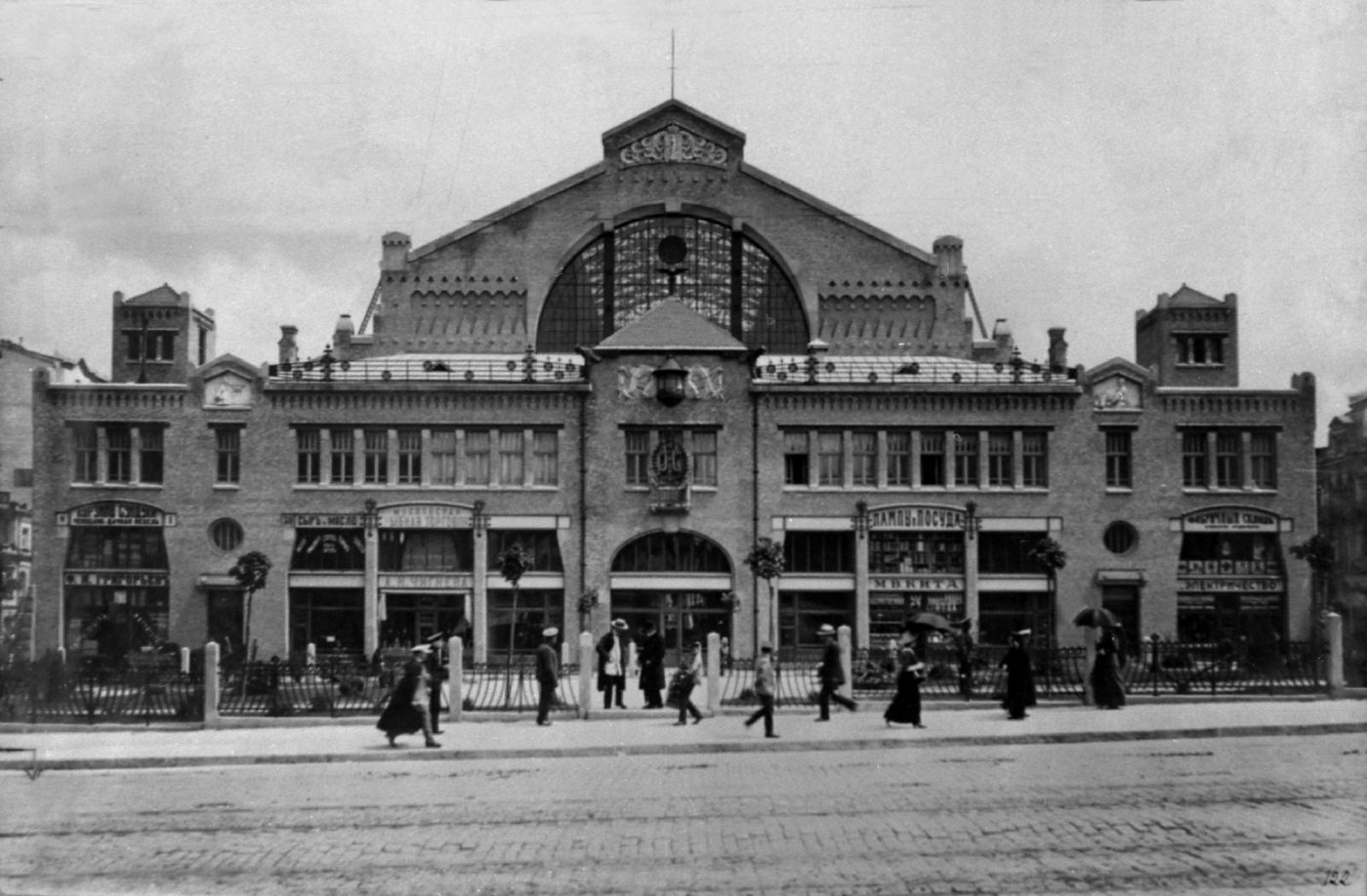
2 Bessarabska SquareBessarabskyi Covered MarketThe Bessarabskyi covered market, photographed before 1917. The building survives, and the square in front of it is now a busy junction at the start of Khreshchatyk.Archival photo: невідомий автор, до 1917, Public domain · Wikimedia Commons
Modern photo: Jorge Franganillo, 2017, CC BY 2.0 · Wikimedia Commons -
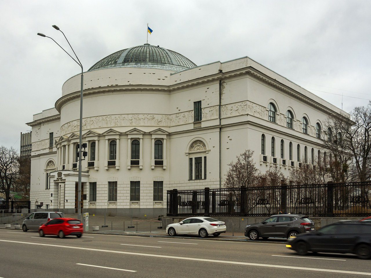
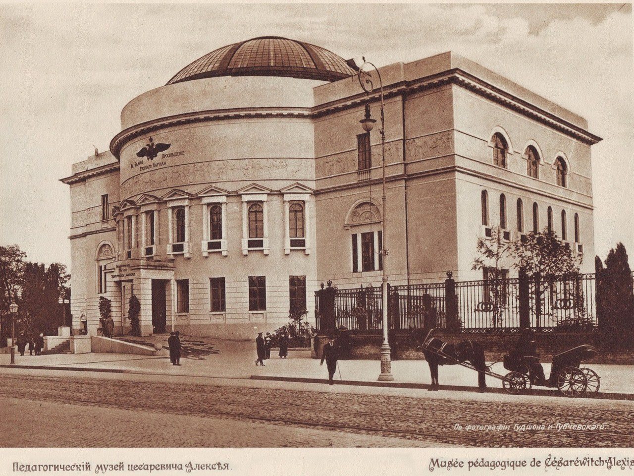
57 Volodymyrska StreetThe Pedagogical MuseumThe Tsarevich Alexei Pedagogical Museum (1909–1911, architect Pavlo Aloshyn) in its opening year. In 1917–1918 it was the seat of the Ukrainian Central Rada, which proclaimed the Ukrainian People's Republic. Today it is the Teacher's House, with a museum of the Ukrainian Revolution.Archival photo: Гудшон і Губчевський, 1911, Public domain · Wikimedia Commons
Modern photo: Сергій Венцеславський, 2021, CC BY-SA 4.0 · Wikimedia Commons -
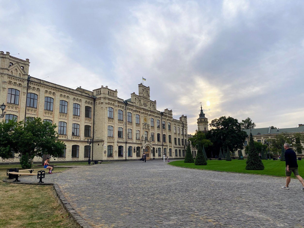
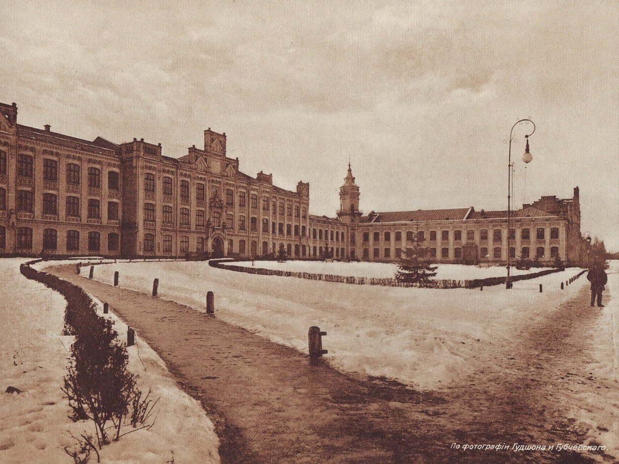
37 Beresteiskyi AvenueThe Polytechnic InstituteThe main building of the Emperor Alexander II Kyiv Polytechnic Institute, founded in 1898, in winter 1911. It then stood among fields on the edge of town; today it is the Igor Sikorsky Kyiv Polytechnic Institute, one of Ukraine's largest technical universities.Archival photo: Гудшон і Губчевський, 1911, Public domain · Wikimedia Commons
Modern photo: Мандрівниця, 2024, CC BY-SA 4.0 · Wikimedia Commons -
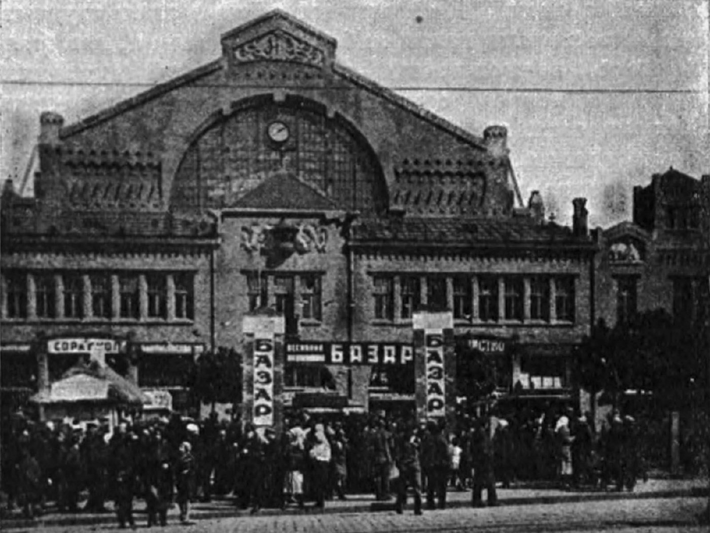
2 Bessarabska SquareBessarabka in the NEP yearsCrowds outside the Bessarabskyi covered market in the mid-1920s: "Bazaar" signs and street trading, as private commerce briefly revived under the New Economic Policy. N. Shevchenko's photograph was published in Sovetskoe Foto magazine in 1927. The market is still open today.Archival photo: М. Шевченко, 1925–1927, ліцензія не вказана · pastvu.com
Modern photo: Olga Loboda 0806, 2018, CC BY-SA 4.0 · Wikimedia Commons -
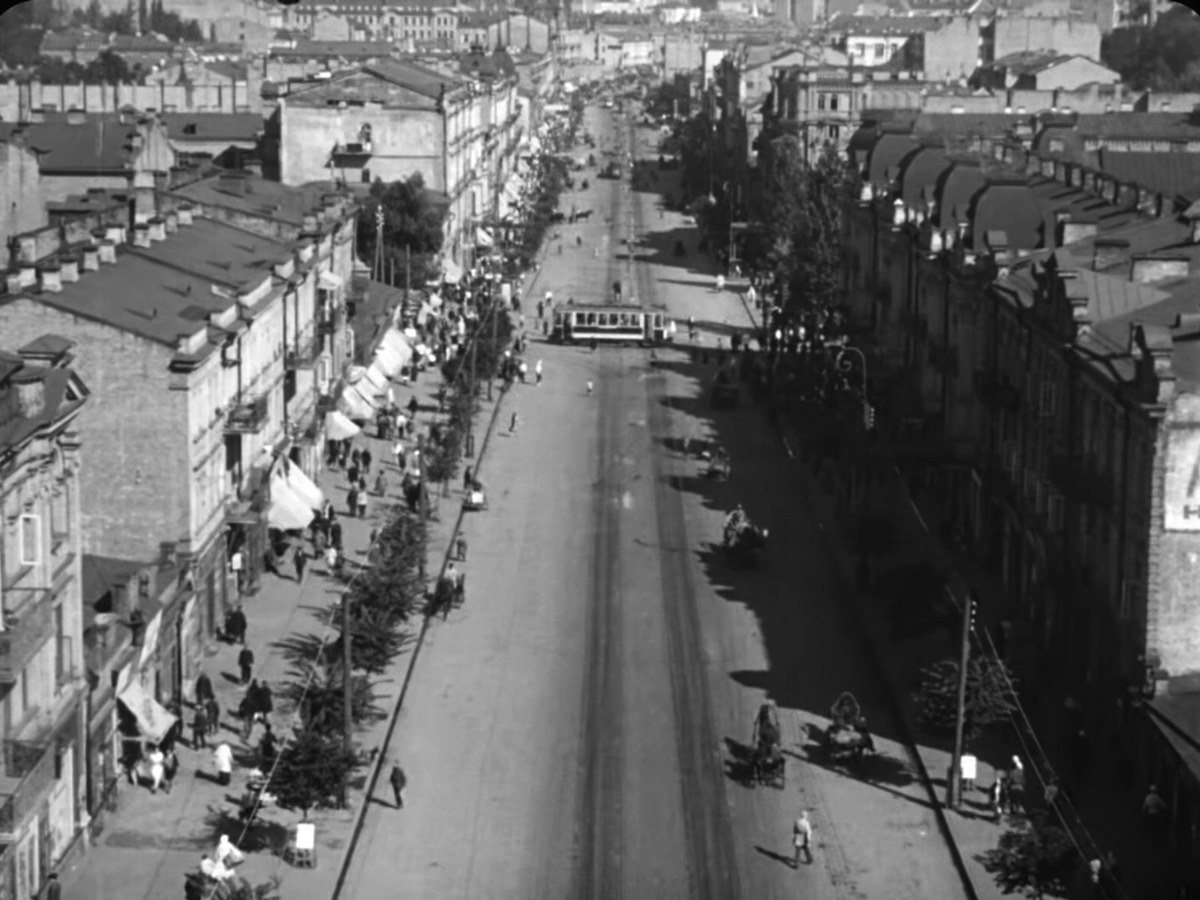
Khreshchatyk / Tarasa Shevchenka BoulevardKhreshchatyk in Man with a Movie CameraA tram crosses Khreshchatyk from Shevchenko Boulevard, a frame from Dziga Vertov's celebrated film Man with a Movie Camera, largely shot in Kyiv at the VUFKU studio. The view from above shows the pre-war Khreshchatyk that no longer exists. On the right, Khreshchatyk from above in 2021: most of the street was blown up and burned in autumn 1941, and after the war it was rebuilt much wider.Archival photo: Михайло Кауфман, 1928, Public domain · pastvu.com
Modern photo: Київська міська рада, 2021, CC BY 4.0 · Wikimedia Commons -
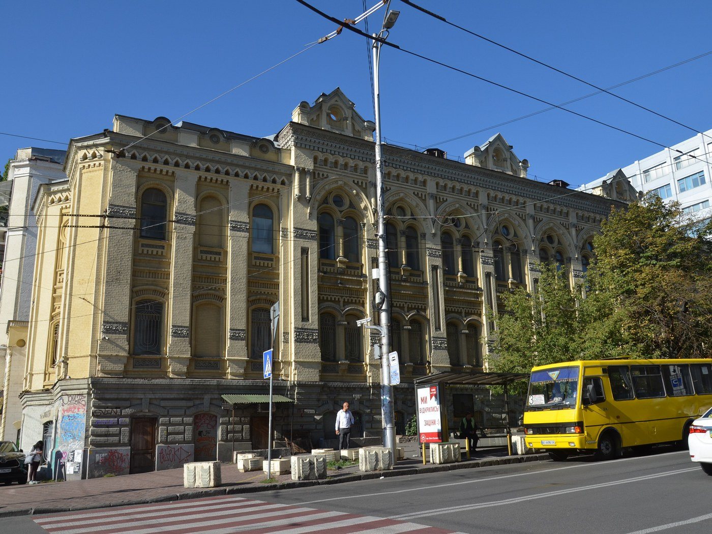
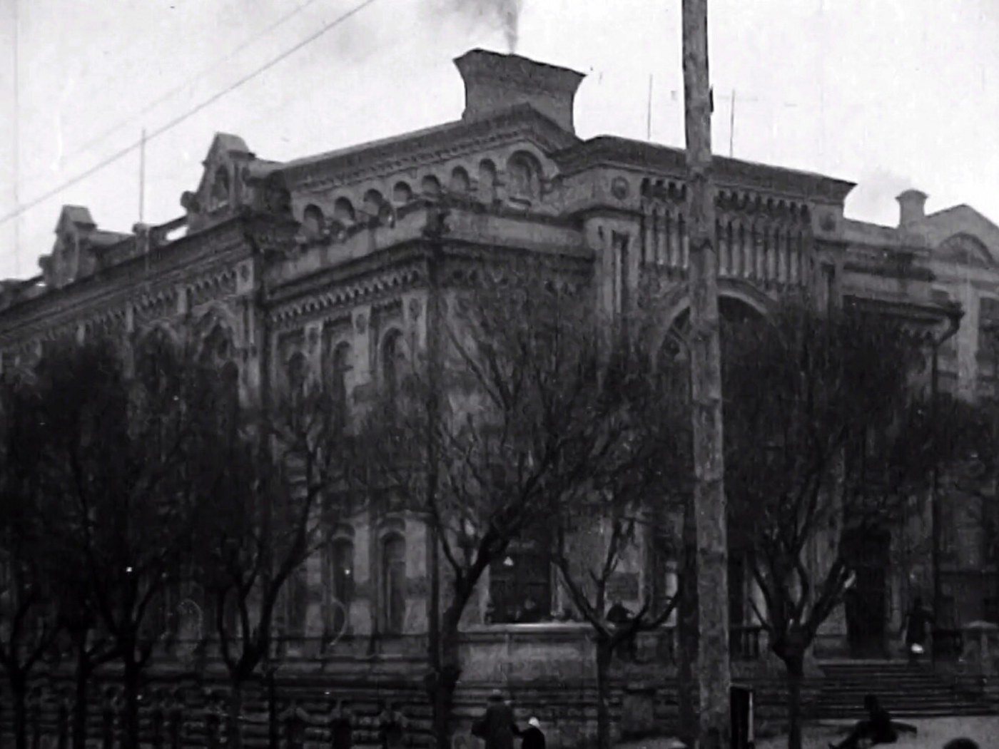
13 Shota Rustaveli StreetBrodsky Synagogue as a craftsmen's clubThe choral synagogue built in 1898 with funds from sugar magnate Lazar Brodsky, seen in 1929 with a sign reading "Central Craftsmen's Club": the community had lost the building in 1926. It later housed a puppet theatre and was returned to the Jewish community in 1997.Archival photo: невідомий автор, 1929, ліцензія не вказана · pastvu.com
Modern photo: Kiyanka, 2020, CC BY-SA 4.0 · Wikimedia Commons -
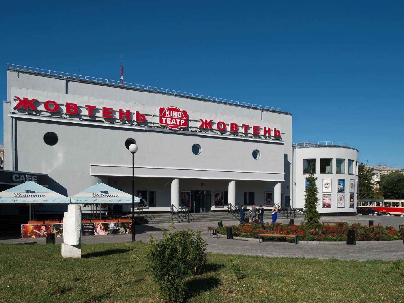
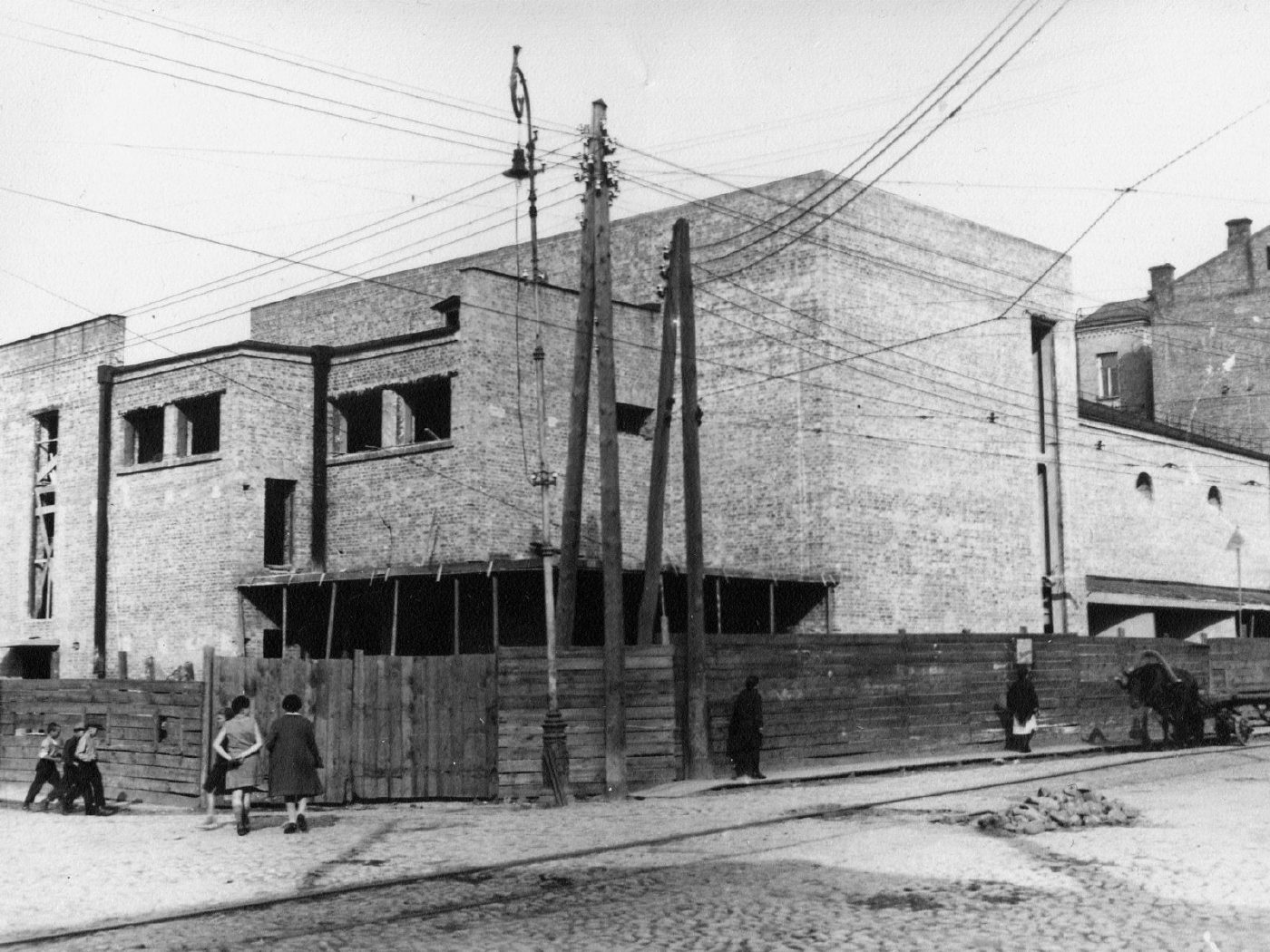
26 Kostiantynivska Street, PodilZhovten cinema before openingThe constructivist building of the Zhovten cinema in Podil shortly before its opening, in a photograph from the cinema's own archive. One of Kyiv's oldest cinemas, it survived an arson attack in 2014, was restored and is still running.Archival photo: невідомий автор, 1929–1931, Public domain · Wikimedia Commons
Modern photo: Albert Bergonzo, 2016, CC BY-SA 4.0 · Wikimedia Commons -
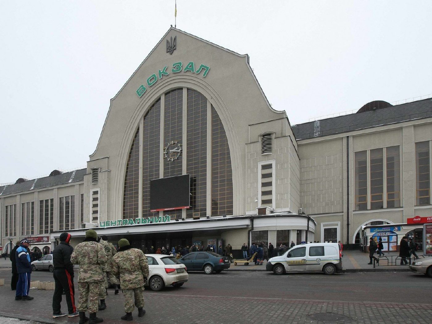
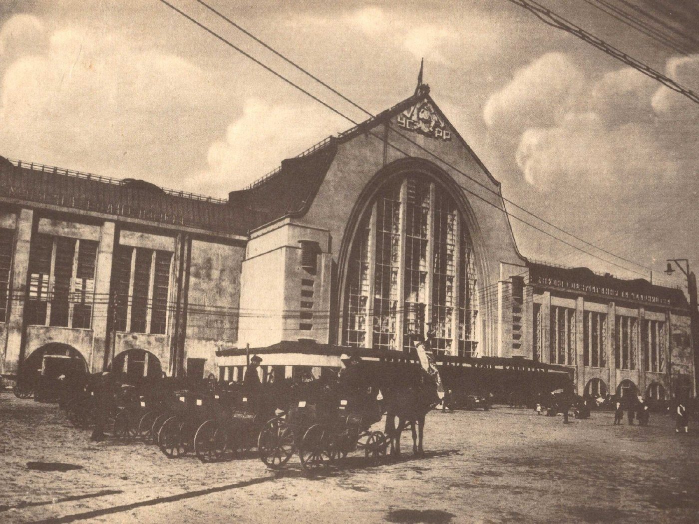
1 Vokzalna SquareCabbies at the new stationThe new passenger station (1927–1932, architect Oleksandr Verbytskyi), blending Ukrainian Baroque with constructivism, and horse cabs still waiting for passengers on the forecourt. The building remains Kyiv's main railway station.Archival photo: невідомий автор, 1932, ліцензія не вказана · pastvu.com
Modern photo: Волтарс, 2015, CC BY-SA 4.0 · Wikimedia Commons -
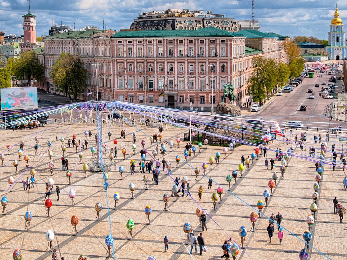
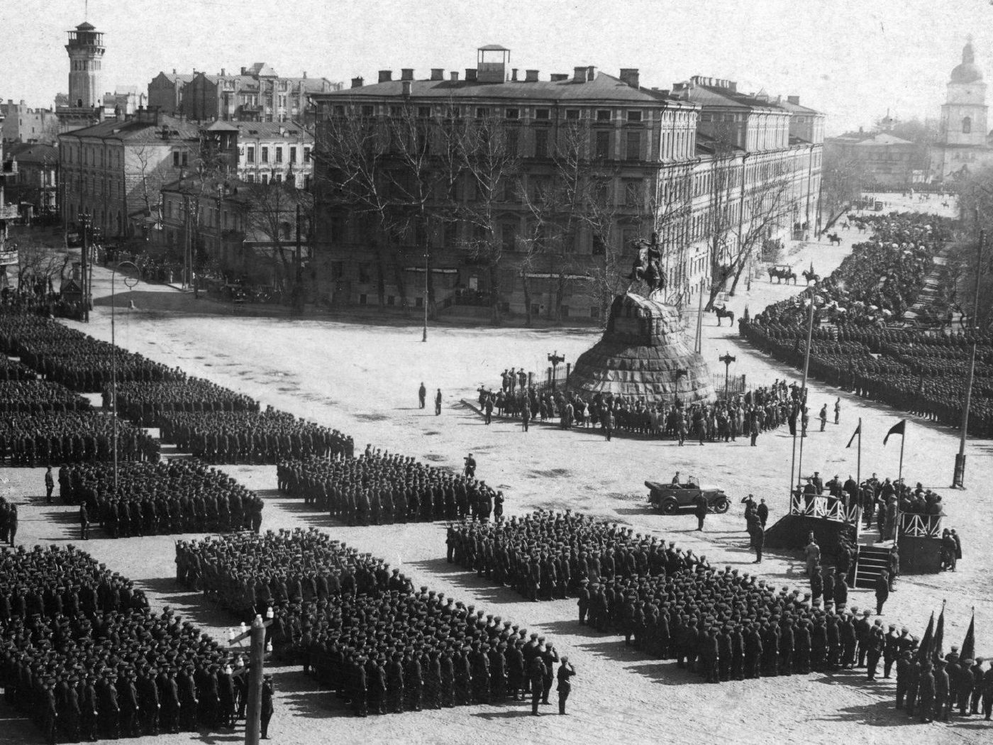
Sofiiska SquareMay Day parade on Sofiiska SquareA May Day parade: ranks of soldiers lined up on Sofiiska Square around the Bohdan Khmelnytsky monument. Soon afterwards Kyiv again became the capital of Soviet Ukraine (1934), and the central squares turned into arenas for mass parades. The modern view, taken from the St Sophia bell tower, shows an Easter egg exhibition where the columns once stood, with the bell tower of St Michael's Golden-Domed Monastery, rebuilt in 1998, beyond the square.Archival photo: невідомий автор, 1933, ліцензія не вказана · pastvu.com
Modern photo: Imass ua, 2017, CC BY-SA 4.0 · Wikimedia Commons -
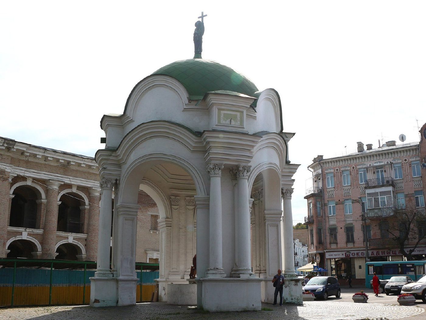
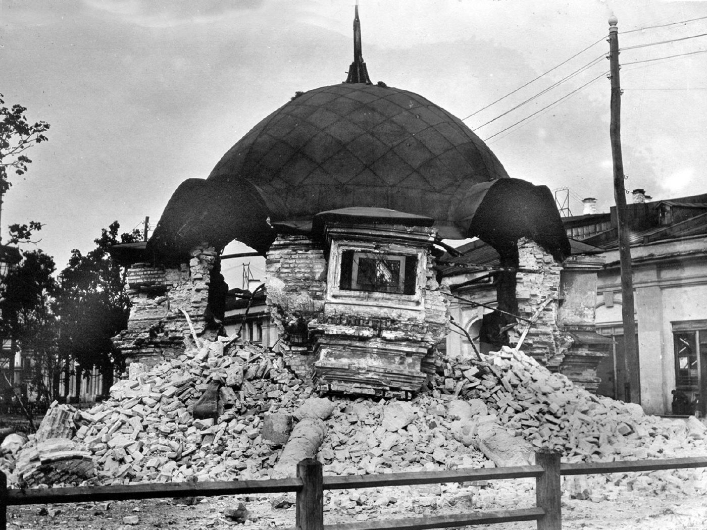
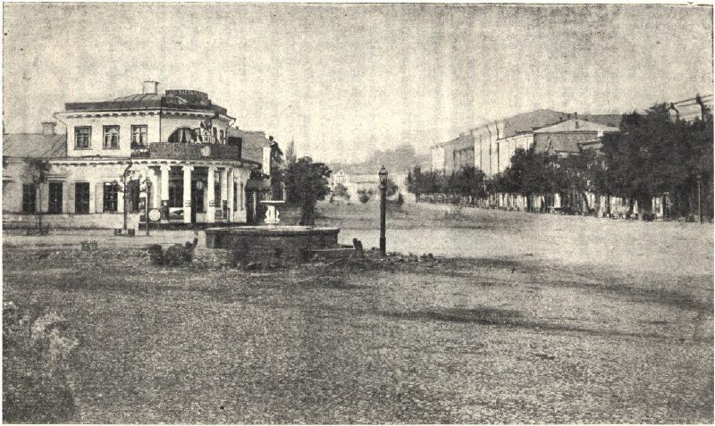
Kontraktova Square, PodilThe demolished Samson FountainThe Samson Fountain on Kontraktova Square, a 1749 pavilion over a spring that had supplied Podil with water for centuries, was pulled down in 1934, leaving its dome amid the rubble. It was recreated in 1982 from old drawings and again graces the square.Archival photo: невідомий автор, 1934, ліцензія не вказана · pastvu.com
Modern photo: Luxoff, 2017, CC BY-SA 4.0 · Wikimedia Commons -
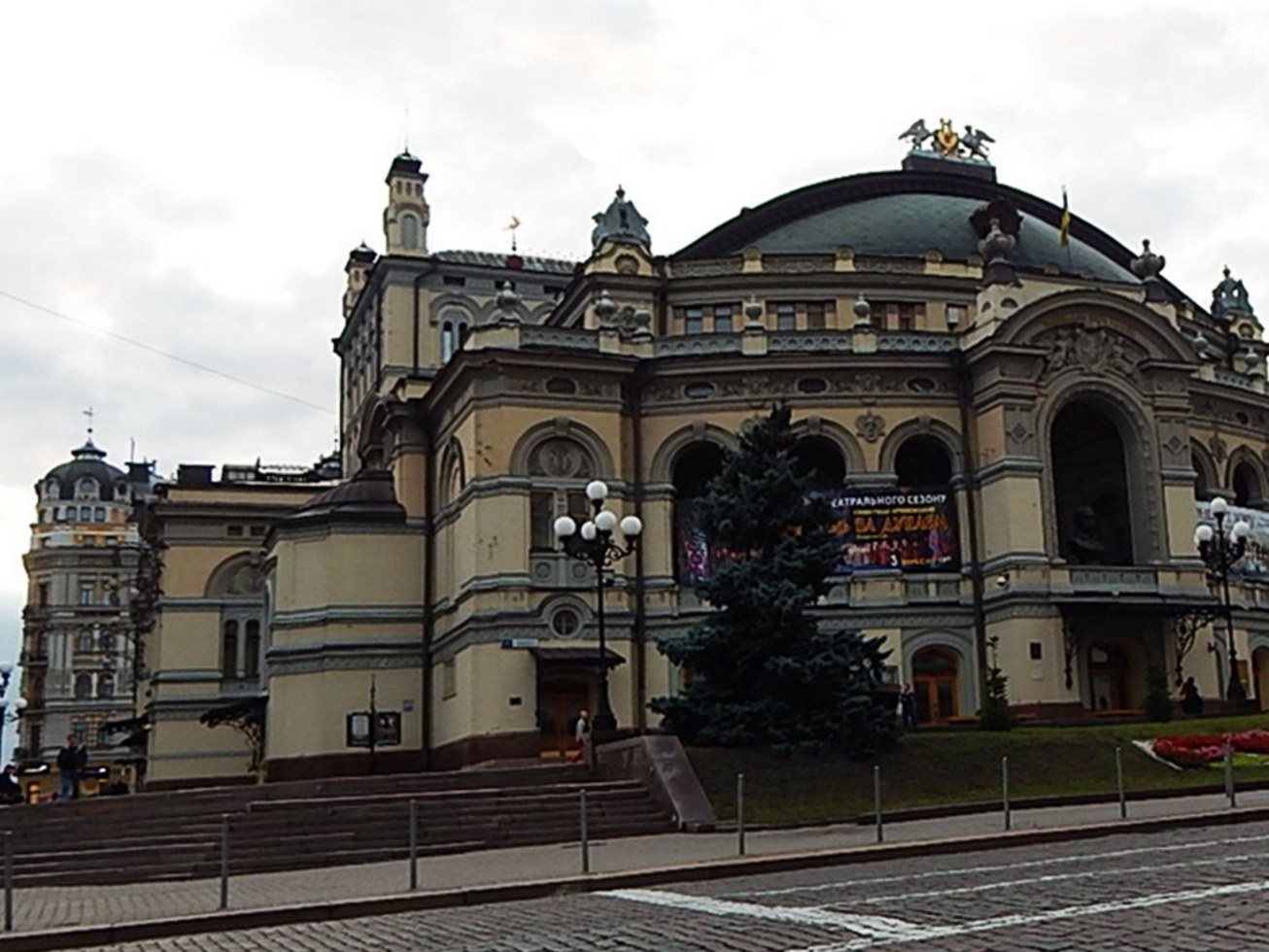
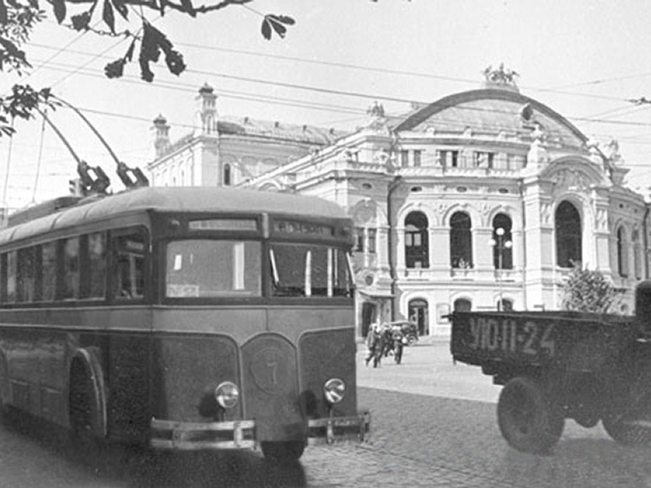
50 Volodymyrska StreetLK-5 trolleybus by the OperaAn LK-5 trolleybus, one of Kyiv's first, outside the Opera House. Trolleybus service in the city opened in November 1935; today Kyiv has one of the largest trolleybus networks in Europe. The opera building (1901, architect Viktor Schröter) survives as the National Opera of Ukraine, now with a small garden in front of its façade.Archival photo: невідомий автор, 1930-ті, Public domain · Wikimedia Commons
Modern photo: МирославаСК, 2017, CC BY-SA 4.0 · Wikimedia Commons -
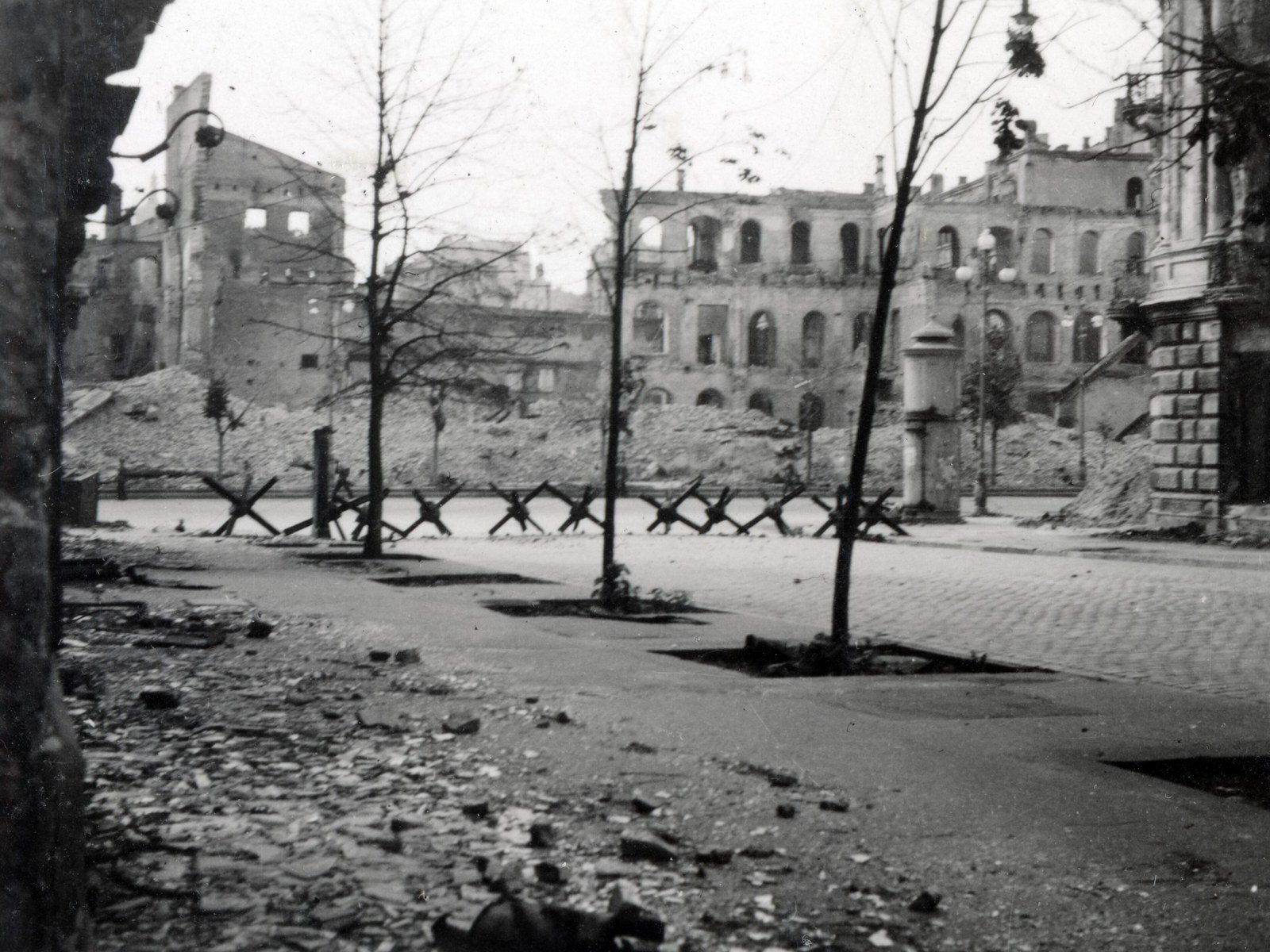
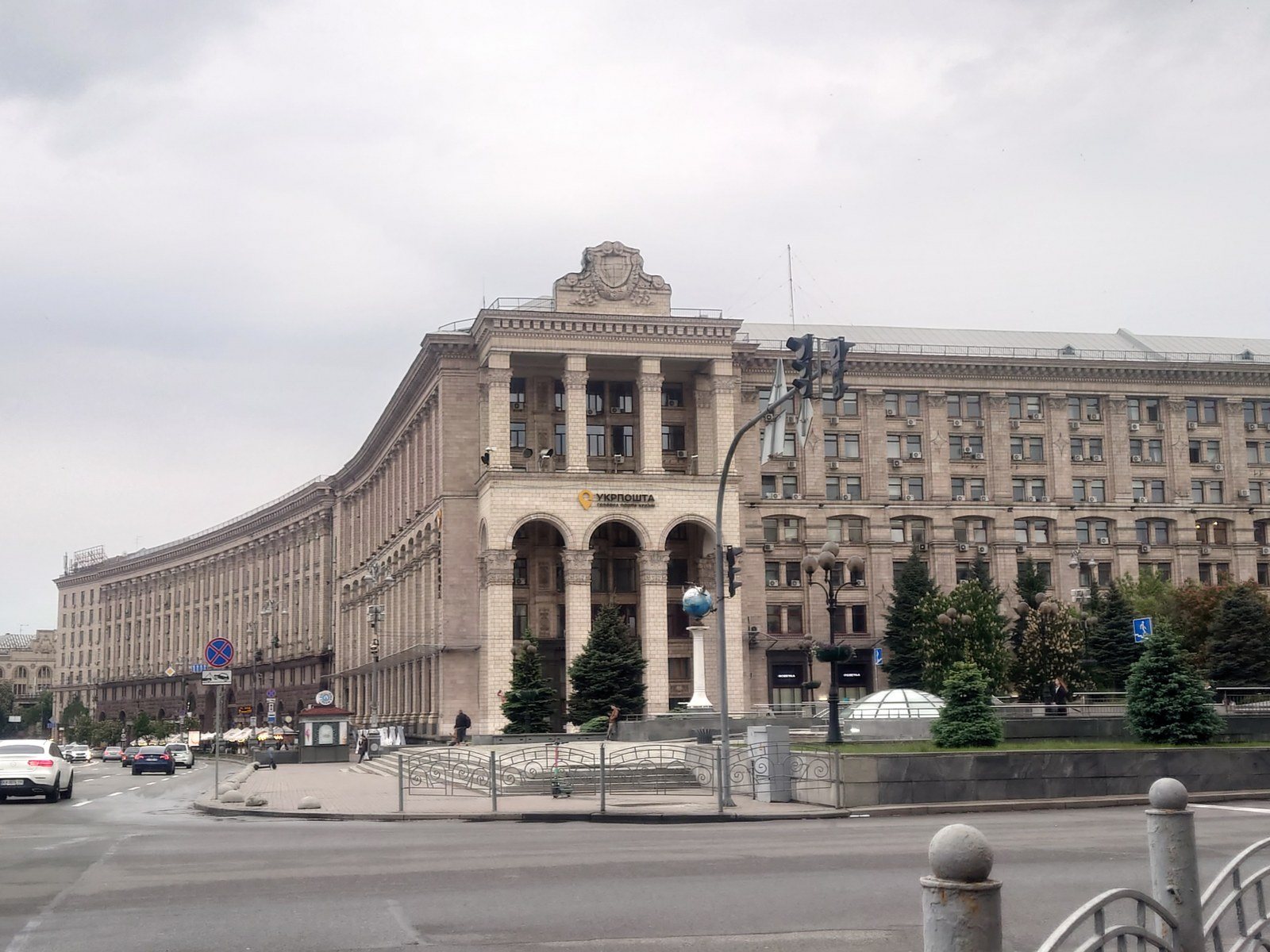
Khreshchatyk at Arkhitektora Horodetskoho StreetKhreshchatyk in ruinsThe ruined Main Post Office and Grand Hotel seen from Horodetskoho Street in 1942. The rubble on Khreshchatyk was not cleared during the occupation. On the right, the same spot in 2025: the corner of Khreshchatyk and the Maidan is now occupied by the post-war Main Post Office (22 Khreshchatyk).Archival photo: Endre Kiss, 1942, CC BY-SA 3.0 · Wikimedia Commons
Modern photo: Valchuk Taisiia, 2025, CC BY-SA 4.0 · Wikimedia Commons -
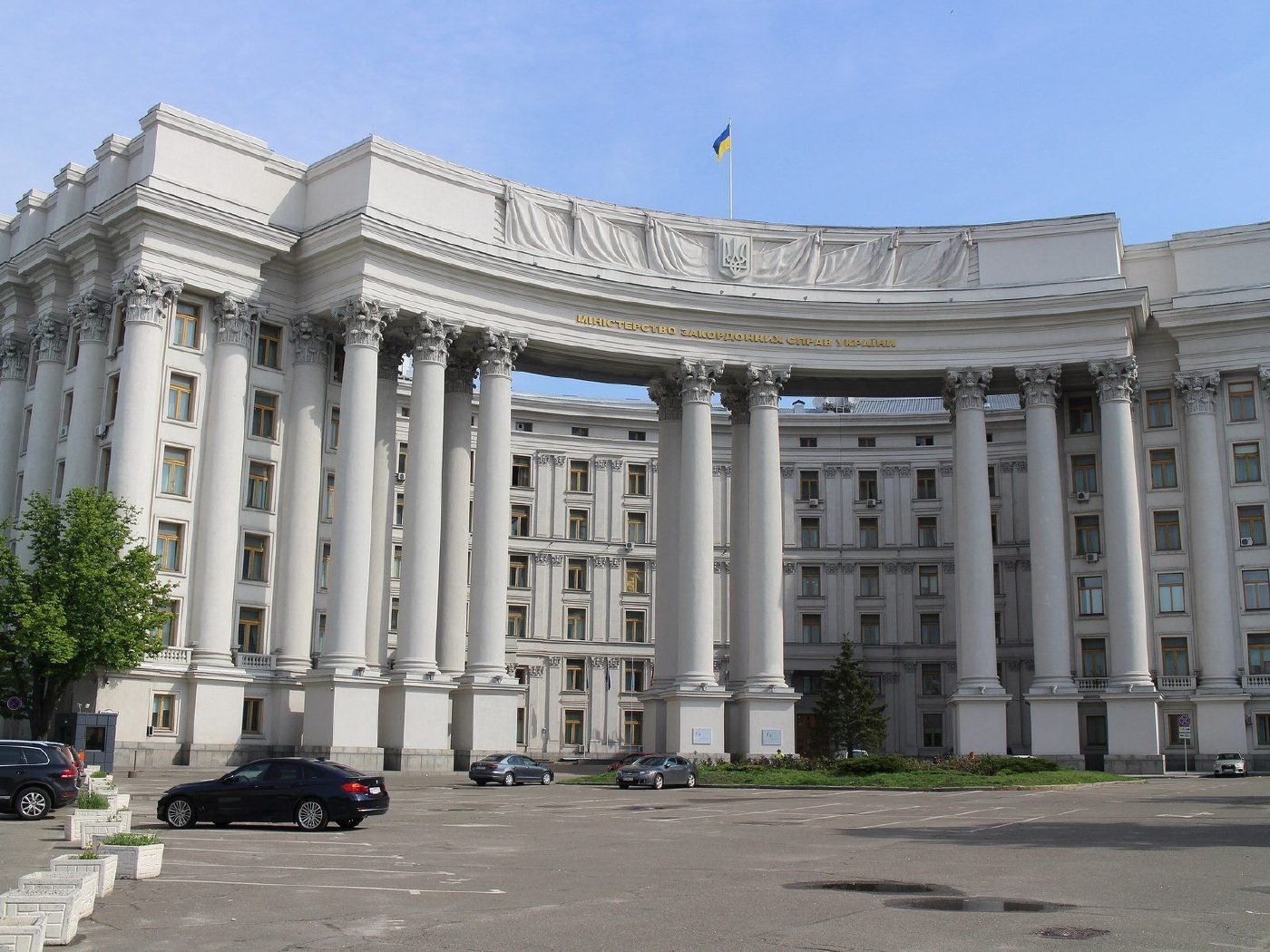
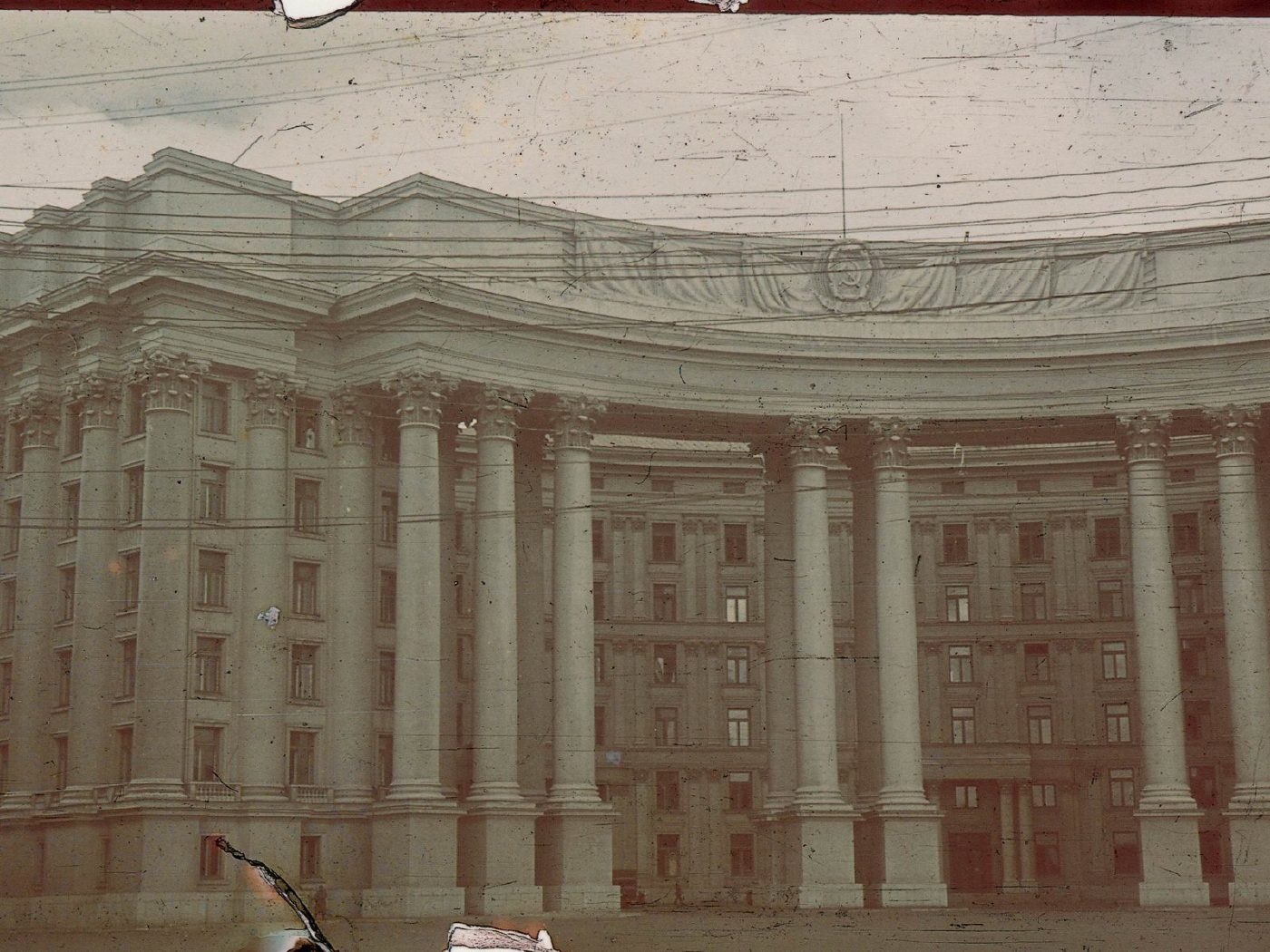
1 Mykhailivska SquareThe Central Committee buildingThe Central Committee building on Mykhailivska Square (1936–1938, architect Iosif Langbard) in autumn 1941, a colour photograph by German photographer Johannes Hähle. It was built on the site of the demolished St Michael's Cathedral; today it houses Ukraine's Ministry of Foreign Affairs.Archival photo: Йоганнес Гехле, 1941, Public domain · Wikimedia Commons
Modern photo: Suicasmo, 2019, CC BY-SA 4.0 · Wikimedia Commons -
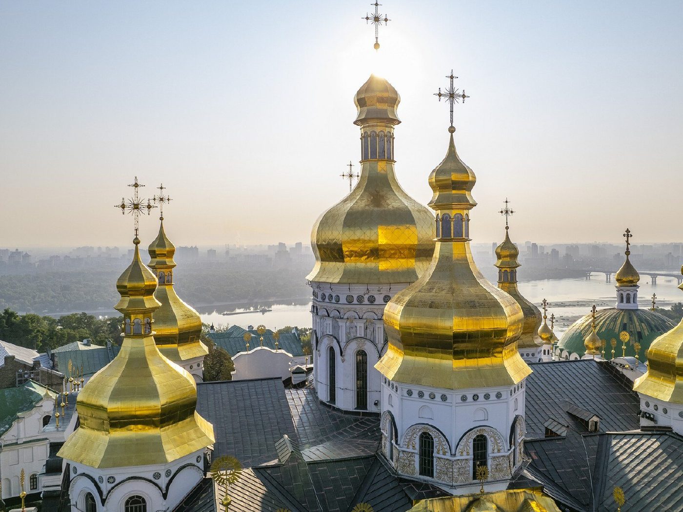
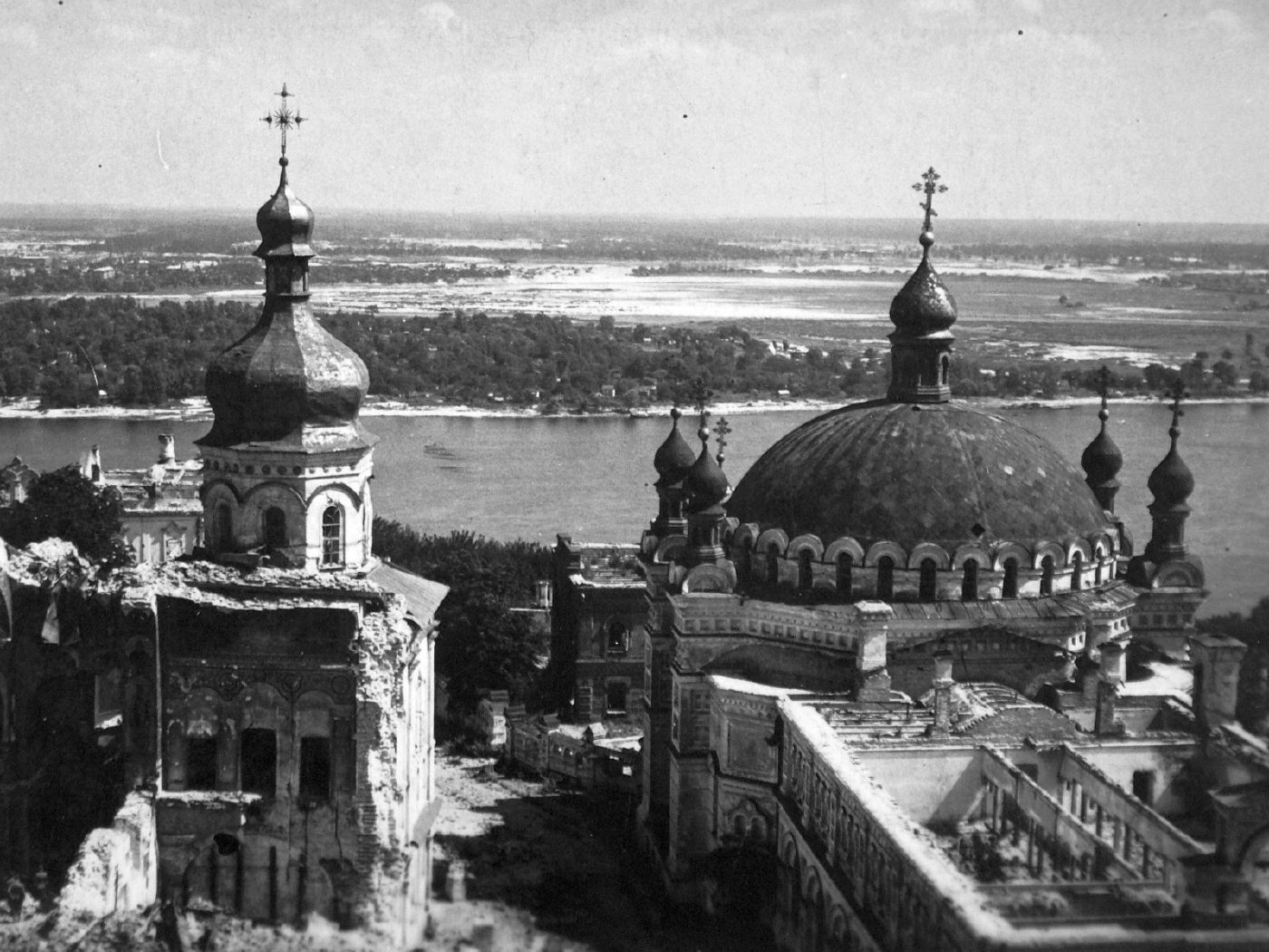
Kyiv Pechersk LavraRuins of the Dormition CathedralThe Kyiv Pechersk Lavra in 1942: on the left the ruins of the Dormition Cathedral, blown up on 3 November 1941, on the right the Church of Saints Anthony and Theodosius, with the Dnipro beyond. The cathedral was rebuilt in 1998–2000.Archival photo: невідомий автор, 1942, CC BY-SA 3.0 · Wikimedia Commons
Modern photo: KyivMax, 2021, CC BY-SA 4.0 · Wikimedia Commons -
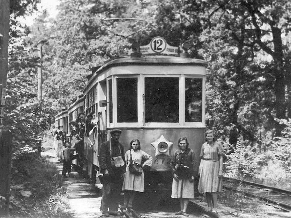
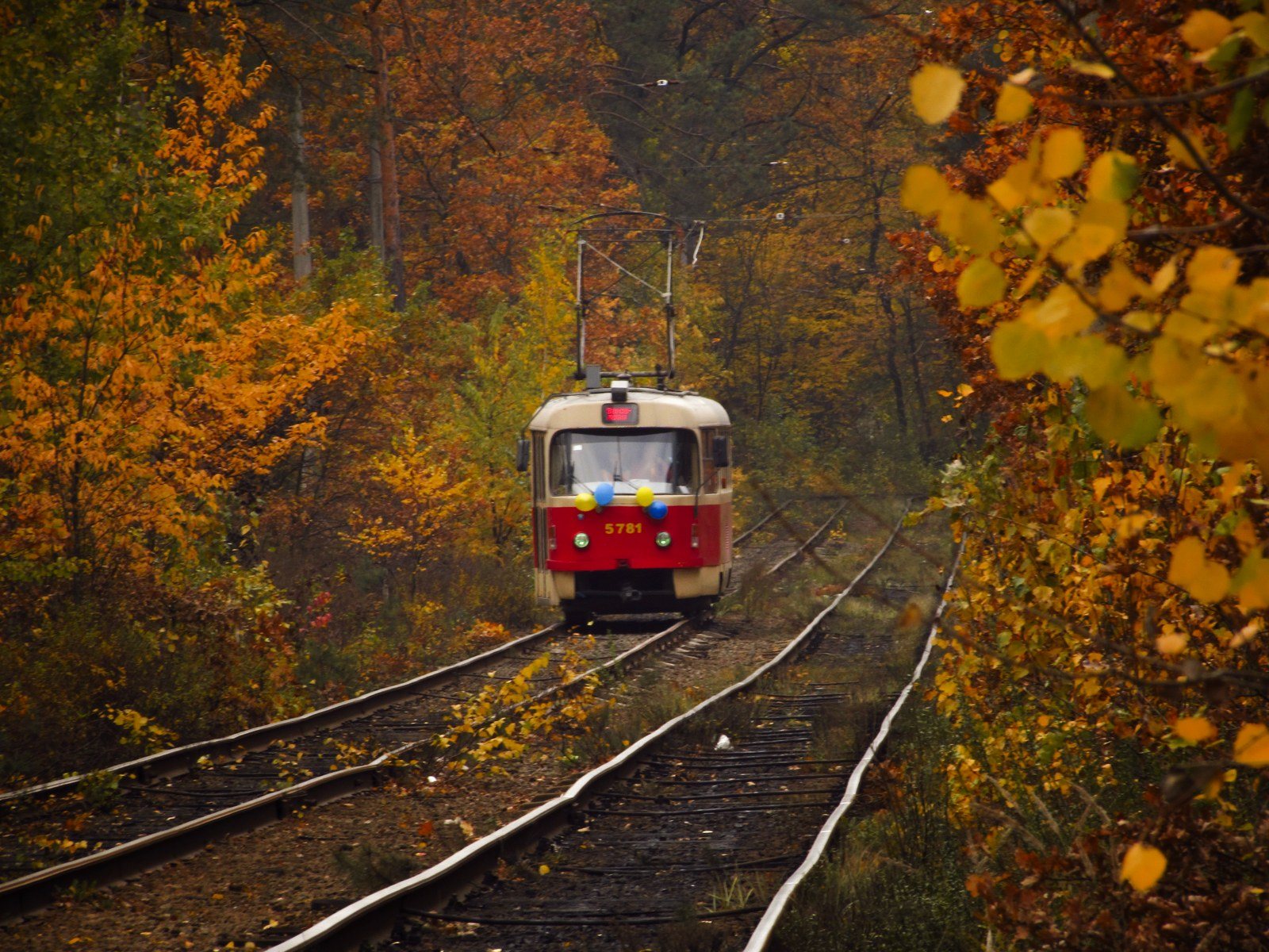
Pushcha-VodytsiaTram in Pushcha-VodytsiaA No. 12 tram among the pines of Pushcha-Vodytsia, June 1949. The line to the forest resort opened back in 1904 and still runs today, one of Kyiv's most picturesque tram routes. On the right, a Tatra tram on the forest line in Pushcha-Vodytsia, 2018.Archival photo: Юрій Хміль, 1949, Public domain · Wikimedia Commons
Modern photo: Tonya Voznyuk, 2018, CC BY-SA 4.0 · Wikimedia Commons -
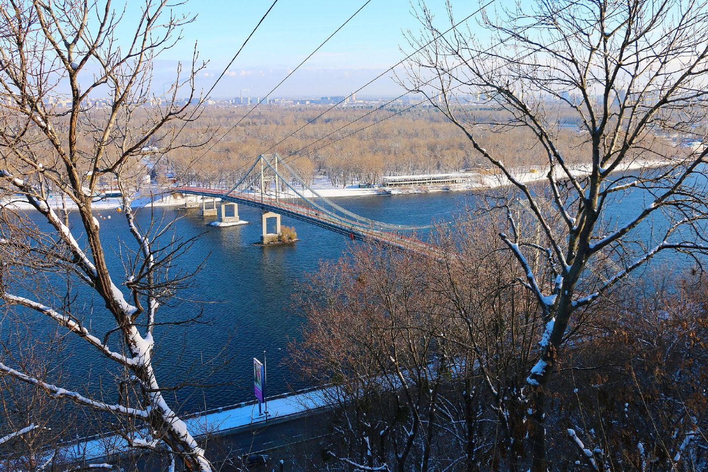
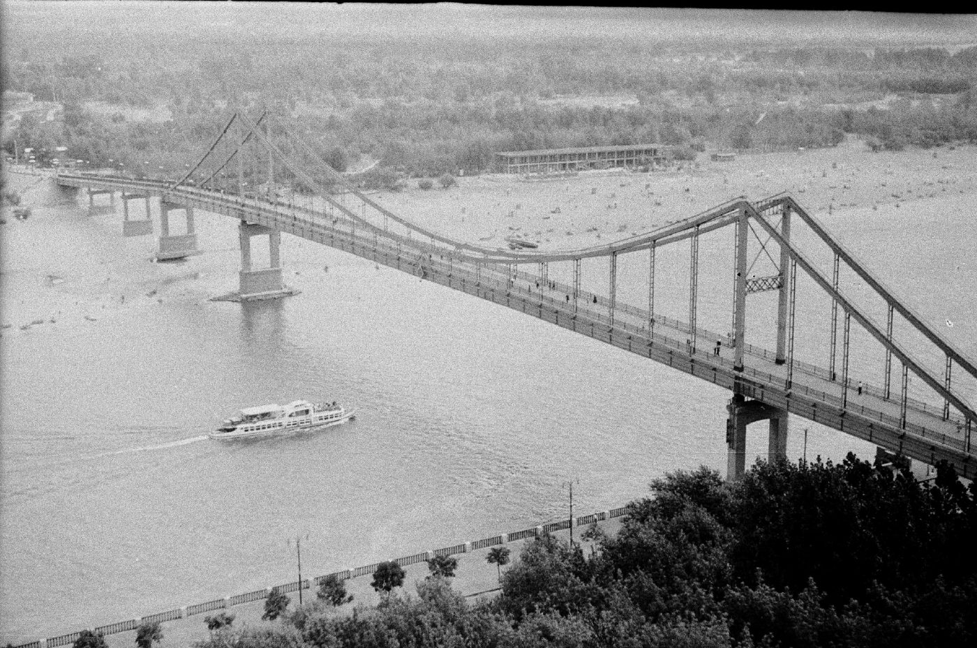
Park Pedestrian Bridge, seen from the Dnipro hillsBridge to Trukhaniv IslandThe pedestrian bridge to Trukhaniv Island in 1958, shortly after it opened, with a pleasure boat on the Dnipro. Today it is called the Park Bridge, and the island's beaches still draw city residents.Archival photo: Юрій Шакурин, 1958, CC BY-SA 4.0 · Wikimedia Commons
Modern photo: Prymasal, 2016, CC BY-SA 4.0 · Wikimedia Commons -
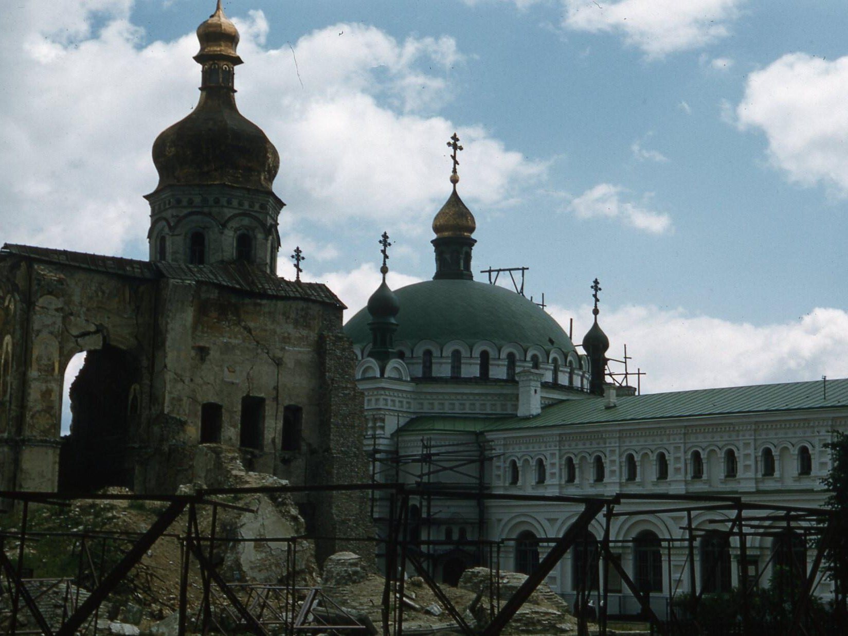
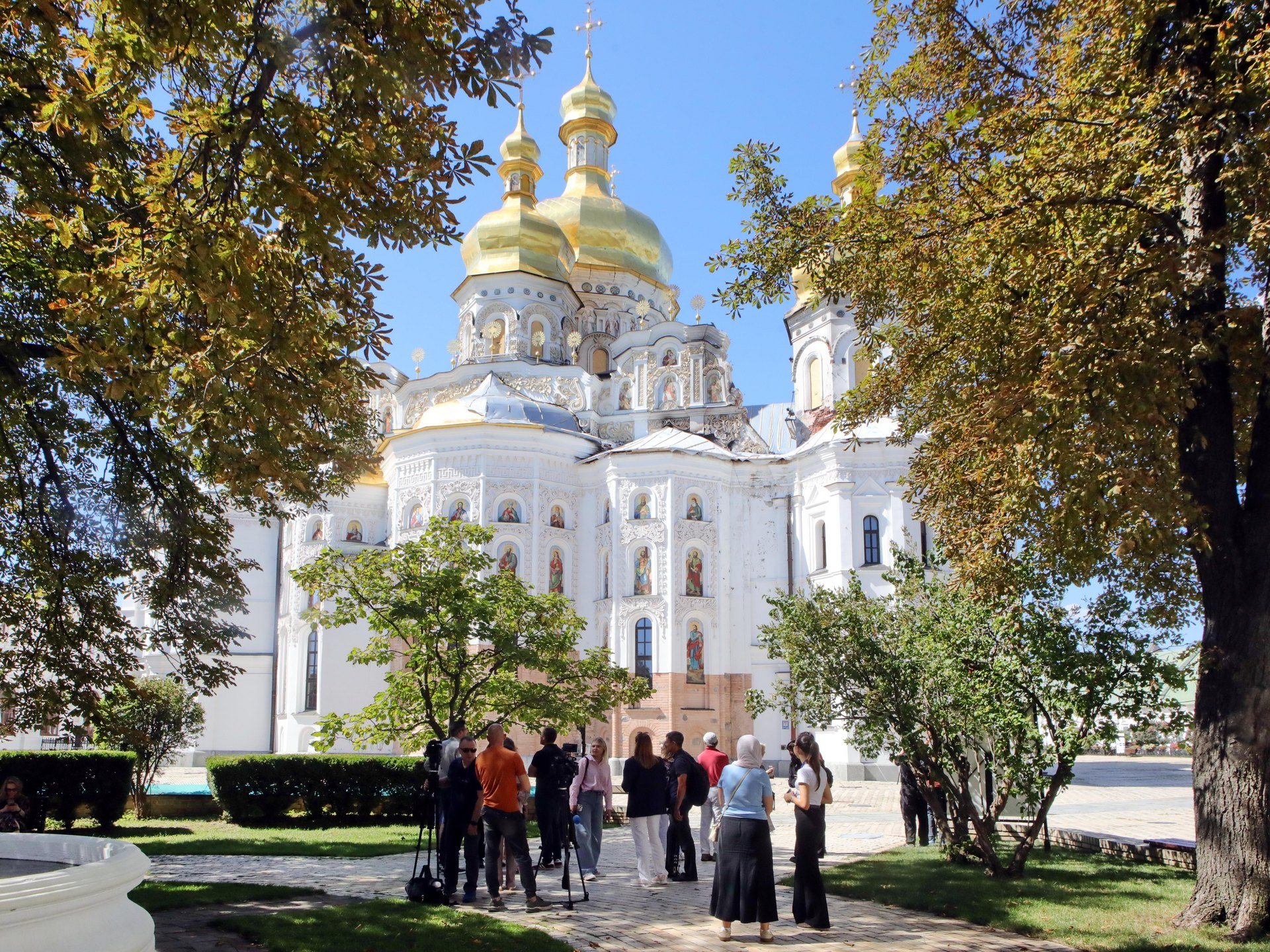
Kyiv Pechersk Lavra, Upper LavraRuins of the Dormition CathedralA 1958 colour slide of the ruins of the Dormition Cathedral of the Kyiv Pechersk Lavra, blown up on 3 November 1941; the Refectory Church is on the right. The cathedral was rebuilt in 1998–2000; on 15 June 2026 it was damaged by fire after a massive Russian attack on Kyiv. The "now" photo, from August 2026, shows the rebuilt cathedral with its gilded domes.Archival photo: Томас Тейлор Гаммонд, 1958, CC BY-SA 4.0 · Wikimedia Commons
Modern photo: Волтарс, 2026, CC BY-SA 4.0 · Wikimedia Commons -
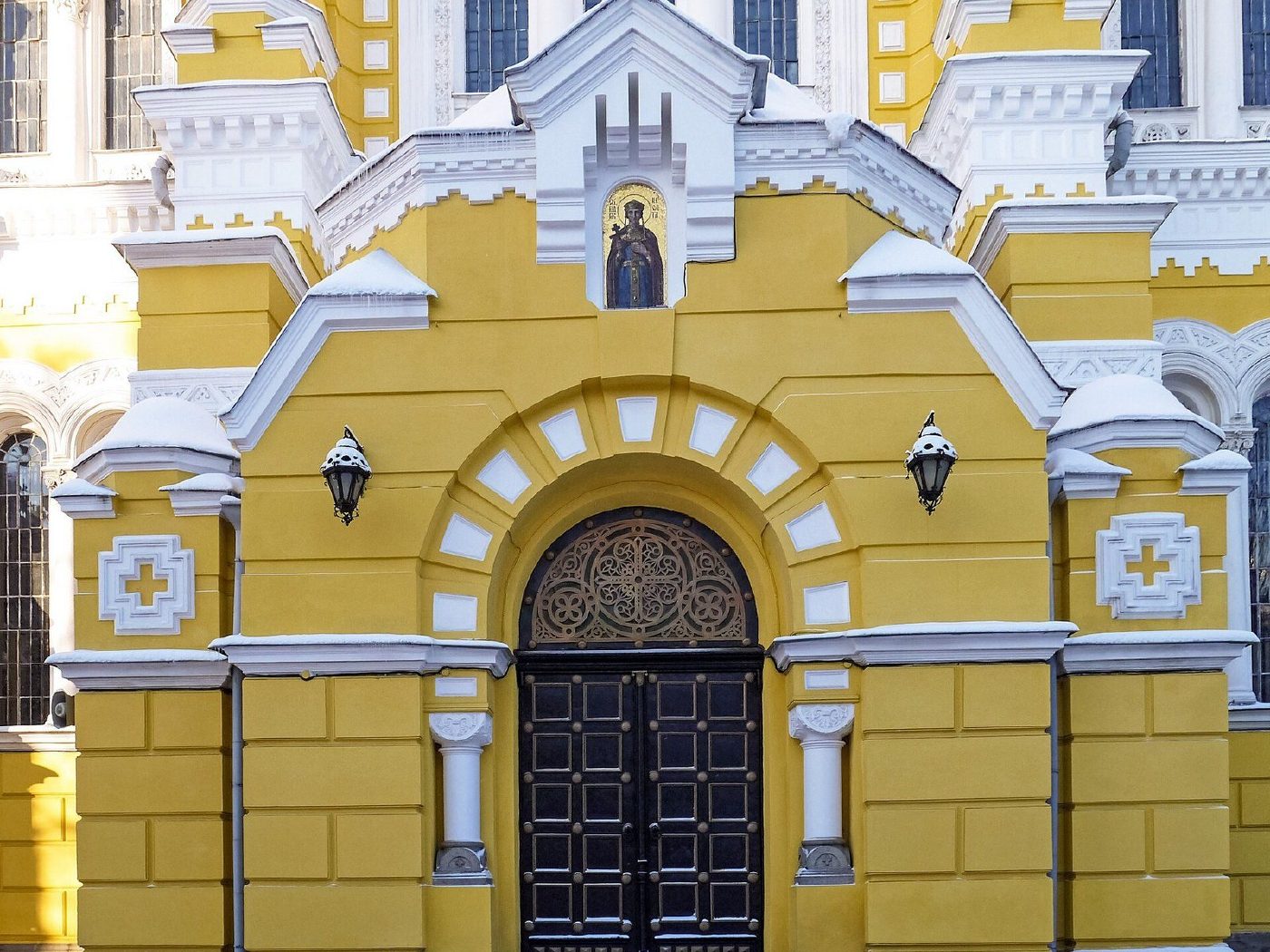
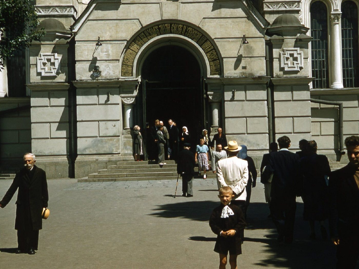
20 Taras Shevchenko BoulevardAt St Volodymyr's CathedralParishioners at the main entrance of St Volodymyr's Cathedral, one of the few Kyiv churches that stayed open in Soviet times. The façade was grey then; today the cathedral is ochre-yellow again, as its builders intended.Archival photo: Томас Тейлор Гаммонд, 1958, CC BY-SA 4.0 · Wikimedia Commons
Modern photo: Posterrr, 2016, CC BY-SA 4.0 · Wikimedia Commons -
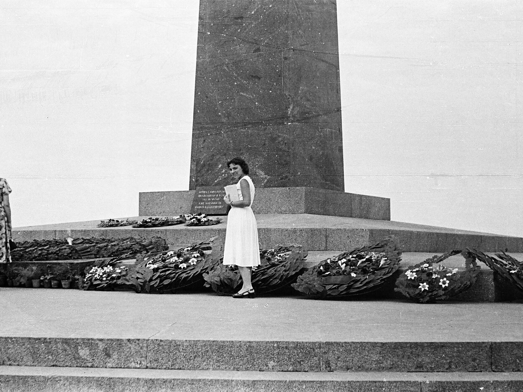
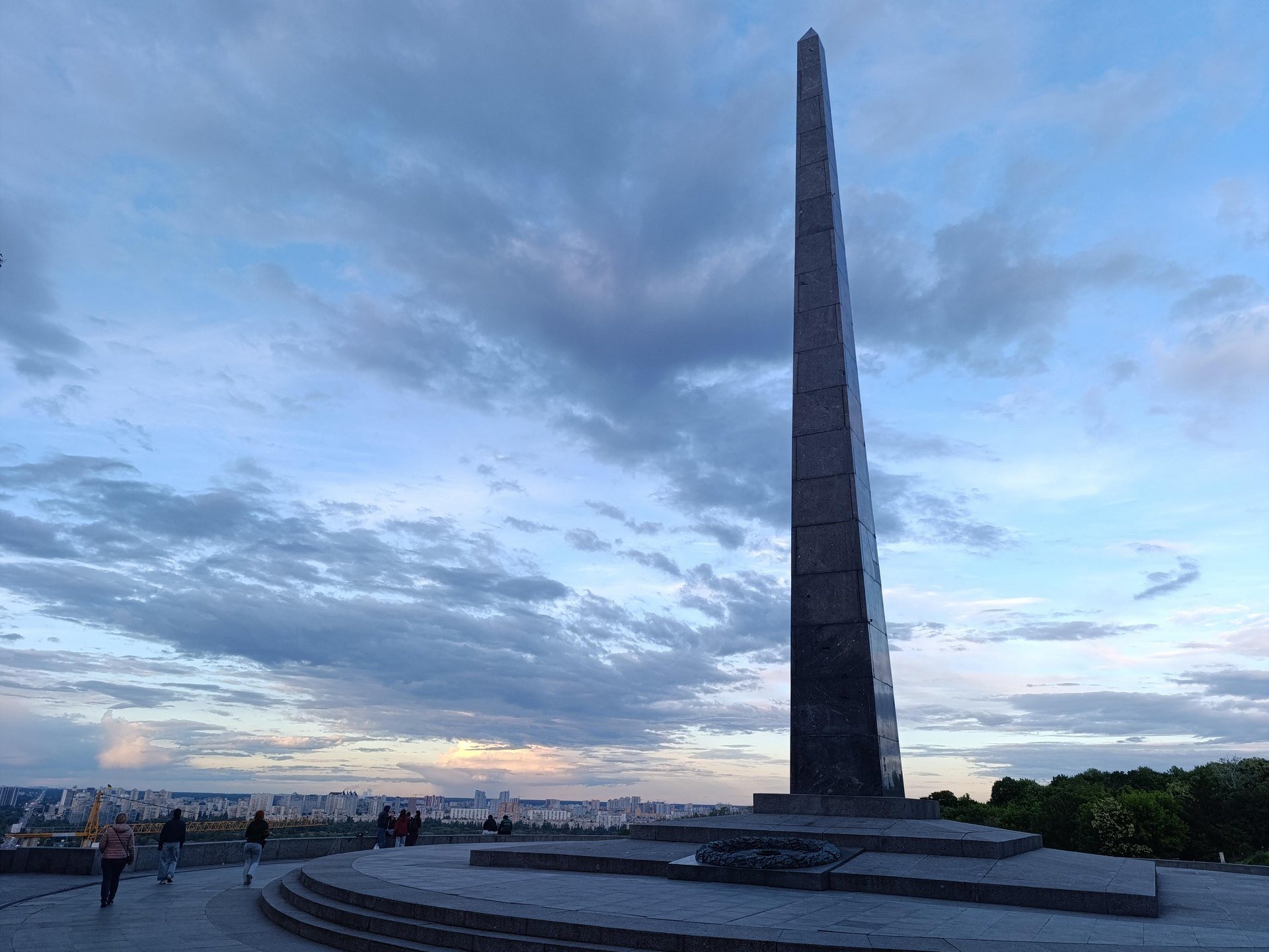
Park of Eternal Glory, PecherskGlory ObeliskAt the 27-metre obelisk over the Tomb of the Unknown Soldier in the Park of Eternal Glory, unveiled in 1957. The eternal flame burns here, and the National Holodomor Museum was later built nearby. The "now" photo shows the obelisk above the Dnipro slopes in May 2026.Archival photo: Юрій Шакурин, бл. 1959, CC BY-SA 4.0 · Wikimedia Commons
Modern photo: Качуровська, 2026, CC BY-SA 4.0 · Wikimedia Commons -
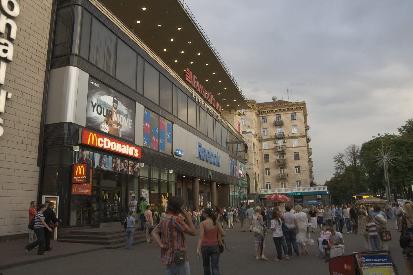
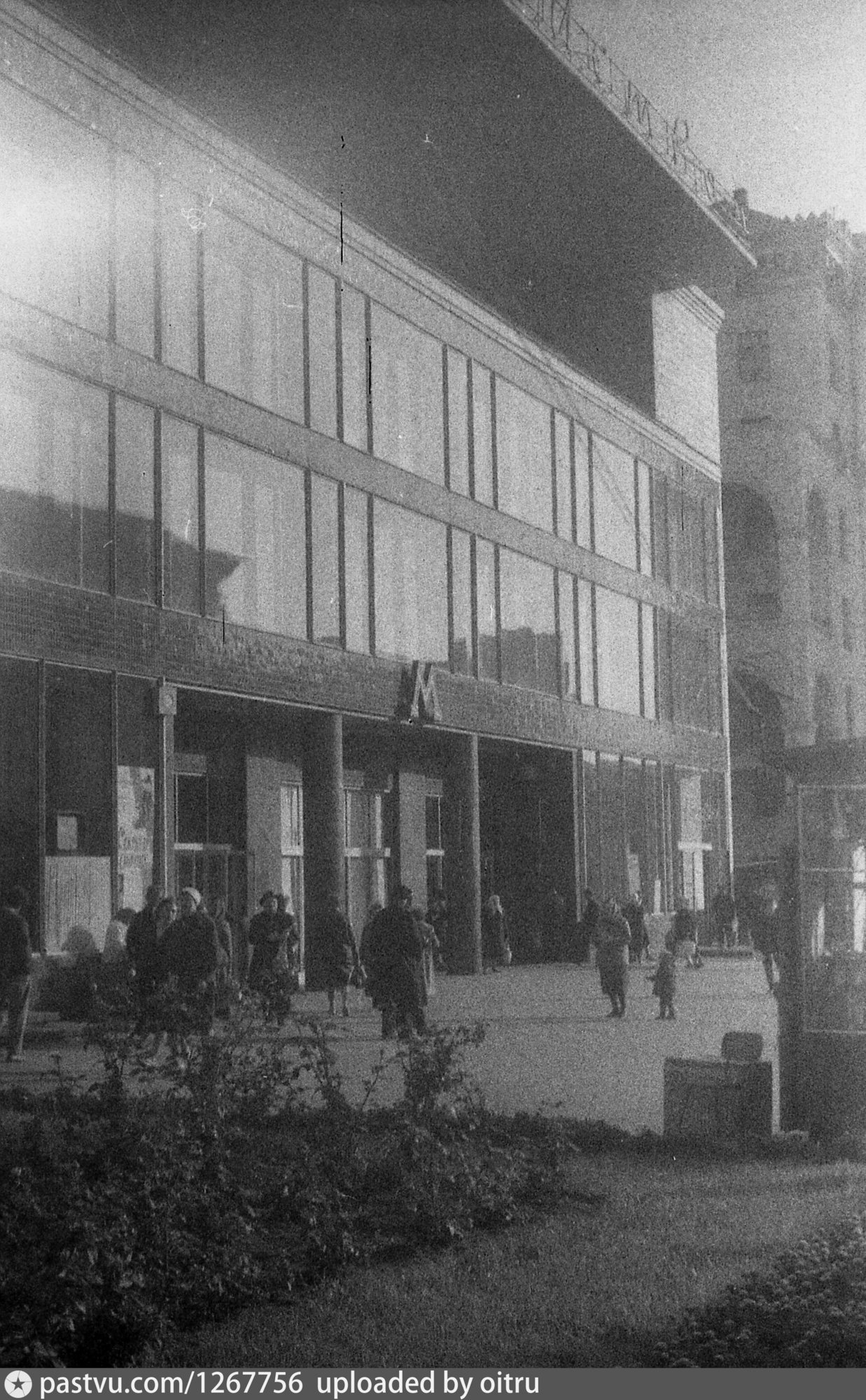
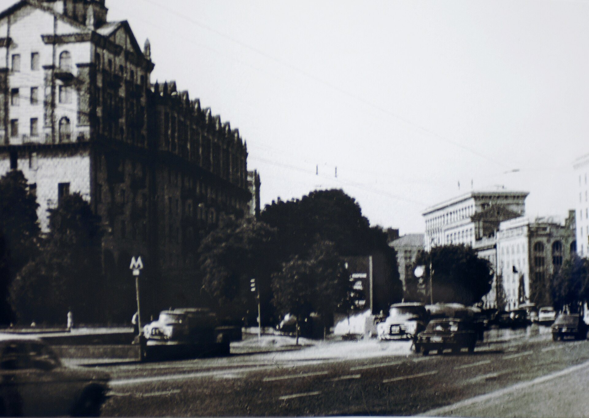
Khreshchatyk metro stationKhreshchatyk metro station entranceThe glazed surface entrance of Khreshchatyk metro station in 1963, three years after Kyiv's first metro line opened. The entrance still operates in the same place, in a building on Khreshchatyk.Archival photo: невідомий автор, 1963, ліцензія не вказана · pastvu.com
Modern photo: Maxim75, 2010-ті, CC BY-SA 3.0 · Wikimedia Commons -
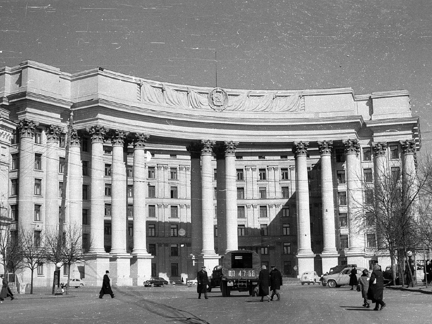
1 Mykhailivska SquareMykhailivska SquareThe building erected in the 1930s for the Communist Party Central Committee — St Michael's Golden-Domed Cathedral was demolished to make way for this government quarter. Today it houses Ukraine's Ministry of Foreign Affairs, facing the rebuilt St Michael's Monastery.Archival photo: невідомий автор, 1961, CC BY-SA 3.0 · Wikimedia Commons
Modern photo: Suicasmo, 2019, CC BY-SA 4.0 · Wikimedia Commons -
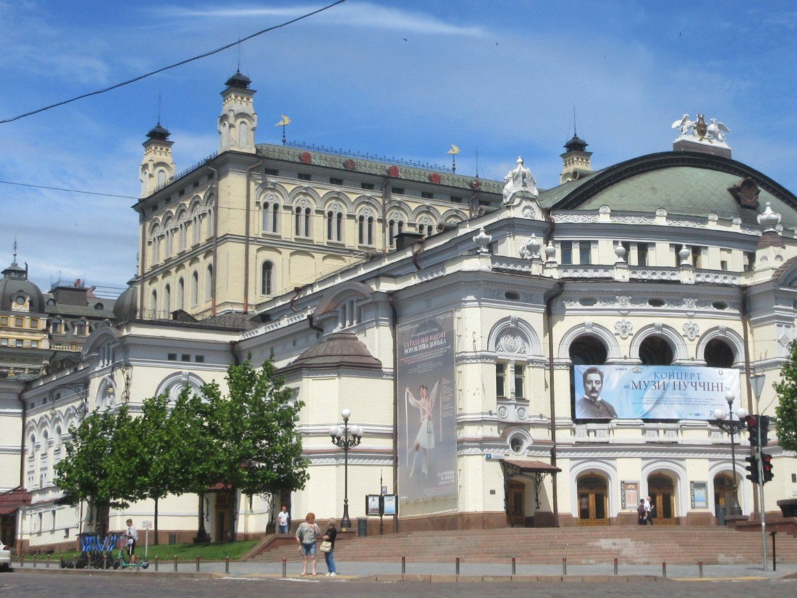
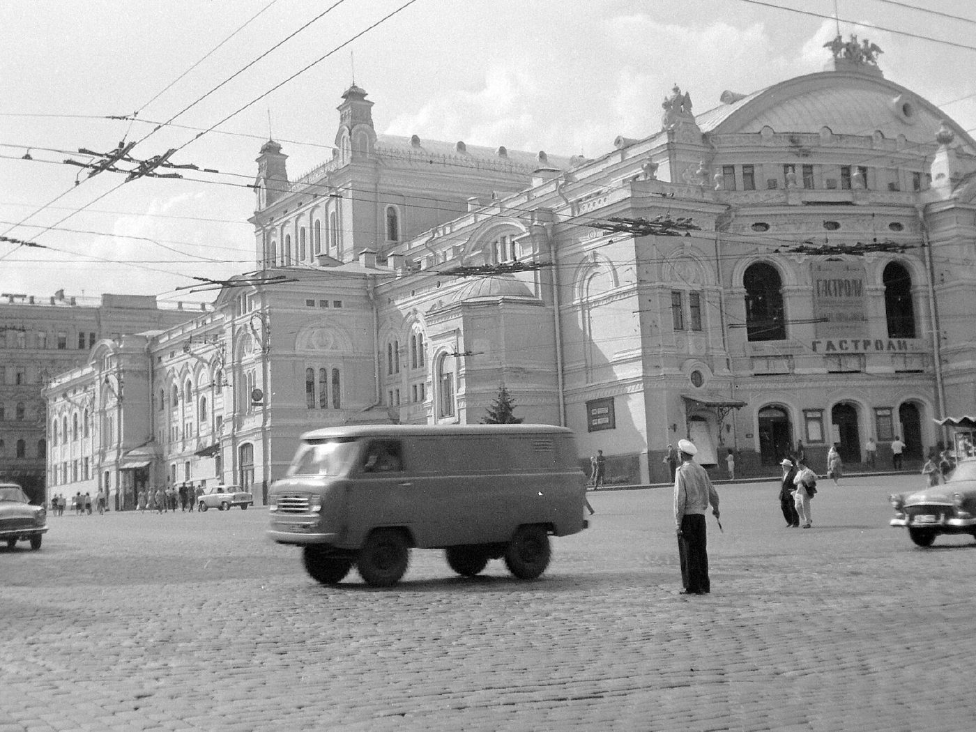
50 Volodymyrska StreetThe Opera HouseThe Taras Shevchenko Opera and Ballet Theatre (architect Viktor Schröter, 1901) seen from Teatralna Square, with a UAZ van passing under the overhead wires — an ordinary 1960s street scene. The 2025 photo shows the same corner: the theatre, now known as the National Opera of Ukraine, with trees grown up along its side facade.Archival photo: невідомий автор, 1965, CC BY-SA 3.0 · Wikimedia Commons
Modern photo: Віктор Полянко, 2025, CC BY-SA 4.0 · Wikimedia Commons -
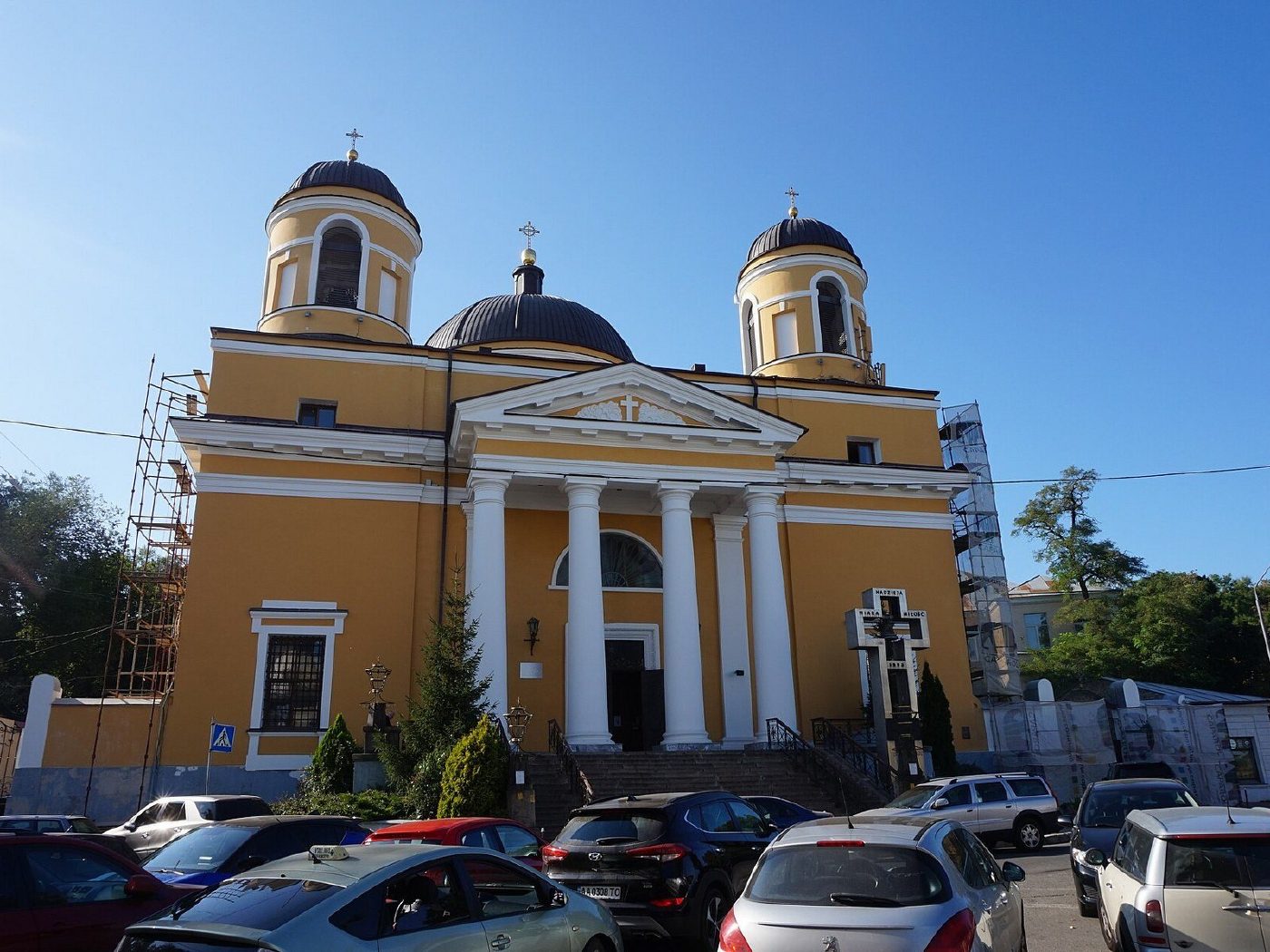
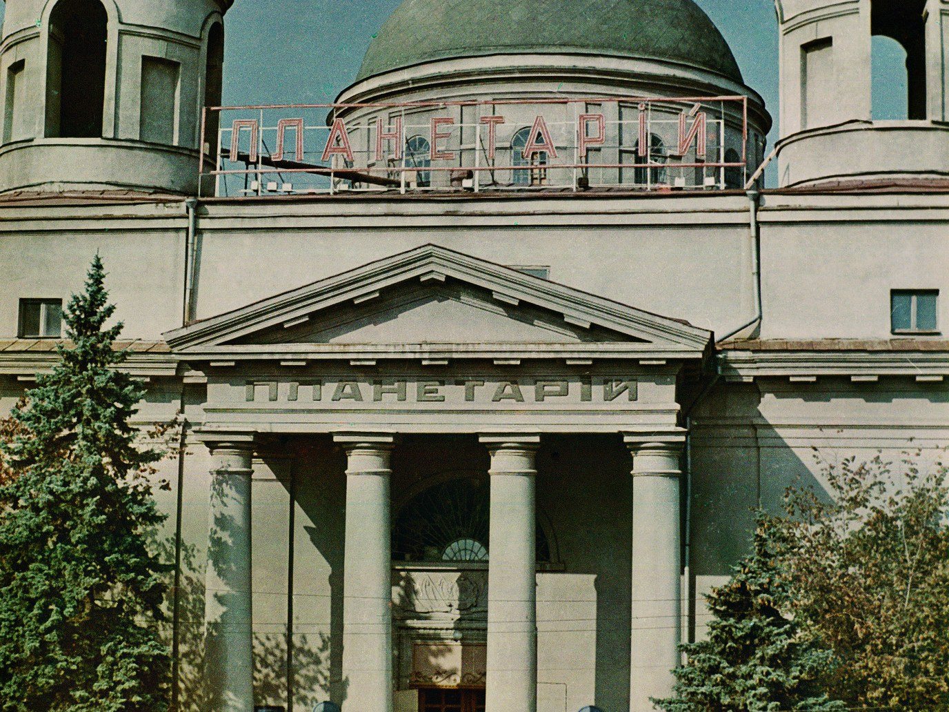
17 Kostolna StreetA planetarium in a churchIn Soviet times the Kyiv Planetarium occupied St Alexander's Church (1817–1842) — the sign is visible on the façade. The church was returned to the Roman Catholic community and is now a co-cathedral.Archival photo: невідомий автор, 1961, CC BY-SA 3.0 · Wikimedia Commons
Modern photo: Бондар Володимир, 2019, CC BY-SA 4.0 · Wikimedia Commons -
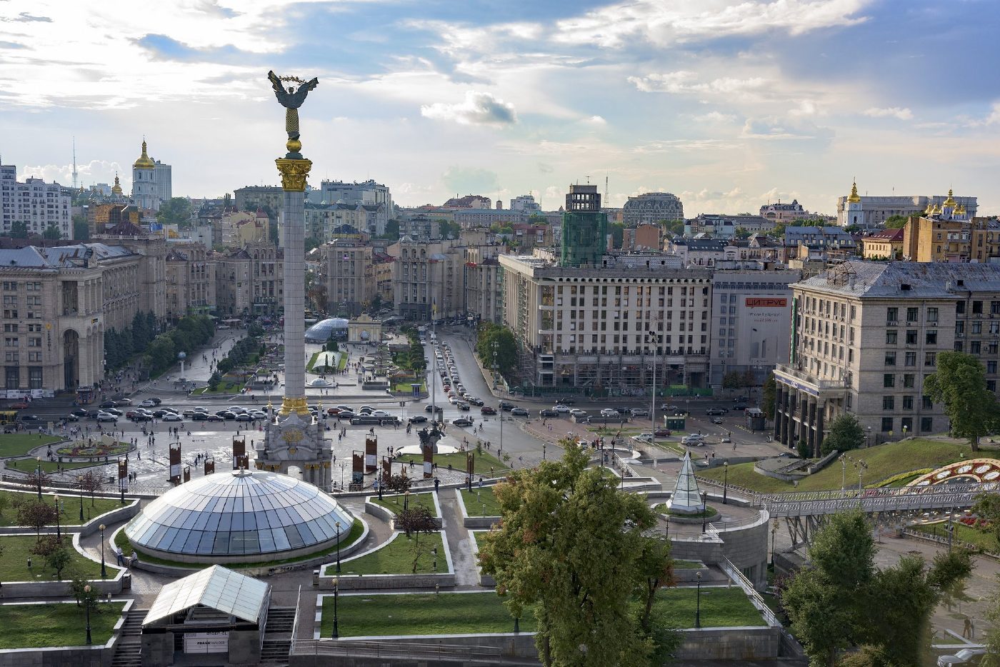
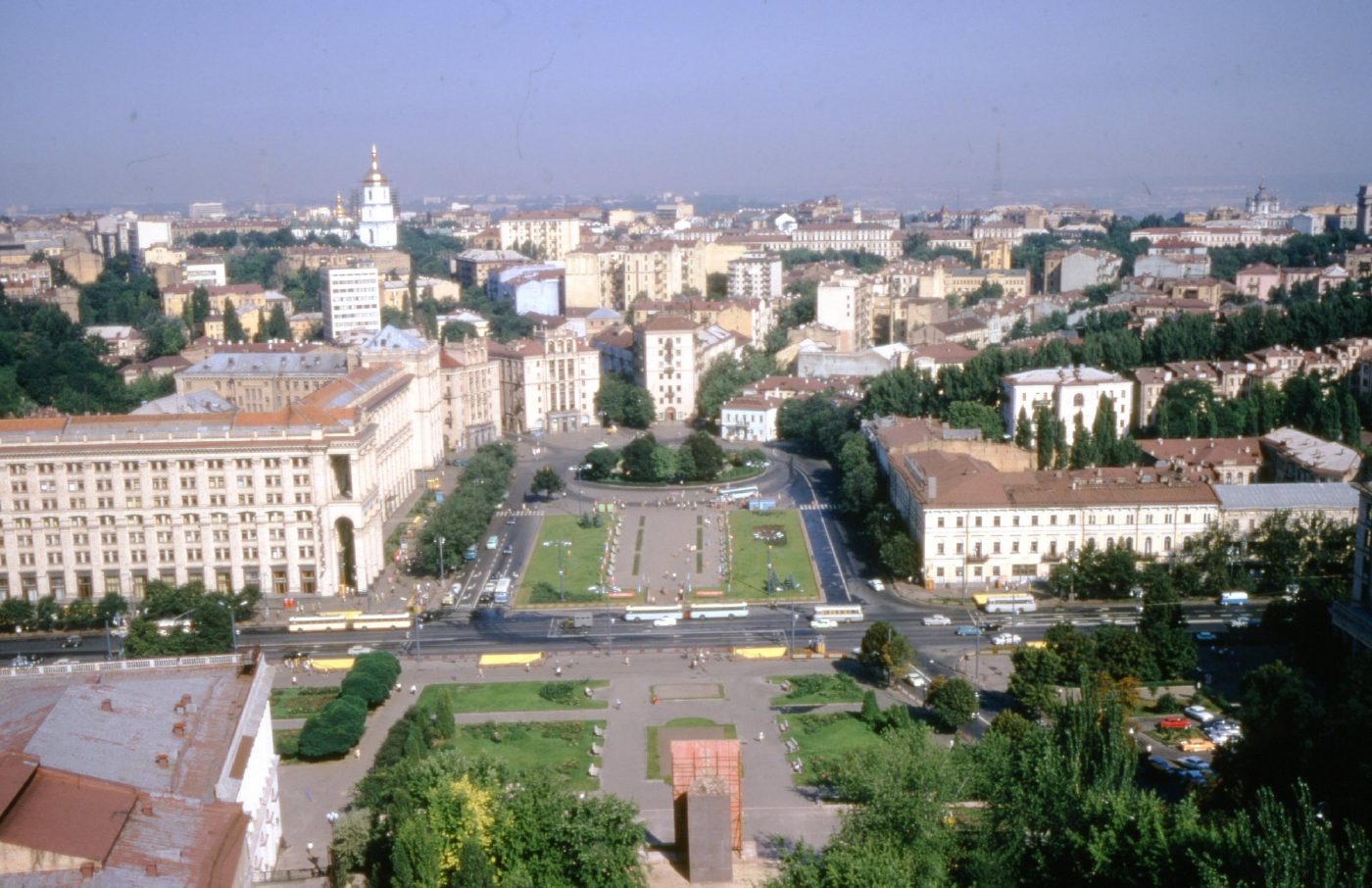
Maidan Nezalezhnosti, seen from Hotel UkraineKalinin Square from aboveKalinin Square (now Maidan Nezalezhnosti), photographed from the Hotel Moskva (now Hotel Ukraine). The square has been rebuilt several times since: the Independence Monument now stands at its centre, with a shopping centre under a glass dome below it.Archival photo: Thomas Taylor Hammond, 1972 (за назвою файлу — 1975), CC BY-SA 4.0 · Wikimedia Commons
Modern photo: Hnapel, 2018, CC BY-SA 4.0 · Wikimedia Commons -
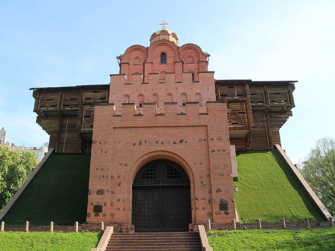
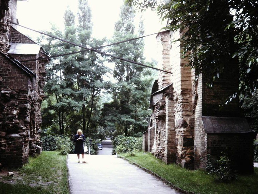
Volodymyrska Street / Yaroslaviv ValThe Golden Gate before the pavilionThe ruins of the 11th-century Golden Gate in 1971: two walls with a passage between them, open to the sky. In 1982, for Kyiv’s 1,500th anniversary, they were enclosed in a protective pavilion recreating the gate’s possible appearance.Archival photo: Jvonkorff, 1971, CC BY-SA 3.0 · Wikimedia Commons
Modern photo: Suicasmo, 2019, CC BY-SA 4.0 · Wikimedia Commons -
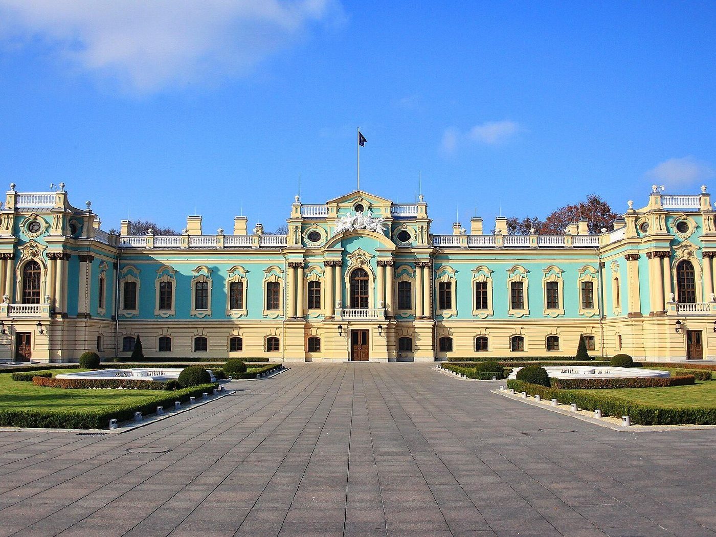
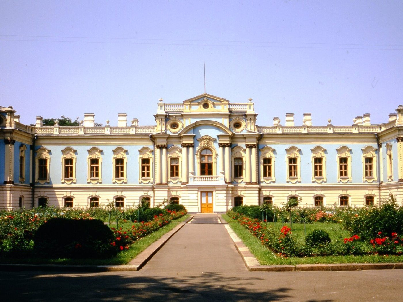
5a Mykhaila Hrushevskoho StreetMariinskyi PalaceThe mid-18th-century Mariinskyi Palace, designed by Bartolomeo Rastrelli, with flower beds in front. Today it is the ceremonial residence of the President of Ukraine, used to receive foreign leaders.Archival photo: Томас Тейлор Гаммонд, 1972, CC BY-SA 4.0 · Wikimedia Commons
Modern photo: SNCH, 2018, CC BY-SA 4.0 · Wikimedia Commons -
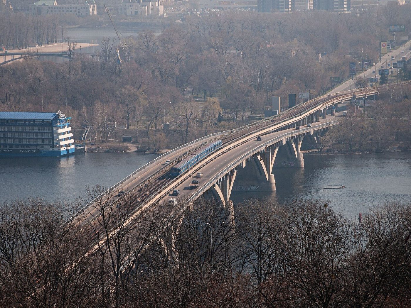
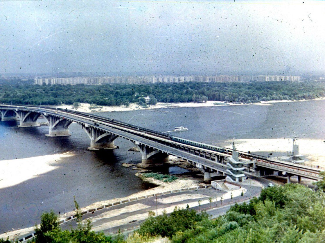
Metro Bridge over the DniproMetro BridgeThe Metro Bridge, opened in 1965, on 1 May 1974. It carried the first metro trains across the Dnipro to Hidropark and the Left Bank, with a road deck below.Archival photo: Andris Malygin, 1974, CC BY 3.0 · Wikimedia Commons
Modern photo: Andrii Prokopov86, 2019, CC BY-SA 4.0 · Wikimedia Commons -
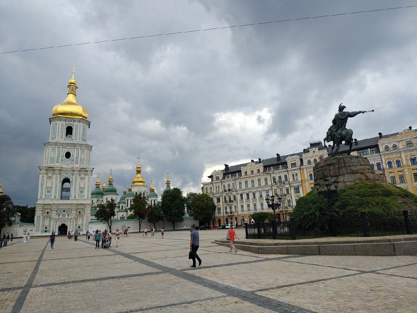
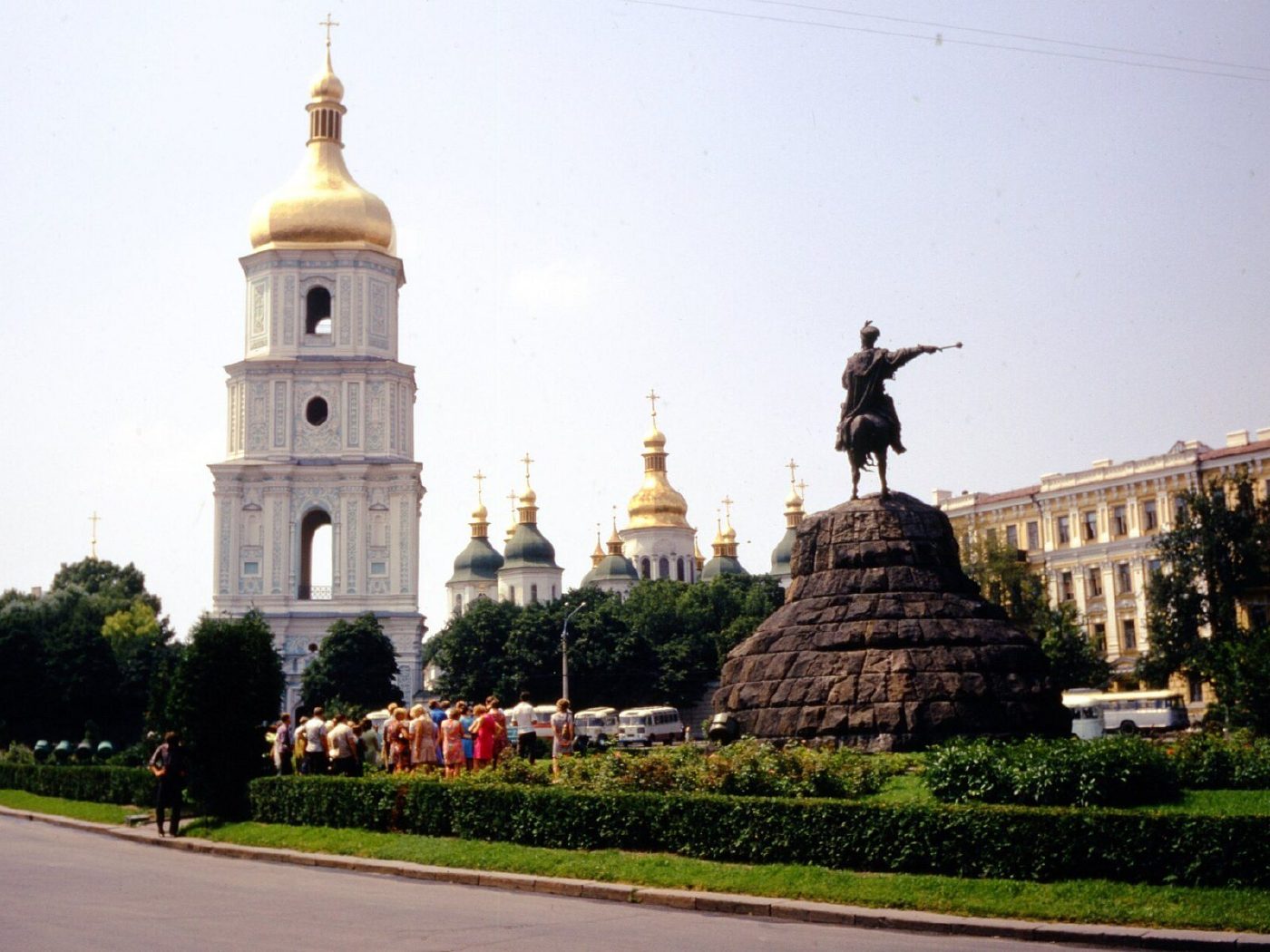
Sofiiska SquareSofiiska SquareThe bell tower of St Sophia's Cathedral and the Bohdan Khmelnytsky monument (1888) amid lawns and flower beds. The square was later paved and is now the main venue for city festivals and the New Year tree.Archival photo: Томас Тейлор Гаммонд, 1970-ті, CC BY-SA 4.0 · Wikimedia Commons
Modern photo: Sasha India, 2018, CC BY 2.0 · Wikimedia Commons -
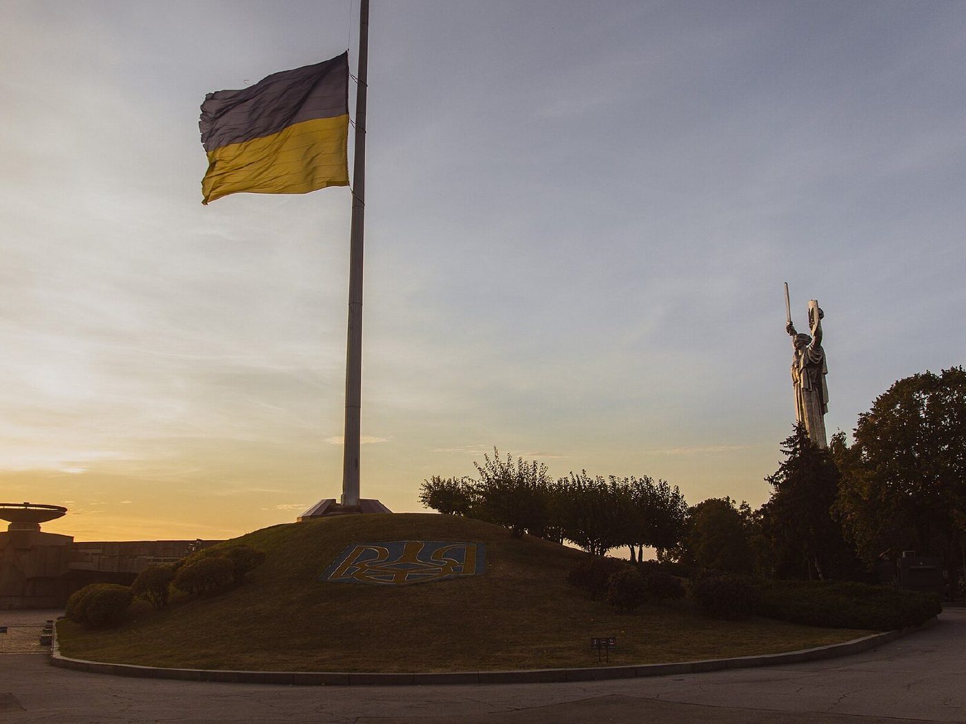
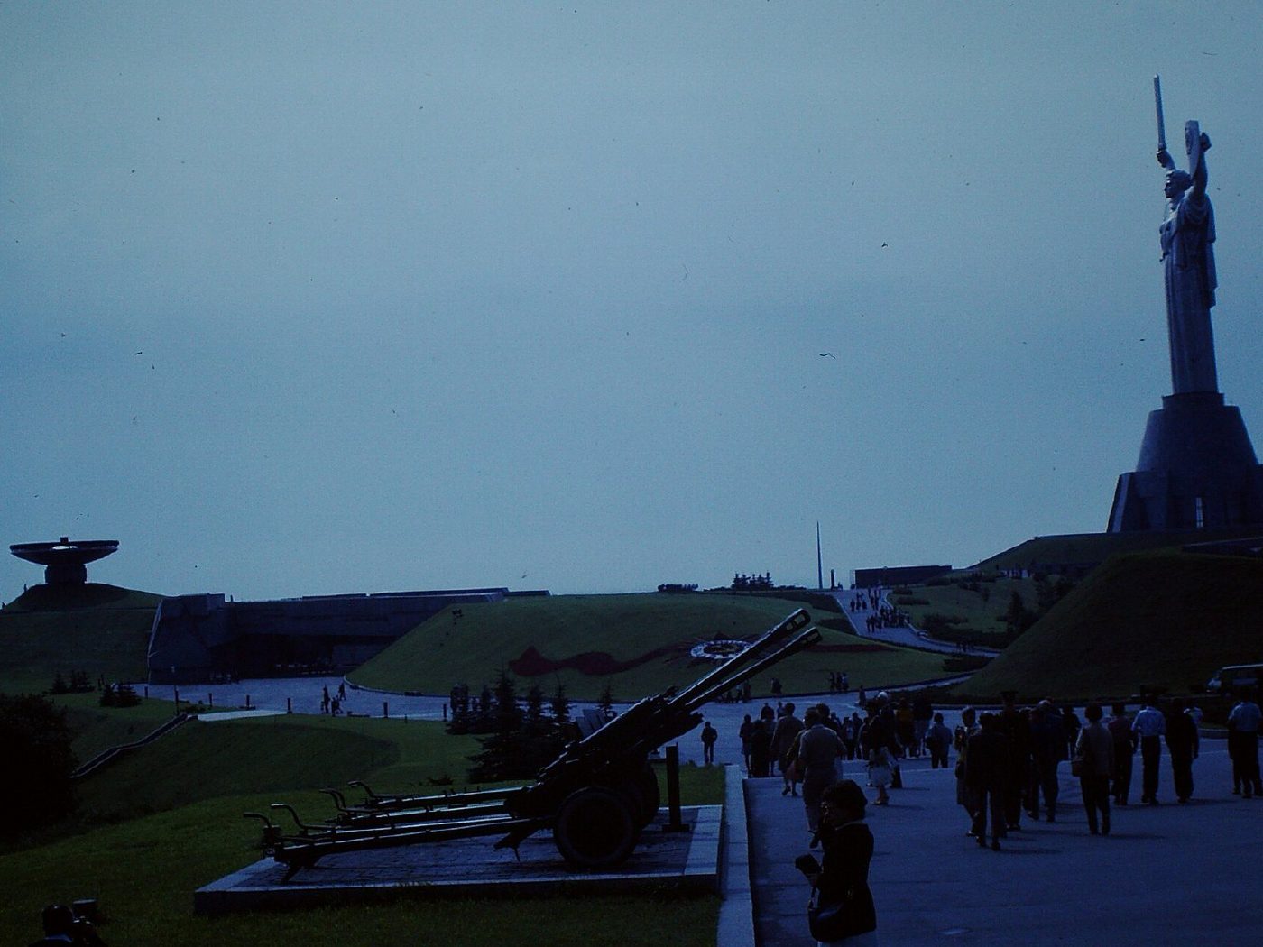
National Museum of the History of Ukraine in WWII, 27 Lavrska StreetThe Motherland MonumentThe Motherland Monument, unveiled in 1981, is Kyiv’s tallest statue. Its shield then bore the Soviet coat of arms; in August 2023 it was replaced with the Ukrainian trident.Archival photo: Robert Brumter, 1984, CC BY-SA 4.0 · Wikimedia Commons
Modern photo: Milena Frohlich, 2023, CC BY-SA 4.0 · Wikimedia Commons -
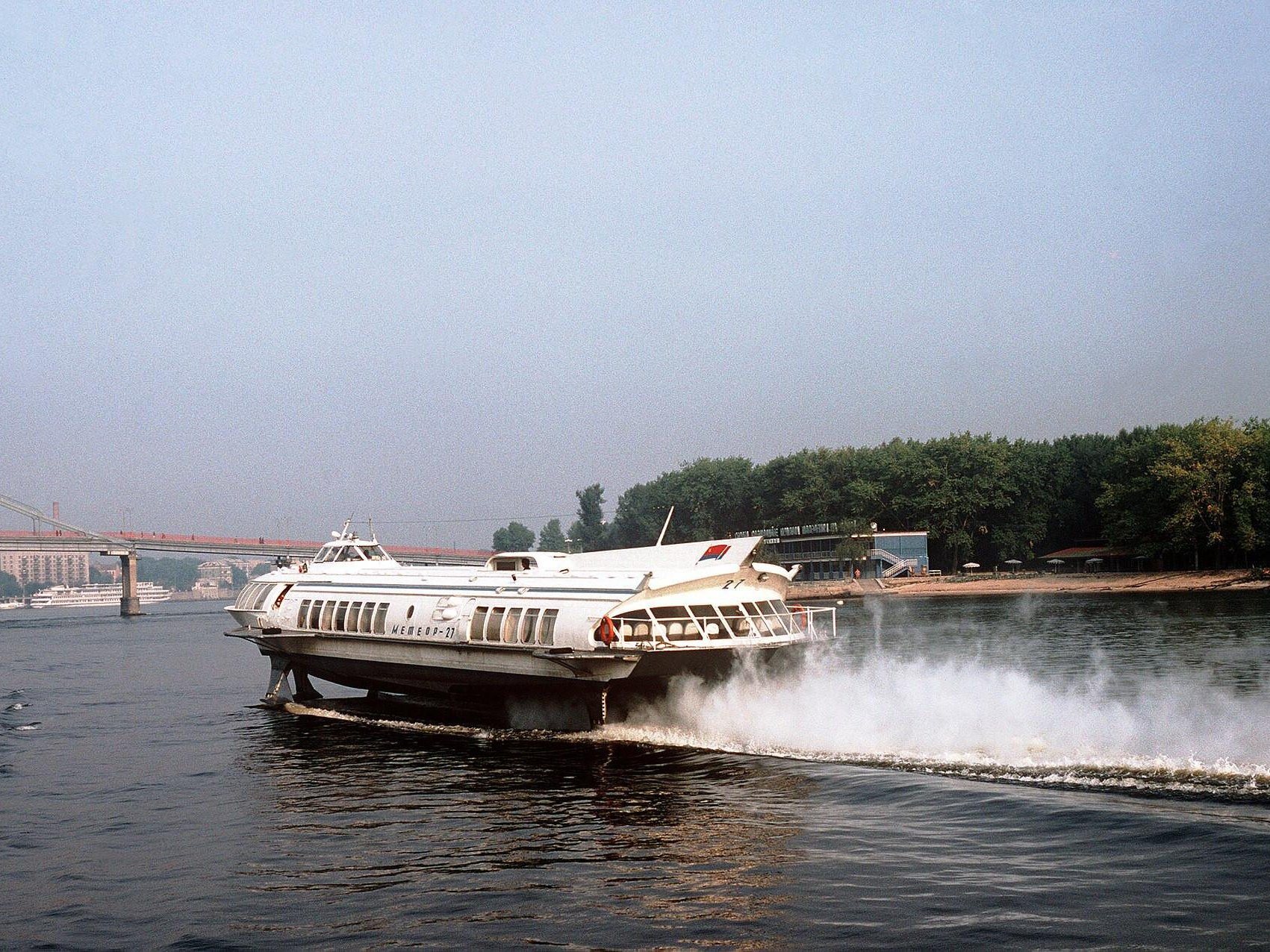
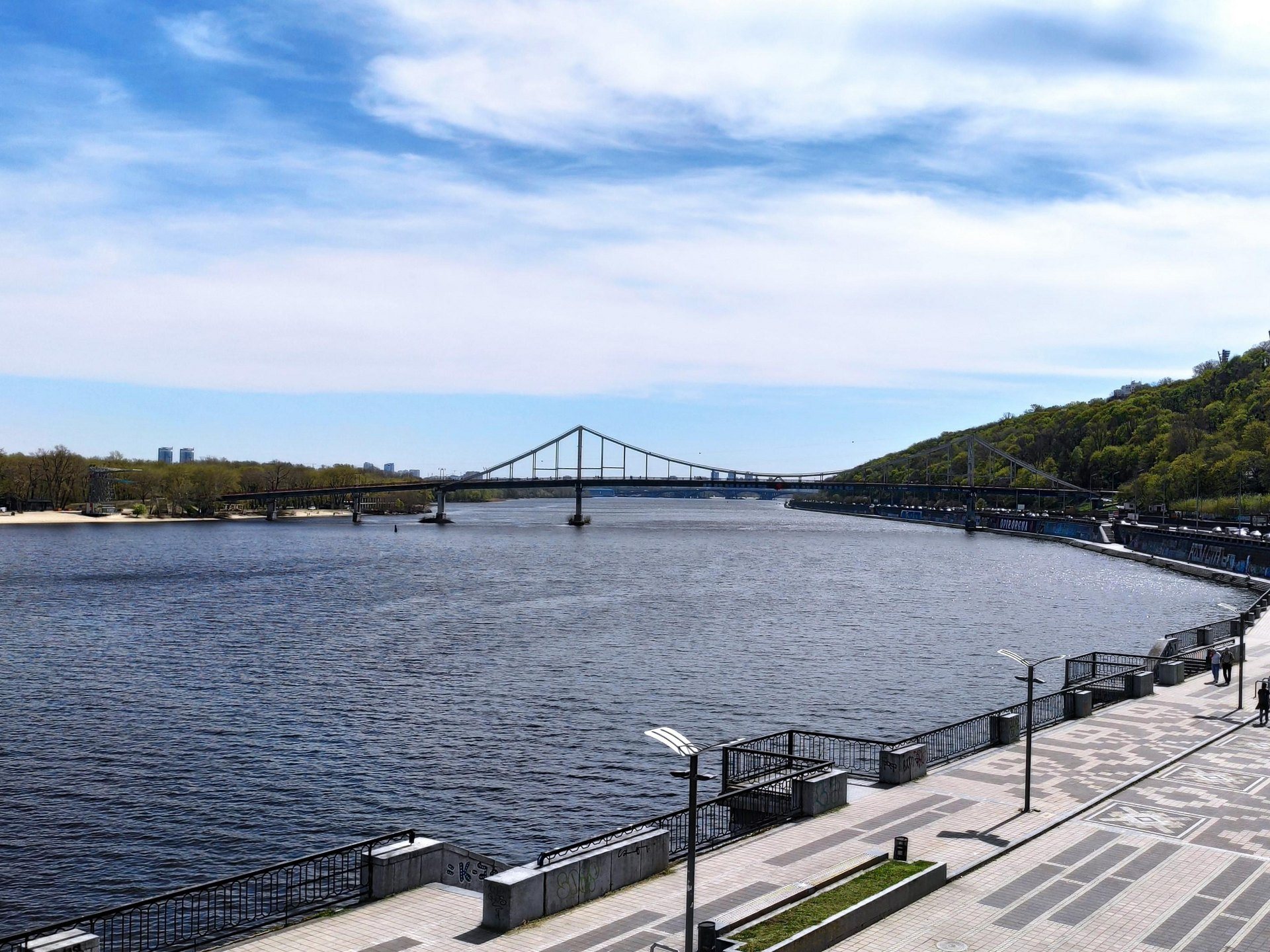
The DniproA hydrofoil on the DniproA hydrofoil speeds along the Dnipro with the Pedestrian Bridge behind. Raketa and Meteor hydrofoils carried passengers from Kyiv to Kaniv, Cherkasy and beyond. The "now" photo, from April 2025, shows the same reach of the Dnipro and the Pedestrian Bridge from the embankment by Poshtova Square.Archival photo: Don S. Montgomery, DoD / National Archives), 1985, суспільне надбання · Wikimedia Commons
Modern photo: Xsandriel, 2025, CC BY-SA 4.0 · Wikimedia Commons -
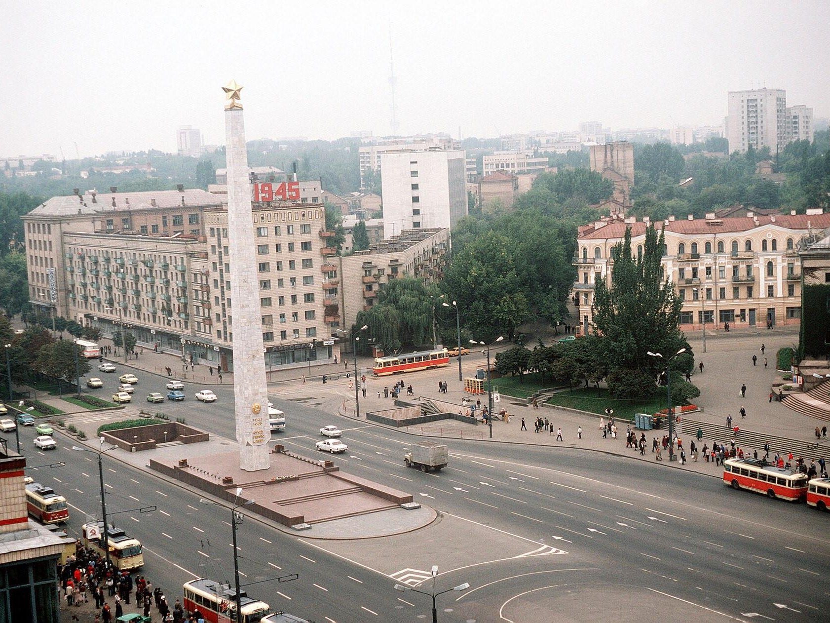
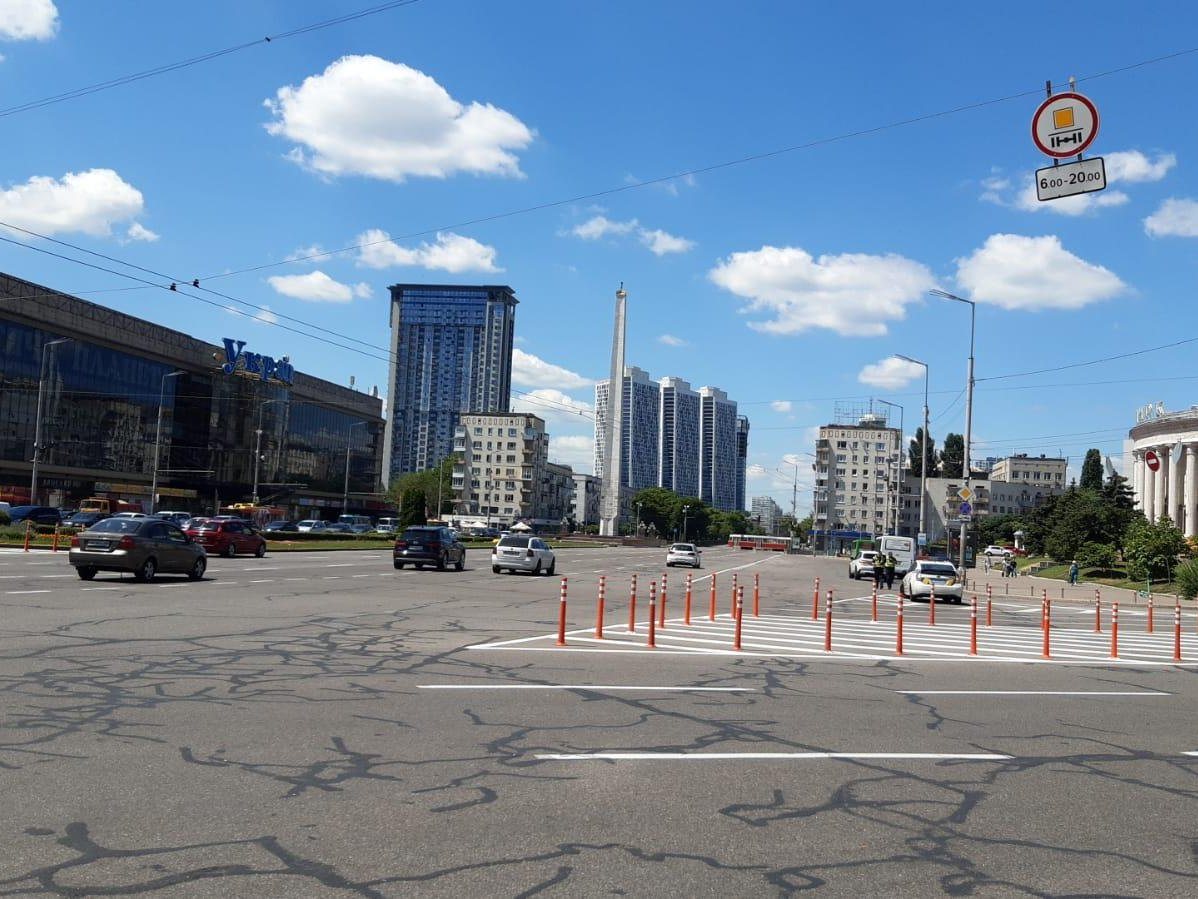
Halytska (Peremohy) SquarePeremohy SquarePeremohy Square from above, with the 1982 "Hero City of Kyiv" obelisk, the Ukraina department store and trams on the loop. It is now called Halytska Square. The "now" photo, from June 2024, shows the obelisk still standing, with high-rises now behind it.Archival photo: Don S. Montgomery, DoD / National Archives), 1985, суспільне надбання · Wikimedia Commons
Modern photo: Mazij, 2024, CC BY-SA 4.0 · Wikimedia Commons -
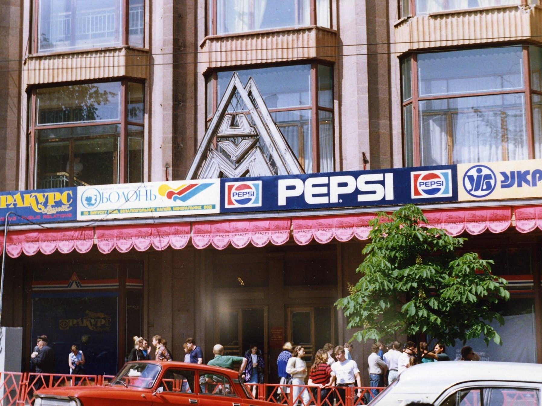
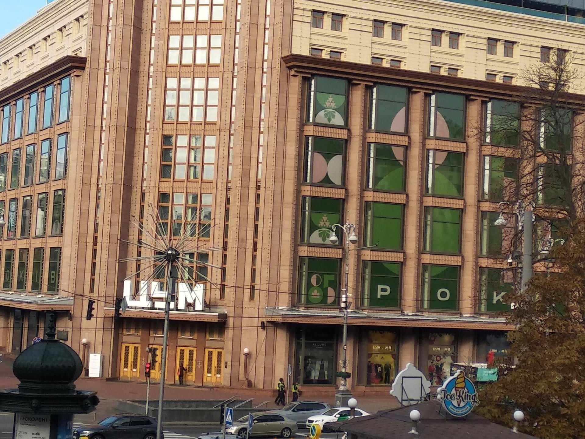
TsUM, 38 KhreshchatykPepsi on TsUMBillboards for Pepsi and other brands on the TsUM department store — some of Kyiv’s first outdoor advertising of the perestroika years. The store at Khreshchatyk and Bohdana Khmelnytskoho reopened after a 2010s reconstruction. The "now" photo, from October 2024, shows the façade free of billboards, with the "ЦУМ" sign over the entrance.Archival photo: Artashot, 1989, CC BY-SA 4.0 · Wikimedia Commons
Modern photo: Olya Tsimbal, 2024, CC BY-SA 4.0 · Wikimedia Commons -
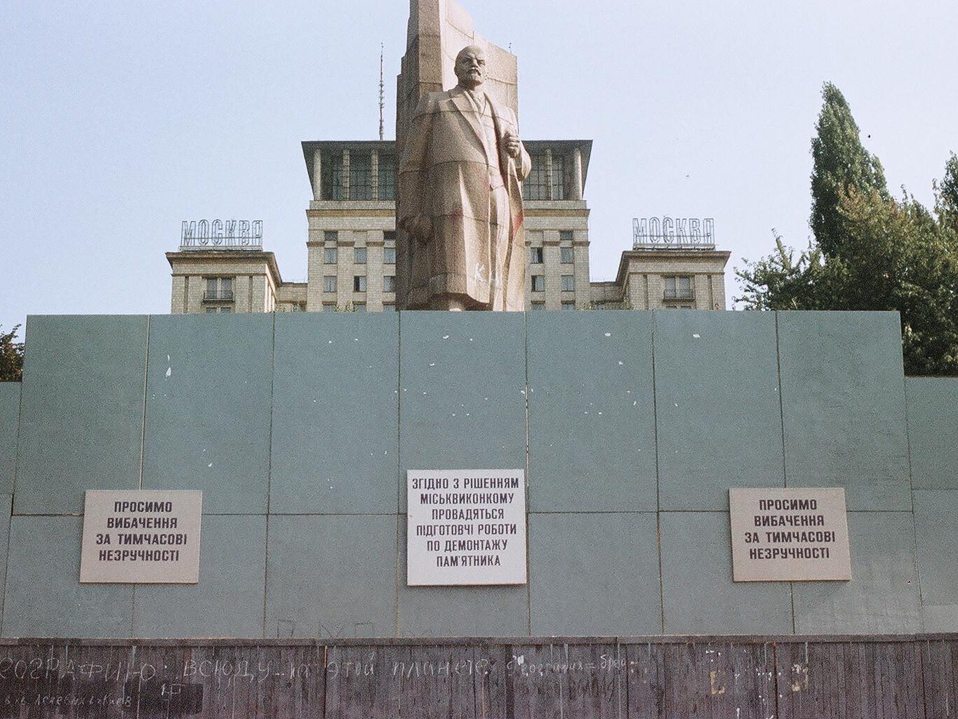
Maidan NezalezhnostiRemoving Lenin from the squareEarly September 1991: the Lenin statue on October Revolution Square is fenced off, with signs announcing the city executive committee’s decision to dismantle it. The square soon became Maidan Nezalezhnosti. The "now" photo, from 10 May 2025, shows the column of the Independence Monument (2001) rising over the square, with the same hotel, now the Hotel Ukraine, behind.Archival photo: М. Яковенко, В. Білецький, 1991, суспільне надбання · Wikimedia Commons
Modern photo: Simon Dawson, 2025, CC BY 2.0 · Wikimedia Commons -
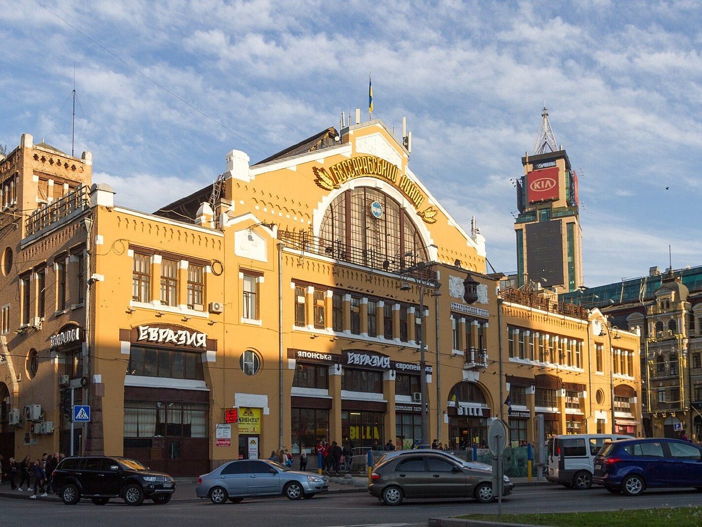
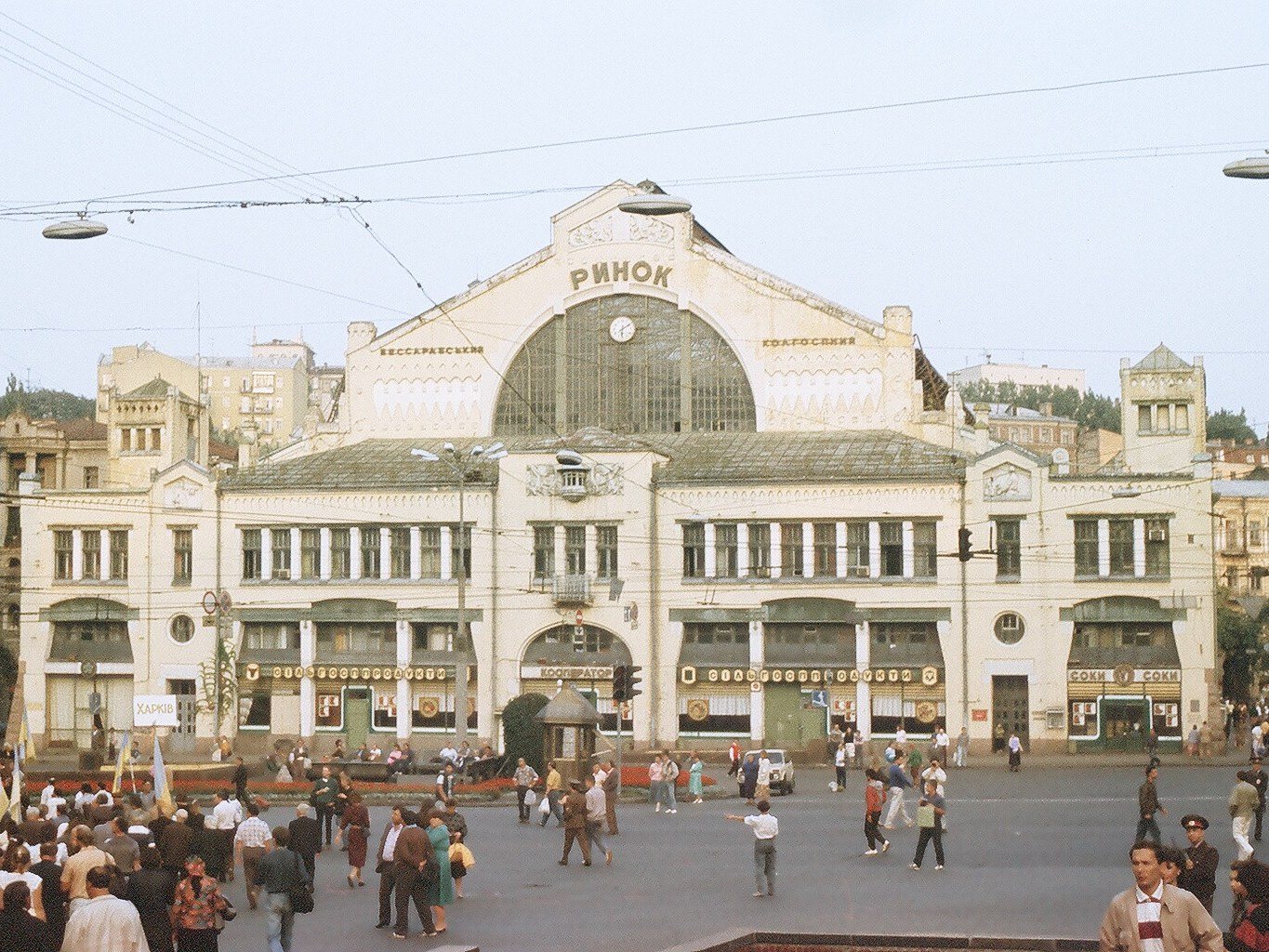
2 Bessarabska SquareBessarabskyi MarketBessarabskyi Market (1910–1912, architect Henryk Gay) in the 1990s, when the square in front also served as an informal trading spot. The market still operates.Archival photo: М. Яковенко, В. Білецький, 1990-ті, суспільне надбання · Wikimedia Commons
Modern photo: Максим Козленко, 2017, CC BY-SA 4.0 · Wikimedia Commons -
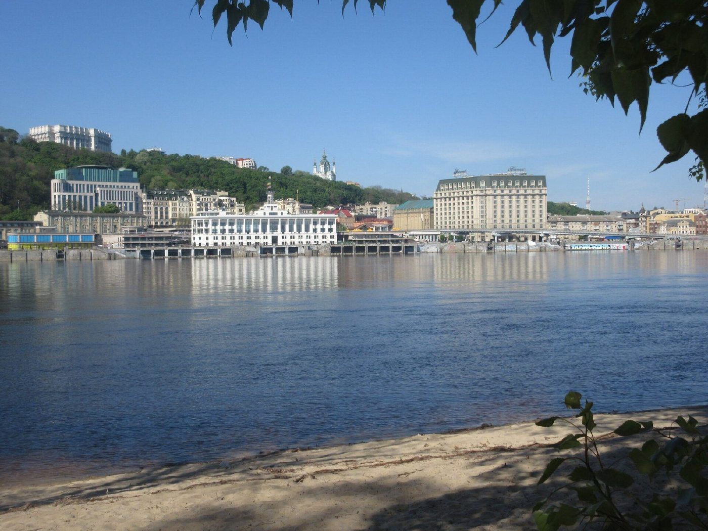
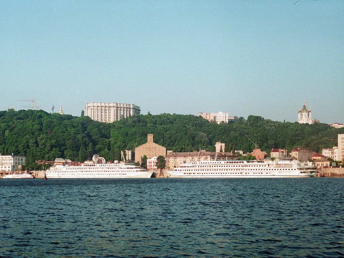
Poshtova Square, River StationPodil from the DniproThe River Station and cruise ships at Podil on 19 July 1998, "still without modern high-rises", as the author put it, below the green slopes of Volodymyrska Hill.Archival photo: khrul, 1998, CC BY 3.0 · Wikimedia Commons
Modern photo: Віктор Полянко, 2024, CC BY-SA 4.0 · Wikimedia Commons -
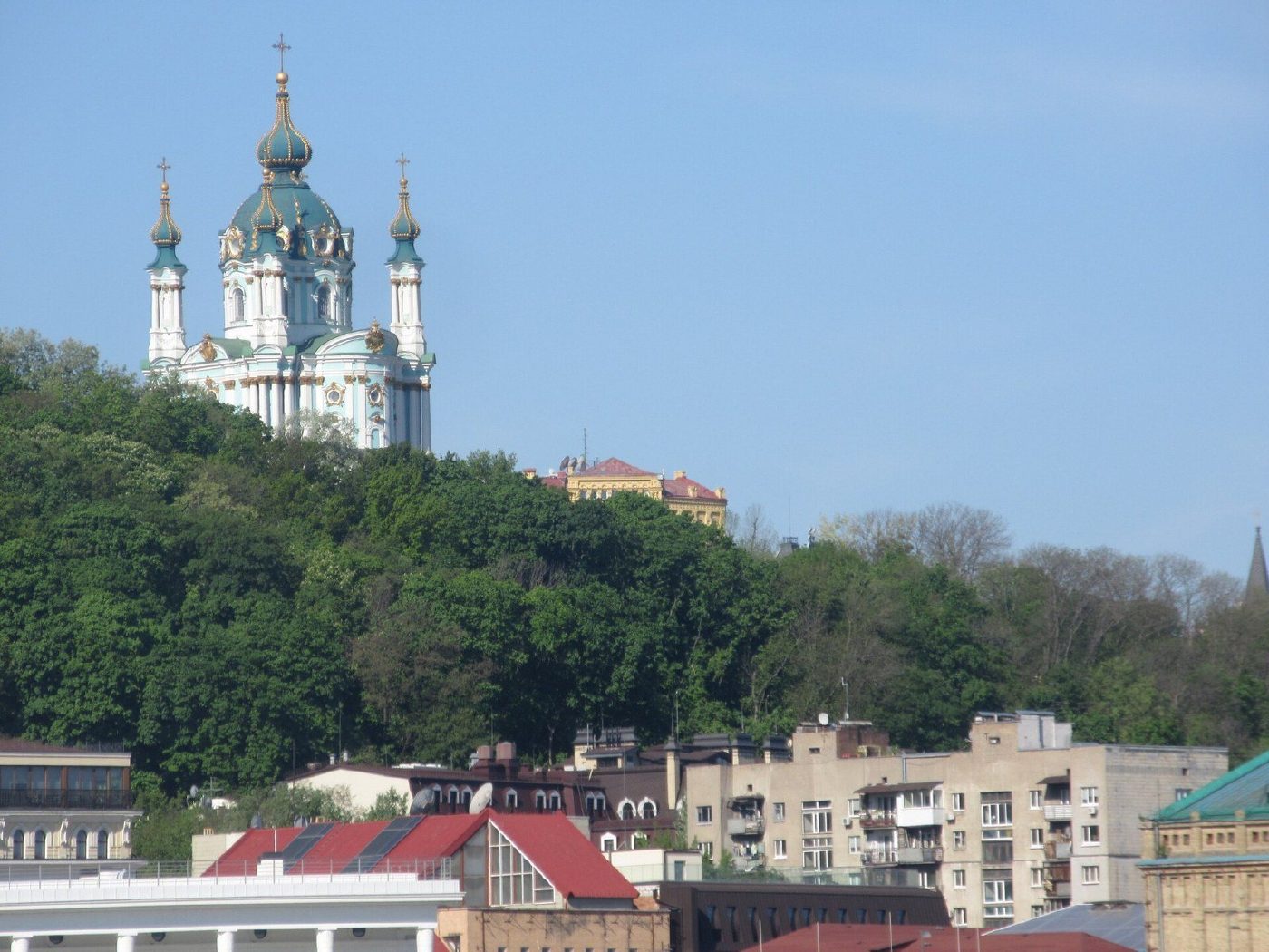
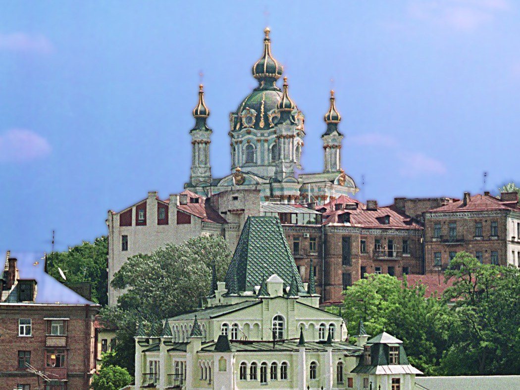
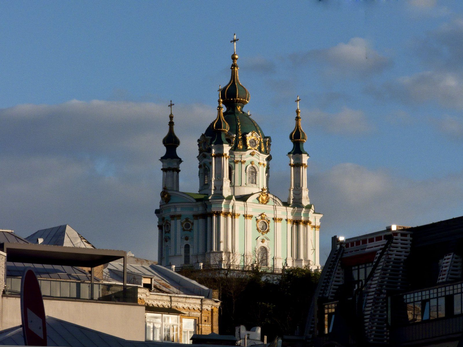
23 Andriivskyi UzvizSt Andrew's ChurchSt Andrew's Church (1747–1762, Bartolomeo Rastrelli) above the rooftops of Podil on 15 July 1998. It has since been restored and in 2018 was handed over to the Ecumenical Patriarchate.Archival photo: khrul, 1998, CC BY 3.0 · Wikimedia Commons
Modern photo: Віктор Полянко, 2024, CC BY-SA 4.0 · Wikimedia Commons -
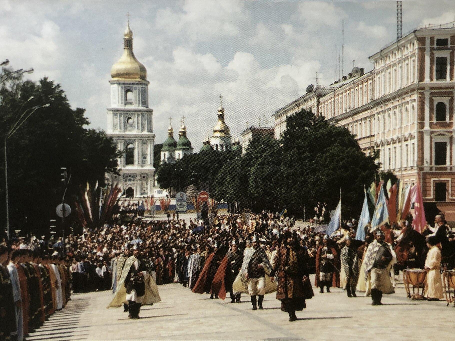
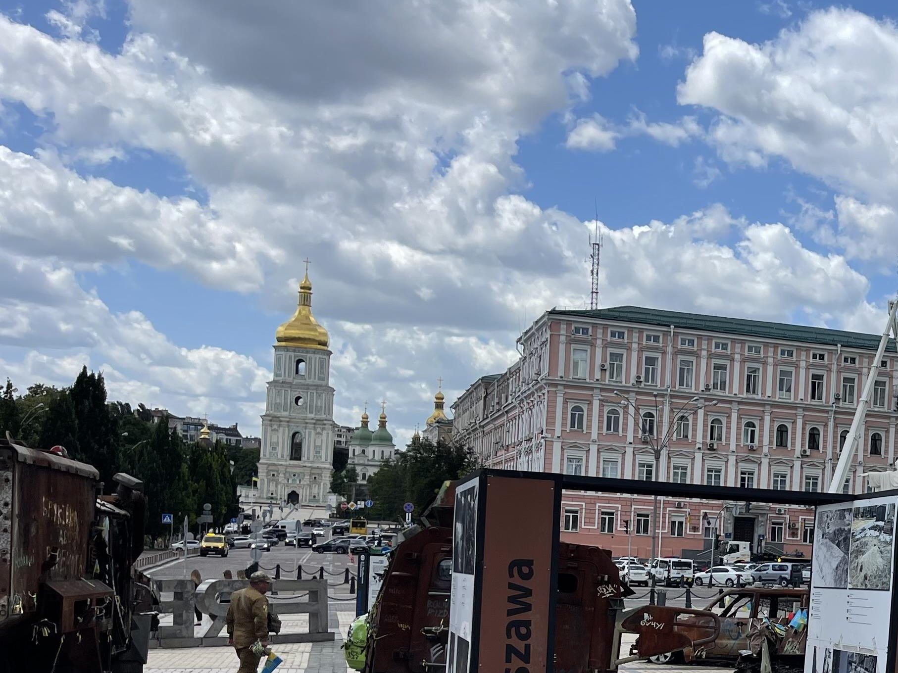
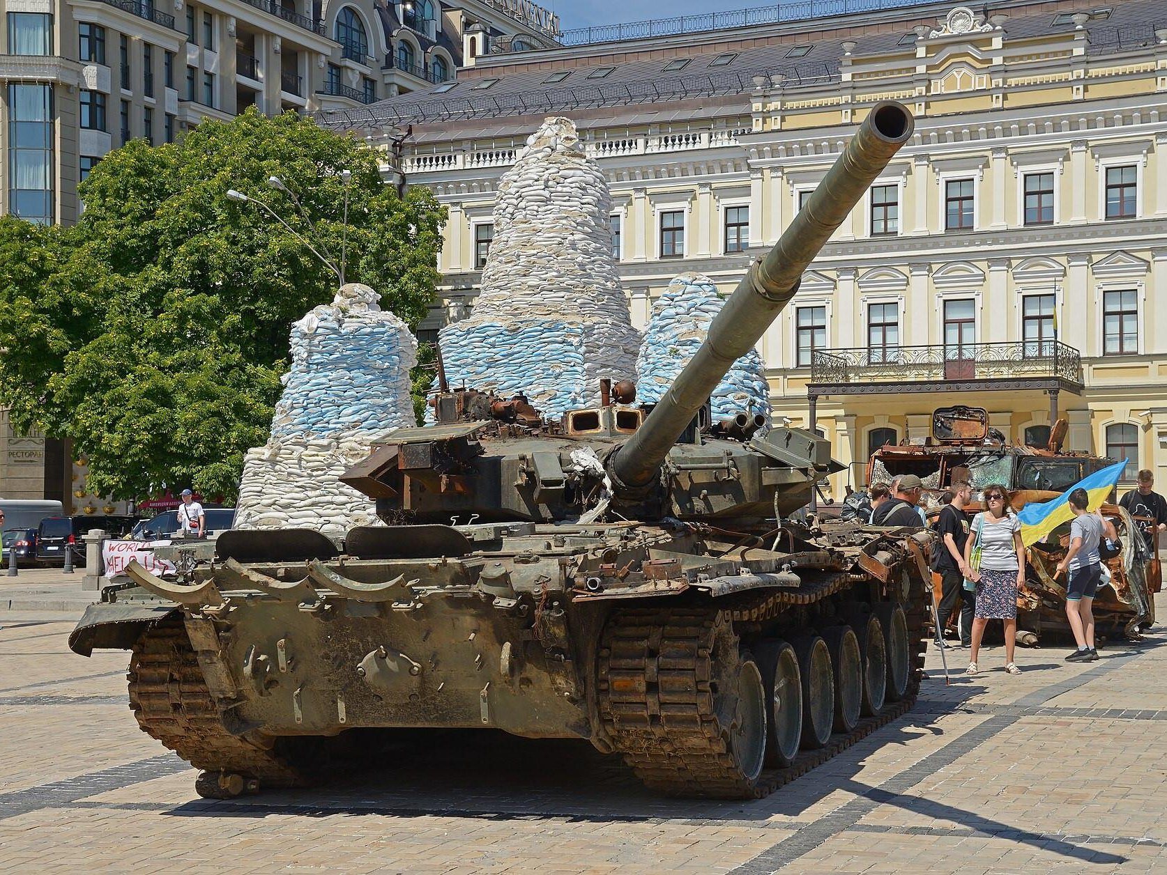
Central KyivOpening of St Michael's bell tower30 May 1999: a costumed procession celebrating the opening of the rebuilt bell tower of St Michael's Golden-Domed Monastery, destroyed in the 1930s. Behind is the bell tower of St Sophia's Cathedral, seen from Mykhailivska Square. The "now" photo, from June 2025, shows the same view, with an exhibition of destroyed Russian armour on the square.Archival photo: Микола Чурпіта, 1999, CC BY-SA 4.0 · Wikimedia Commons
Modern photo: Lklundin, 2025, CC BY-SA 4.0 · Wikimedia Commons -
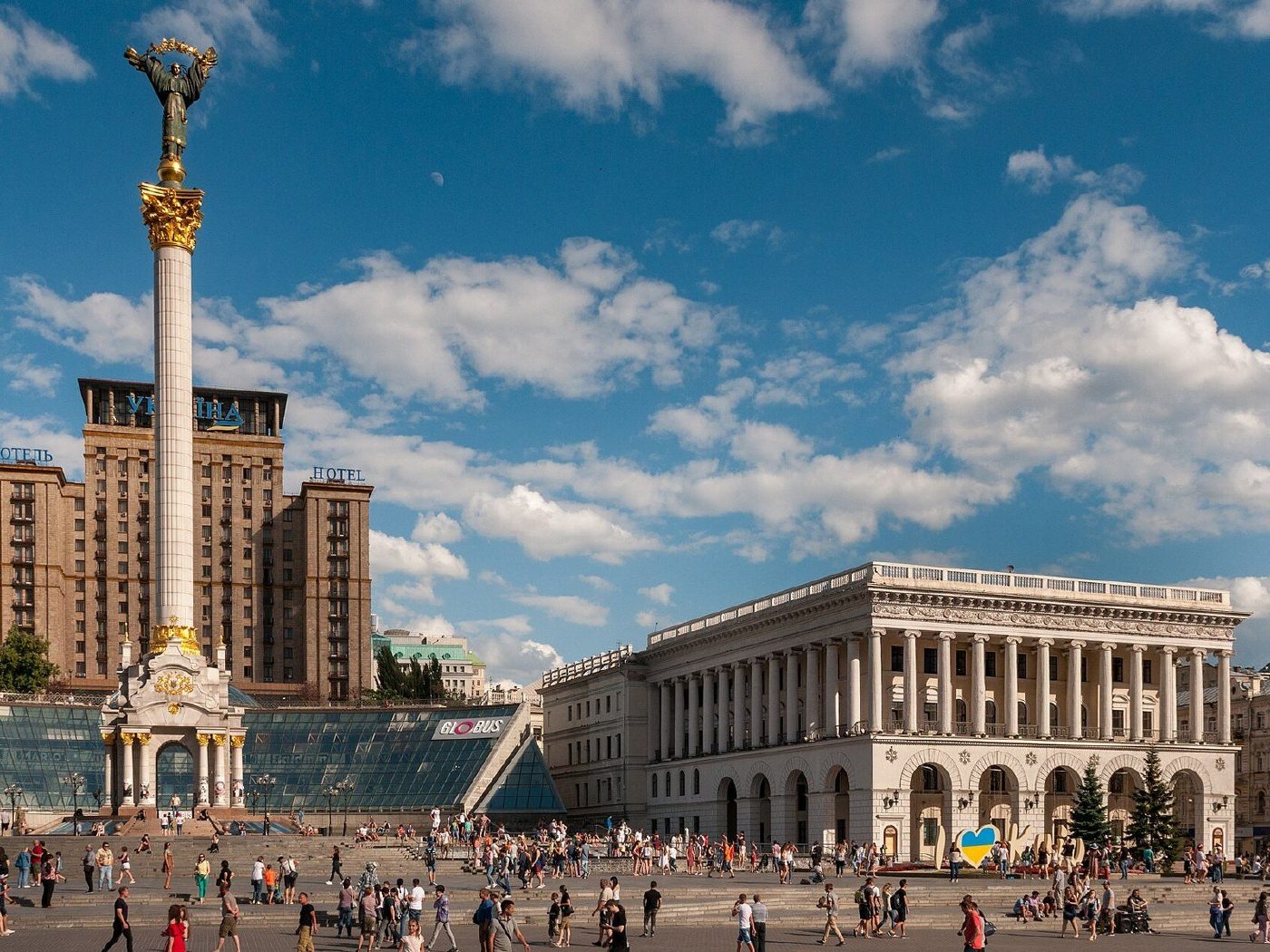
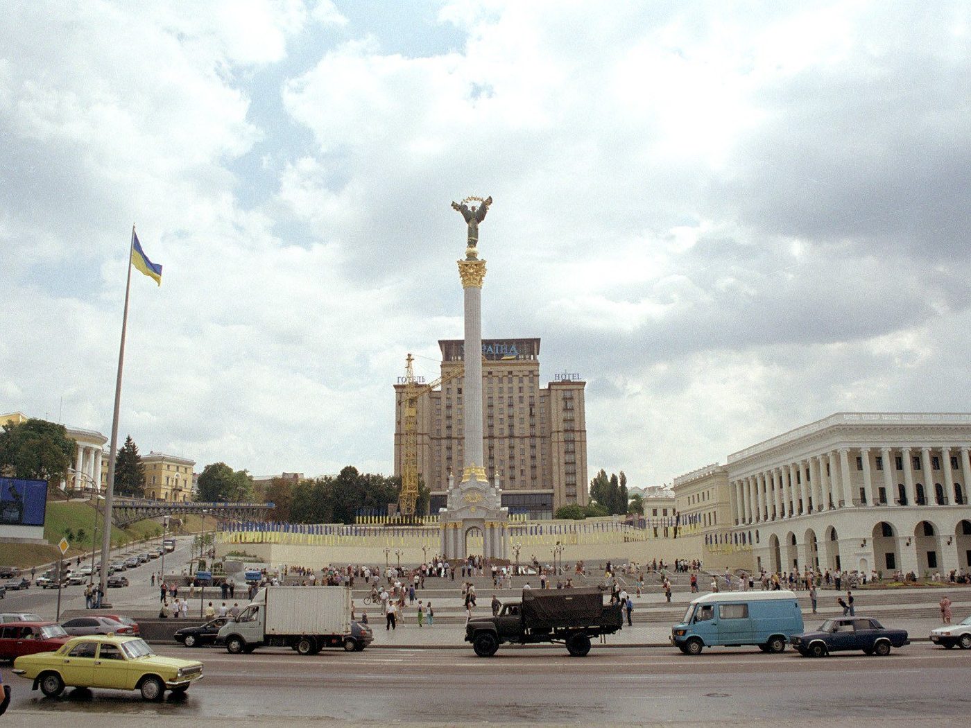
Maidan NezalezhnostiMaidan after reconstructionMaidan Nezalezhnosti in summer 2001: the column with the Berehynia statue has just gone up and the square is still empty of crowds. The Independence Monument was unveiled for the 10th anniversary of independence on 24 August 2001.Archival photo: Максим Козленко, 2001, CC0 · Wikimedia Commons
Modern photo: Ralf Roletschek, 2017, GFDL 1.2 · Wikimedia Commons -
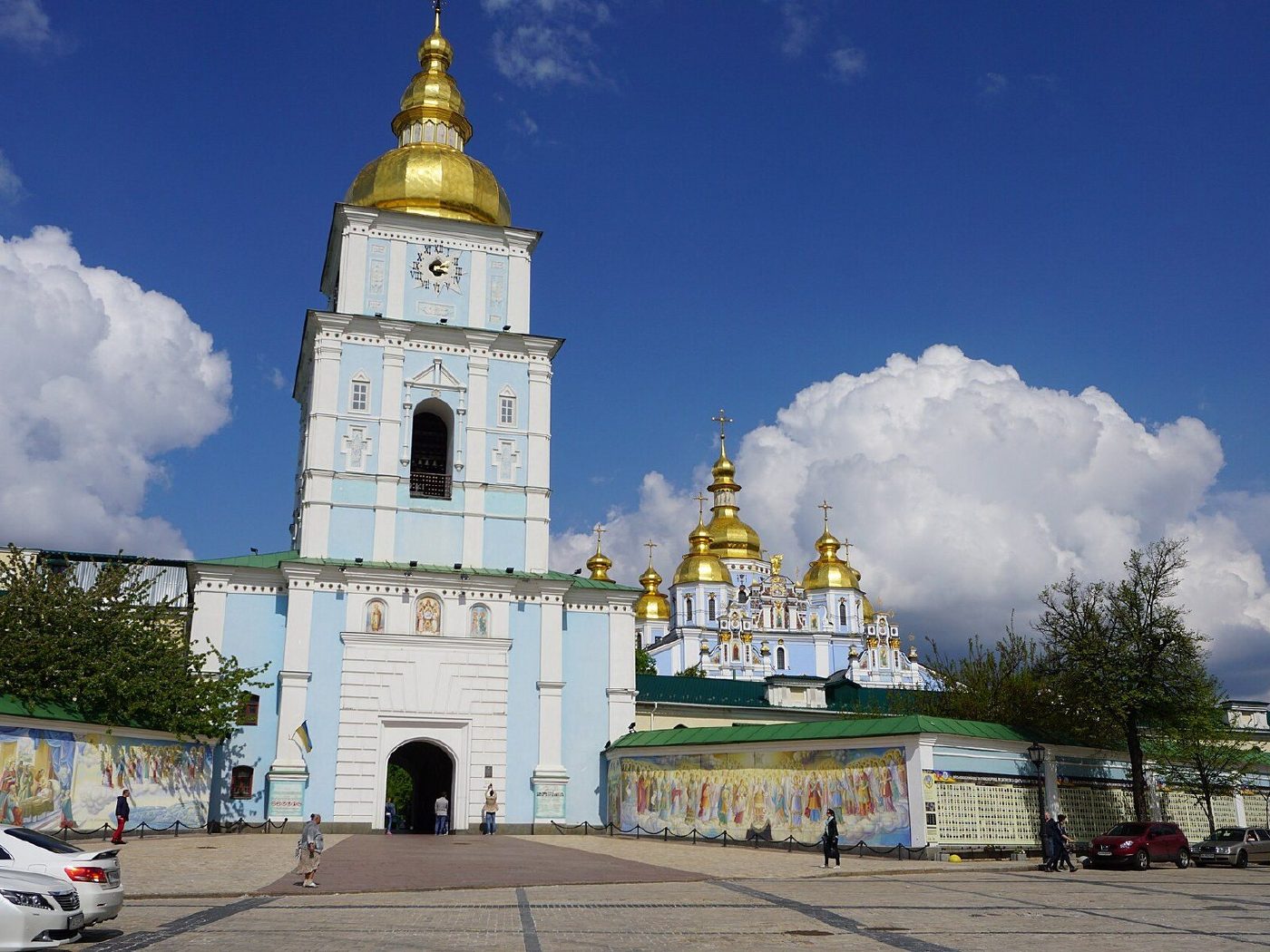
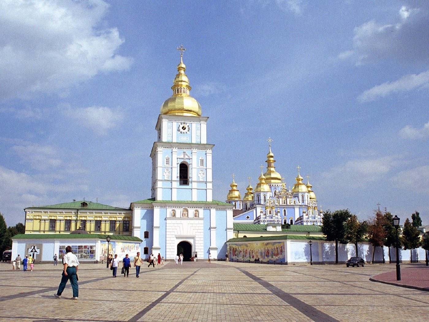
Mykhailivska SquareSt Michael's rebuiltSt Michael's Golden-Domed Monastery in 2000, shortly after the cathedral and bell tower were rebuilt (1997–1999). The 12th-century original was destroyed in the 1930s; work was still going on around it.Archival photo: Максим Козленко, 2000, CC BY-SA 4.0 · Wikimedia Commons
Modern photo: Andrew Milligan, 2018, CC BY 2.0 · Wikimedia Commons -
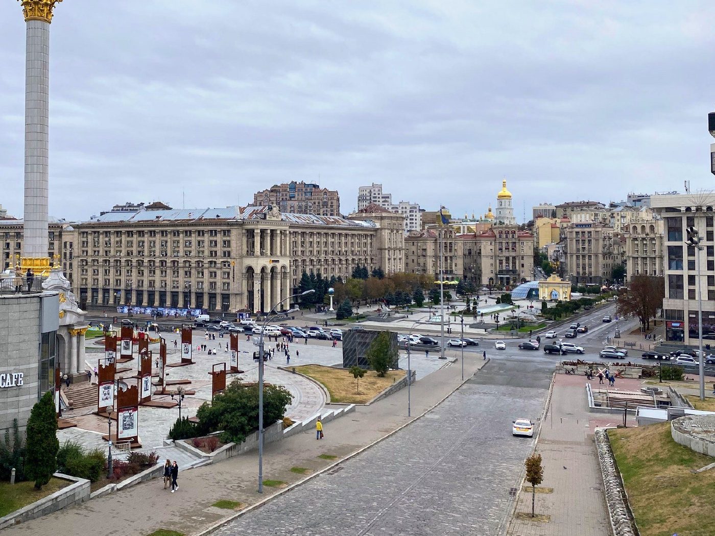
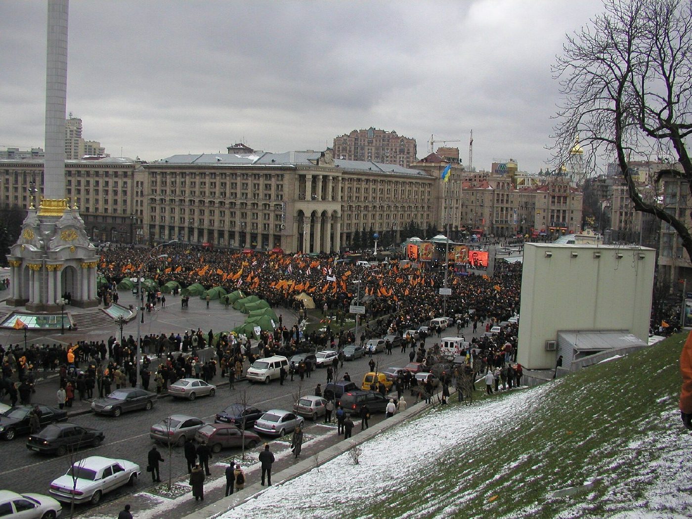
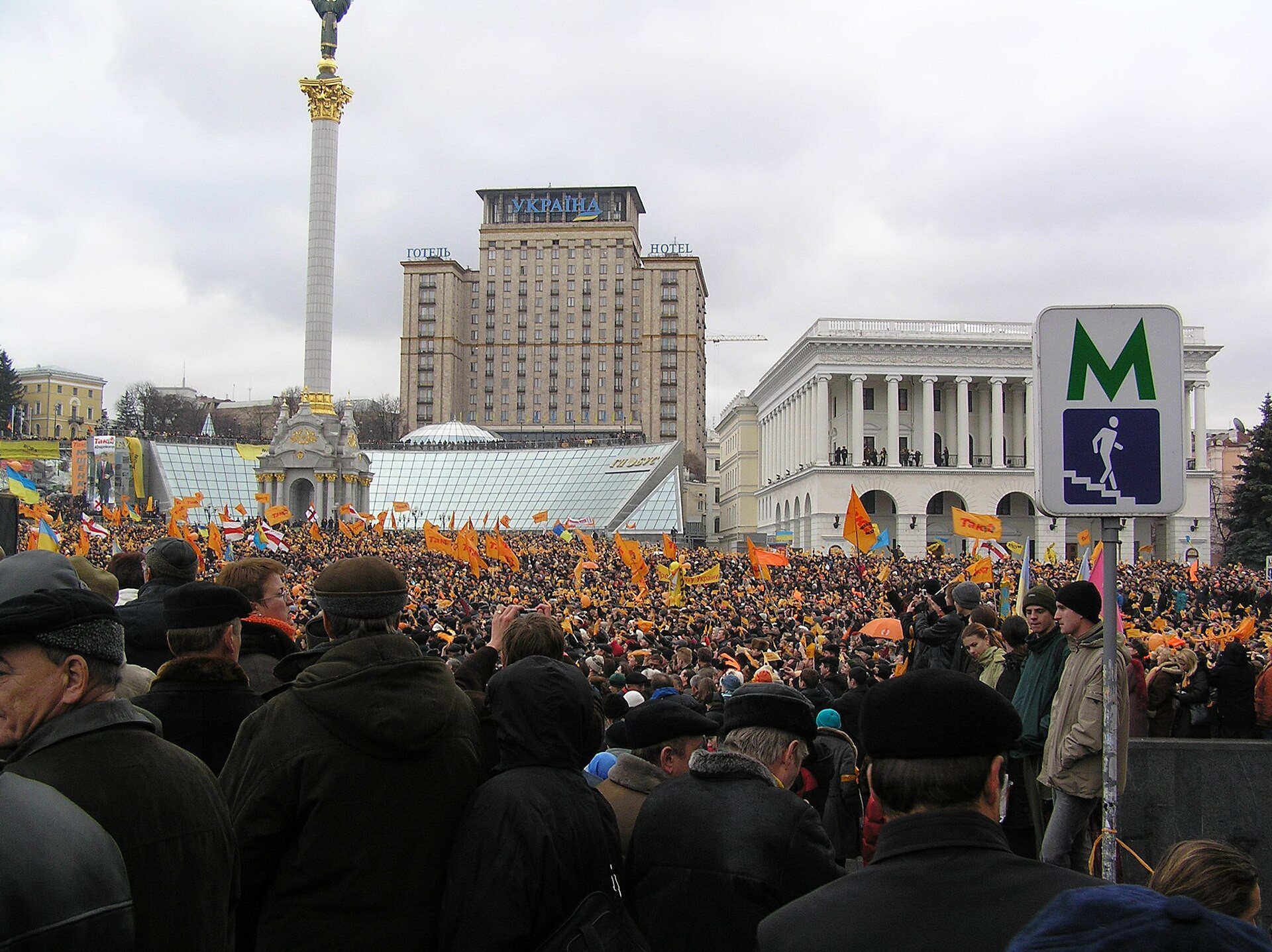
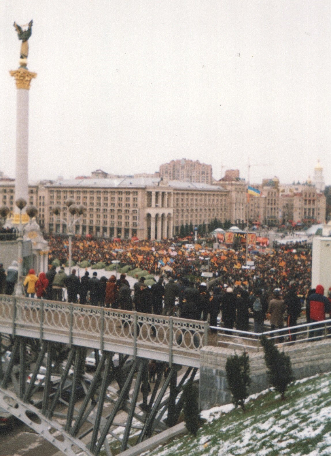
Maidan NezalezhnostiThe Orange MaidanNovember 2004: after the presidential run-off, the square fills with people in orange. The protests against electoral fraud lasted weeks and ended with a repeat vote on 26 December. The "now" photo was taken from the same slope in October 2023: no tents and no crowd, but the same Independence Monument and Khreshchatyk buildings.Archival photo: Toronto_guy, 2004, CC BY 3.0 · Wikimedia Commons
Modern photo: Мандрівниця, 2023, CC BY-SA 4.0 · Wikimedia Commons -
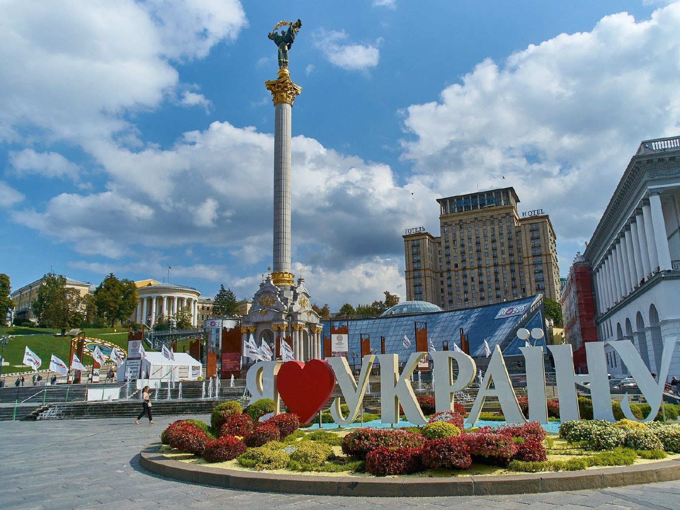
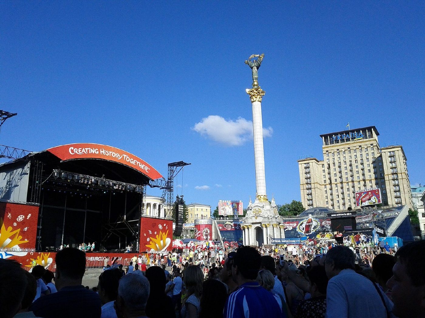
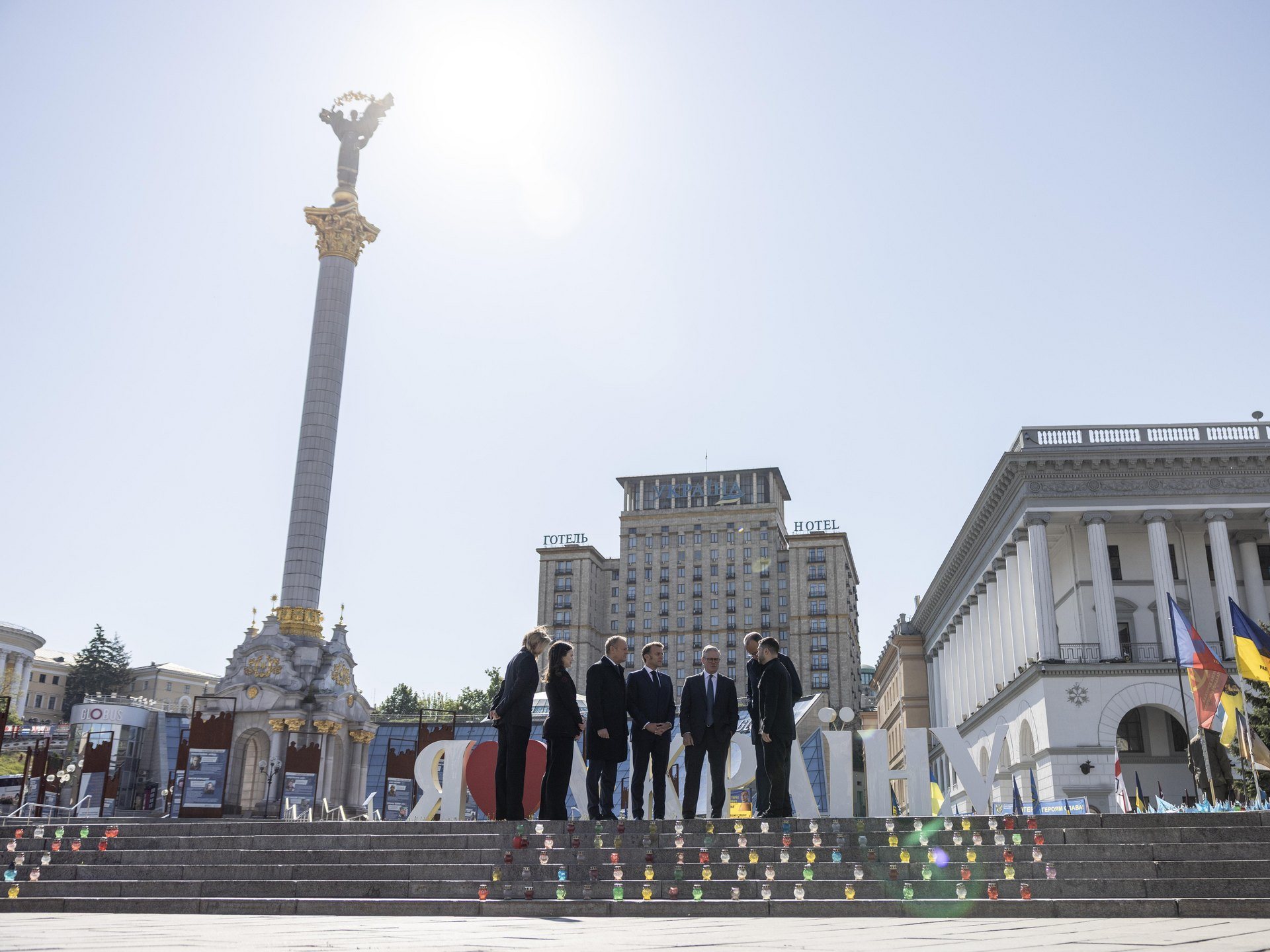
Maidan NezalezhnostiEuro 2012 fan zoneThe UEFA Euro 2012 fan zone on Maidan Nezalezhnosti in June 2012. Ukraine co-hosted the tournament with Poland; the final was played in Kyiv at the Olimpiyskiy stadium on 1 July. In September 2021 a flower bed spelling "Я ❤ Україну" ("I love Ukraine") stood where the stage had been, with Hotel Ukraina still rising behind the Independence Monument.Archival photo: Erik Cleves Kristensen, 2012, CC BY 2.0 · Wikimedia Commons
Modern photo: Грибюк Руслан Володимирович, 2021, CC BY-SA 4.0 · Wikimedia Commons -
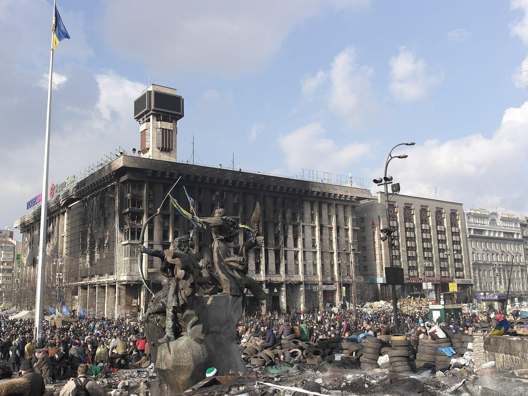
Maidan NezalezhnostiThe Maidan after the assault21 February 2014: the Maidan after the bloodshed of 18–20 February — torn-up paving, burnt tyres and the gutted Trade Unions Building. The next day Yanukovych fled Kyiv; the protesters killed are remembered as the Heavenly Hundred. The Trade Unions Building was later restored; the "now" photo was taken at the parade for the 30th anniversary of independence on 24 August 2021.Archival photo: Kiyanka, 2014, CC BY-SA 4.0 · Wikimedia Commons
Modern photo: Офіс Президента України, 2021, CC BY 4.0 · Wikimedia Commons -
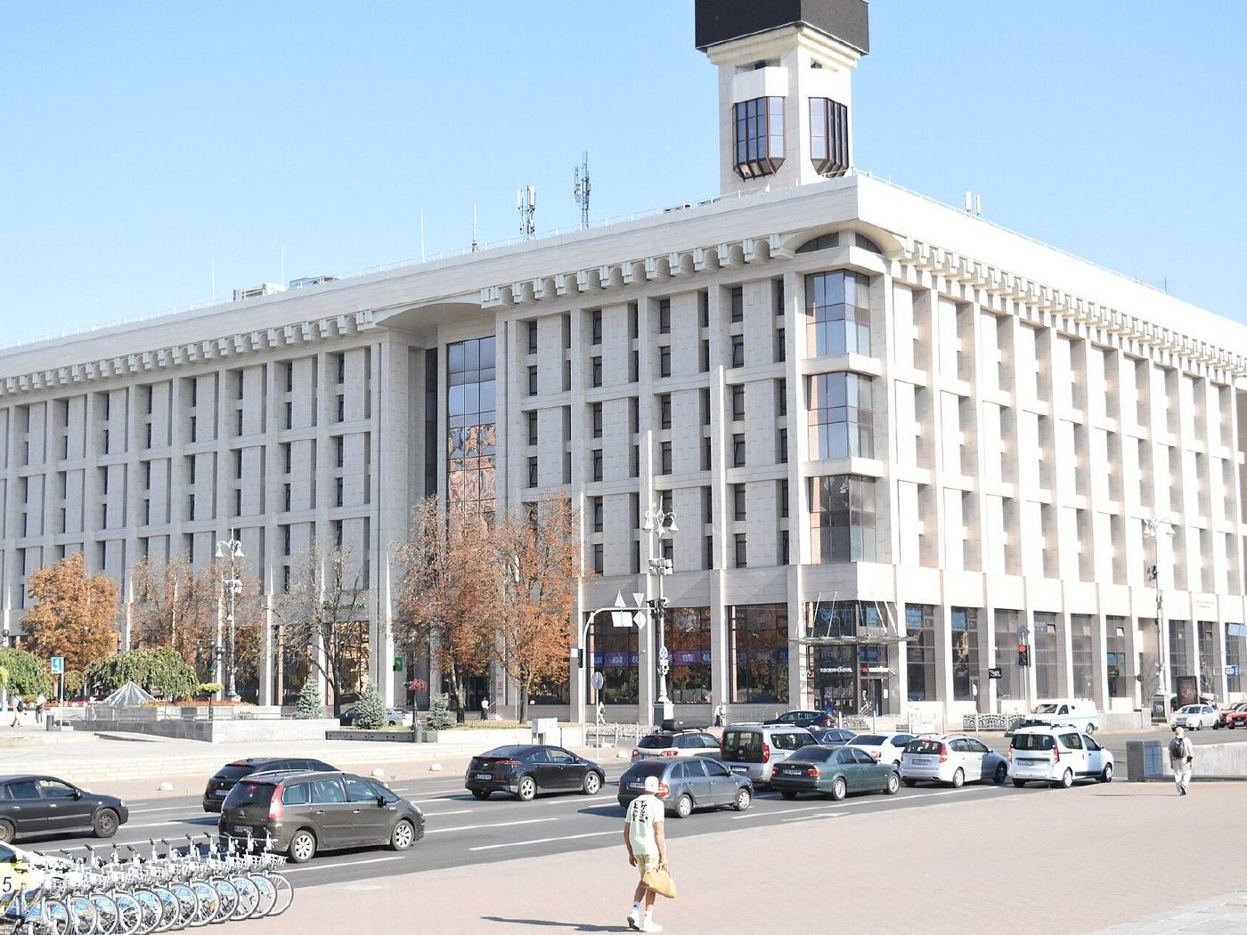
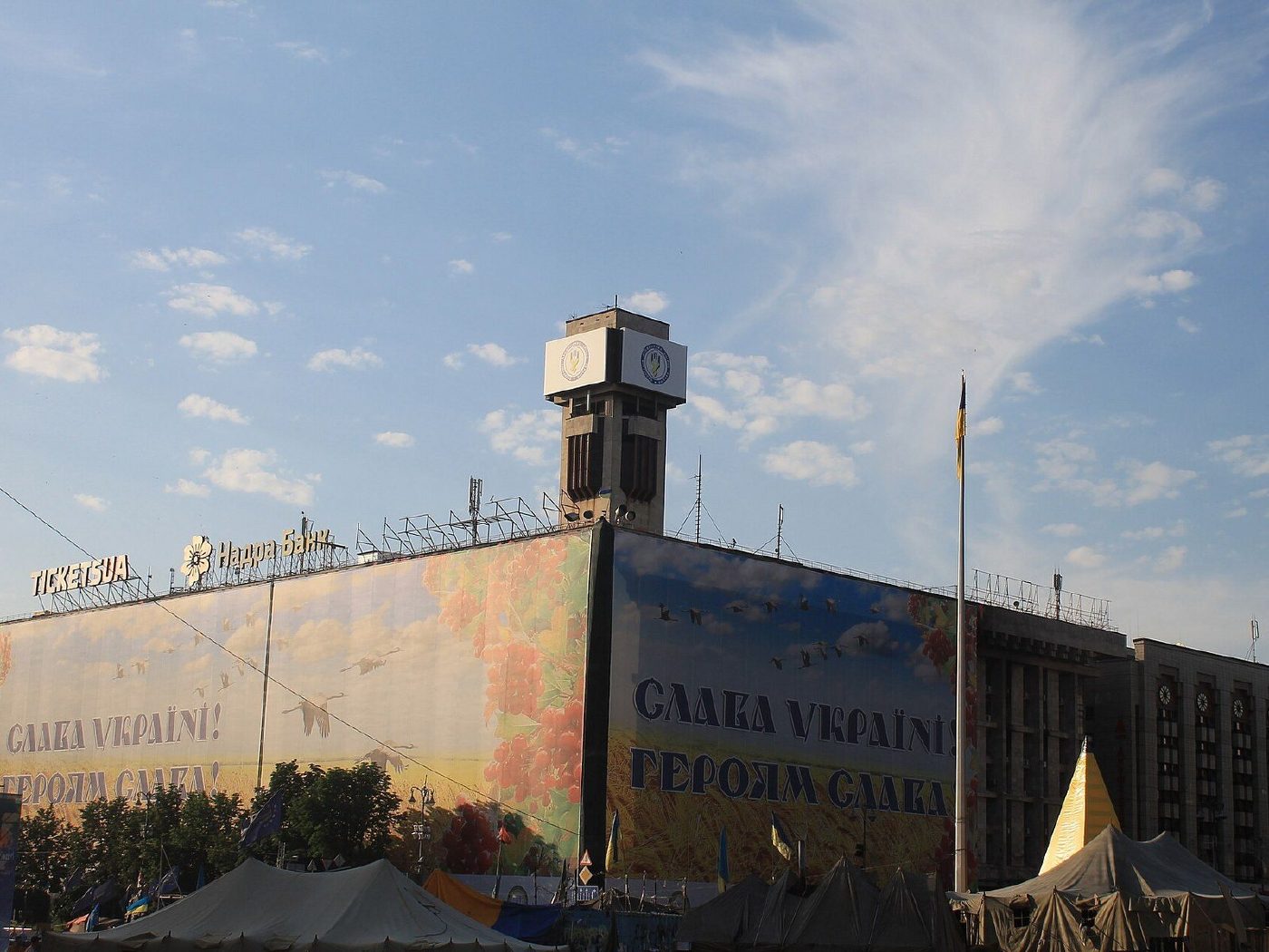
2 Maidan NezalezhnostiThe Trade Unions Building after the fireThe Trade Unions Building in June 2014, after the fire of the night of 18–19 February, when it housed the Maidan headquarters. The building has been restored, and its rooftop clock and display are lit again.Archival photo: A1, 2014, CC0 · Wikimedia Commons
Modern photo: Marcuspn, 2024, CC BY-SA 4.0 · Wikimedia Commons -
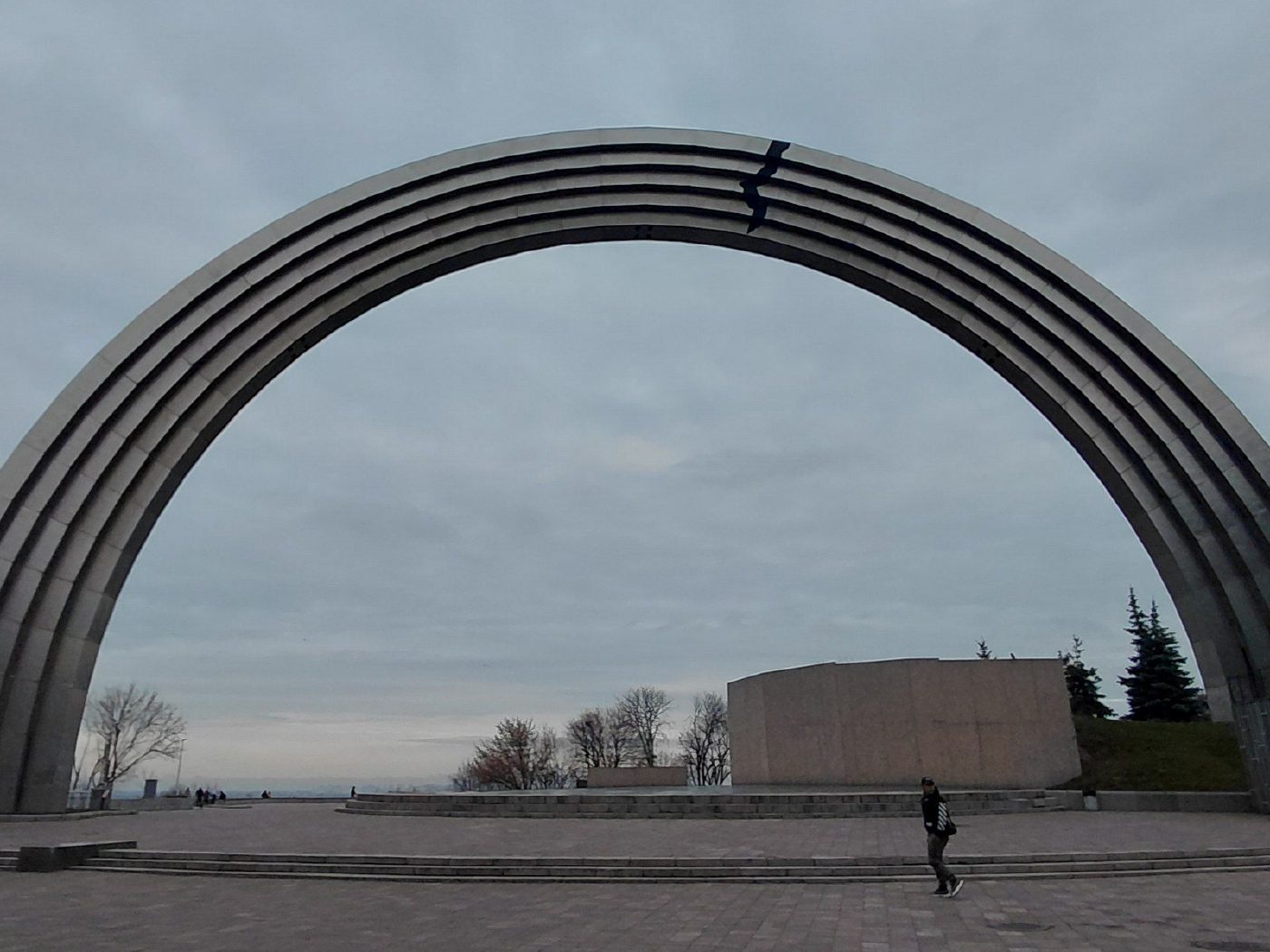
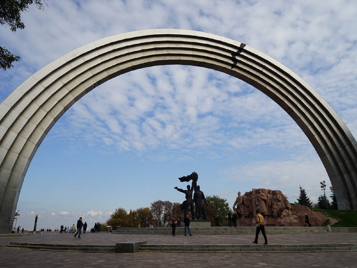
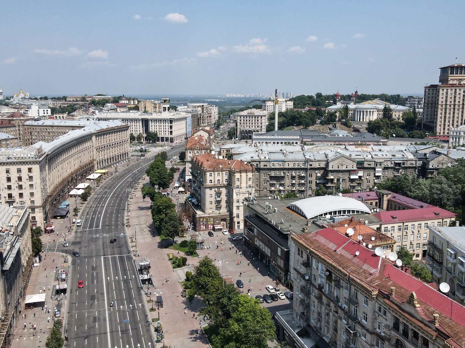
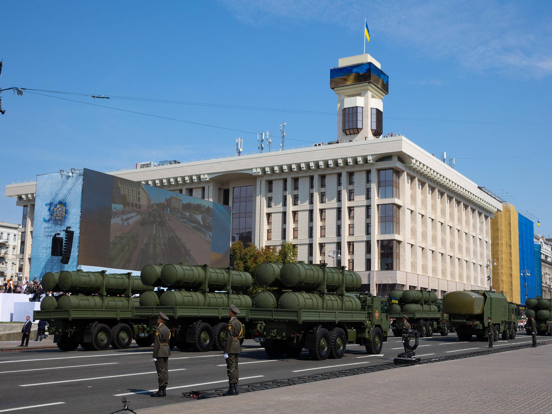
Khreshchatyi ParkPeople's Friendship ArchOctober 2019: the 1982 titanium arch with its bronze figures of two workers symbolising the "reunification" of Ukraine with Russia, and a black "crack" painted at the top. The sculpture was dismantled on 26 April 2022; on 14 May the city council renamed the monument the Arch of Freedom of the Ukrainian People, and in 2024 work began on removing the granite Pereiaslav Council group as well. The "now" photo dates from November 2025.Archival photo: Canercangul, 2019, CC BY-SA 4.0 · Wikimedia Commons
Modern photo: Venzz, 2025, CC BY-SA 4.0 · Wikimedia Commons -
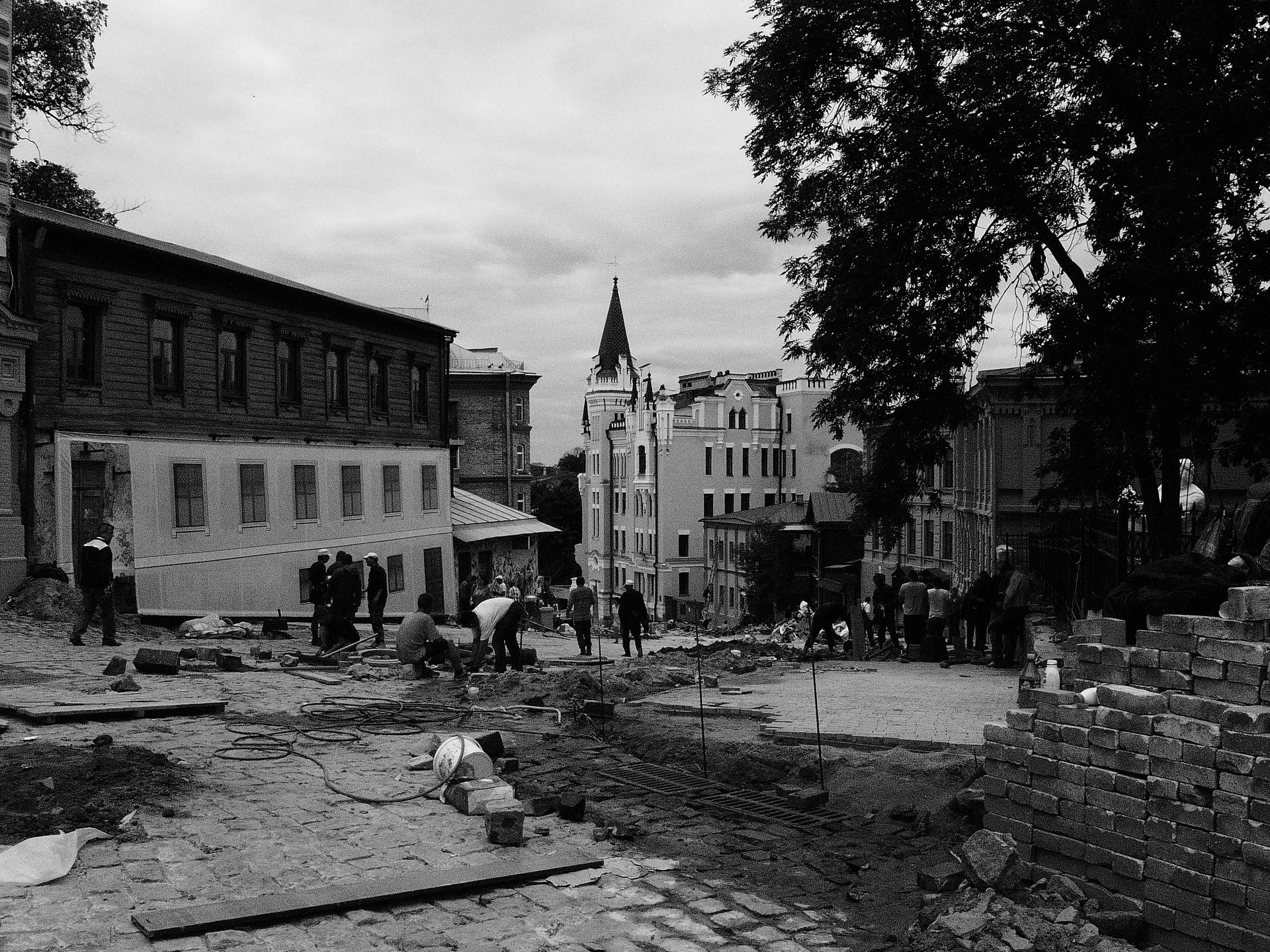
Andriivskyi UzvizAndriivskyi Uzviz under repair24 May 2012: the cobbles of Andriivskyi Uzviz torn up during the street's 2012 reconstruction, with workers relaying the stone and the spire of Richard's Castle in the distance. The "now" photo, from February 2024, shows the same street with its new paving.Archival photo: Andrew Niukin, 2012, CC BY-SA 3.0 · Wikimedia Commons
Modern photo: Щука Олександра, 2024, CC BY-SA 4.0 · Wikimedia Commons -
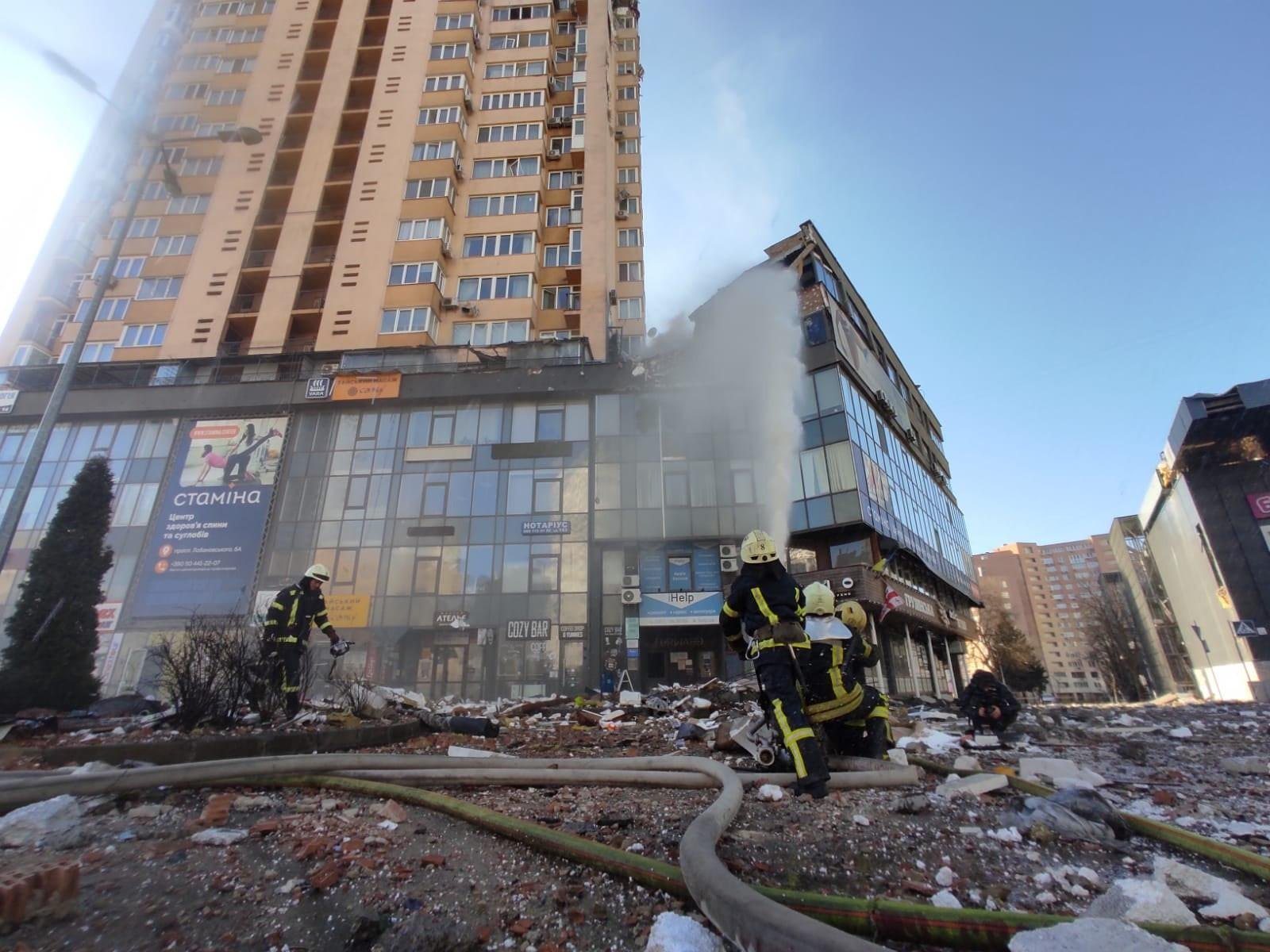
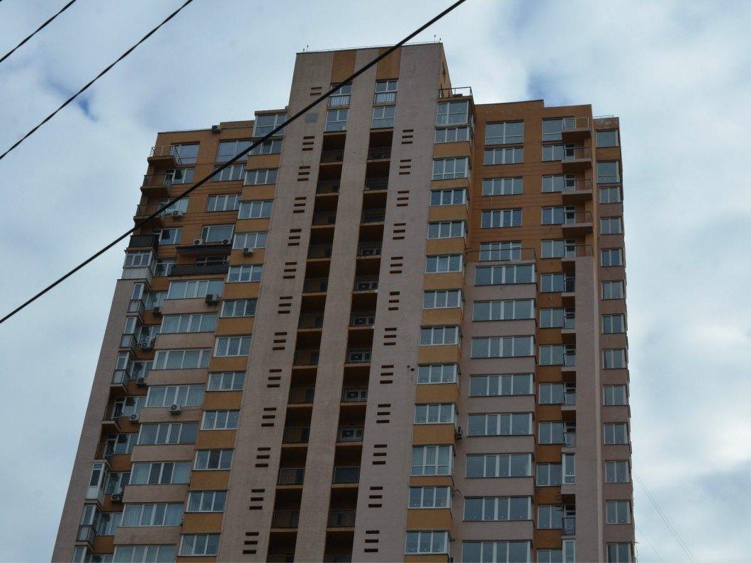
6-A Valeriia Lobanovskoho AvenueMissile strike on a high-rise26 February 2022: State Emergency Service rescuers at the apartment tower at 6-A Valeriia Lobanovskoho Avenue after it was hit by a Russian missile; 80 residents were evacuated. The damaged floors were rebuilt within months, and residents began moving back in late 2022. The "now" photo dates from early 2023.Archival photo: ДСНС України, 2022, CC BY 4.0 · Wikimedia Commons
Modern photo: The Village Україна, 2023 · village.com.ua -
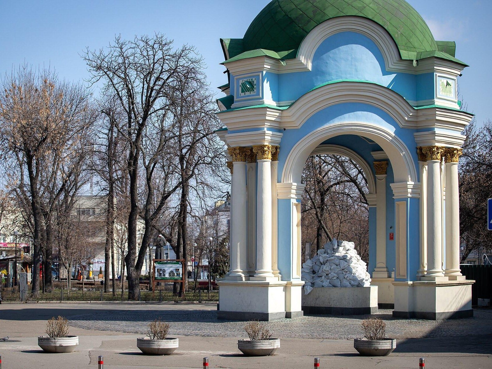
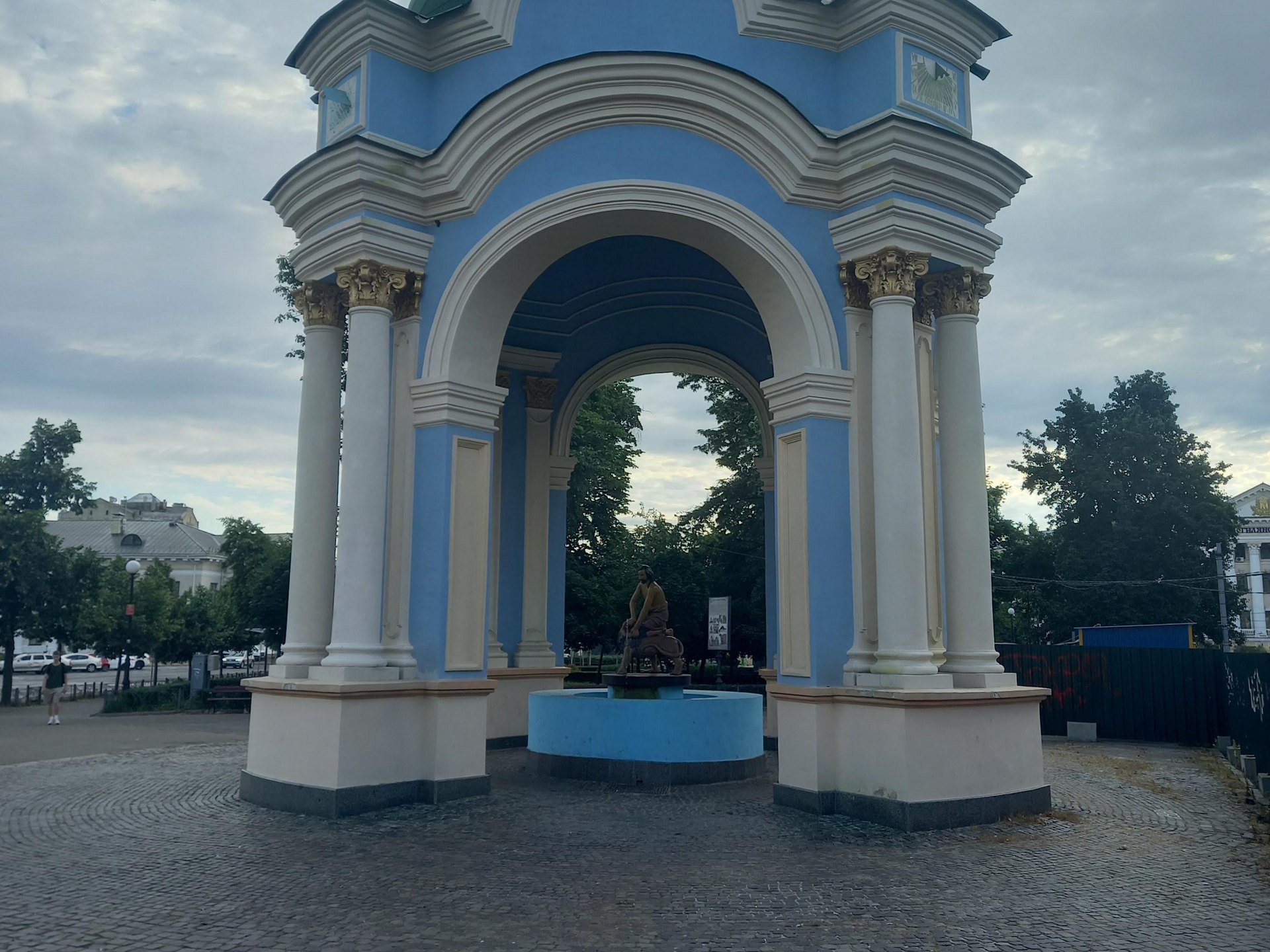
Kontraktova Square, PodilSamson Fountain protected25 March 2022: the statue inside the Samson Fountain on Kontraktova Square is packed with sandbags, while the rotunda, recreated in 1982 after the 18th-century original, remains visible. The "now" photo, from June 2026, shows the sandbags gone and Samson uncovered again under the rotunda.Archival photo: КМДА, Олексій Самсонов, 2022, CC BY 4.0 · Wikimedia Commons
Modern photo: Liliia2022, 2026, CC BY-SA 4.0 · Wikimedia Commons -
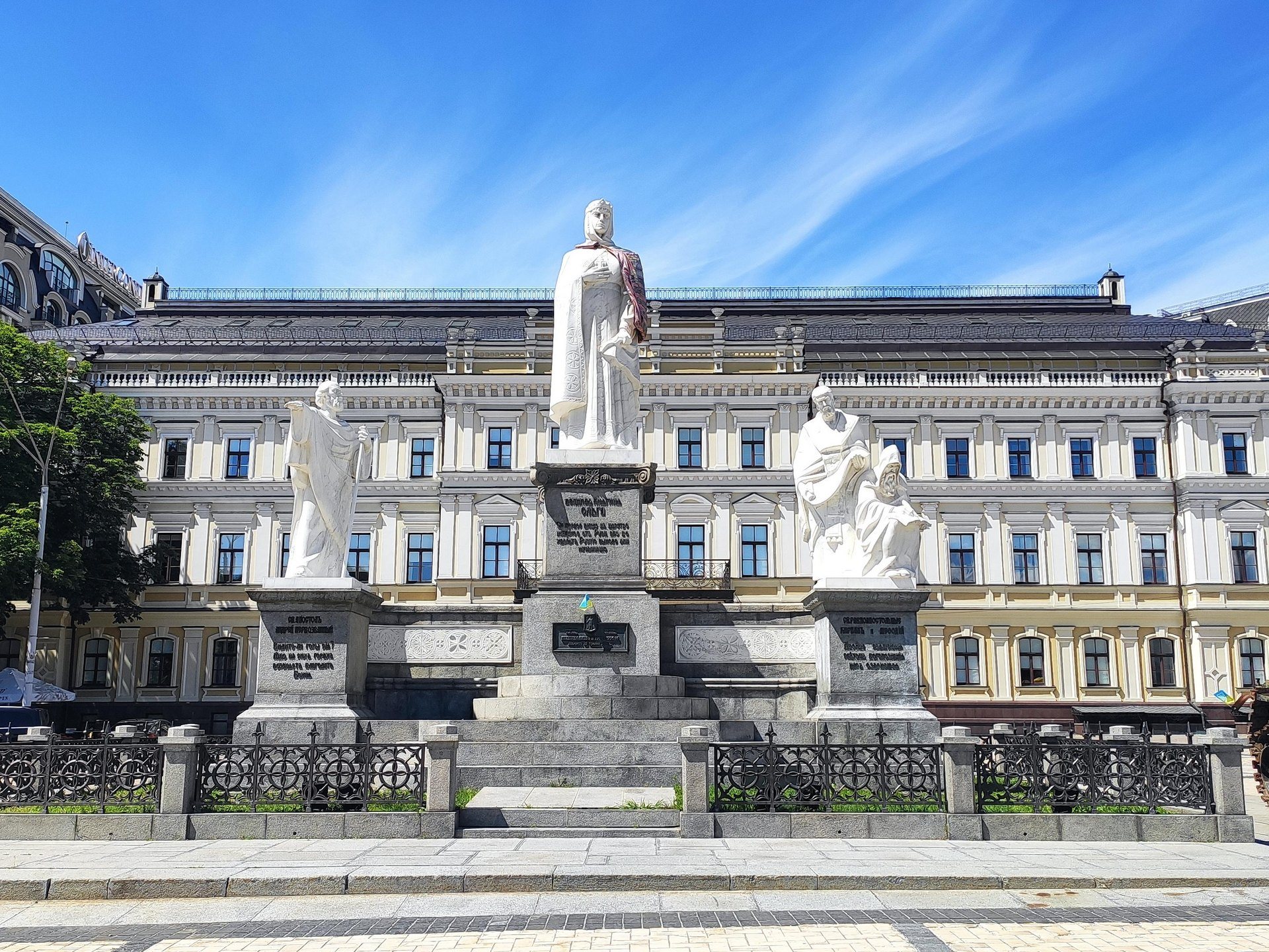
Mykhailivska SquareWrecked tanks on Mykhailivska SquareJuly 2022: an exhibition of destroyed Russian armour, captured during the defence of the Kyiv region, on Mykhailivska Square, next to the sandbagged monument to Princess Olha. The "now" photo, from July 2025, shows the monument to Olha, St Andrew and Cyril and Methodius uncovered, while the armour exhibition continues on the square.Archival photo: Ввласенко, 2022, CC BY-SA 3.0 · Wikimedia Commons
Modern photo: Xsandriel, 2025, CC BY-SA 4.0 · Wikimedia Commons -
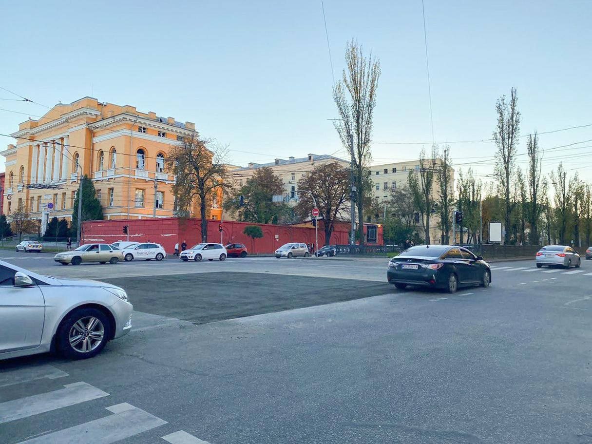
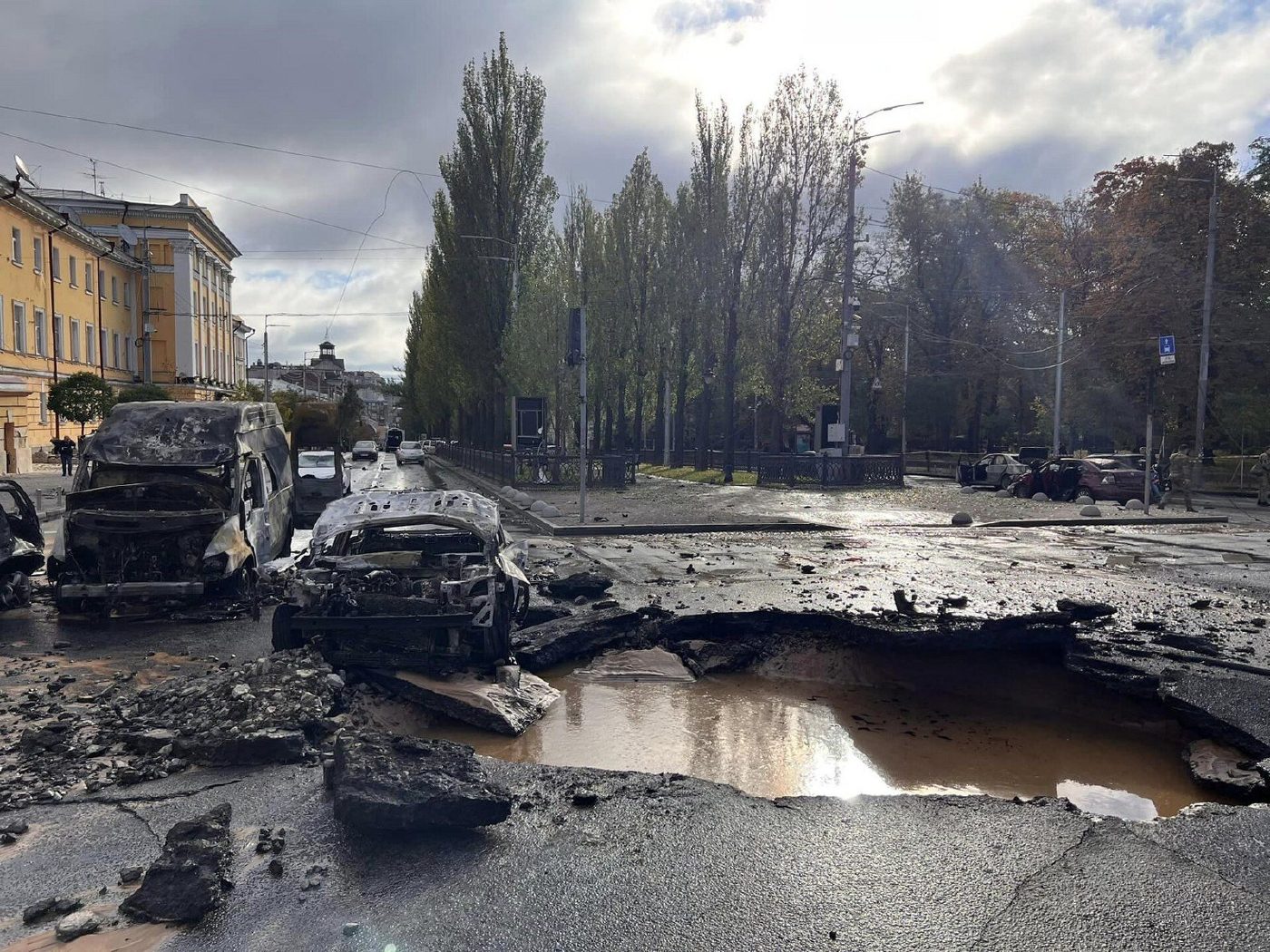
Volodymyrska Street at Taras Shevchenko BoulevardA crater in the city centreOn 10 October 2022 a morning missile strike left a crater at the junction of Volodymyrska Street and Shevchenko Boulevard. City crews filled and resurfaced it the very next day; the "now" photo was taken on 11 October.Archival photo: Національна поліція України, 2022, CC BY 4.0 · Wikimedia Commons
Modern photo: КМДА, 2022, CC BY 4.0 · Wikimedia Commons -
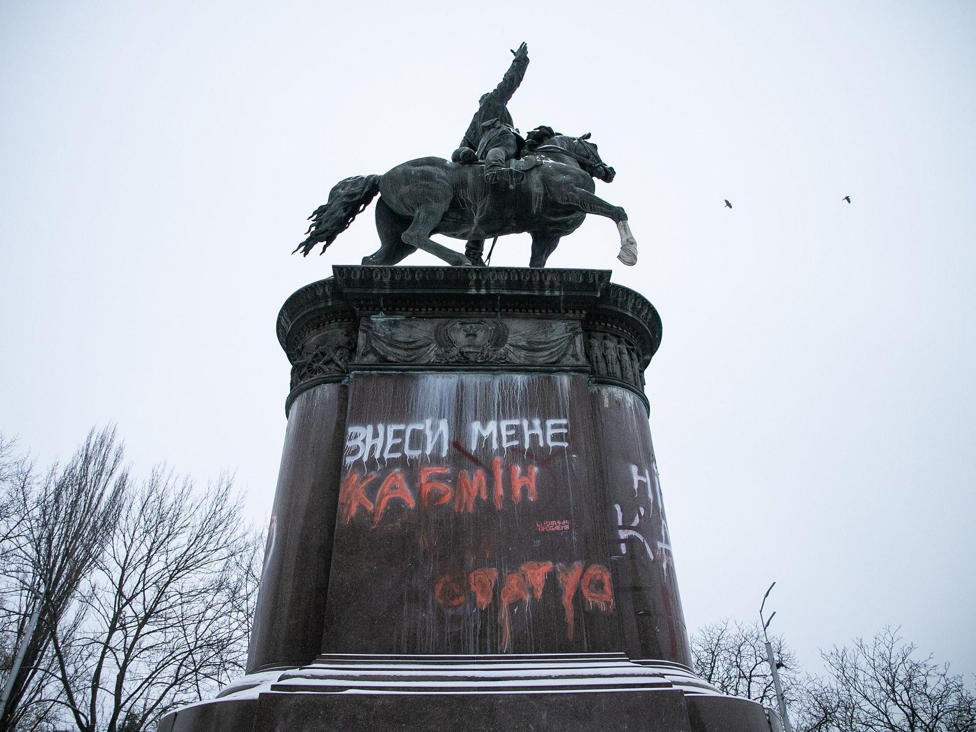
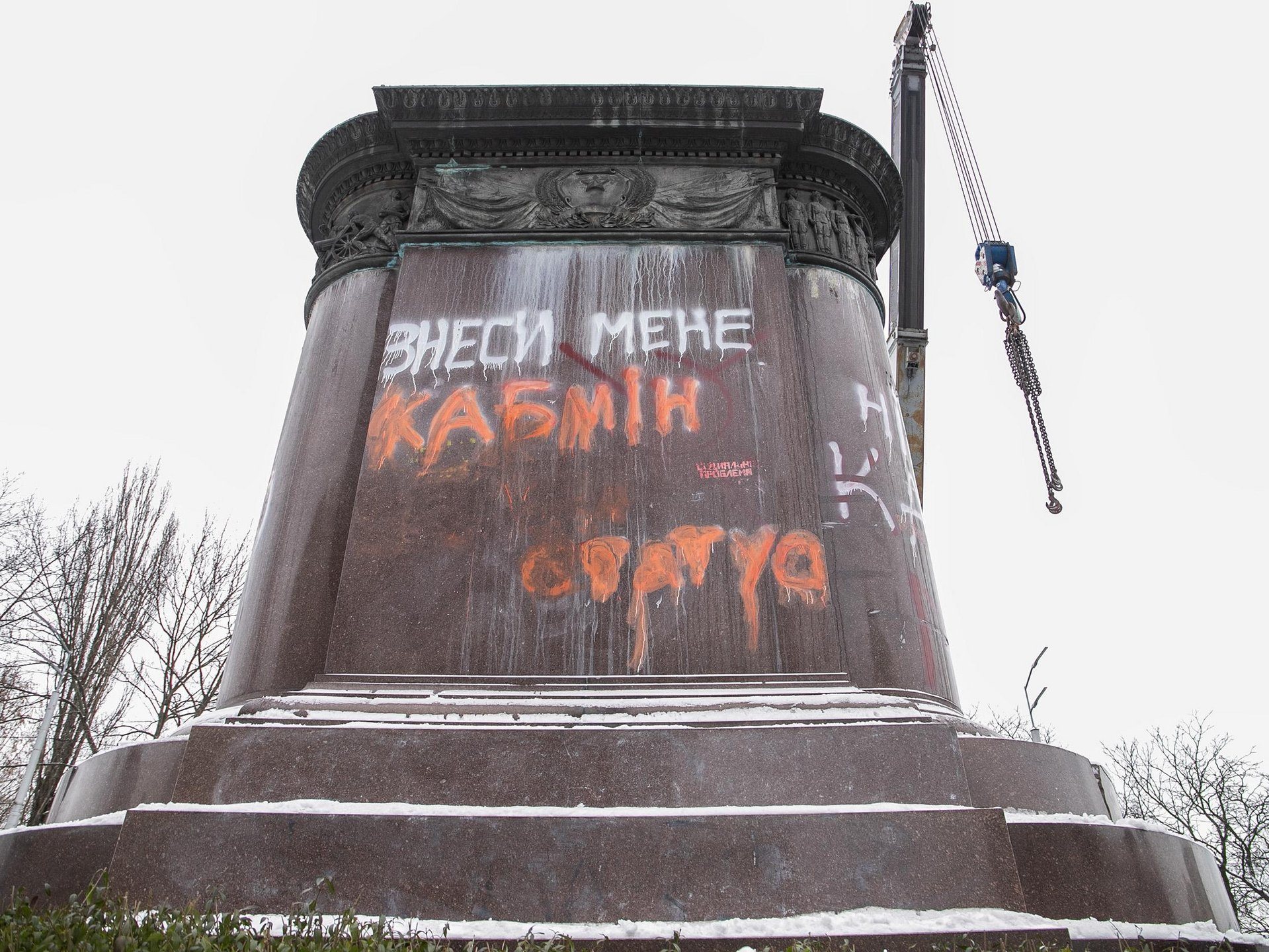
Taras Shevchenko Boulevard at Symona Petliury StreetThe Shchors monumentThe morning of 9 December 2023: the equestrian monument to the Red commander Mykola Shchors on Taras Shevchenko Boulevard, its plinth sprayed with "Tear me down, Cabinet". The government had removed it from the State Register of Immovable Monuments in November, and that day city workers dismantled the statue and handed it to the State Aviation Museum for storage. The "now" photo was taken the same day: an empty plinth where the rider stood.Archival photo: КМДА, 2023, CC BY 4.0 · Wikimedia Commons
Modern photo: КМДА, 2023, CC BY 4.0 · Wikimedia Commons






















From the archive
-
European SquareKhreshchatyk from the Tsar's GardenA photograph by Yosyp Kordysh, one of Kyiv's first photographers: the view from the Tsar's Garden towards today's European Square and the start of Khreshchatyk. The "Ivan" fountain still stands here before its 1871 rebuilding, surrounded by low manor-style houses. Today the site is occupied by the Ukrainian House, the Dnipro Hotel and a metro exit.Archival photo: Йосип Кордиш, поч. 1870-х, Public domain · Wikimedia Commons -
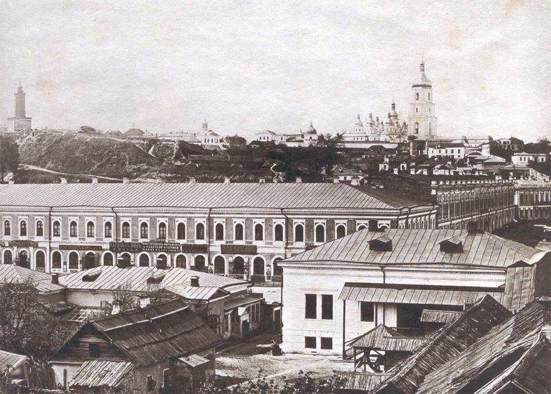
KhreshchatykTwo-storey KhreshchatykKhreshchatyk around 1870: in the foreground is the long Eisman building with its shops (No. 20 in the old numbering), and behind it the slopes of the Old Town with monastery domes and bell towers. The main street was only just being built up; the Eisman house, later enlarged, was destroyed in autumn 1941.Archival photo: невідомий автор, 1870, Public domain · Wikimedia Commons -
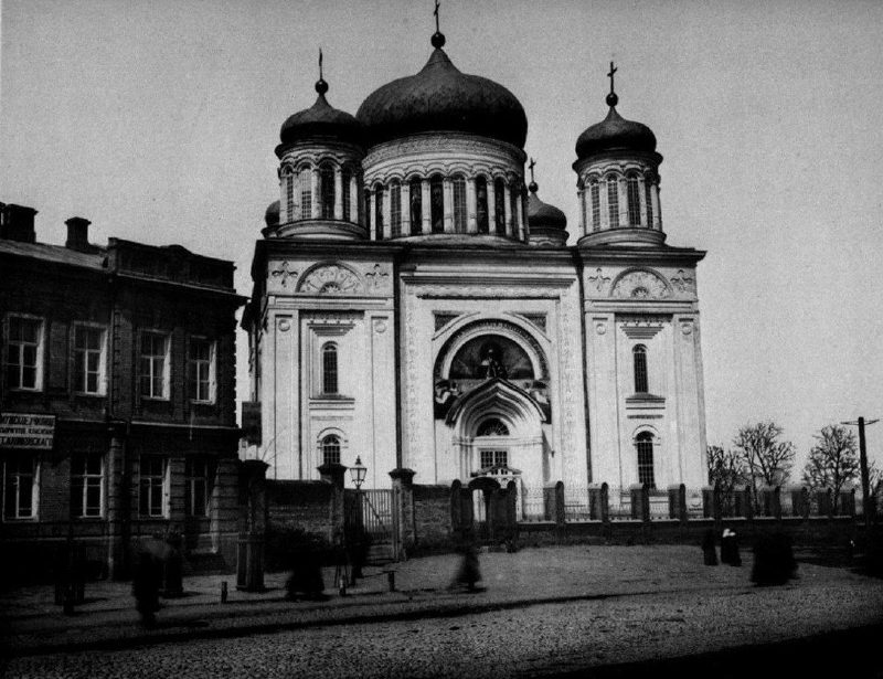
Desiatynna StreetThe Stasov Church of the TithesThis church was built in 1828–1842 to a design by Vasily Stasov, on the site of the Church of the Tithes, the first stone church of Rus, which was destroyed in 1240. It was dismantled in 1928. Today only the stone-marked foundations of the ancient church can be seen on Starokyivska Hill.Archival photo: С. В. Кульженко, 1888, Public domain · Wikimedia Commons -
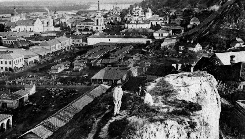
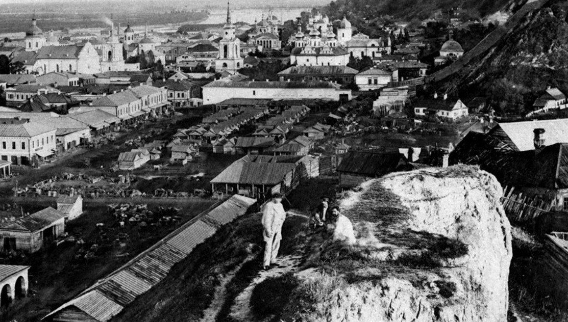
Verkhnii Val Street, PodilZhytnii MarketZhytnii Market in Podil seen from the surrounding hills: rows of shops and stalls, Podil churches and the Dnipro beyond, and St Andrew's Church on the hill to the right. Trade still goes on here: the site is occupied by the Zhytnii Market, whose building dates from 1980.Archival photo: С. В. Кульженко, 1888, Public domain · Wikimedia Commons -
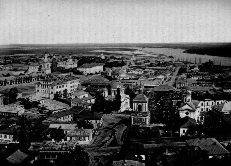
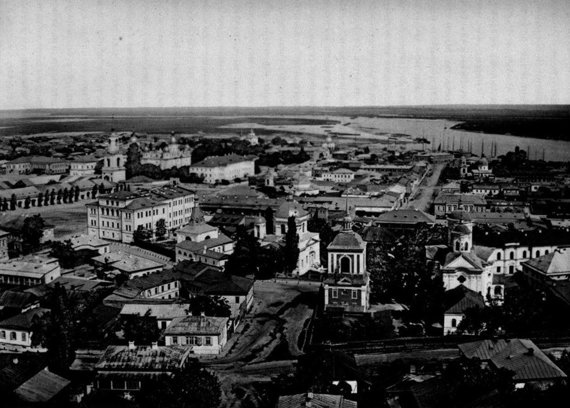
PodilPodil from St Andrew'sA panorama of Podil from the porch of St Andrew's Church. Kulzhenko captioned the Third Gymnasium and the churches of St Nicholas the Good and the Protection; on the horizon are the Dnipro and the floodplain meadows of the left bank, with no housing estates yet.Archival photo: С. В. Кульженко, 1888, Public domain · Wikimedia Commons -
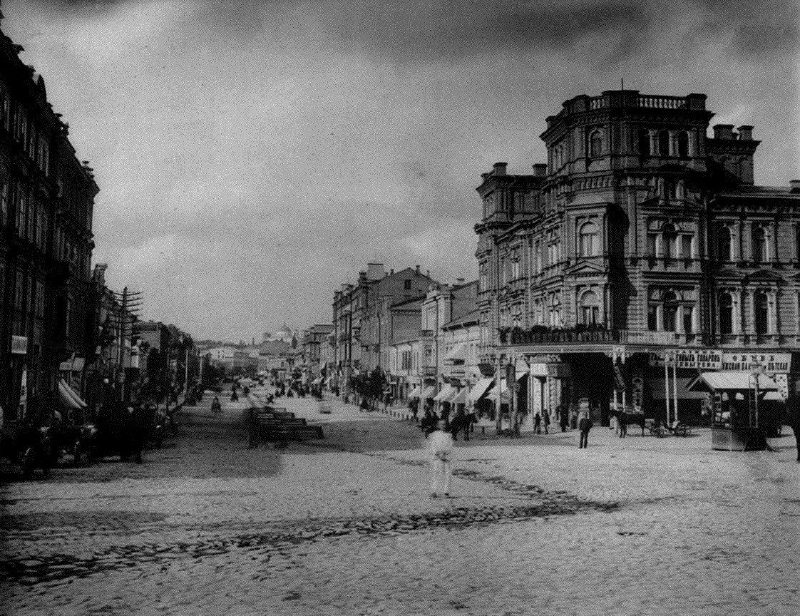
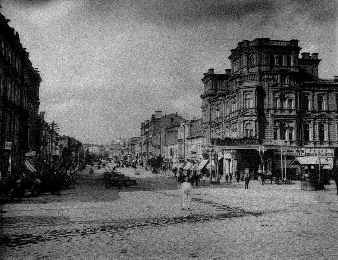
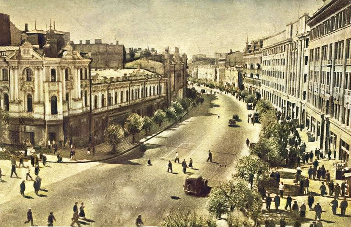
KhreshchatykKhreshchatyk in 1888Khreshchatyk in the late 1880s, still without trams (the electric tram arrived in Kyiv in 1892), with horse-drawn carriages and the first multi-storey apartment buildings. Almost all of the street's buildings of that time perished in 1941, and Khreshchatyk was rebuilt after the war.Archival photo: С. В. Кульженко, 1888, Public domain · Wikimedia Commons -
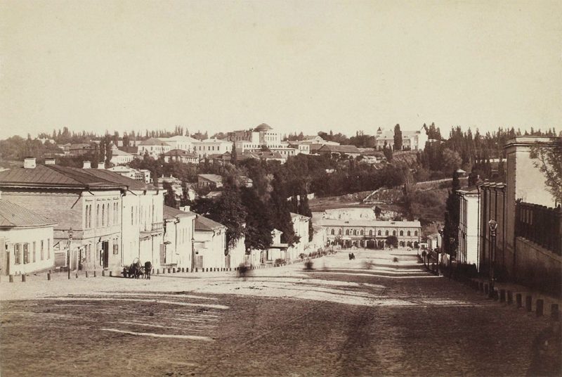
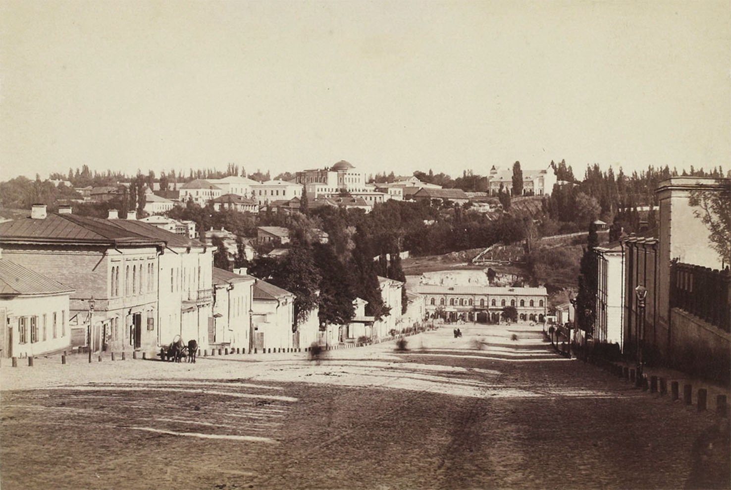
Bohdana Khmelnytskoho StreetLypky and Fundukleivska StreetA panorama of Lypky and today's Bohdana Khmelnytskoho Street (then Fundukleivska) photographed by Yosyp Kordysh in 1886. The street was just being built up with two- and three-storey houses, while the manors of aristocratic Lypky already stood on the hill.Archival photo: Йосип Кордиш, 1886, Public domain · Wikimedia Commons -
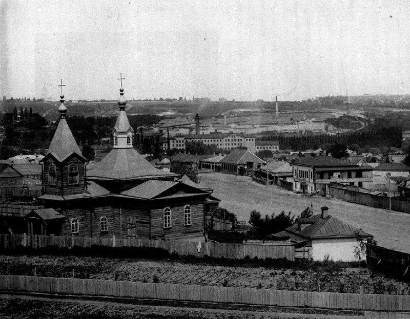
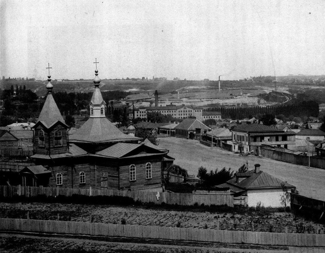
Demiivka, Holosiivskyi DistrictDemiivka suburbDemiivka in 1888, a suburb outside the city limits of the time, with a wooden church, fences and single-storey cottages. It was later incorporated into Kyiv; today it is home to Holosiivskyi Avenue, Demiivska metro station and residential blocks.Archival photo: С. В. Кульженко, 1888, Public domain · Wikimedia Commons -
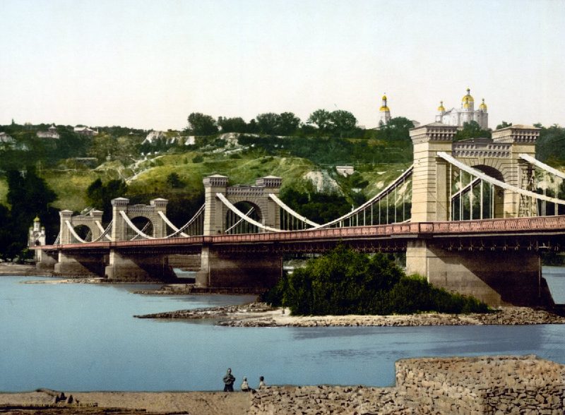
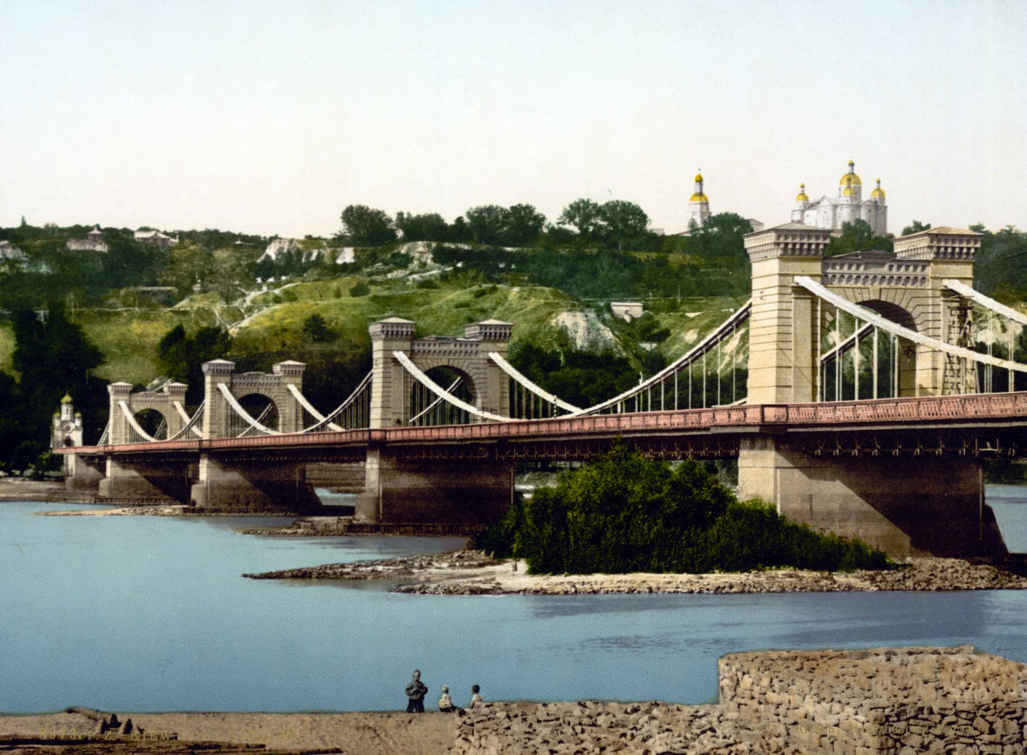
Dnipro River below Volodymyrska HillNicholas Chain BridgeThe chain bridge across the Dnipro, opened in 1853, on an 1890s photochrom print. It was blown up in 1920; the Metro Bridge now stands roughly on the same spot.Archival photo: невідомий автор, бл. 1890–1900, Public domain · Wikimedia Commons -
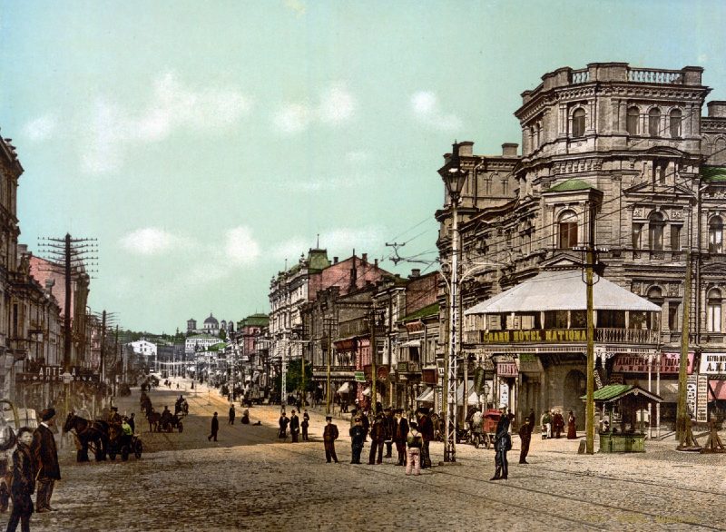
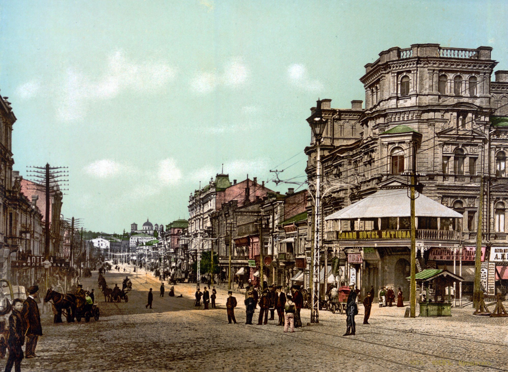
Khreshchatyk, near Bessarabska SquareKhreshchatyk and the Grand Hotel NationalKhreshchatyk on an 1897 postcard: the Grand Hotel National on the right, horse cabs on the cobbles and utility poles and wires above the street.Archival photo: невідомий автор, 1897, Public domain · Wikimedia Commons -
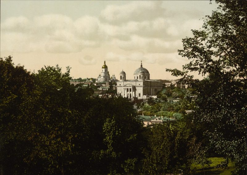
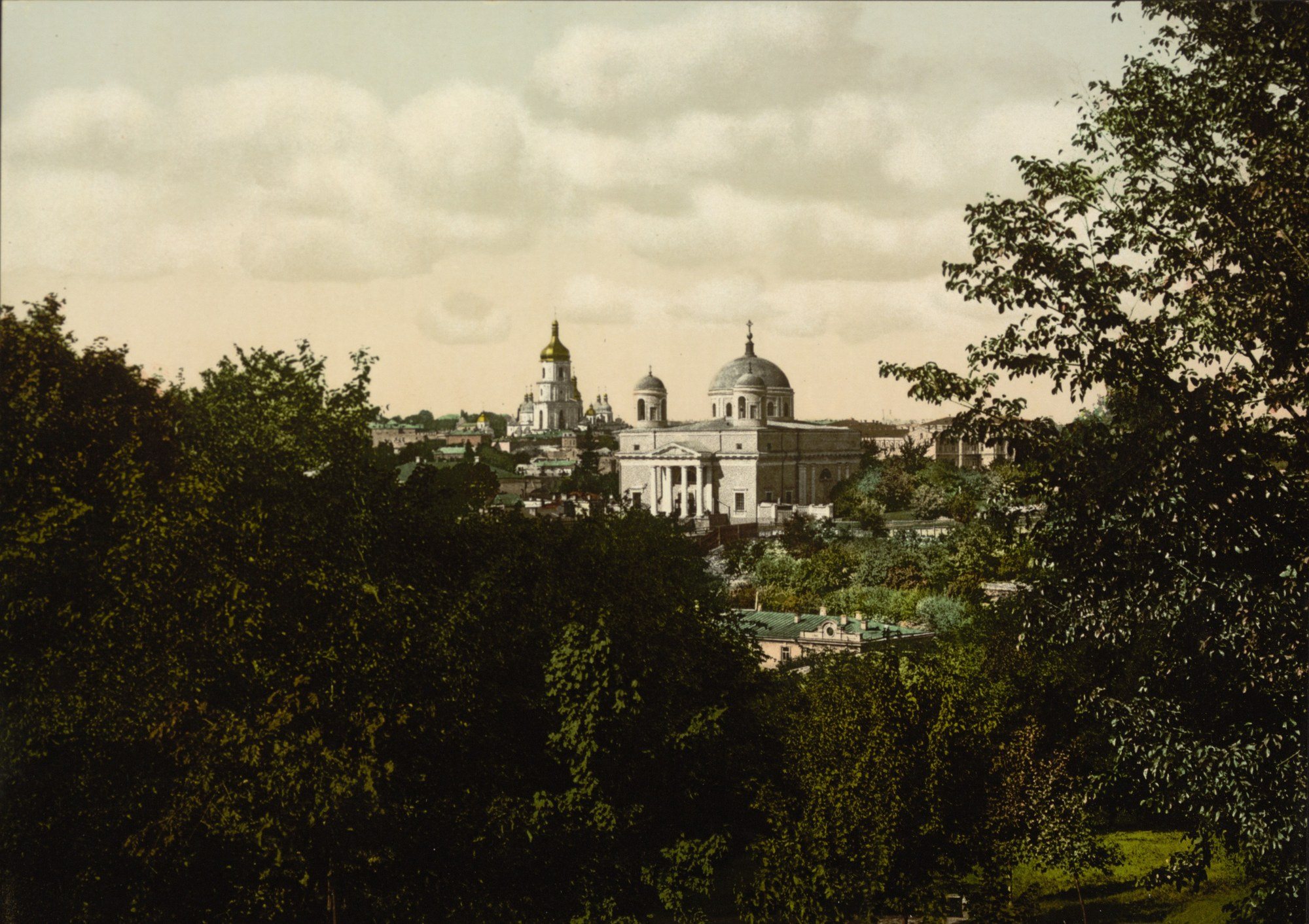
17 Kostolna StreetSt Alexander's ChurchThe Roman Catholic Church of St Alexander (1817–1842) above green slopes in an 1890s photochrom. Kyiv's oldest Catholic church was closed in the 1930s and turned into a planetarium; it was returned to the parish in the 1990s.Archival photo: невідомий автор LCCN 2001697420, бл. 1890–1900, Public domain · Wikimedia Commons -
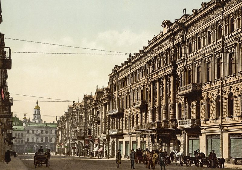
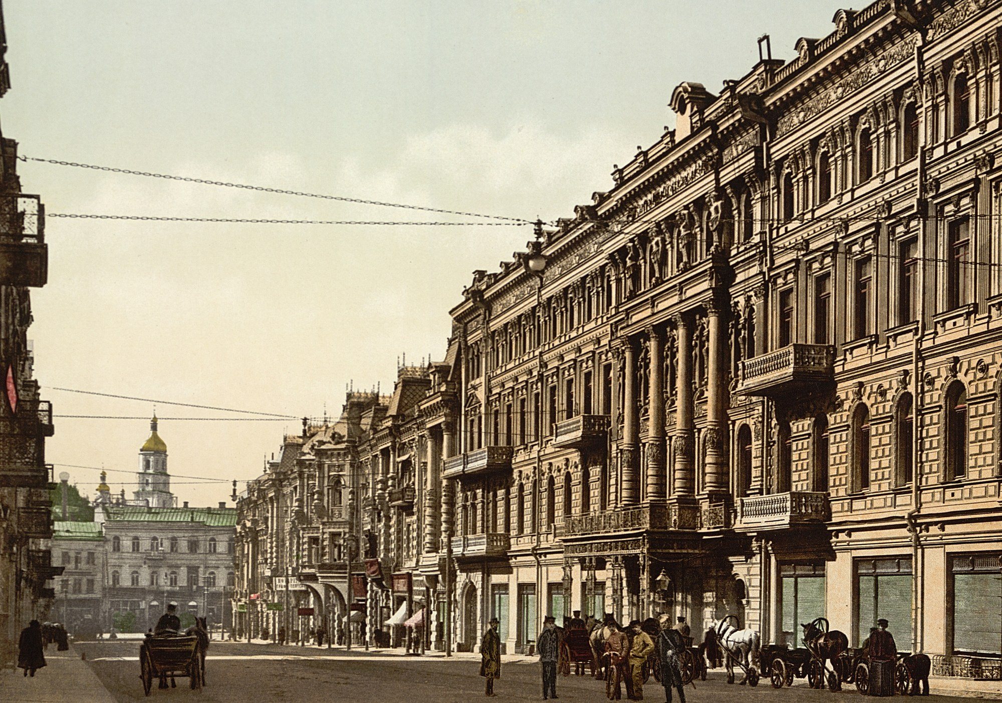
Arkhitektora Horodetskoho StreetNikolaievska Street and the ContinentalNikolaievska Street (now Arkhitektora Horodetskoho Street), laid out in the 1890s, with the fashionable Continental Hotel, where the city's wealthiest visitors stayed. The hotel burned down in September 1941; the National Music Academy of Ukraine now stands on its site.Archival photo: невідомий автор LCCN 2001697432, бл. 1900, Public domain · Wikimedia Commons -
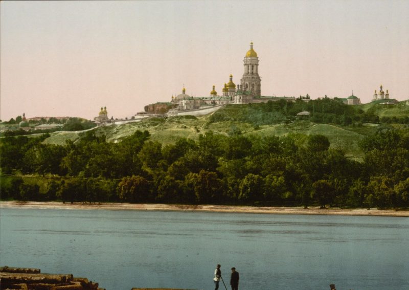
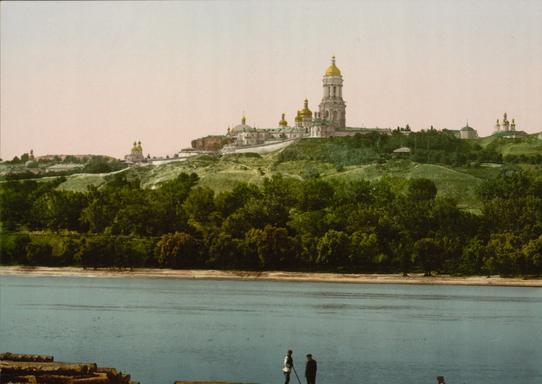
The Dnipro by PecherskThe Lavra from the DniproThe Kyiv Pechersk Lavra on the green bluffs of the right bank, as passengers on Dnipro steamers saw it. Above the trees rise the Great Lavra Bell Tower and the domes of the Dormition Cathedral. Today the Paton Bridge crosses this view and the slopes are parkland.Archival photo: невідомий автор LCCN 2001697428, бл. 1890–1900, Public domain · Wikimedia Commons -
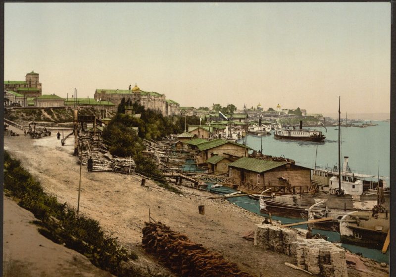
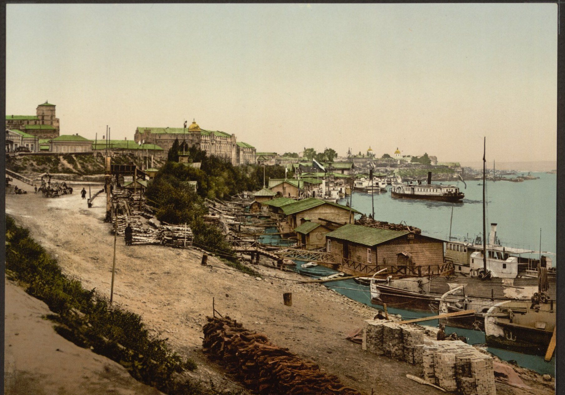
Naberezhne Highway, PodilPiers on the DniproThe riverside near Podil at the end of the 19th century: landing stages, barges, steamers and stacks of firewood on the sandy bank. The Dnipro was then the city's main trade route. Today this is the area of Poshtova Square, the river terminal and a wide embankment.Archival photo: невідомий автор LCCN 2001697440, бл. 1890–1900, Public domain · Wikimedia Commons -
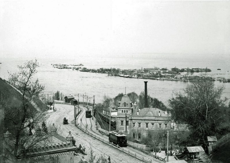
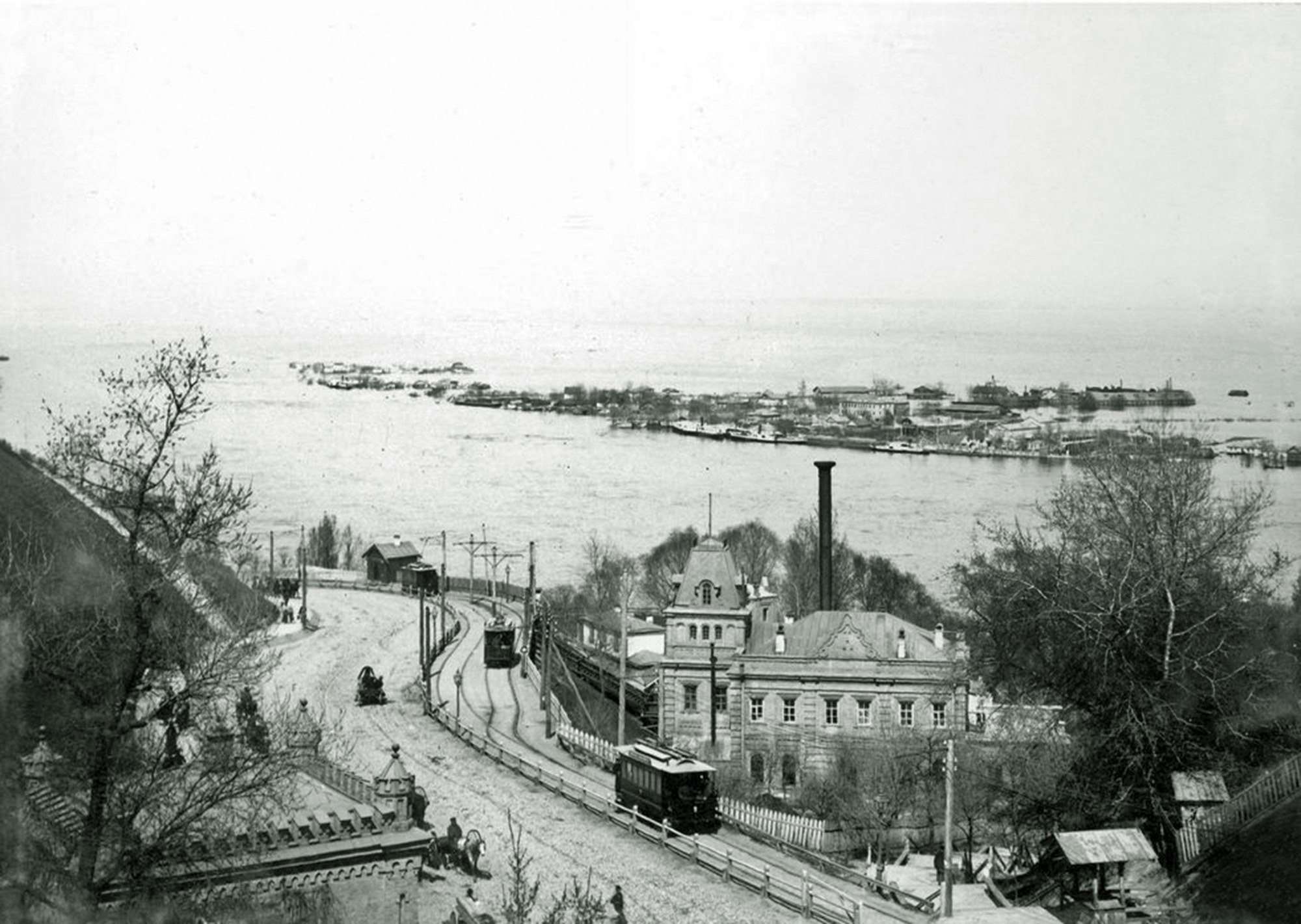
Volodymyrskyi UzvizA tram on the descentOleksandrivskyi (now Volodymyrskyi) Uzviz in 1895: a tram heads down to Podil past the filter house of the city waterworks. Ukraine's first electric tram began running here in 1892. Across the Dnipro, Trukhaniv Island lies under the spring flood.Archival photo: невідомий автор, 1895, Public domain · Wikimedia Commons -
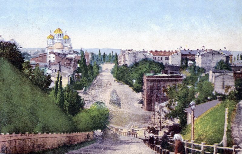
Ivana Franka StreetNesterivska StreetNesterivska Street (now Ivana Franka Street) runs down into the Afanasiivskyi ravine, with St Volodymyr's Cathedral, consecrated in 1896, at the top. This postcard by August Richter's publishing house shows a district not yet fully built up: steep slopes, fences and new apartment houses.Archival photo: невідомий автор, 1899, Public domain · Wikimedia Commons -
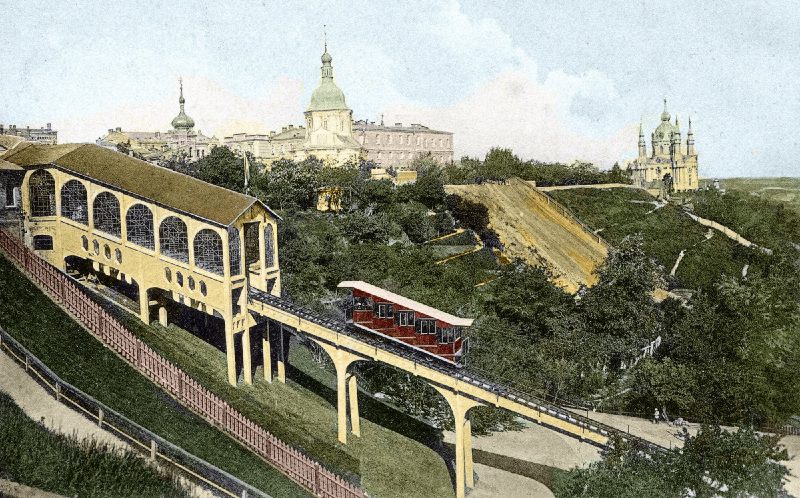
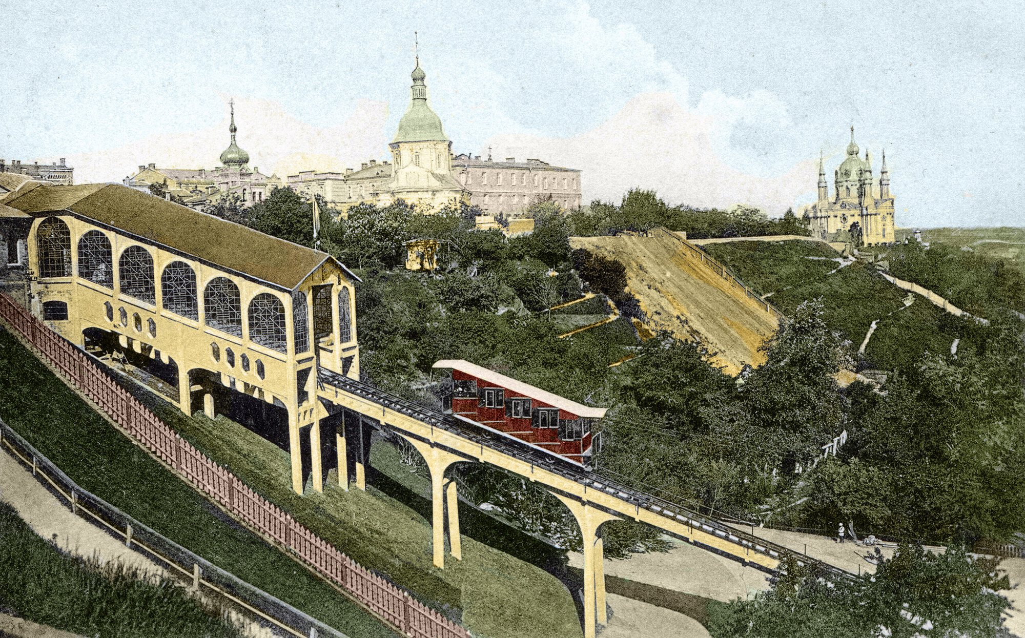
Volodymyrska Hill to Poshtova SquareThe funicular in its opening yearThe Mykhailivskyi mechanical lift (funicular), photographed by Dmytro Markov in 1905, the year it opened. At the top is the Church of the Three Saints, demolished in the 1930s, and St Andrew's Church is on the right.Archival photo: Дмитро Марков, 1905, Public domain · Wikimedia Commons -
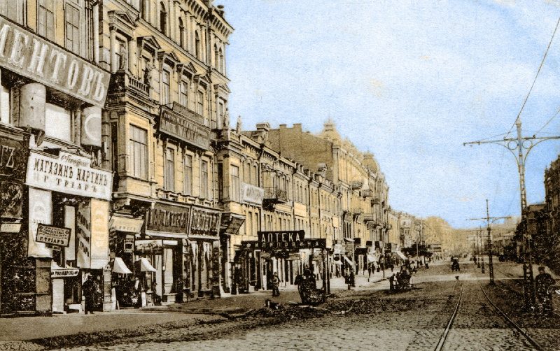
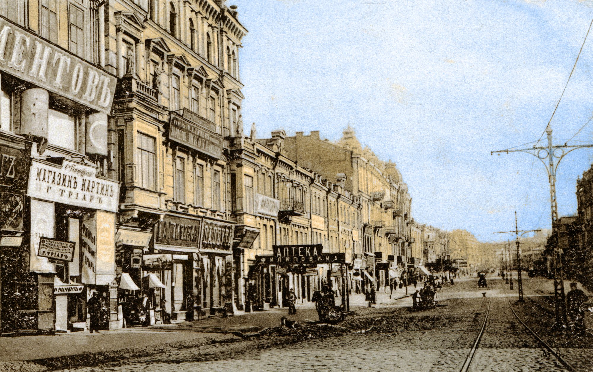
KhreshchatykKhreshchatyk with tramsKhreshchatyk at the beginning of the 20th century: shop signs, tram tracks, overhead line poles and cobbles. On the left are Nos. 50, 48 and 46 in the numbering of the time. Within a few years the street would be paved with asphalt and built up even more densely.Archival photo: невідомий автор, 1900–1905, Public domain · Wikimedia Commons -
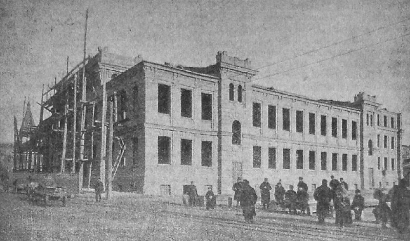
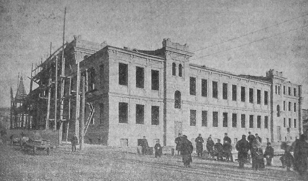
53/3 Velyka Vasylkivska StreetBuilding the Trinity People's HouseFebruary 1902: the Trinity People's House under construction on Velyka Vasylkivska Street, a cultural centre with a theatre hall, library and tea room for less well-off townspeople. Various theatres later used the building; today it is home to the Kyiv National Academic Operetta Theatre.Archival photo: невідомий автор, 1902, Public domain · Wikimedia Commons -
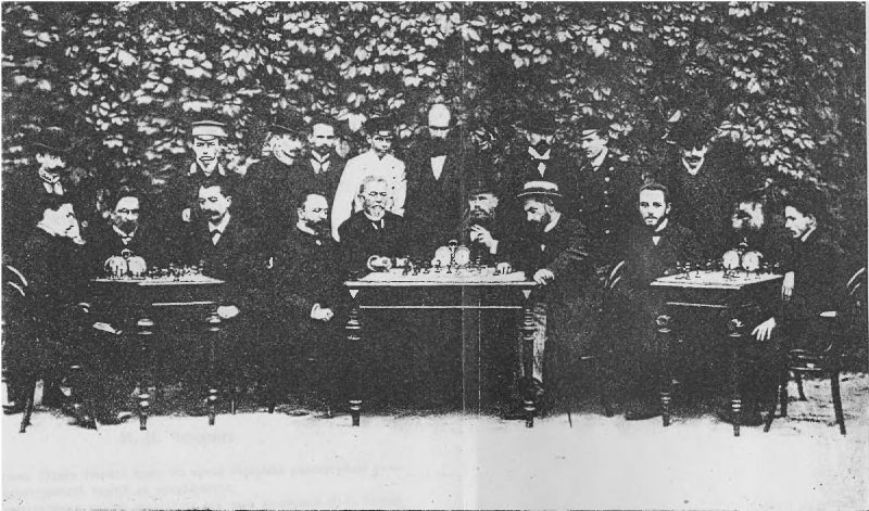
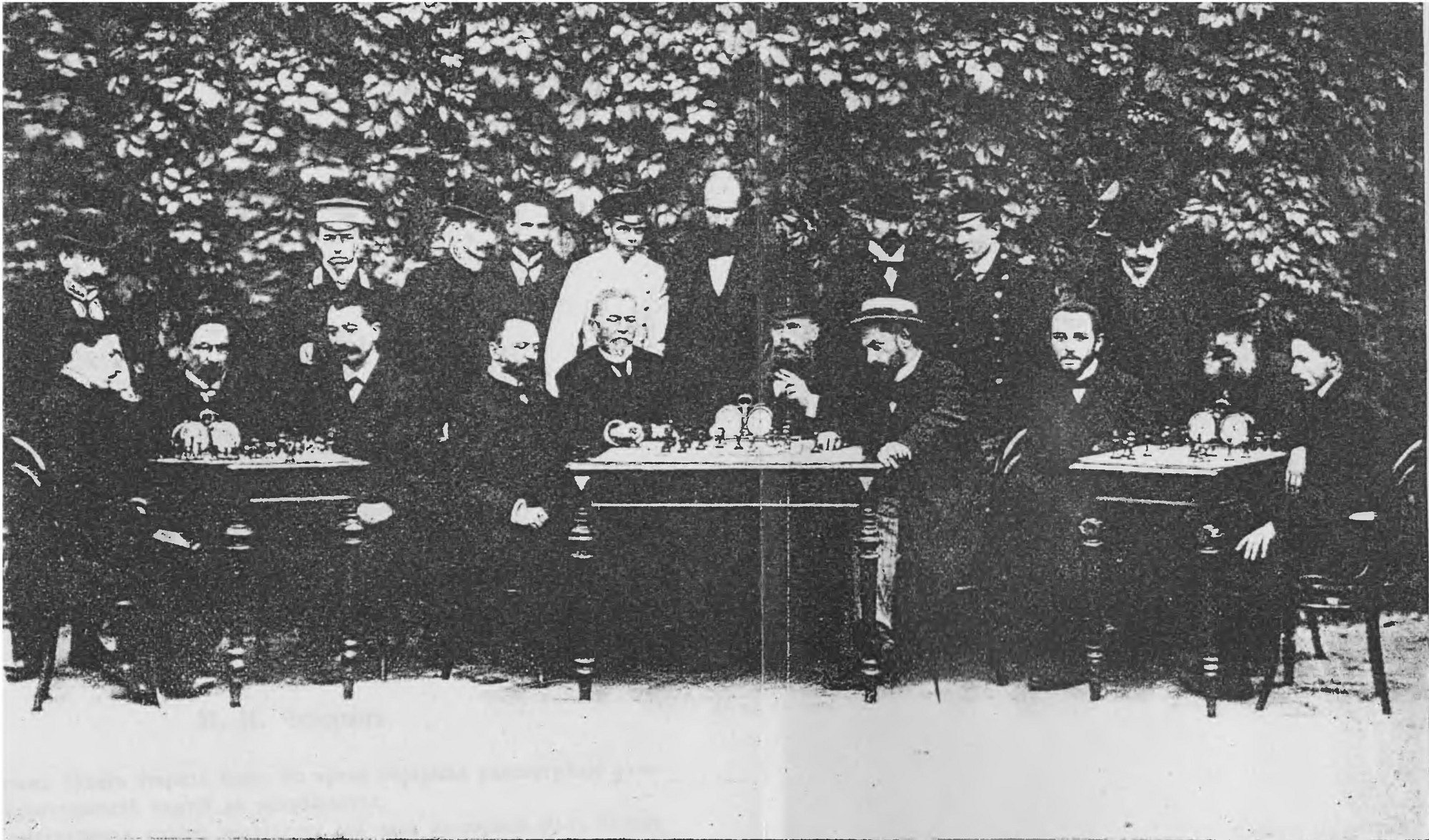
KyivChess tournament in KyivPlayers at the Third All-Russian Chess Tournament, held in Kyiv in September 1903. It was won by Mikhail Chigorin, the strongest player in the empire at the time.Archival photo: І. Н. Афанасьєва, 1903, Public domain · Wikimedia Commons -
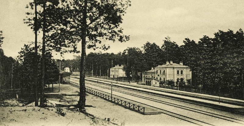
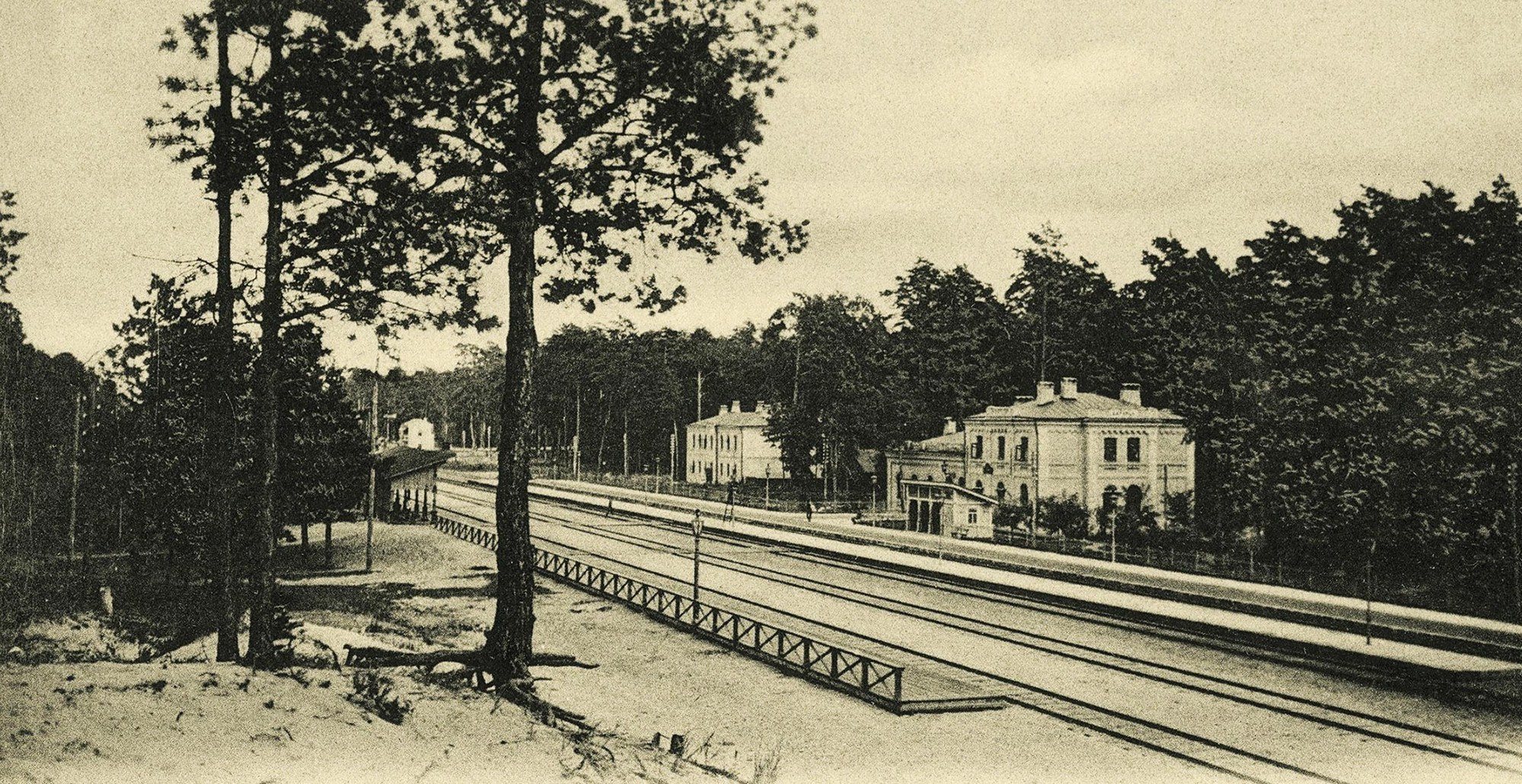
Darnytsia, left bankDachas in DarnytsiaThe railway station and dachas in the pine woods of Darnytsia on a 1904 postcard by photographer Dmytro Markov. The left bank was then a summer retreat for Kyivans; today Darnytsia is a large district of factories, housing estates and a railway hub.Archival photo: Дмитро Марков, 1904, Public domain · Wikimedia Commons -
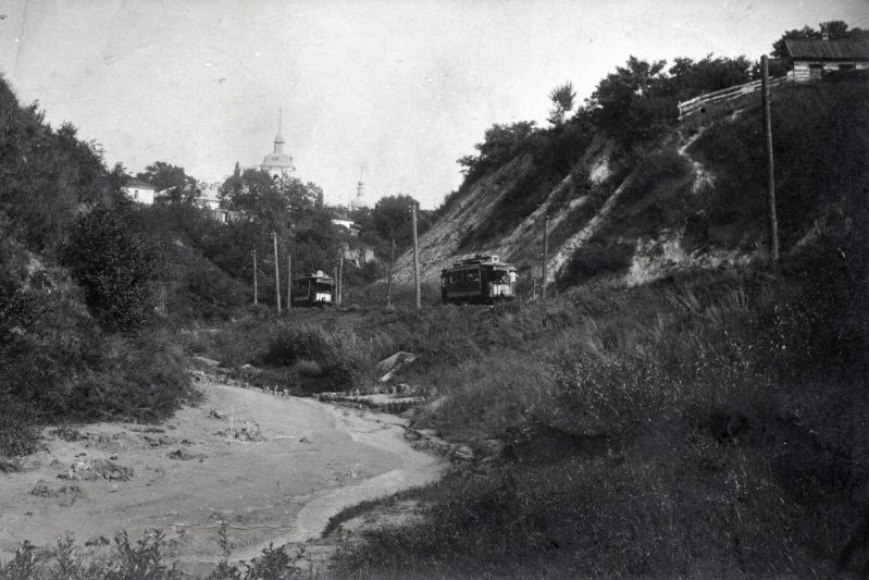
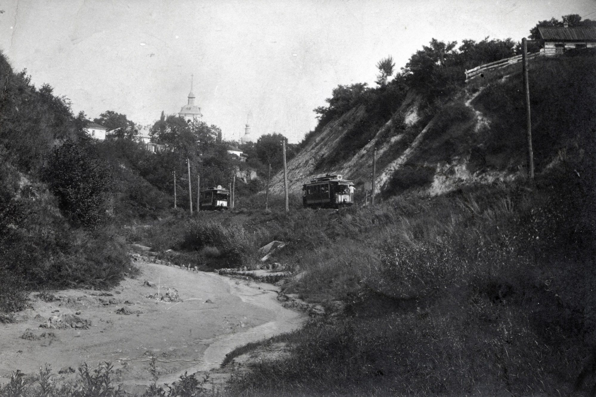
LukianivkaTram in LukianivkaTrams among the ravines of Lukianivka in Dmytro Markov's 1908 photograph. Kyiv was one of the first cities in the Russian Empire to get electric trams, and by the early 20th century the lines linked the centre with outlying suburbs.Archival photo: Дмитро Марков, 1908, Public domain · Wikimedia Commons -
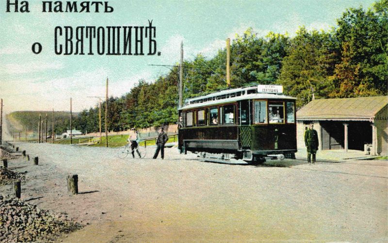
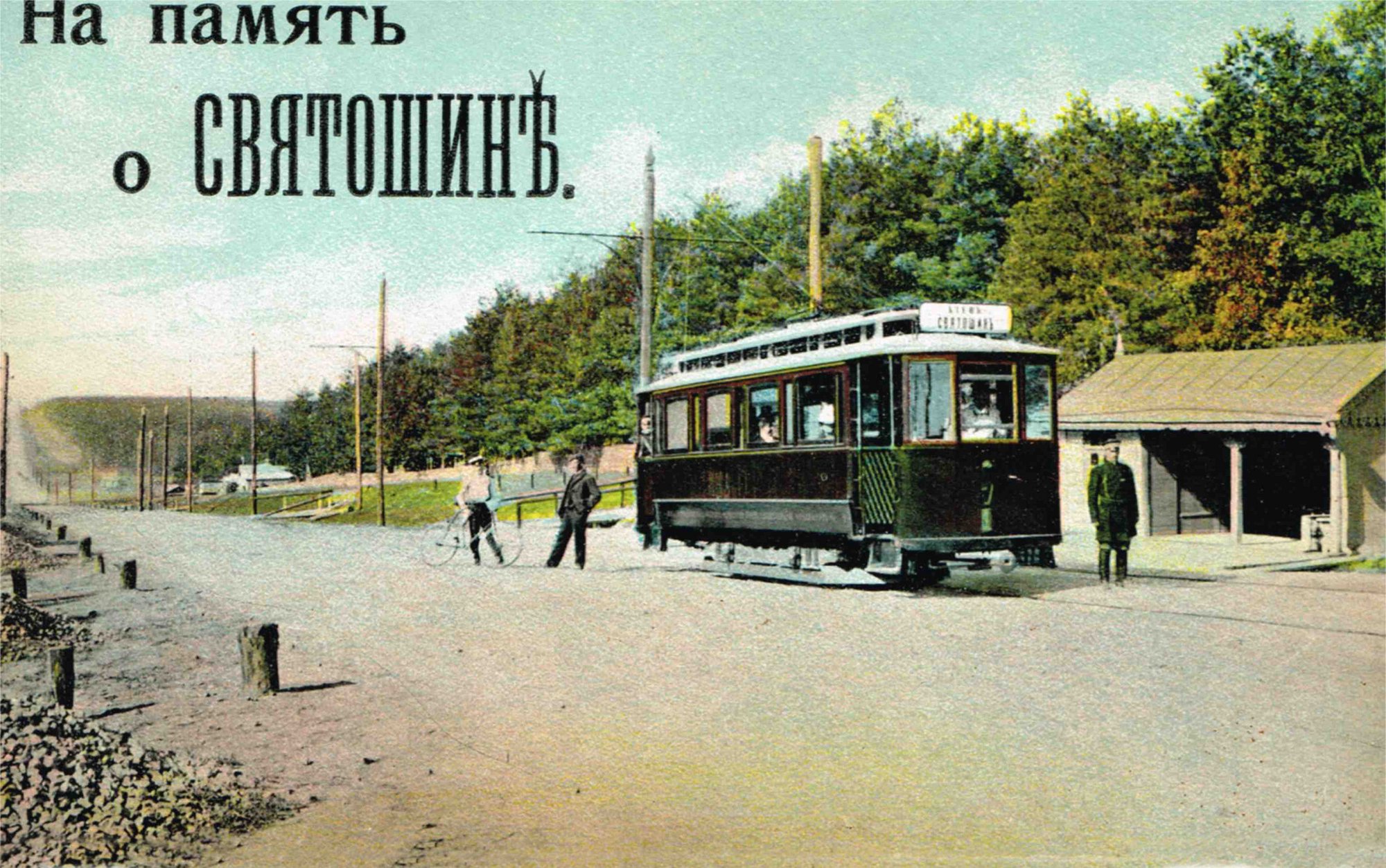
SviatoshynTram in SviatoshynThe Sviatoshyn tram on a 1912 postcard by Dmytro Markov: a tramcar at a stop in Sviatoshyn, then a dacha suburb of Kyiv.Archival photo: Дмитро Марков, 1912, Public domain · Wikimedia Commons -
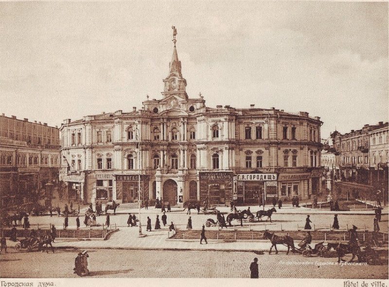
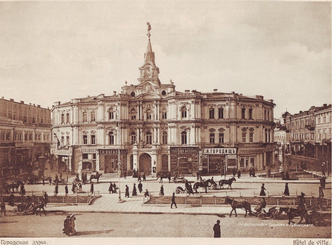
Maidan NezalezhnostiThe City DumaThe City Duma building (1876–1878, architect Oleksandr Schille), with a figure of Archangel Michael on its spire, stood on Duma Square, today's Maidan Nezalezhnosti. It was destroyed during the Second World War and the ruins were cleared. Archangel Michael returned to the Maidan in 2001, atop the Liadski Gate.Archival photo: Гудшон і Губчевський, 1911, Public domain · Wikimedia Commons -
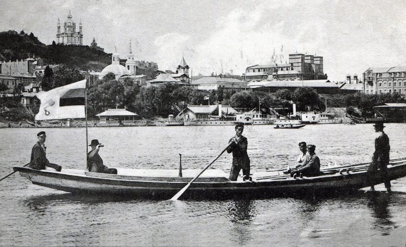
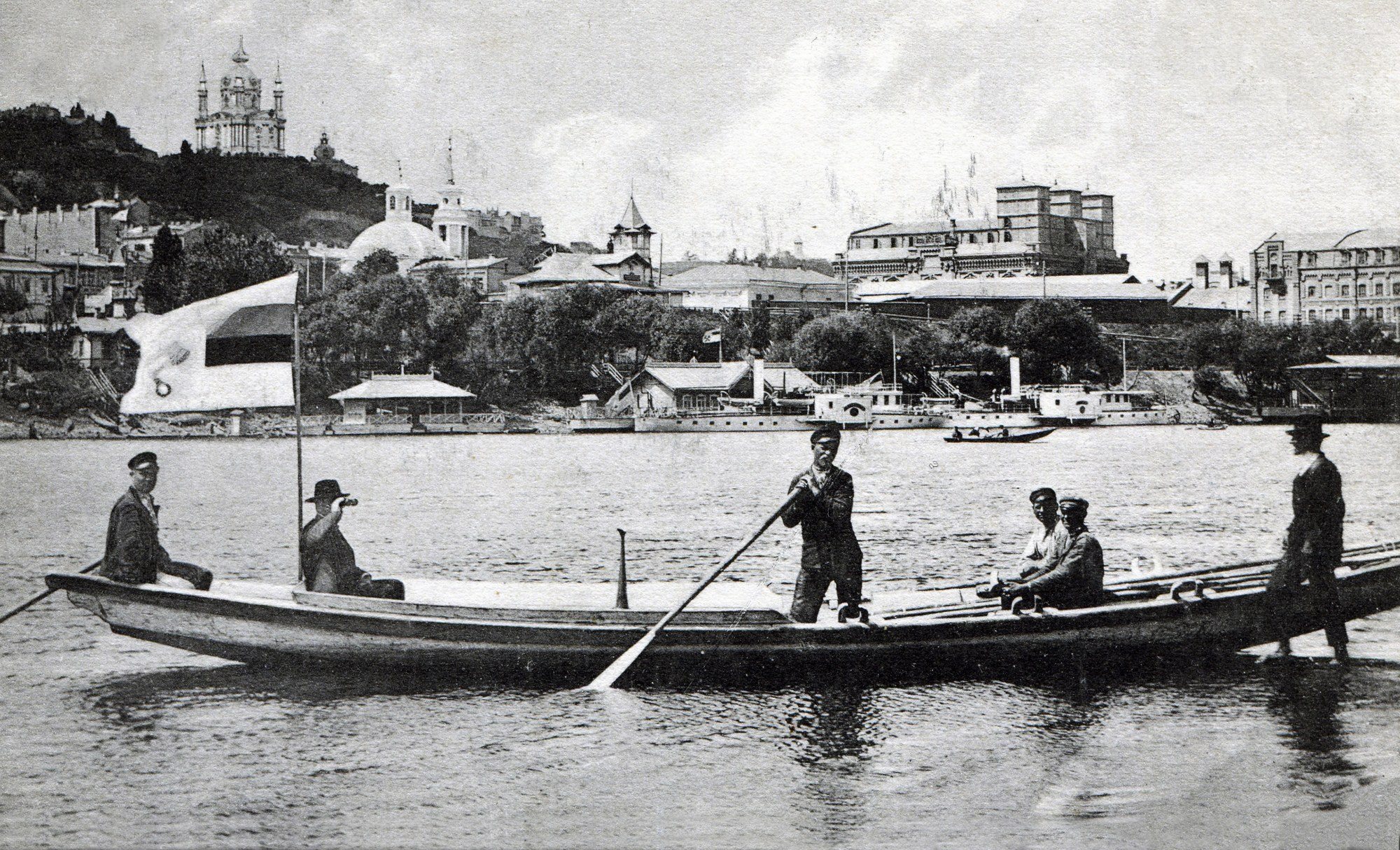
Trukhaniv IslandA boat off Trukhaniv IslandThe view from Trukhaniv Island to Podil: a boat with passengers, steamers at the piers and St Andrew's Church on the hill. The island then had its own settlement, which was burned down during the war; today Trukhaniv is a park with beaches in the middle of the city.Archival photo: невідомий автор, 1912, Public domain · Wikimedia Commons -
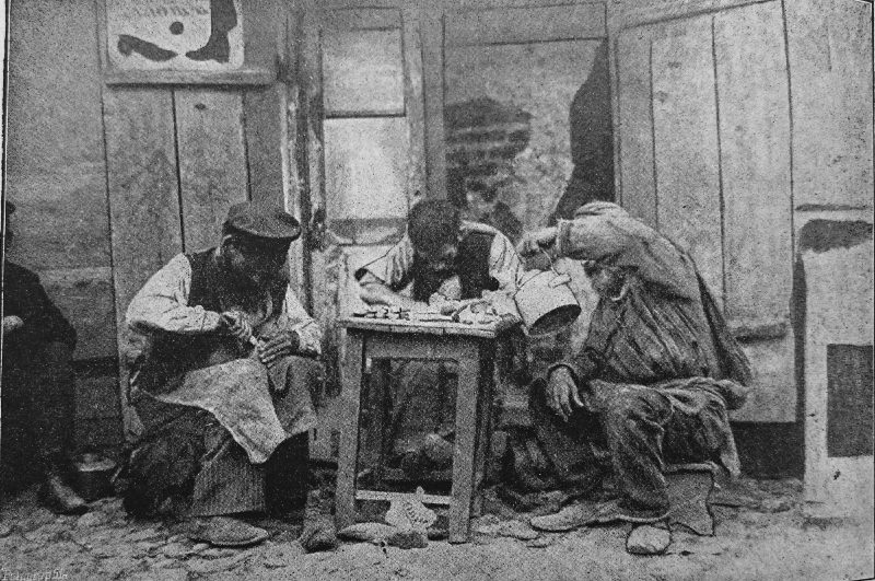
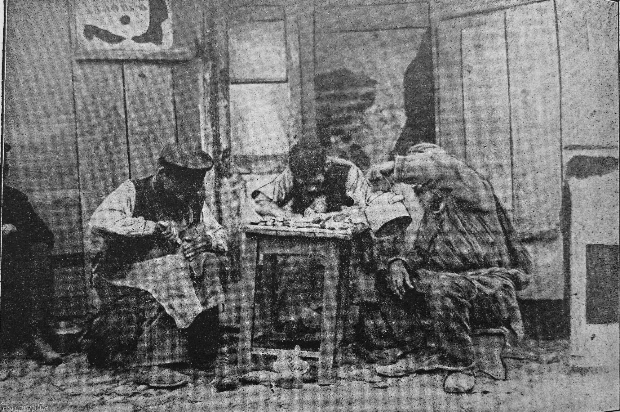
KyivStreet cobblersJewish street cobblers at work, a photograph from the Czech magazine Rudé květy, 1913. Craftsmen with a stool and a toolbox were a familiar sight on Kyiv's streets, especially in Podil and near the markets.Archival photo: невідомий автор, 1913, Public domain · Wikimedia Commons -
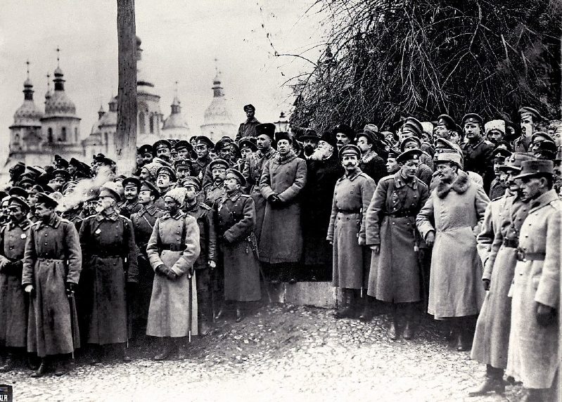
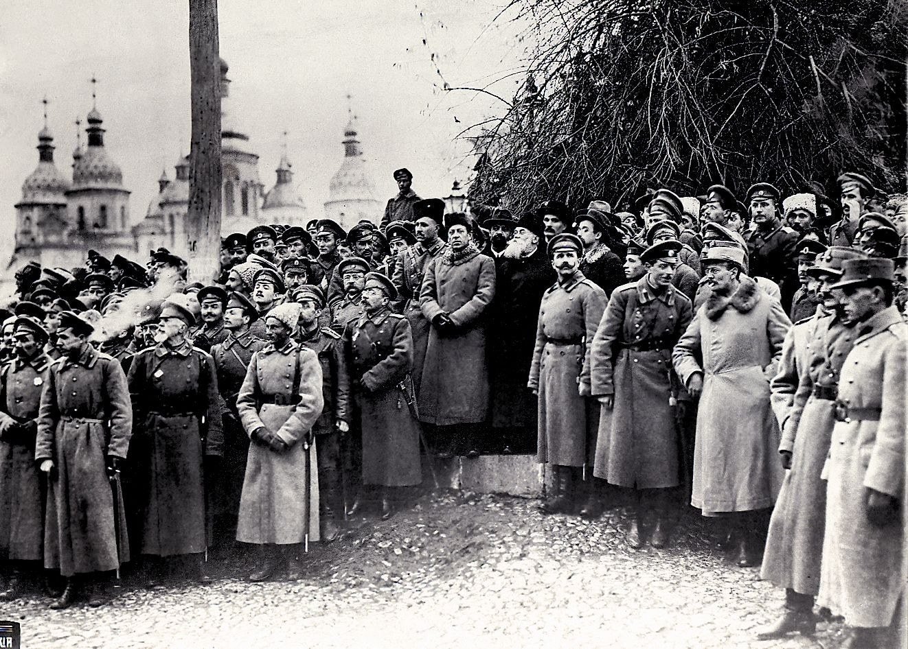
Sofiiska SquareSoldiers by St SophiaSoldiers attending the Third All-Ukrainian Military Congress in front of St Sophia's Cathedral, November 1917. In those days the Central Rada proclaimed its Third Universal on Sofiiska Square, establishing the Ukrainian People's Republic.Archival photo: невідомий автор, 1917, Public domain · Wikimedia Commons -
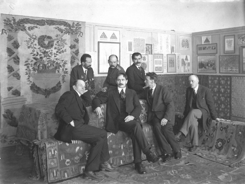
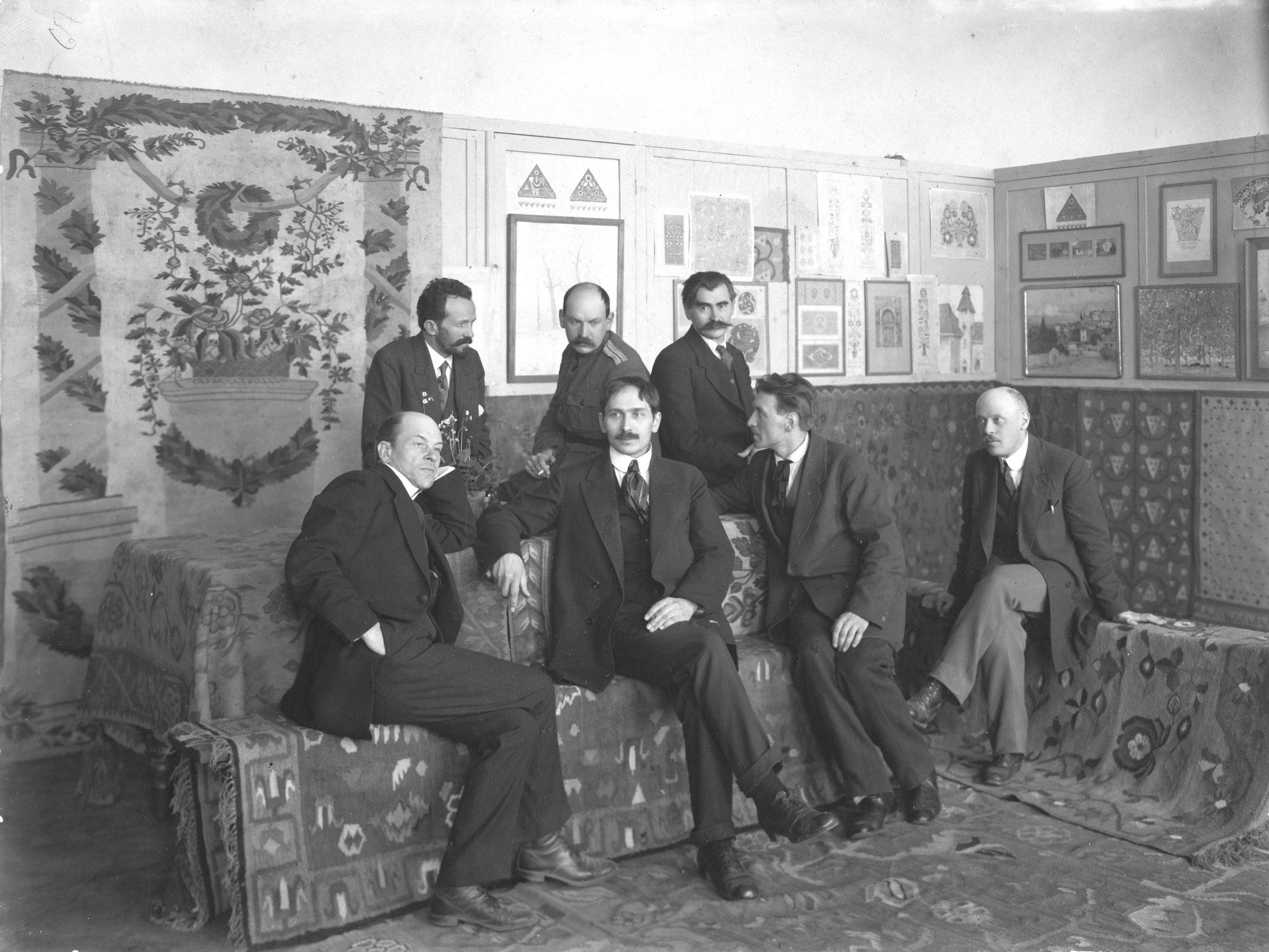
KyivFounders of the Academy of ArtsThe founders of the Ukrainian State Academy of Arts at its opening in December 1917, artists who shaped a new Ukrainian modernism. Its successor is the National Academy of Fine Arts and Architecture.Archival photo: невідомий автор, 1917, Public domain · Wikimedia Commons -
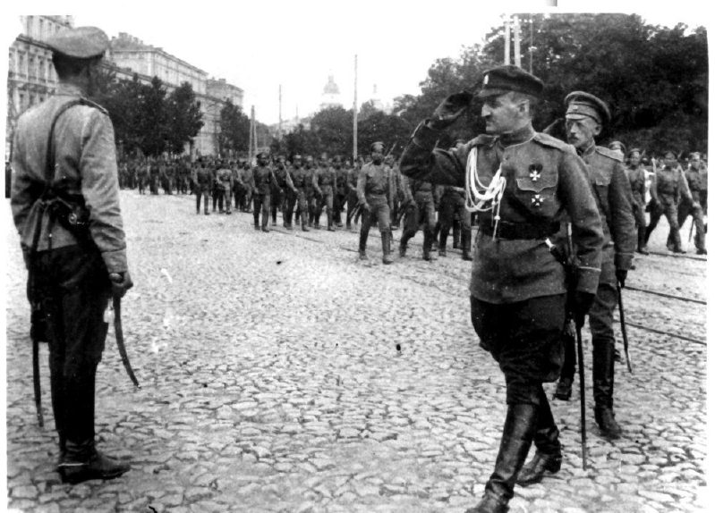
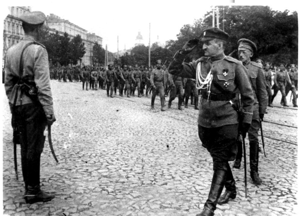
KyivParade of the Ukrainian StateA military parade of Hetman Pavlo Skoropadskyi's Ukrainian State in 1918. In the foreground is Oleksandr Slyvynskyi, Chief of the General Staff. The Hetmanate lasted from April to December 1918.Archival photo: невідомий автор, 1918, Public domain · Wikimedia Commons -
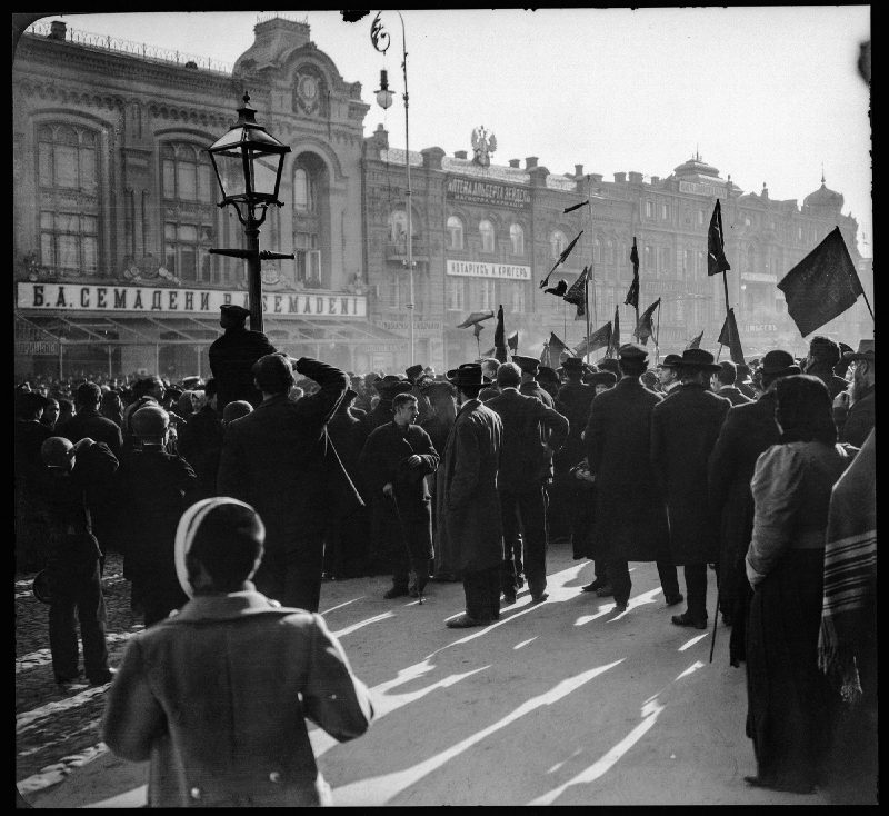
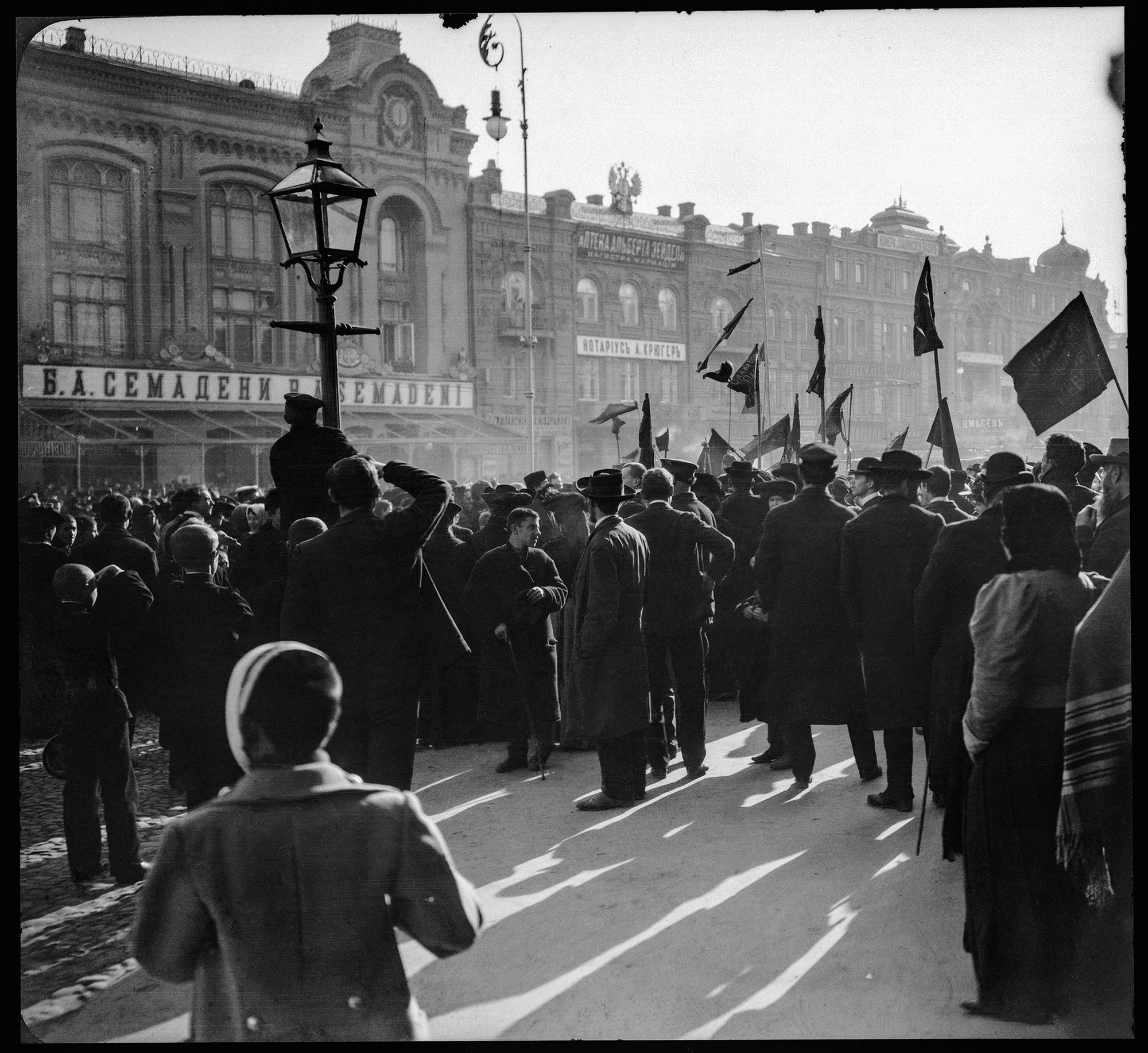
KhreshchatykRally on KhreshchatykA rally with flags on Khreshchatyk during the revolutionary years, c. 1918–1919, photographed by the Polish photographer Witold Marczewski. Power in Kyiv changed hands more than a dozen times in those years.Archival photo: Вітольд Марчевський, бл. 1918–1919, Public domain · Wikimedia Commons -
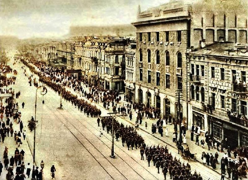
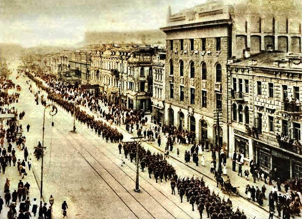
KhreshchatykParade on KhreshchatykA military parade on Khreshchatyk on 9 May 1920, during the Polish–Soviet War, with columns marching past the street's pre-revolutionary buildings.Archival photo: невідомий автор, 1920, Public domain · Wikimedia Commons -
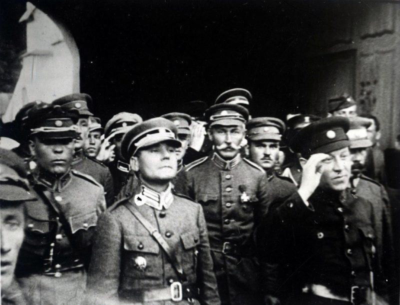
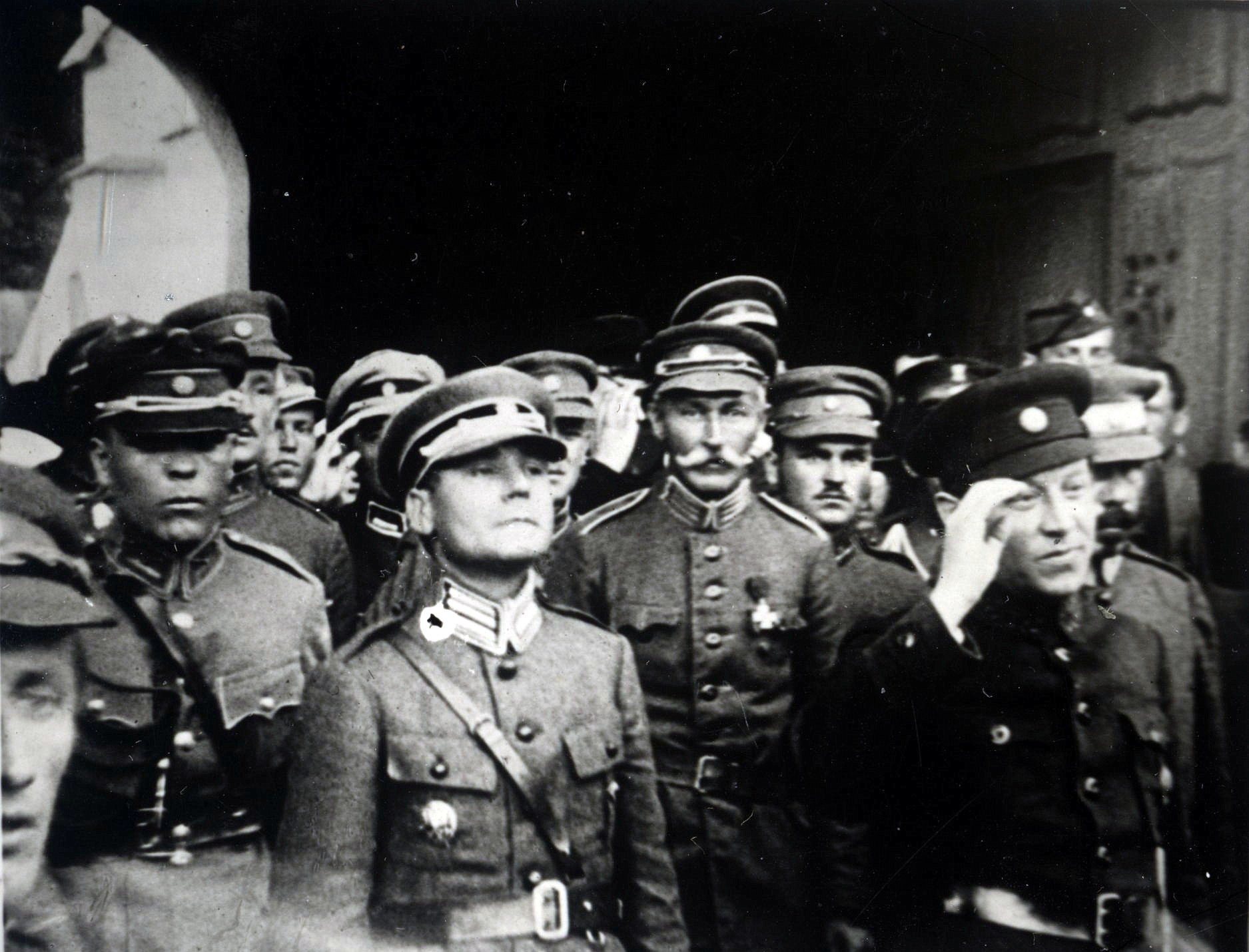
Sofiiska SquarePetliura by the St Sophia belfrySymon Petliura, Supreme Otaman of the UNR army, with officers by the bell tower of St Sophia's Cathedral in May 1920, when Ukrainian and Polish troops briefly retook Kyiv. A month later the Red Army occupied the city again.Archival photo: невідомий автор, 1920, ліцензія не вказана · pastvu.com -
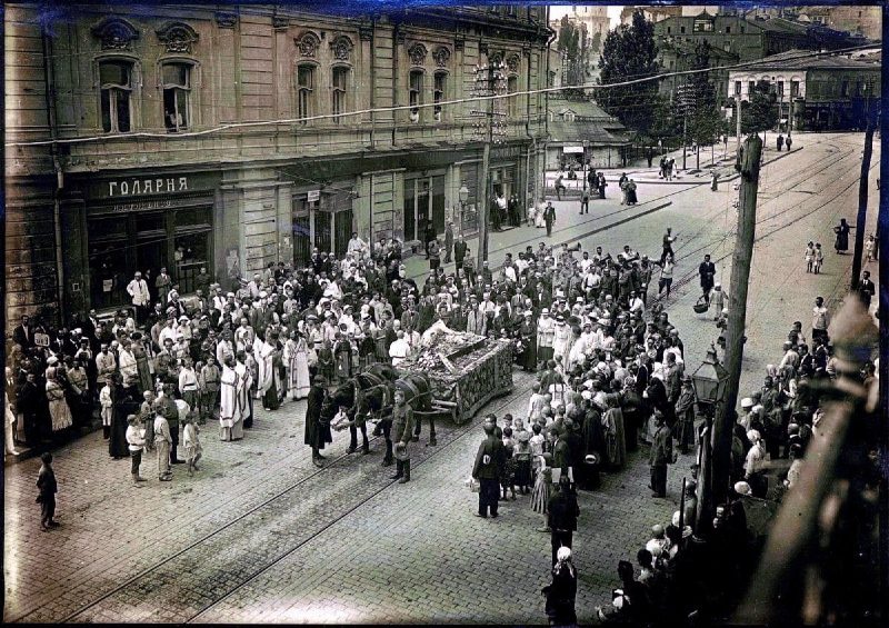
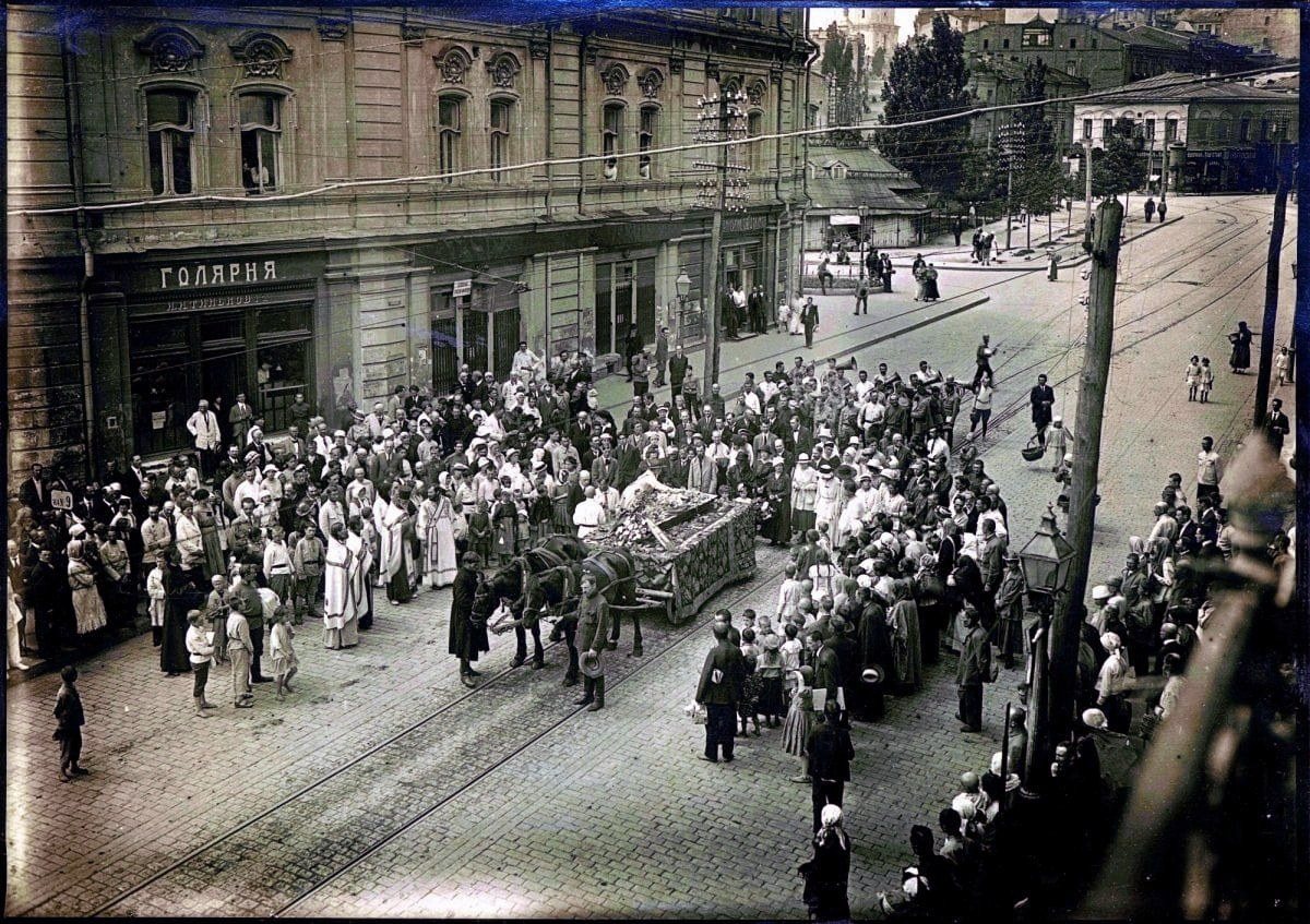
Maidan NezalezhnostiThe funeral of Heorhii NarbutOn 25 May 1920 the funeral procession of artist Heorhii Narbut, designer of the first Ukrainian stamps, banknotes and the UNR coat of arms, passes Duma Square (now Maidan Nezalezhnosti). Narbut died of typhus aged 34.Archival photo: невідомий автор, 1920, Public domain · Wikimedia Commons -
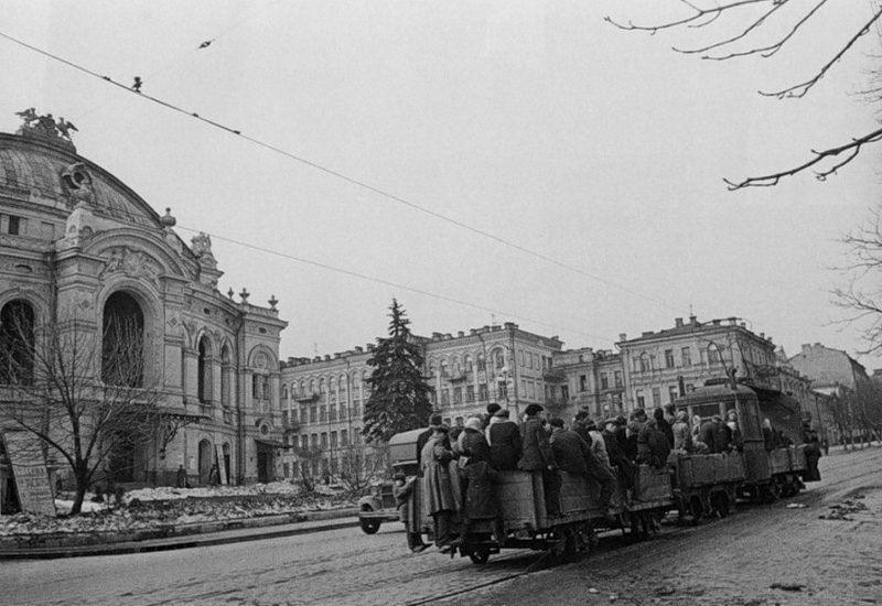
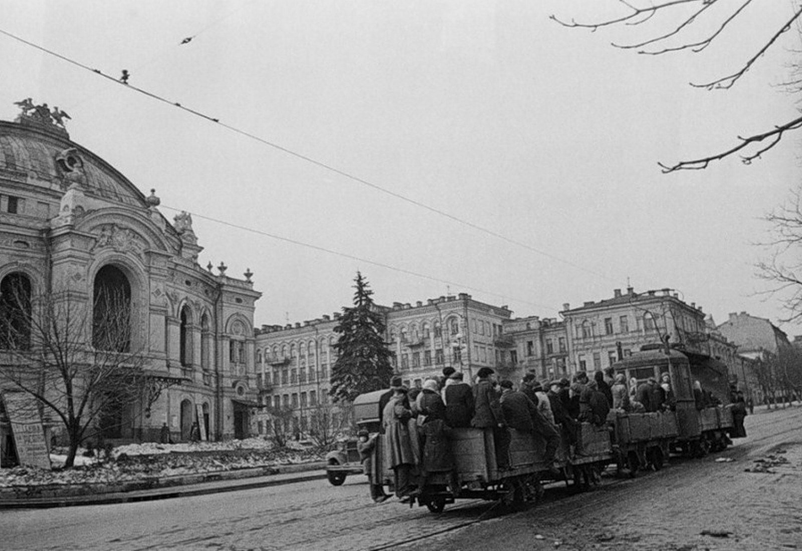
Volodymyrska Street by the National OperaFreight tram by the OperaA freight tram with people riding on its platform by the City (Opera) Theatre. In the hard years of the civil war, trams often carried firewood, food and passengers on open wagons.Archival photo: невідомий автор, бл. 1920, Public domain · Wikimedia Commons -
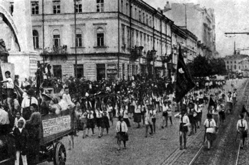
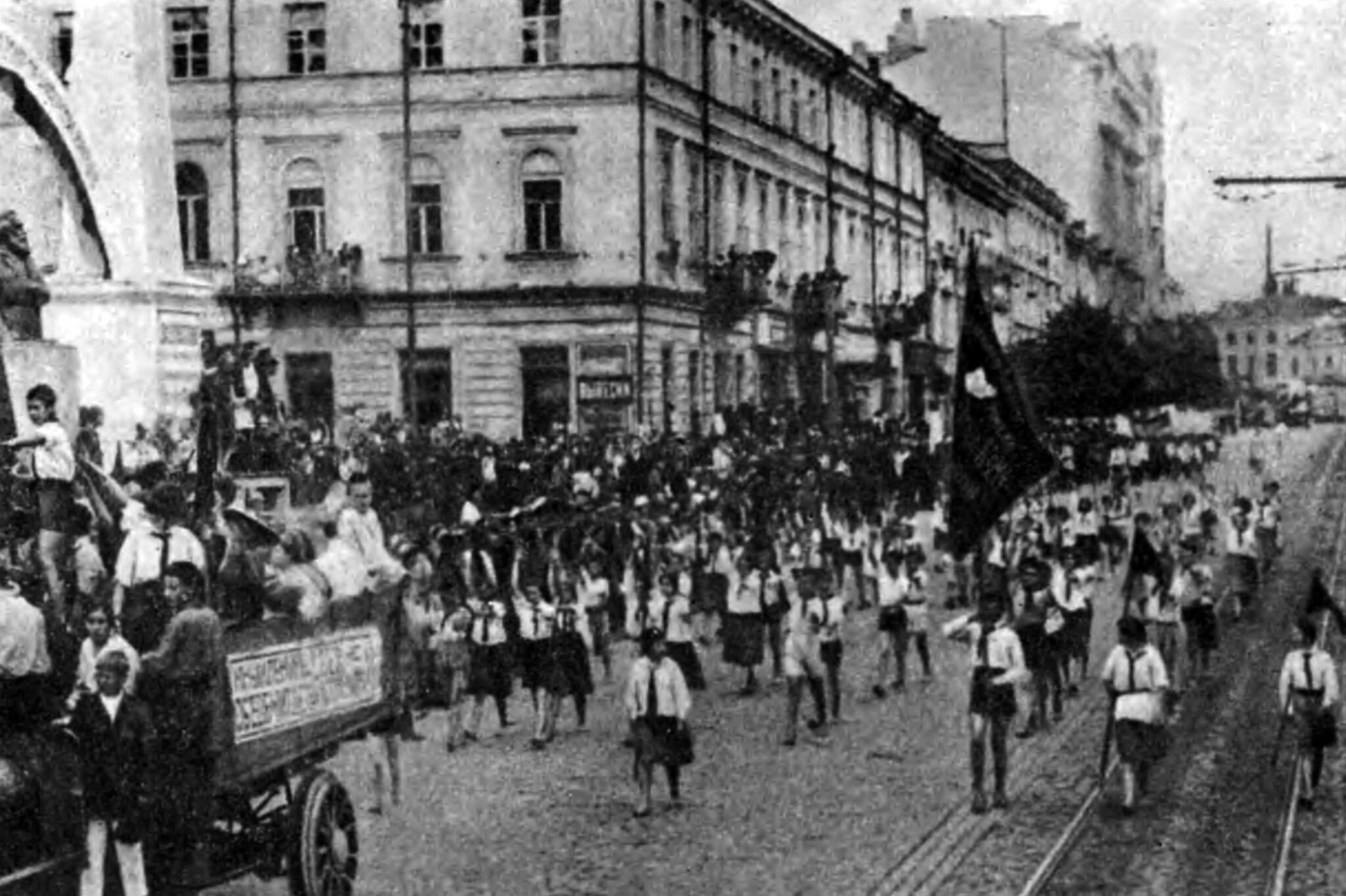
Central KyivPioneers on paradeA column of Young Pioneers at a demonstration marking the 10th anniversary of the outbreak of the First World War, summer 1924. Early Soviet Kyiv was full of rallies and marches; the capital of Soviet Ukraine was then Kharkiv, and Kyiv regained that status only in 1934.Archival photo: невідомий автор, 1924, ліцензія не вказана · pastvu.com -
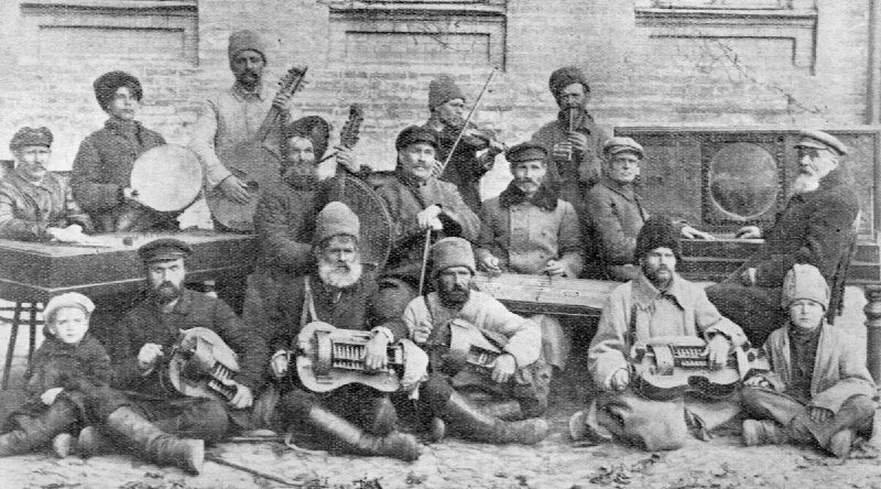
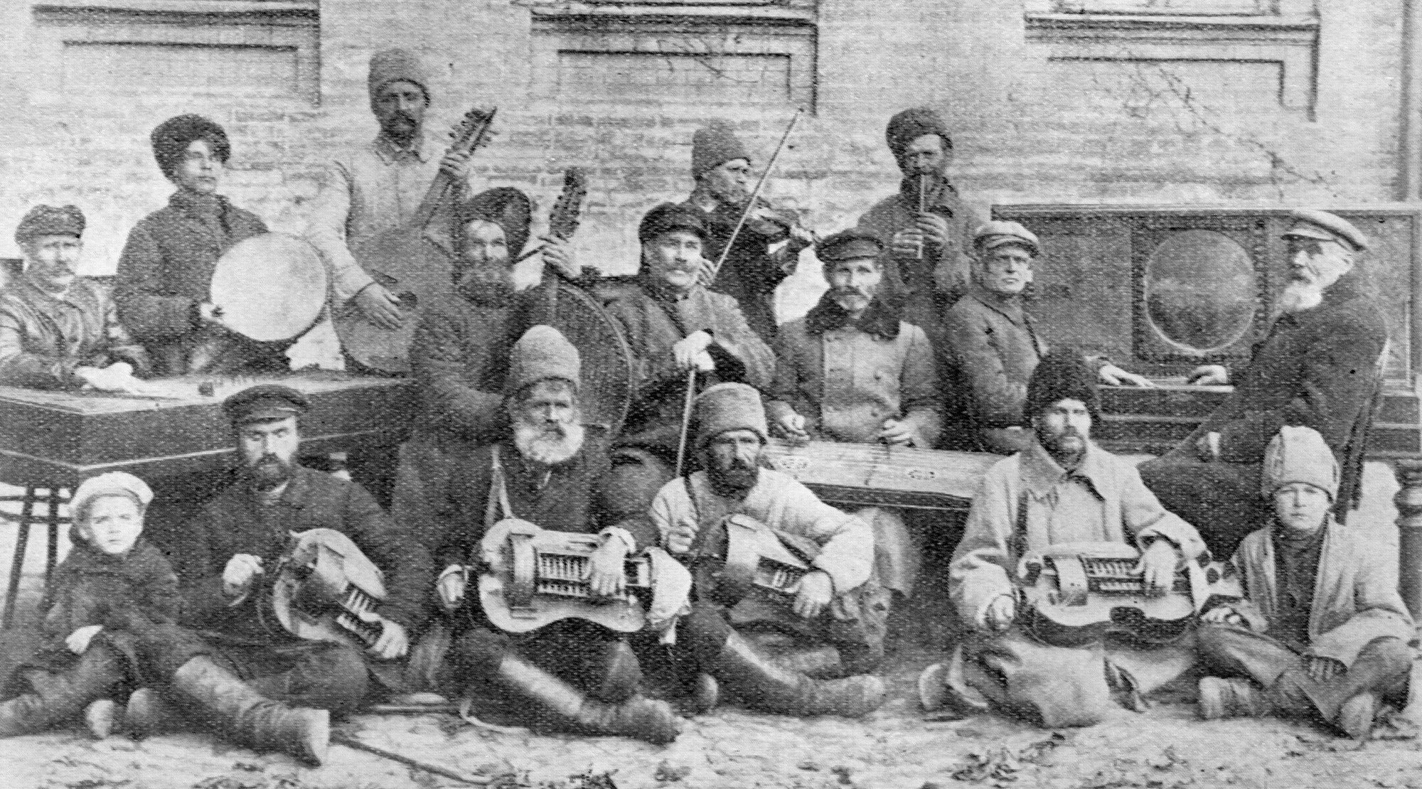
KyivLyre players and street musiciansPerformers at an "Ethnographic Concert" held in Kyiv on 9 November 1926: street singers and musicians with hurdy-gurdies, banduras, fiddles and a tambourine. Wandering lirnyky and kobzars were a living tradition that the Soviet authorities all but destroyed in the 1930s.Archival photo: невідомий автор, 1926, Public domain · Wikimedia Commons -
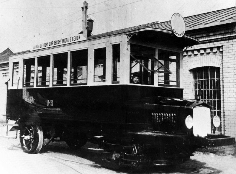
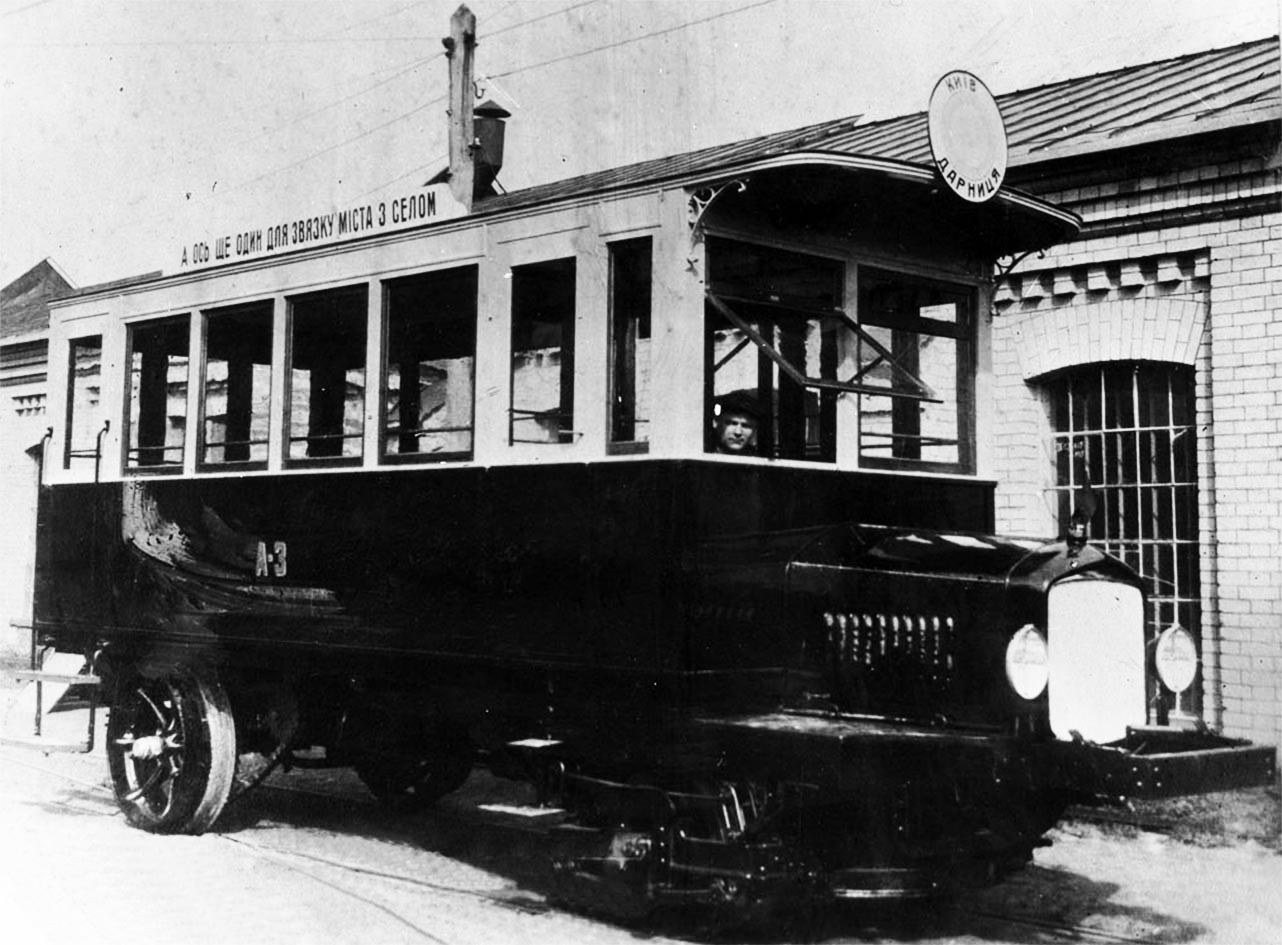
DarnytsiaMotor tram to DarnytsiaA motor tram for the Darnytsia line, turned out by the Main Tram Workshops on 1 May 1926. These petrol-engined cars carried passengers to the left bank, where the overhead power lines had not yet reached.Archival photo: невідомий автор, 1926, Public domain · Wikimedia Commons -
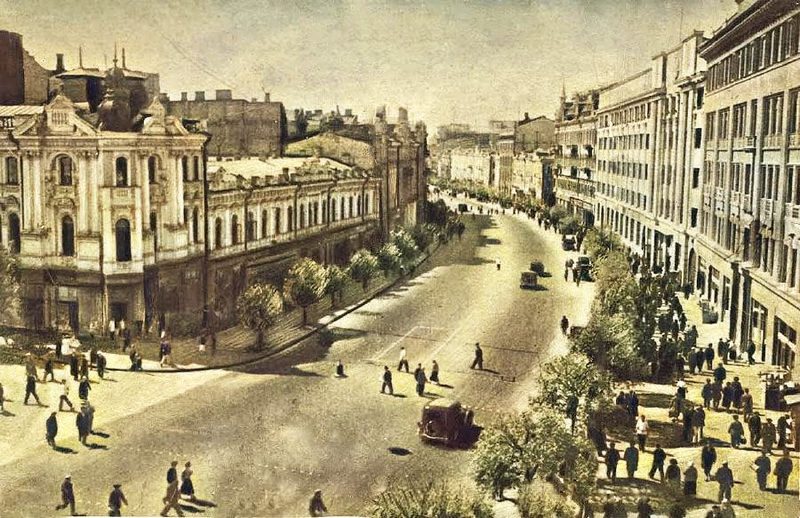
Khreshchatyk at Arkhitektora Horodetskoho StreetKhreshchatyk before the warThe corner of Khreshchatyk and Horodetskoho Street in 1938, with pre-war buildings and a line of trees. In September 1941 the buildings on this corner were destroyed by explosions and fires.Archival photo: невідомий автор, 1938, Public domain · Wikimedia Commons -
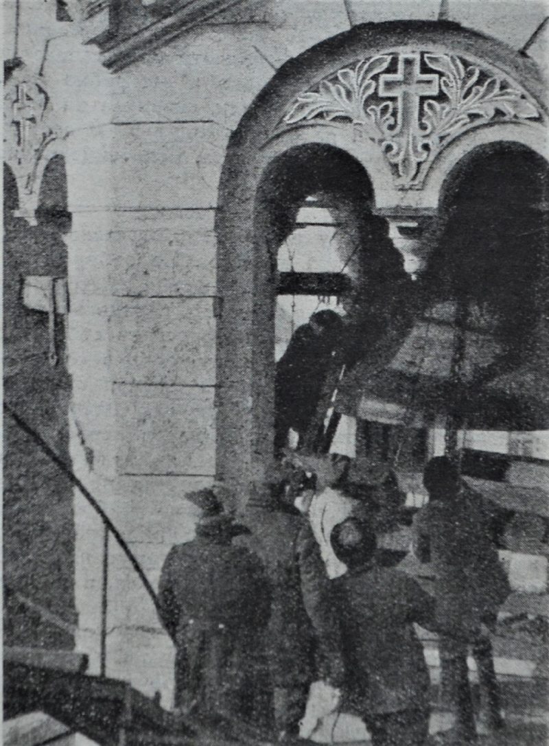
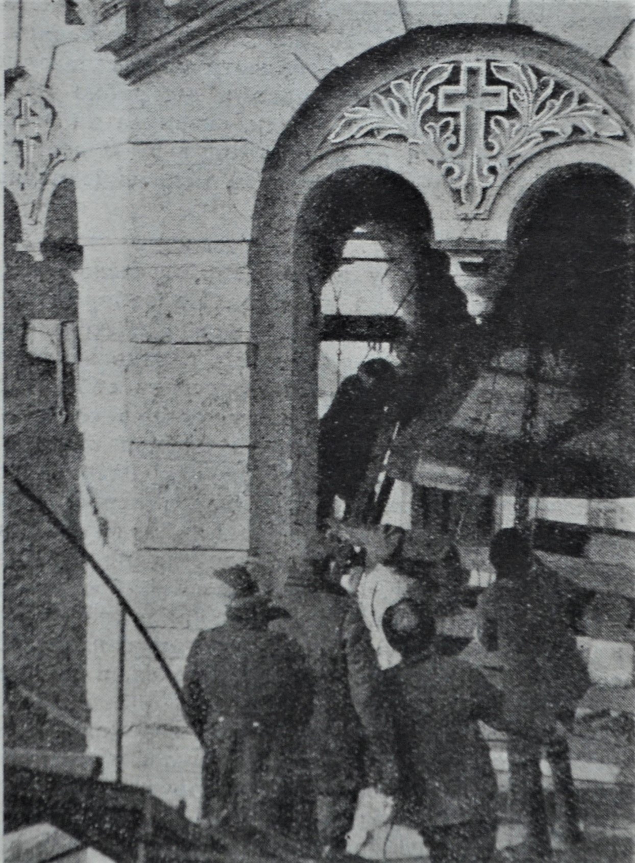
20 Tarasa Shevchenka BoulevardRemoving the bell of St Volodymyr'sActivists remove a five-tonne bell from the belfry of St Volodymyr's Cathedral. The photograph was published in Prozhektor magazine in January 1930, captioned that "the precious metal will be used far more effectively elsewhere". The anti-religious campaign of the late 1920s and 1930s destroyed dozens of Kyiv churches.Archival photo: Самаріна, 1929–1930, Public domain · Wikimedia Commons -
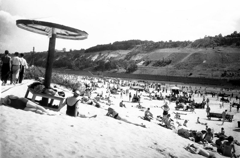
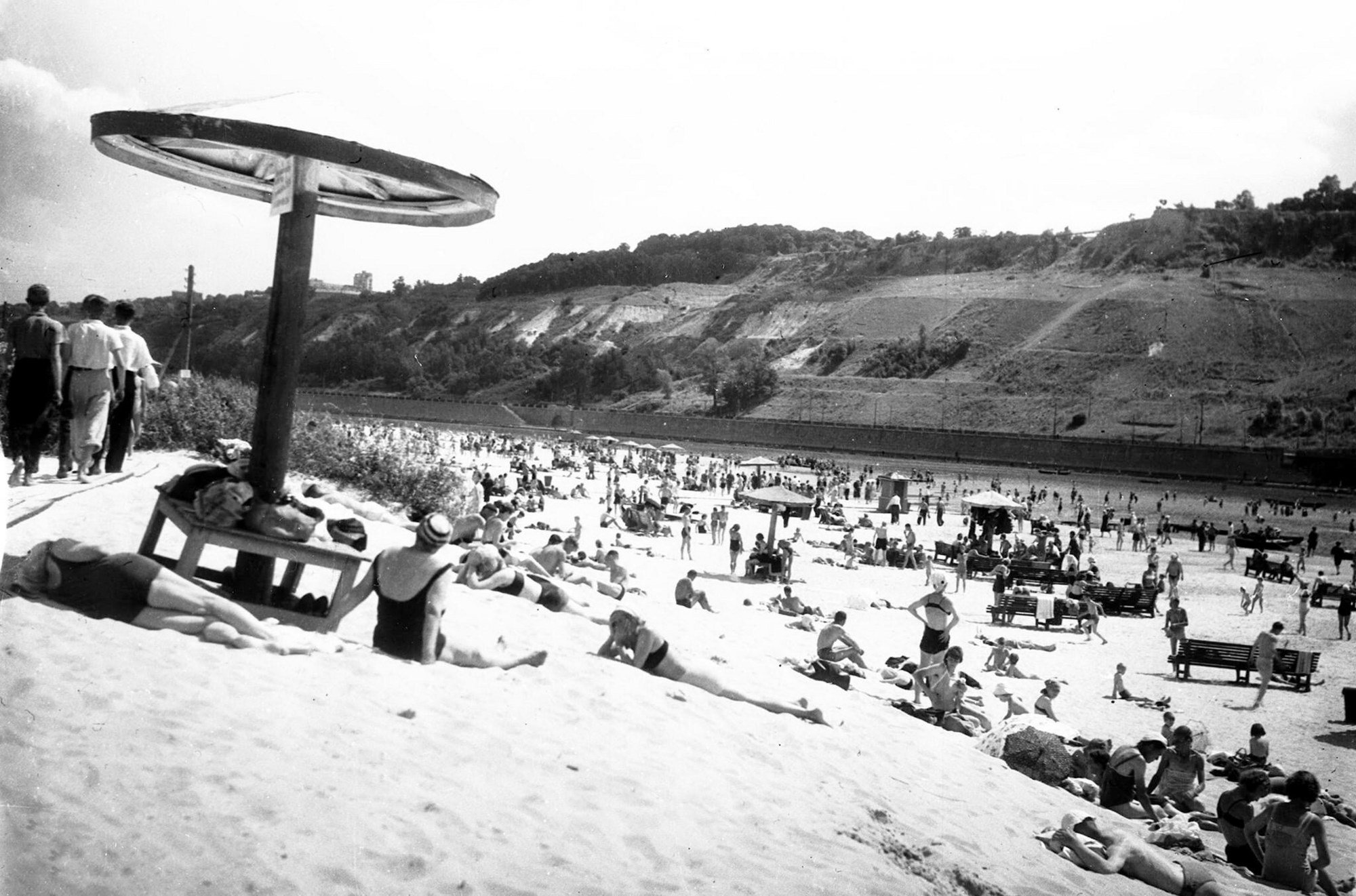
Trukhaniv IslandCentral beach on Trukhaniv IslandThe central beach on Trukhaniv Island: sunbathing Kyivans, umbrella shades and the steep right bank across the Dnipro. In the 1930s the island became the city's favourite summer spot, and it still is, linked to the centre by the Pedestrian Bridge.Archival photo: невідомий автор, 1930-ті, ліцензія не вказана · pastvu.com -
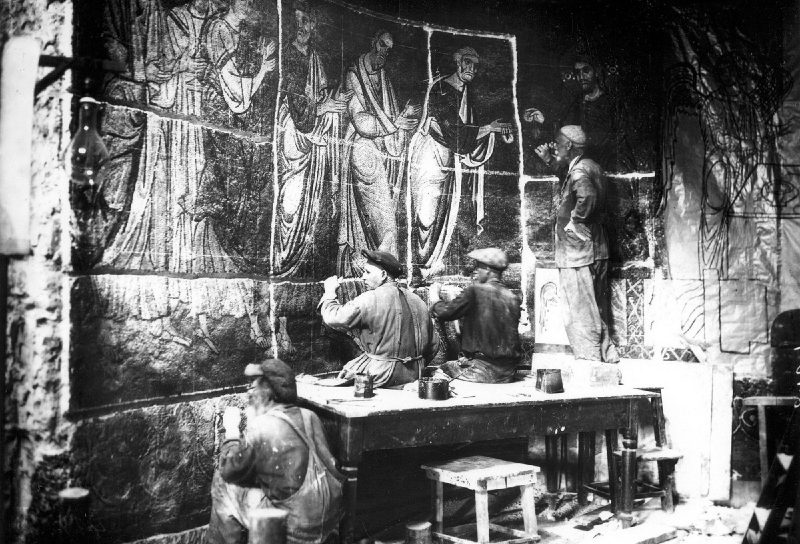
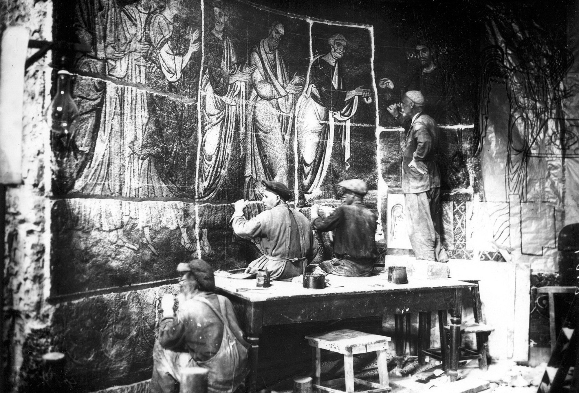
Mykhailivska SquareRemoving the mosaics of St Michael'sLeningrad mosaicist Frolov and his assistants remove 12th-century mosaics from the walls of St Michael's Golden-Domed Cathedral before its destruction in 1935–1936. Some of the salvaged mosaics and frescoes are now in St Sophia's, others in museums in Moscow and St Petersburg. The cathedral was rebuilt in the late 1990s.Archival photo: невідомий автор, 1934–1935, ліцензія не вказана · pastvu.com -
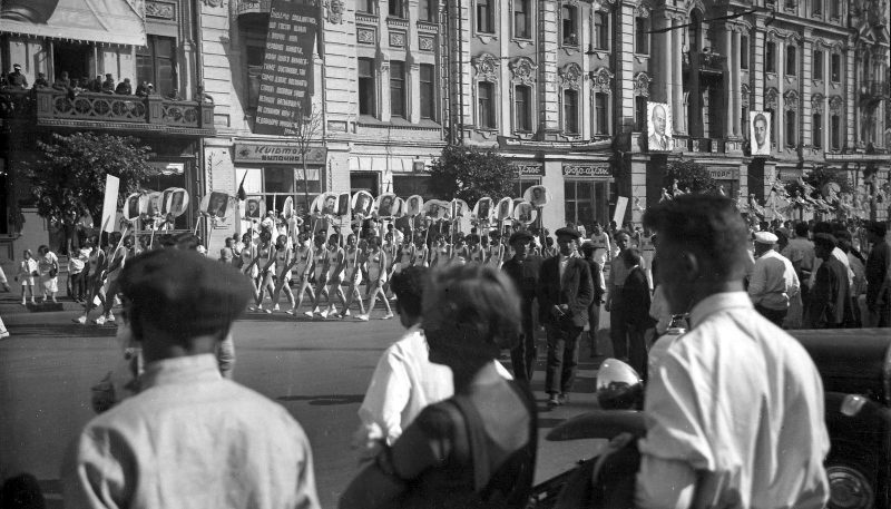
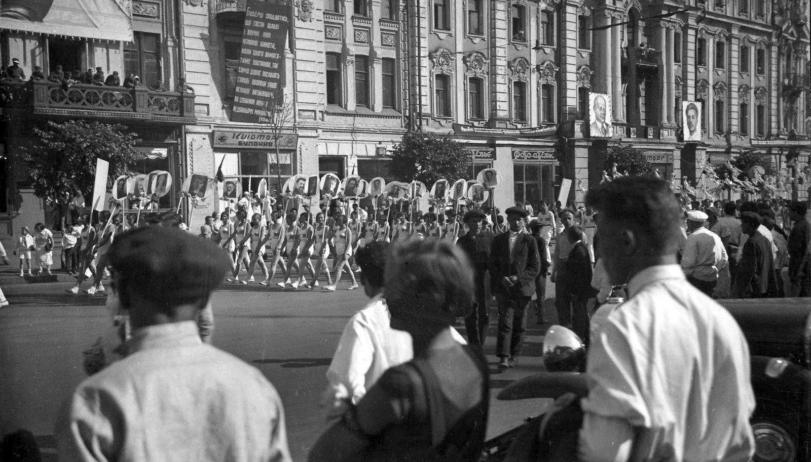
KhreshchatykAthletes on KhreshchatykColumns of athletes march along Khreshchatyk during a 1935 parade as onlookers watch from the pavement. The photograph is attributed to French photographer Pierre Verger, who travelled in the USSR that year. The buildings in the background perished in autumn 1941.Archival photo: П'єр Верже, 1935, ліцензія не вказана · pastvu.com -
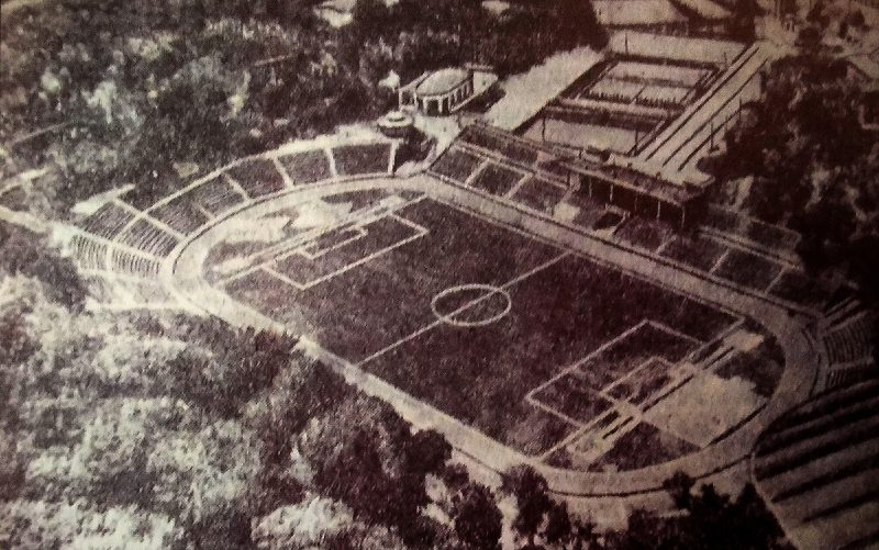
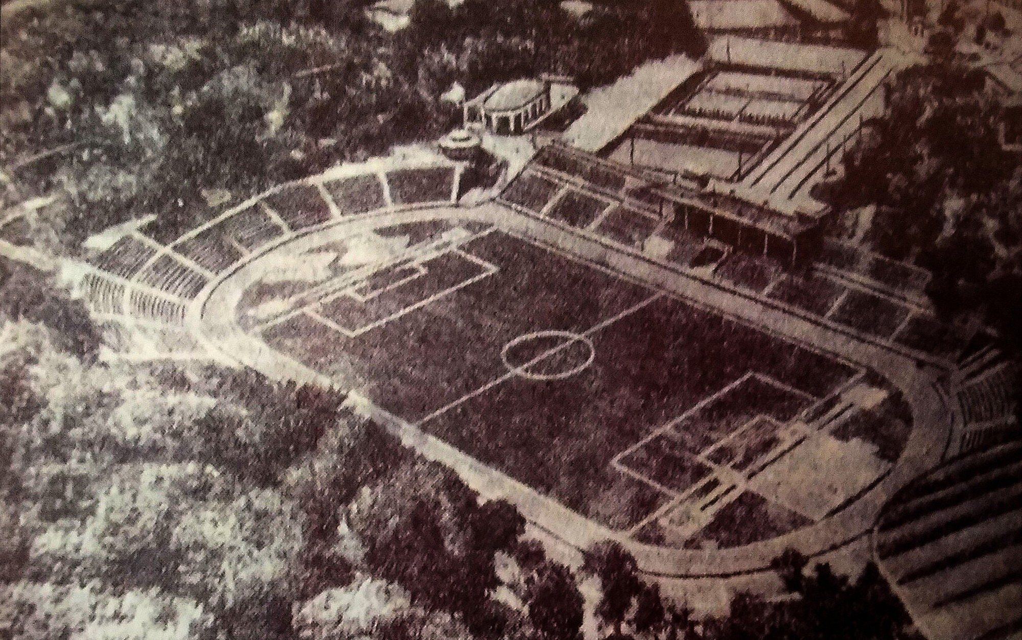
3 Mykhaila Hrushevskoho StreetDynamo Stadium from the airDynamo Stadium on the slopes above the Dnipro from the air in 1935, when it was named after the interior commissar Vsevolod Balytskyi. Today it is the Valeriy Lobanovskyi Dynamo Stadium, home ground of the Kyiv club.Archival photo: невідомий автор, 1935, ліцензія не вказана · pastvu.com -
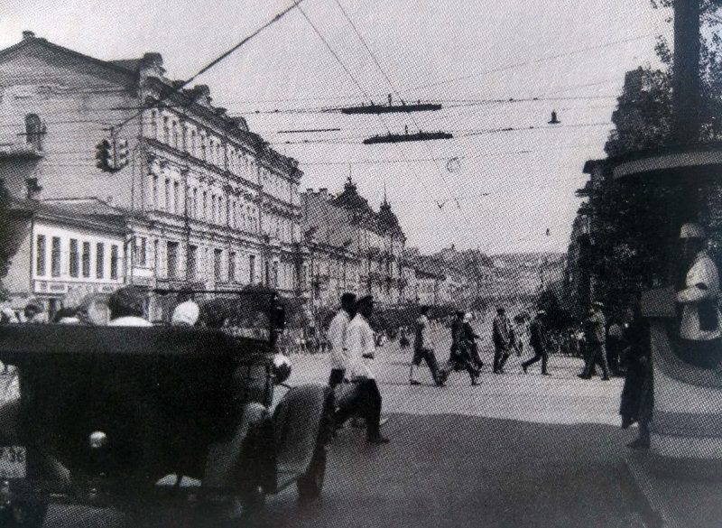
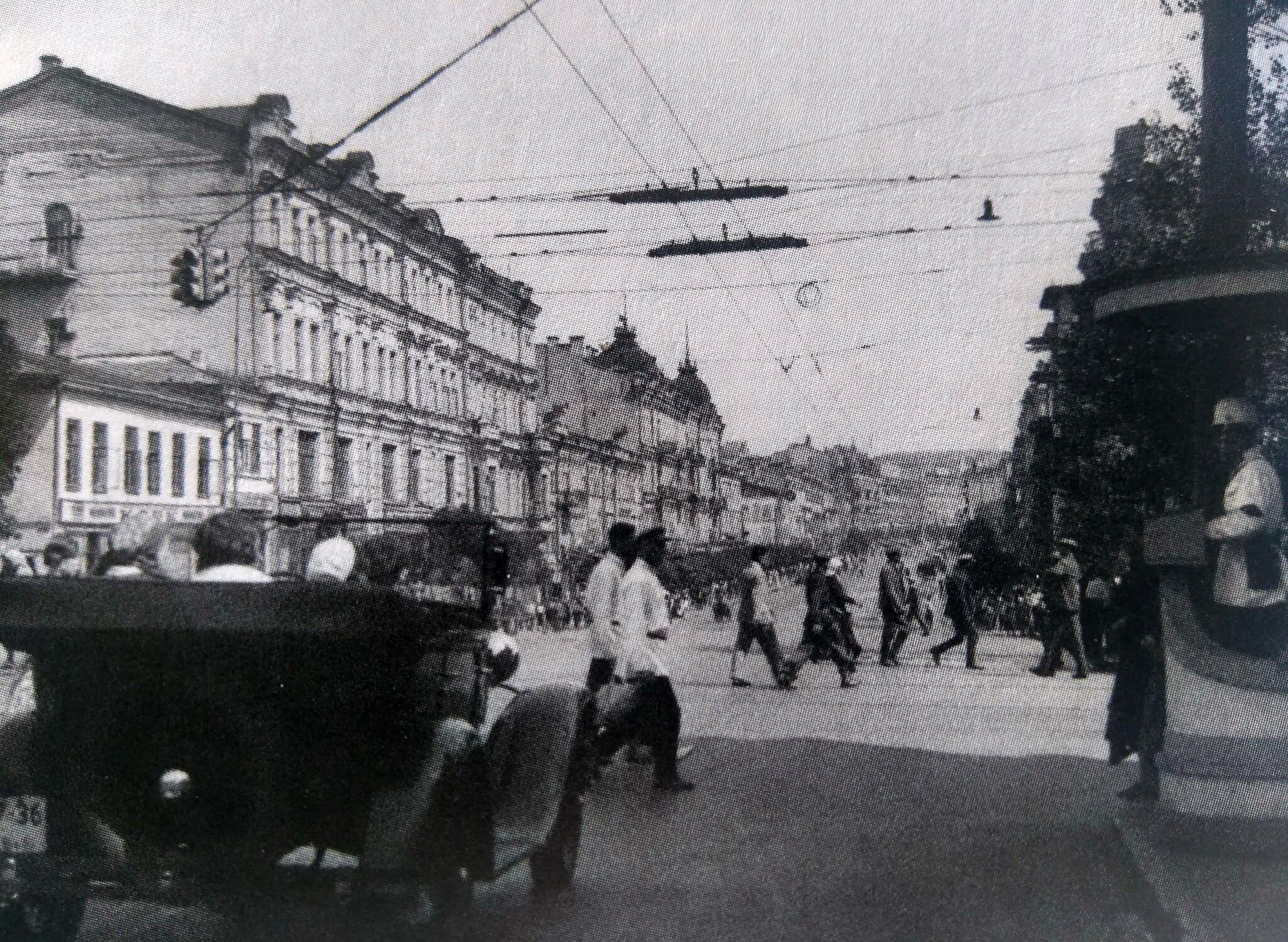
Bessarabska SquareTraffic officer at BessarabkaA traffic officer switches the lights on Bessarabska Square in 1936. As cars multiplied in the capital, the first traffic lights appeared at its main junctions. Behind him is the top of Khreshchatyk, whose buildings were destroyed in 1941.Archival photo: невідомий автор, 1936, ліцензія не вказана · pastvu.com -
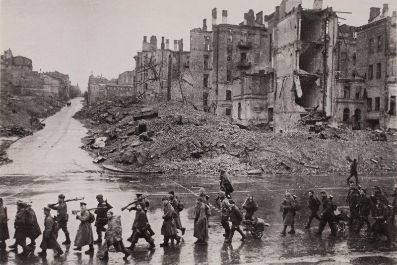
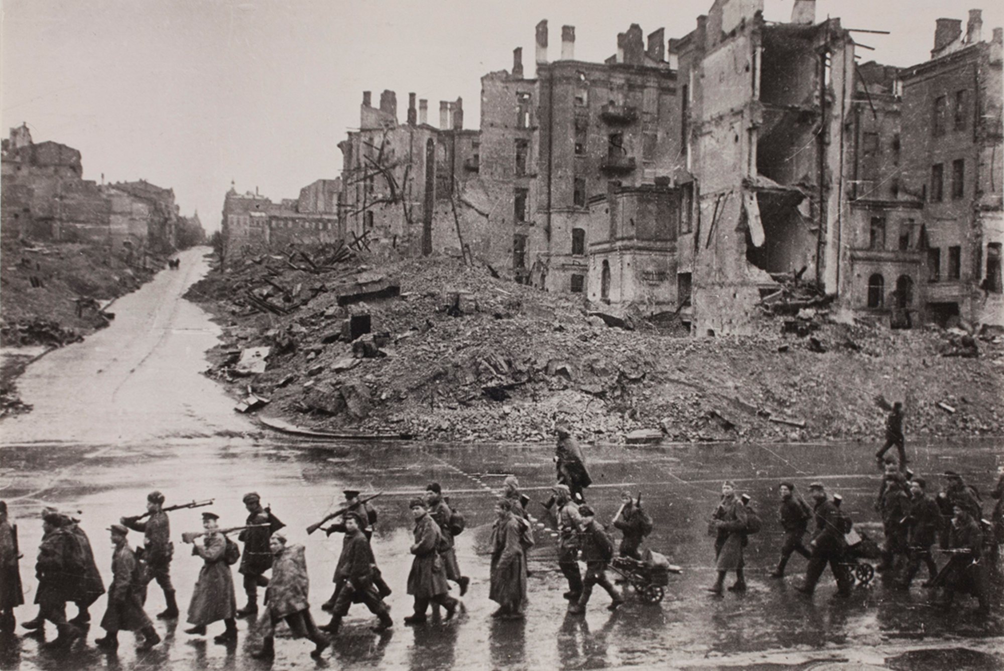
KhreshchatykKhreshchatyk after liberationNovember 1943: Soviet infantry march along the ruined Khreshchatyk after the liberation of Kyiv. The street was rebuilt from the late 1940s through the 1950s.Archival photo: Аркадій Шайхет, 1943, Public domain · Wikimedia Commons -
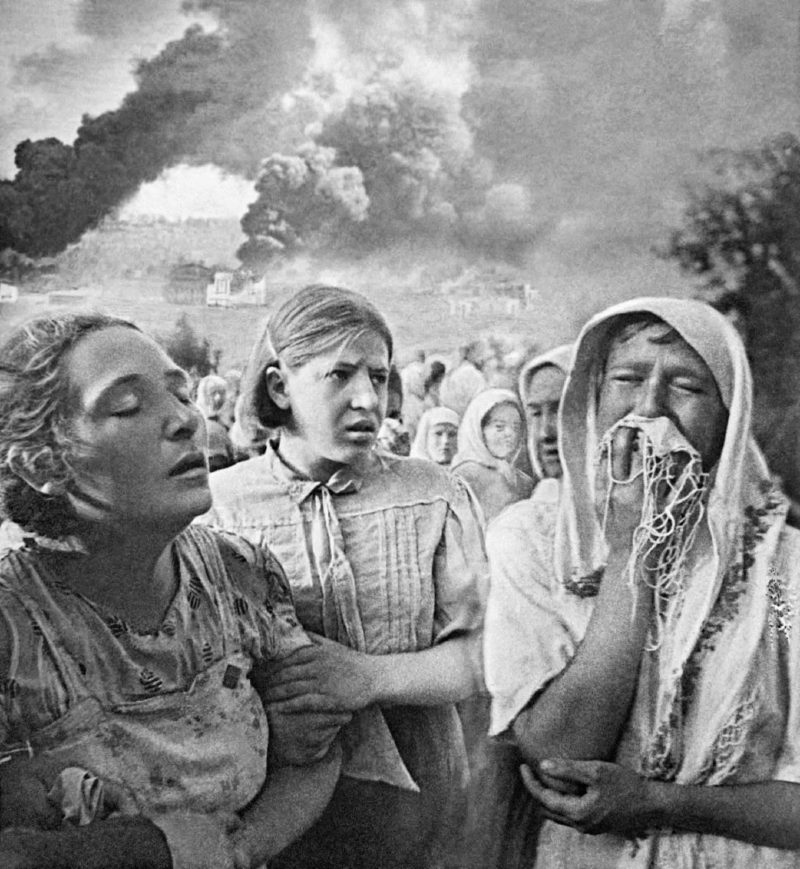
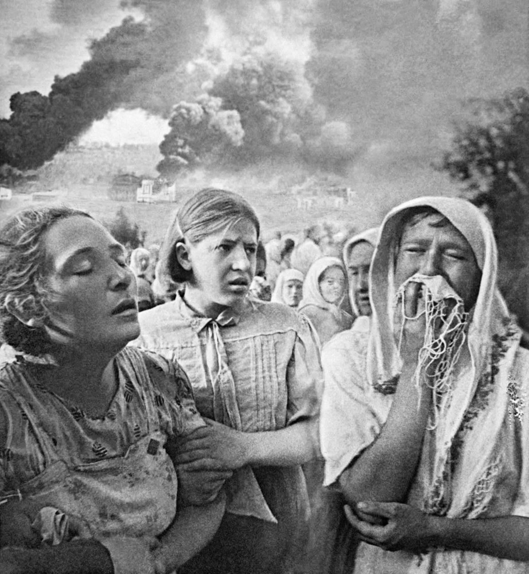
KyivKyiv, 23 June 1941Kyivans on the second day of the war, 23 June 1941, photographed by press photographer Kazimir Lishko. Kyiv was bombed at dawn on 22 June; three months later, on 19 September, German troops occupied the city.Archival photo: Казимир Лішко, 1941, CC BY-SA 3.0 · Wikimedia Commons -
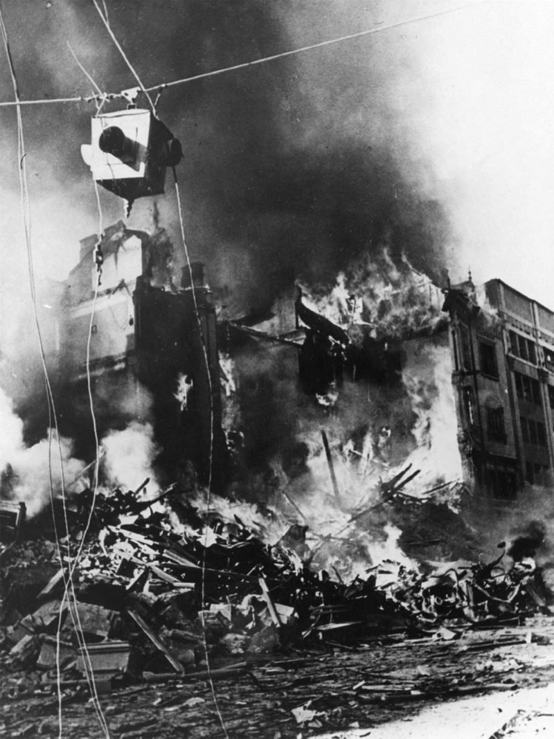
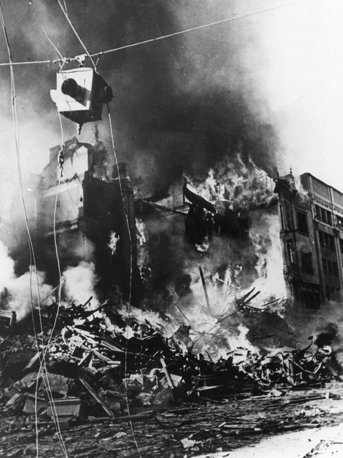
Khreshchatyk / Prorizna StreetFire on KhreshchatykFire at the corner of Khreshchatyk and Prorizna Street, 24 September 1941. That day a series of explosions of charges laid by Soviet sappers began, and within days the city centre, including almost all of Khreshchatyk, burned out.Archival photo: невідомий автор, 1941, Public domain · Wikimedia Commons -
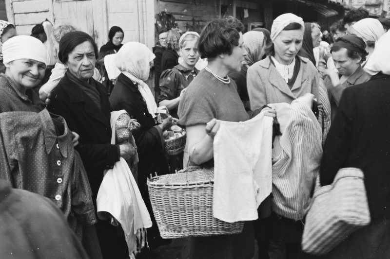
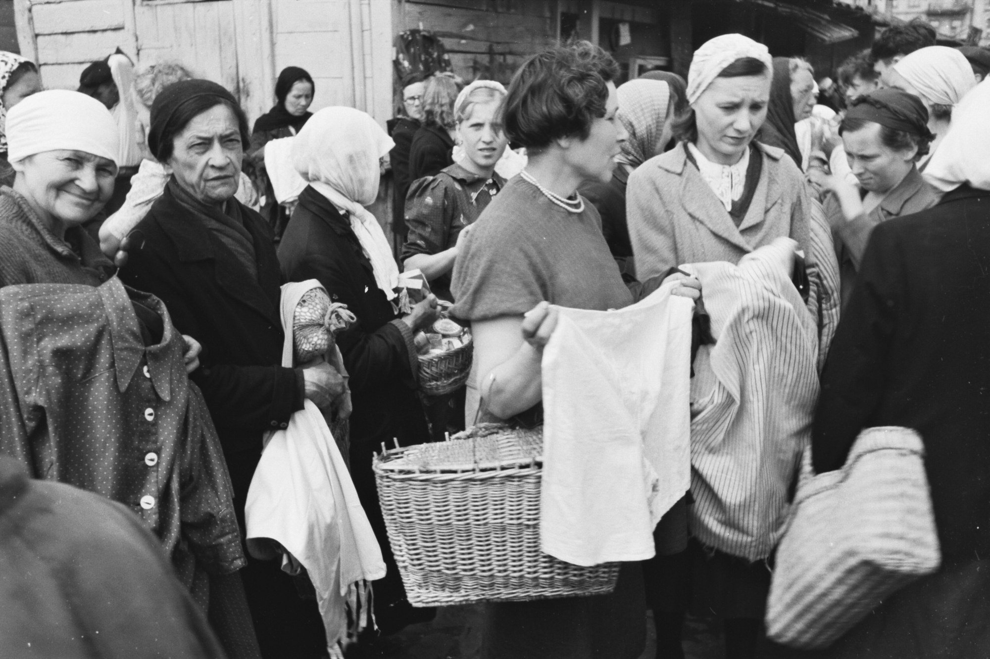
Peremohy SquareMarket in occupied KyivThe market on today's Peremohy Square (then 1905 Uprising Square), 1942. In the occupied city ration cards provided almost nothing, and Kyivans survived by bartering clothes, belongings, whatever they had.Archival photo: невідомий автор, 1942, CC BY-SA 3.0 · Wikimedia Commons -
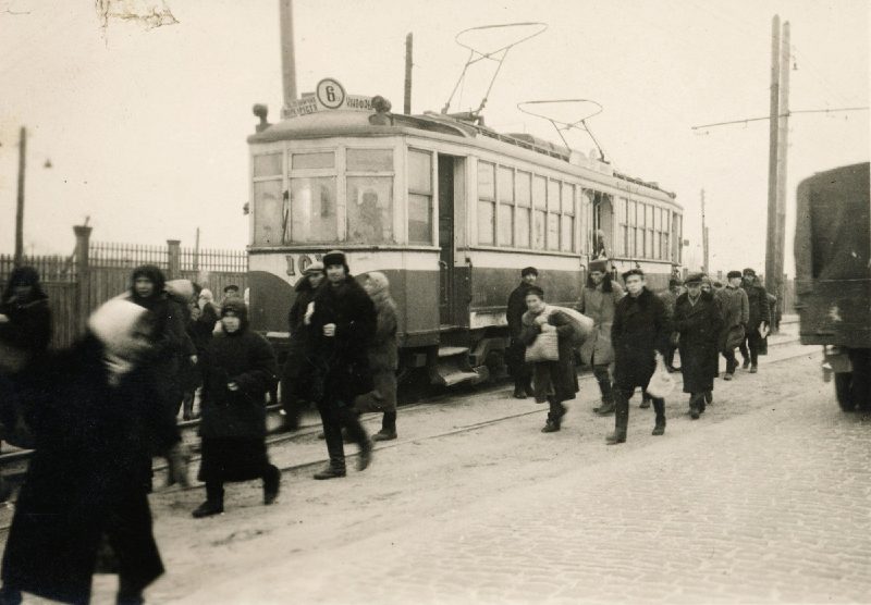
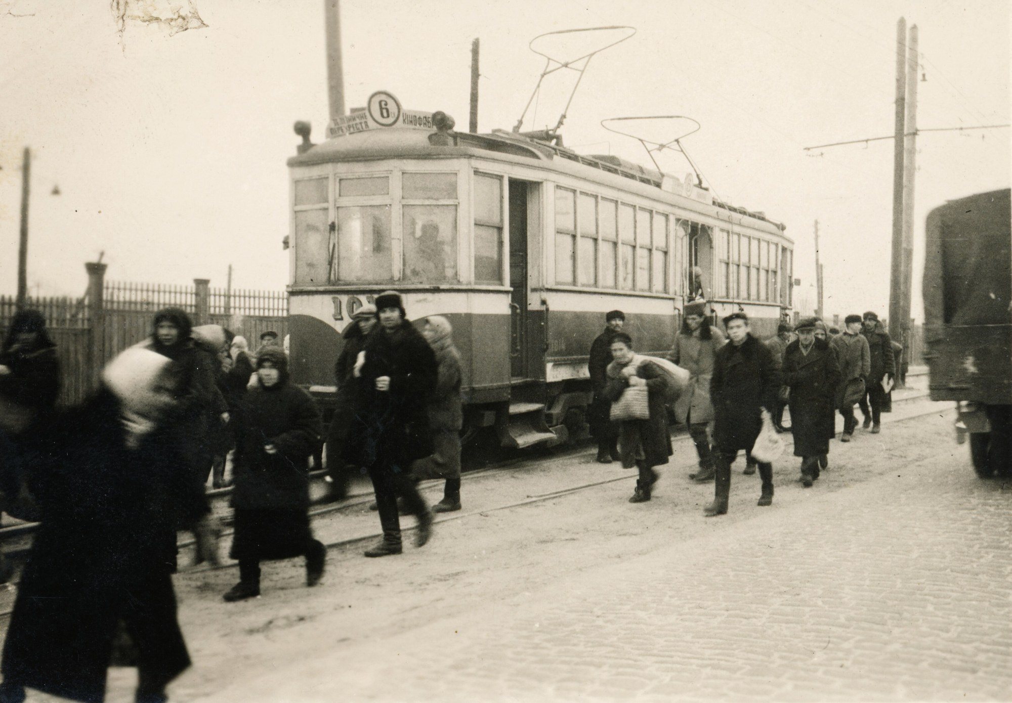
KyivTram No. 6 in 1942A No. 6 tram on the "Railway crossing – Film Studio" route in occupied Kyiv, 1942. Some tram lines were restored within months of the fighting and remained the city's main public transport.Archival photo: невідомий автор, 1942, CC BY-SA 3.0 · Wikimedia Commons -
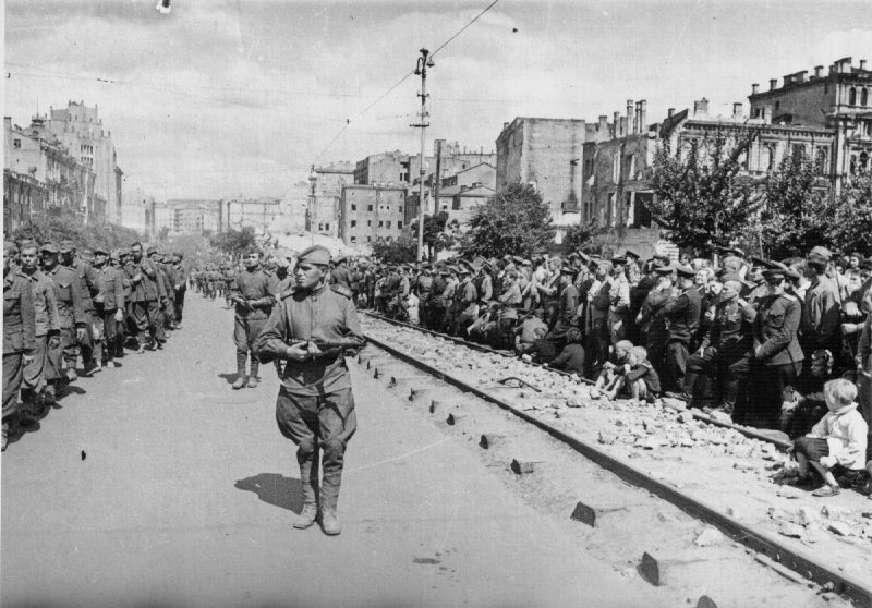
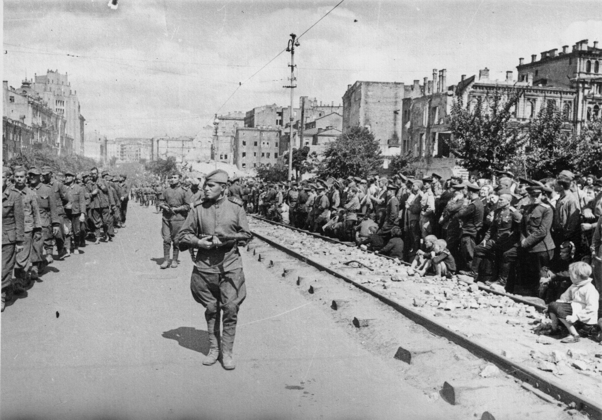
Central KyivPOWs marched through KyivOn 16 August 1944 a column of German prisoners of war was marched through the streets of ruined Kyiv, watched by residents and soldiers. Photograph by Heorhii Uhrynovych. In the background are ruined buildings that had only begun to be cleared.Archival photo: Георгій Угринович, 1944, Public domain · Wikimedia Commons -
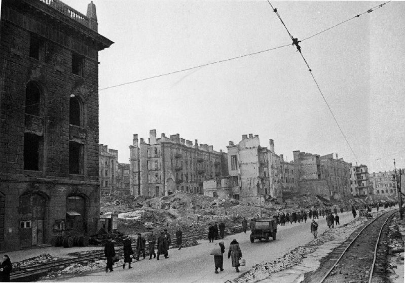
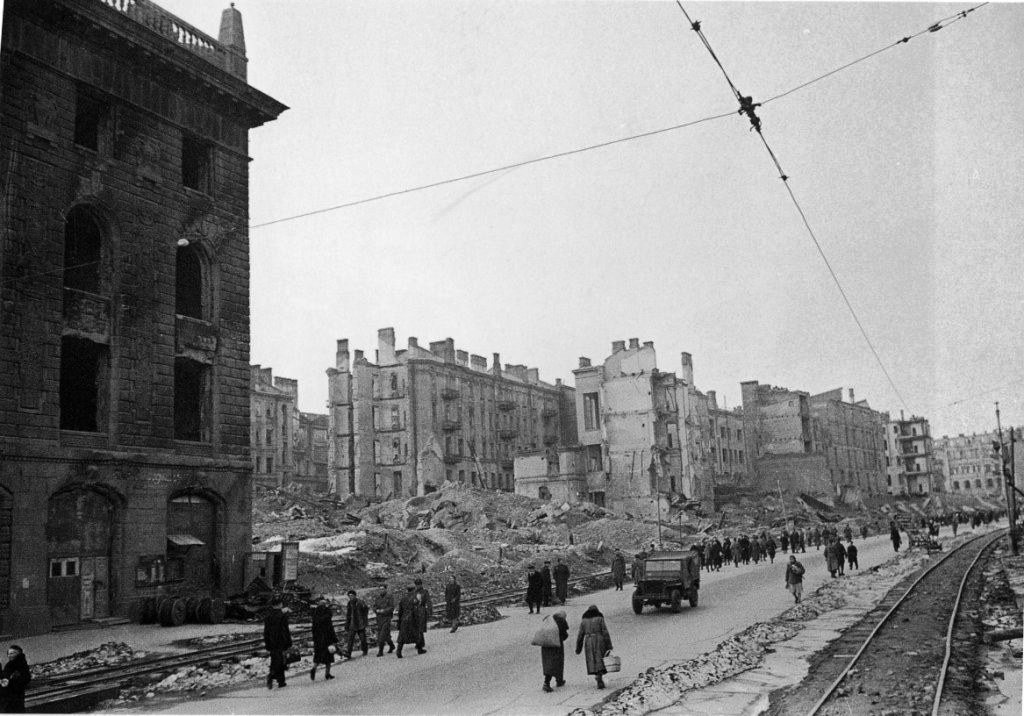
KhreshchatykTemporary tracks on KhreshchatykKhreshchatyk cleared of rubble, with temporary tram tracks used to haul debris away, photographed by Ivan Shagin. The new street, almost twice as wide, was built up until the mid-1950s.Archival photo: Іван Шагін, 1944, Public domain · Wikimedia Commons -
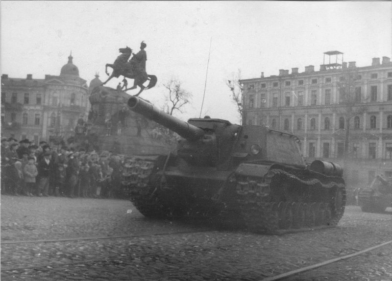
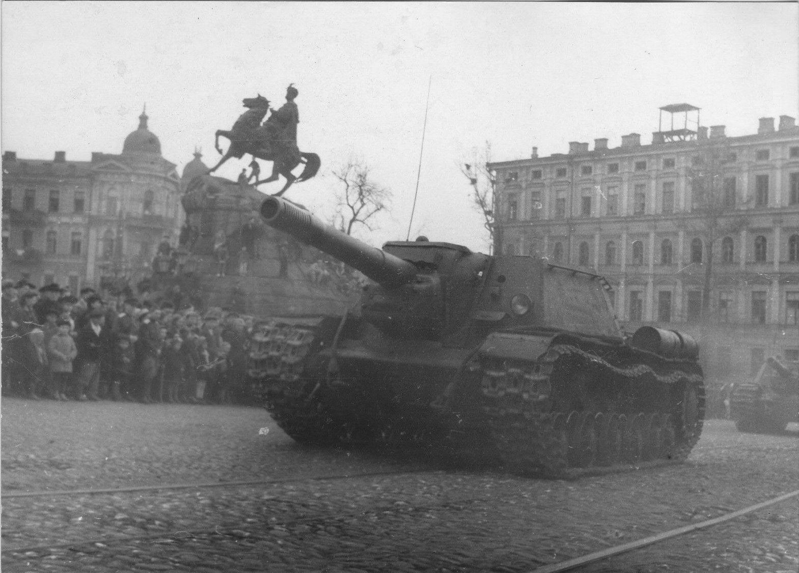
Sofiiska SquareMay Day parade, 1945An SU-152 self-propelled gun passes the Bohdan Khmelnytsky monument during the May Day parade of 1945, a week before the end of the war in Europe. Photograph by Heorhii Uhrynovych.Archival photo: Георгій Угринович, 1945, Public domain · Wikimedia Commons -
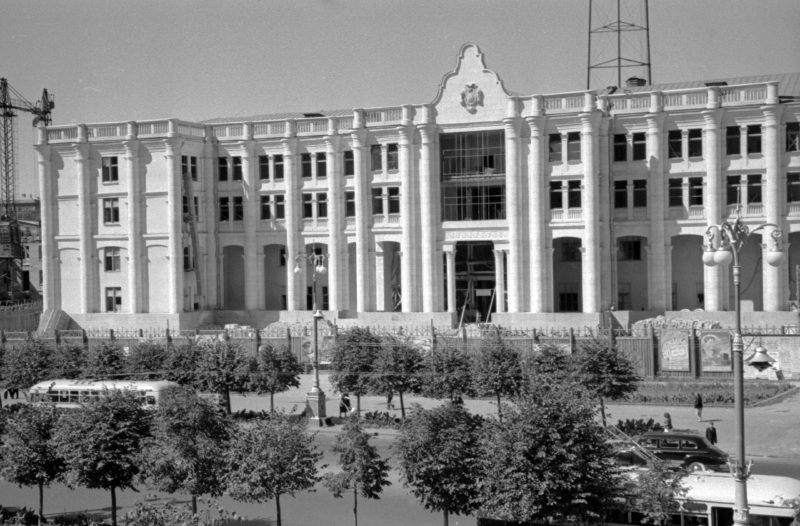
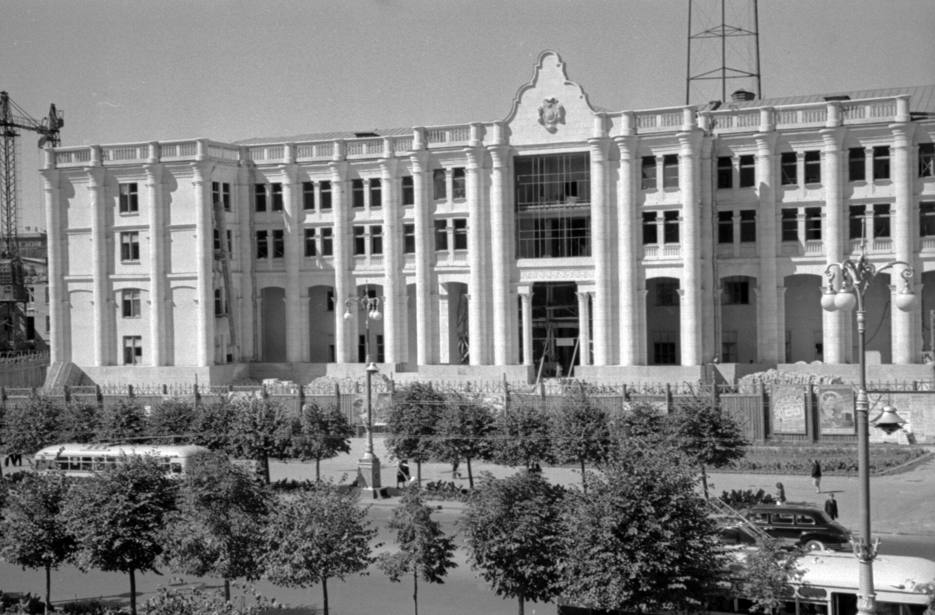
26 KhreshchatykThe new radio and TV centreThe newly built radio and television centre at 26 Khreshchatyk, with an antenna on the roof. Kyiv’s first television broadcast went on air from here in November 1951; today the building is the House of Radio.Archival photo: невідомий автор, 1951, суспільне надбання · Wikimedia Commons -
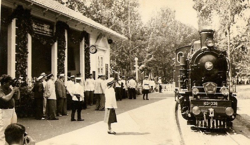
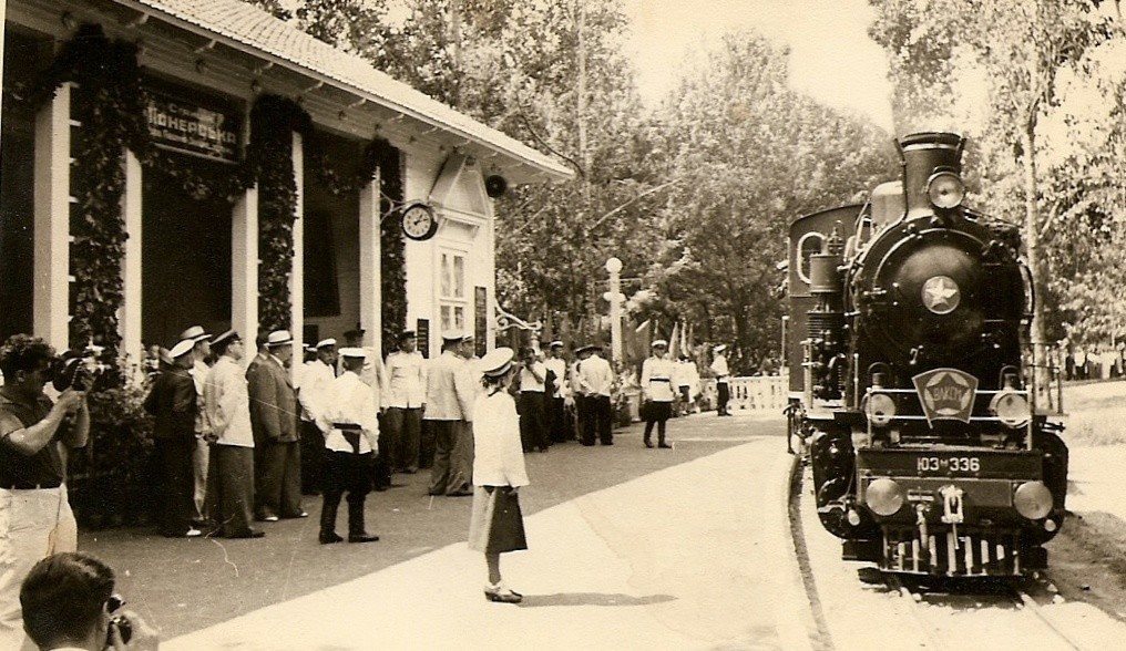
Syrets ParkChildren's RailwayA steam locomotive at Pionerska station of the Kyiv Children’s Railway, 8 May 1954. The line, where schoolchildren run the trains, opened in Syrets Park in 1953 and still operates.Archival photo: В. Жабунев, 1954, CC BY-SA 4.0 · Wikimedia Commons -
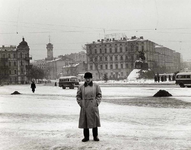
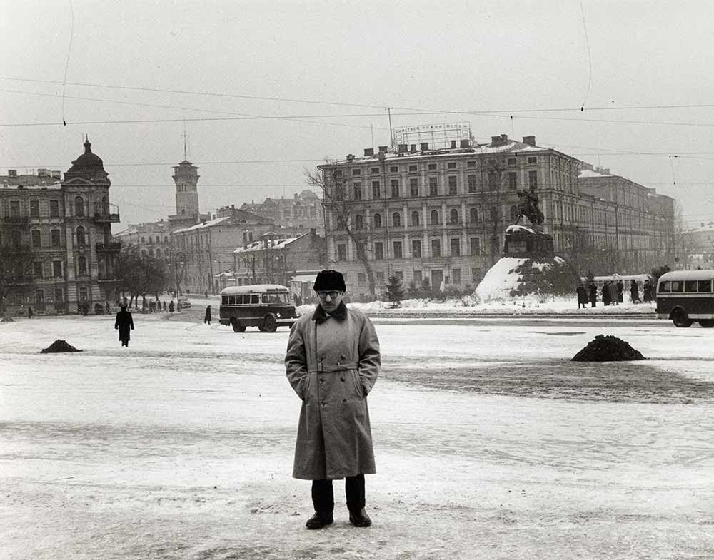
Sofiiska SquareSteinberg on Sofiiska SquareFrom the papers of American cartoonist Saul Steinberg, who toured the USSR in 1956: the man on snow-covered Sofiiska Square is probably Steinberg himself. Behind him are the Bohdan Khmelnytsky monument and the fire watchtower on Volodymyrska Street.Archival photo: невідомий автор, 1956, суспільне надбання · Wikimedia Commons -
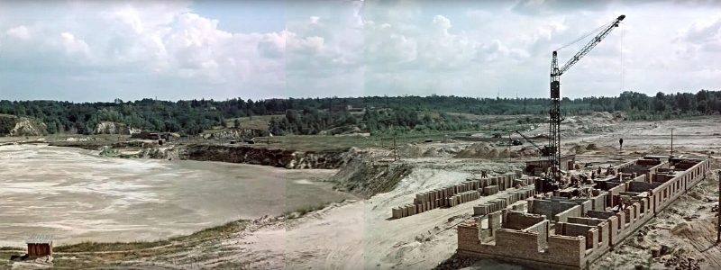
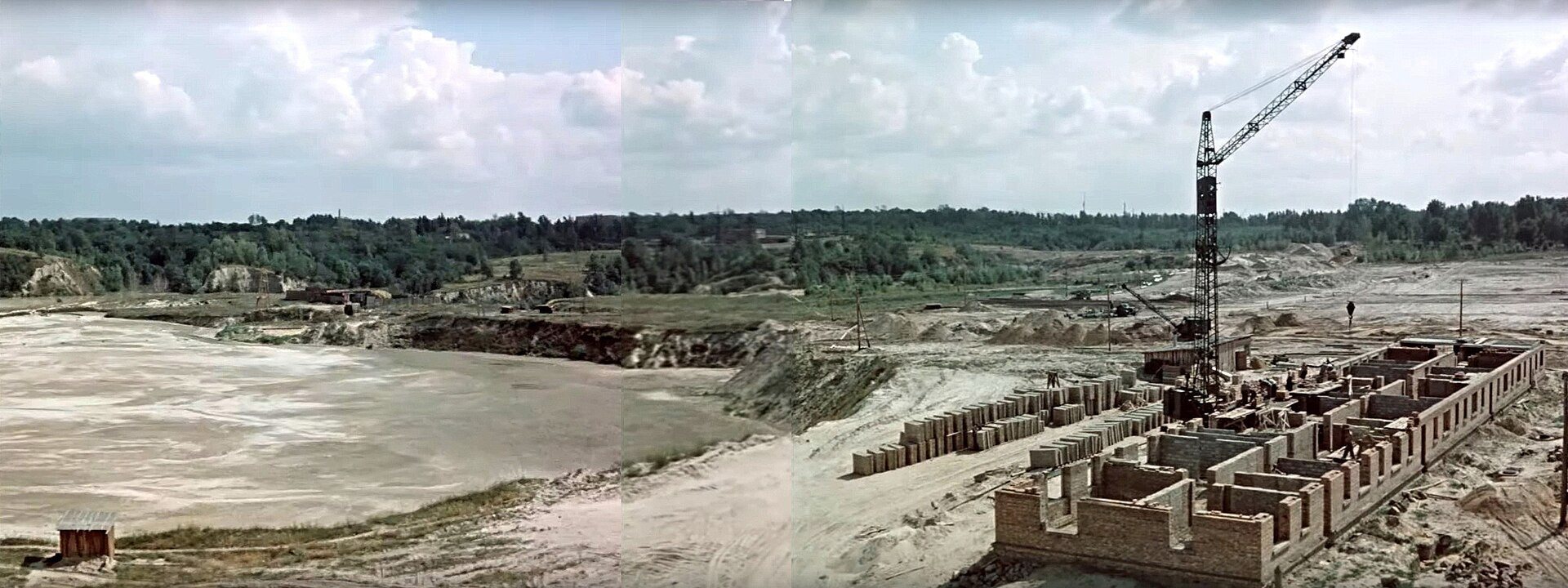
Oleha Olzhycha (Demiana Bednoho) StreetFilling in Babyn YarIn the late 1950s Babyn Yar, the site of the 1941–1943 mass shootings, was being filled with slurry from brickworks while apartment blocks rose nearby on Demiana Bednoho (now Olzhycha) Street. On 13 March 1961 the dam burst and the slurry flooded Kurenivka.Archival photo: невідомий автор, 1959, CC BY-SA 4.0 · Wikimedia Commons -
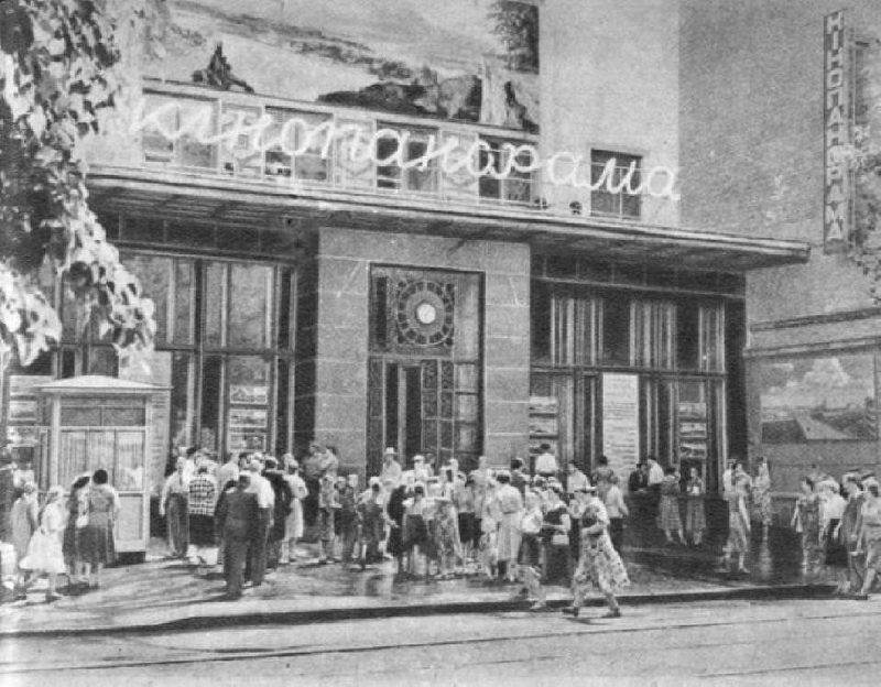
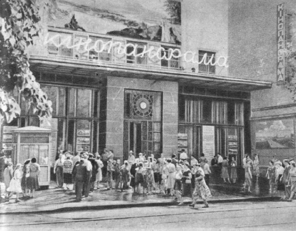
19 Shota Rustaveli StreetKinopanorama cinemaQueues outside the newly opened widescreen Kinopanorama cinema, installed in the rebuilt late-19th-century Merchants’ Synagogue.Archival photo: невідомий автор, 1958, суспільне надбання · Wikimedia Commons -
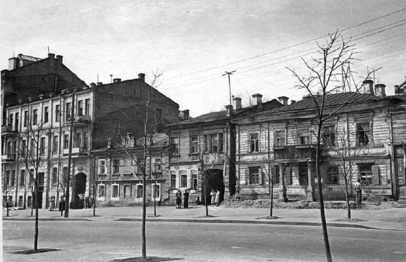
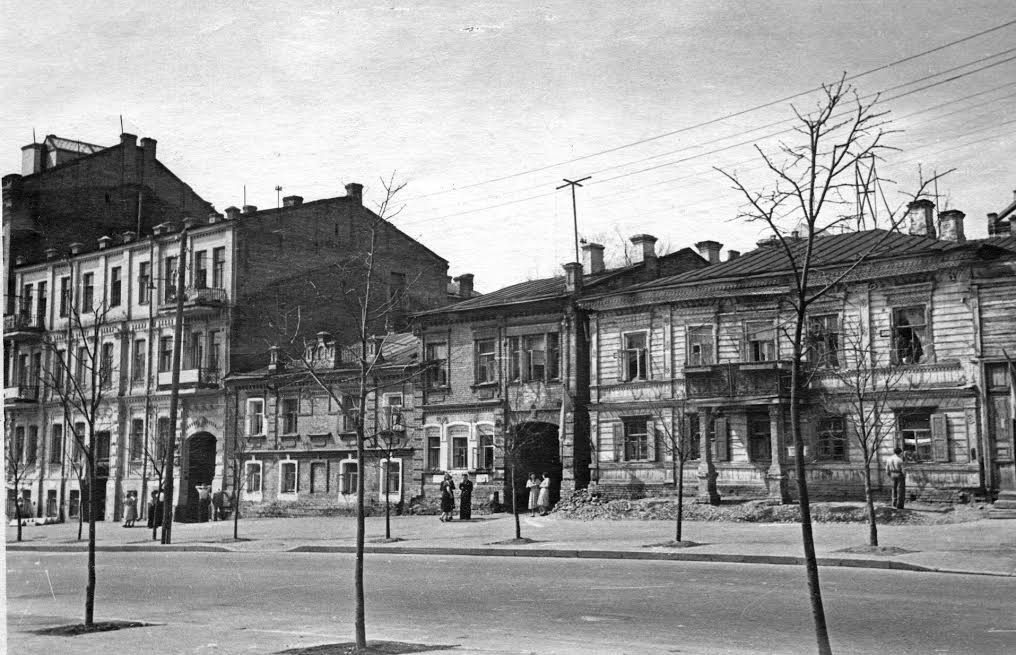
Esplanadna (Prozorivska) StreetProzorivska StreetHouses Nos. 24, 26 and 28 on Prozorivska (now Esplanadna) Street on 1 May 1955: the low-rise streetscape of old Pechersk, photographed by a news photographer on a holiday.Archival photo: Олександр Бормотов, 1955, CC BY-SA 4.0 · Wikimedia Commons -
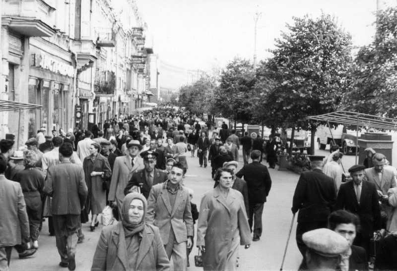
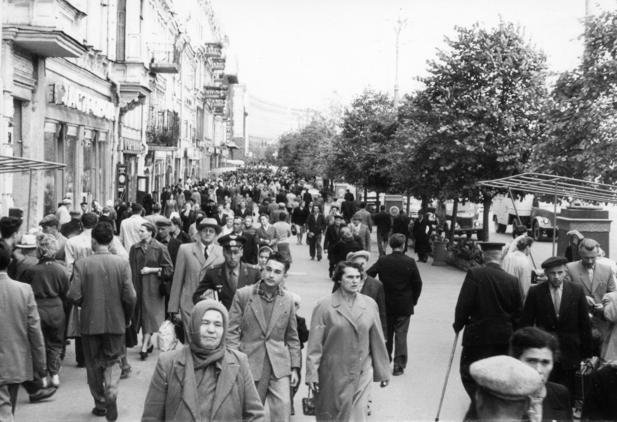
Khreshchatyk near Taras Shevchenko BoulevardRebuilt KhreshchatykKhreshchatyk near Shevchenko Boulevard in 1960: a crowded pavement along the post-war buildings and trees.Archival photo: невідомий автор, 1960, CC BY-SA 3.0 · Wikimedia Commons -
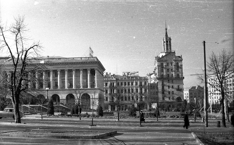
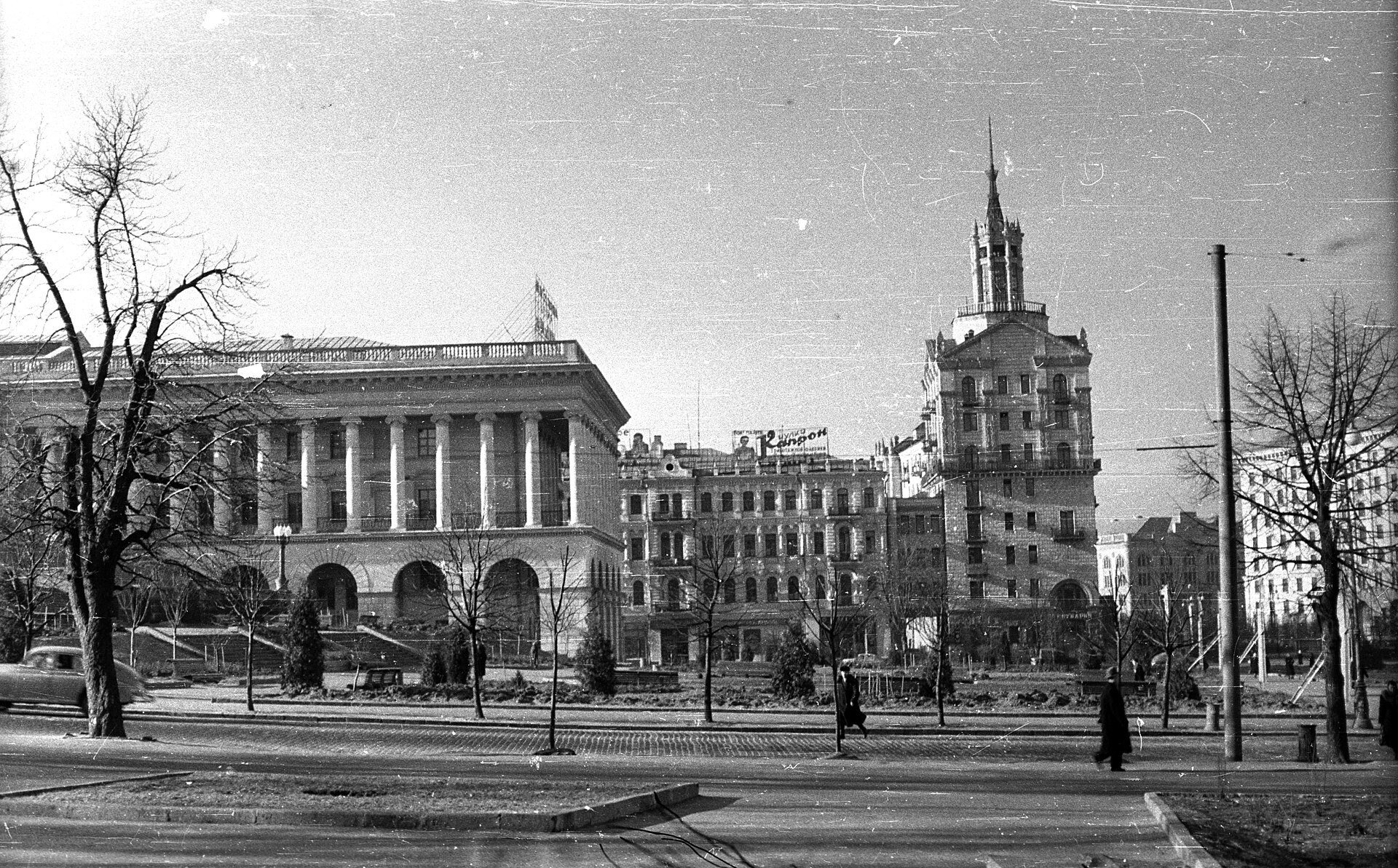
Maidan NezalezhnostiKalinin Square and the ConservatoryKalinin Square (now Maidan Nezalezhnosti) in 1961: on the left the new colonnaded Conservatory, on the right post-war Khreshchatyk with its spired tower. The square was still open, with no underpasses or underground mall.Archival photo: невідомий автор, 1961, CC BY-SA 3.0 · Wikimedia Commons -
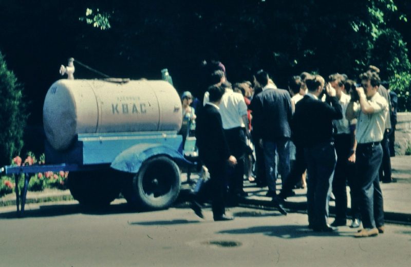
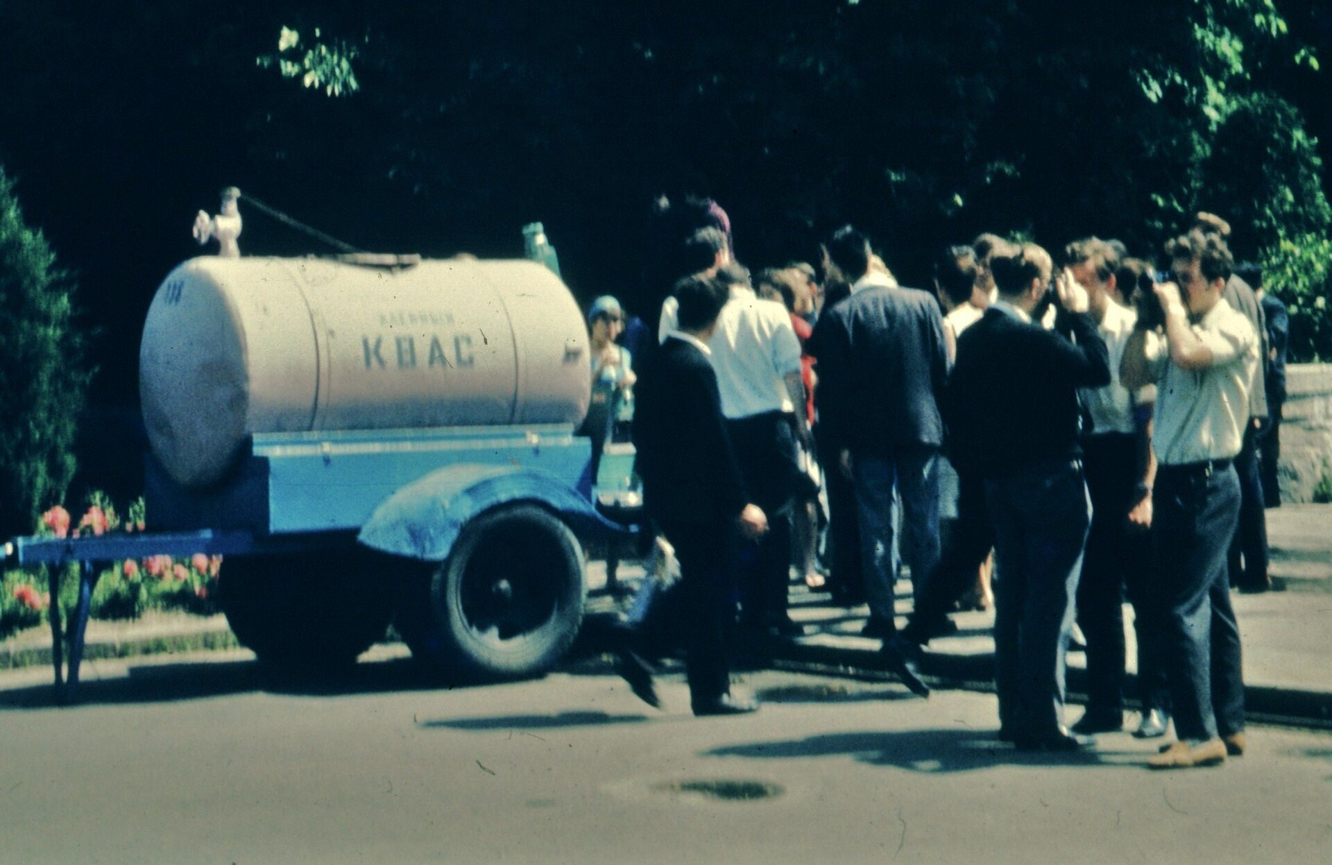
KyivKvass from the barrelA queue at a yellow kvass tanker — a fixture of Kyiv summers from the 1960s to the 1980s, when kvass was poured into mugs right on the street.Archival photo: Robert Schediwy, 1965, CC BY-SA 4.0 · Wikimedia Commons -
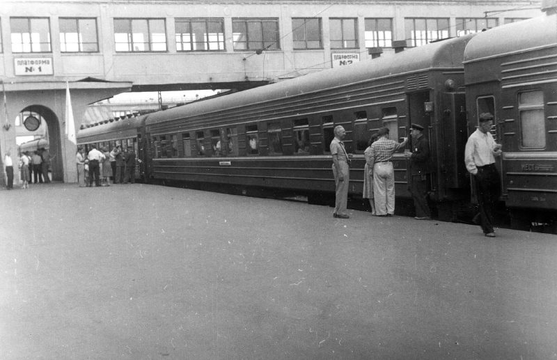
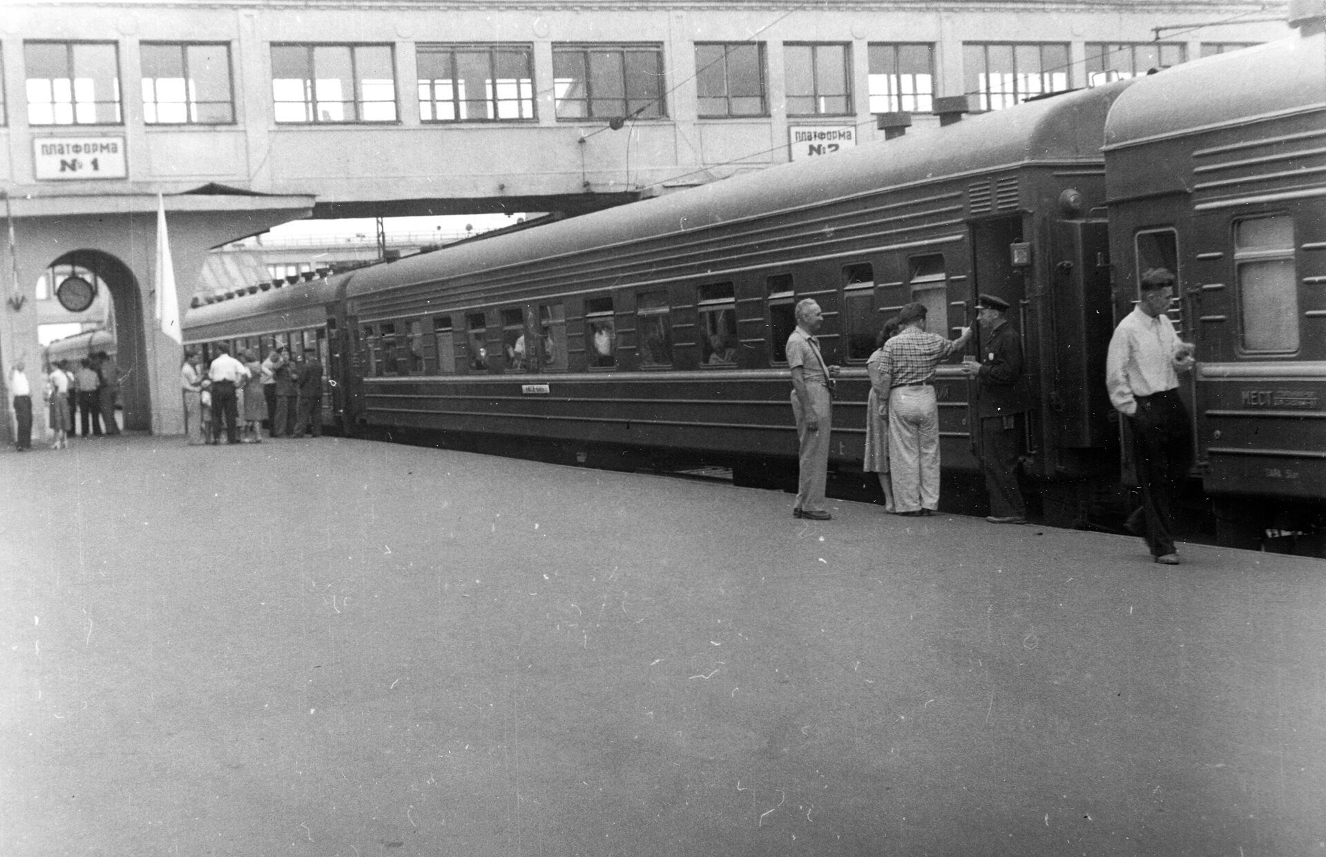
Kyiv-Pasazhyrskyi railway stationAt the station platformA passenger train at a platform of Kyiv-Pasazhyrskyi station. In the early 1960s the railway was still the main way to reach the Soviet Ukrainian capital.Archival photo: невідомий автор, 1960, CC BY-SA 3.0 · Wikimedia Commons -
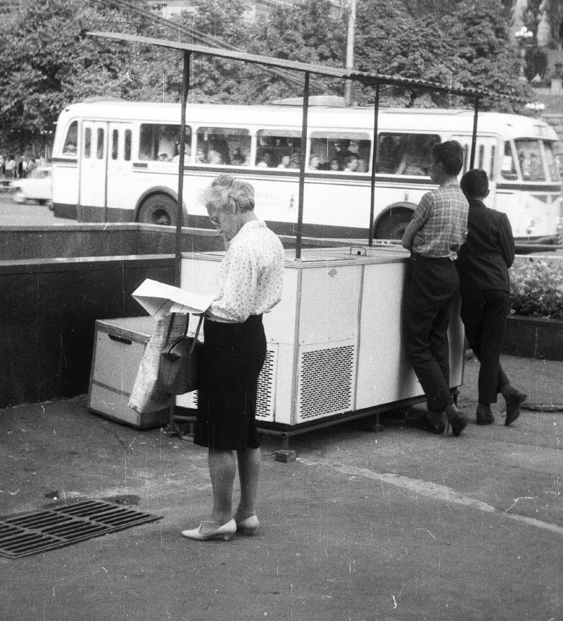
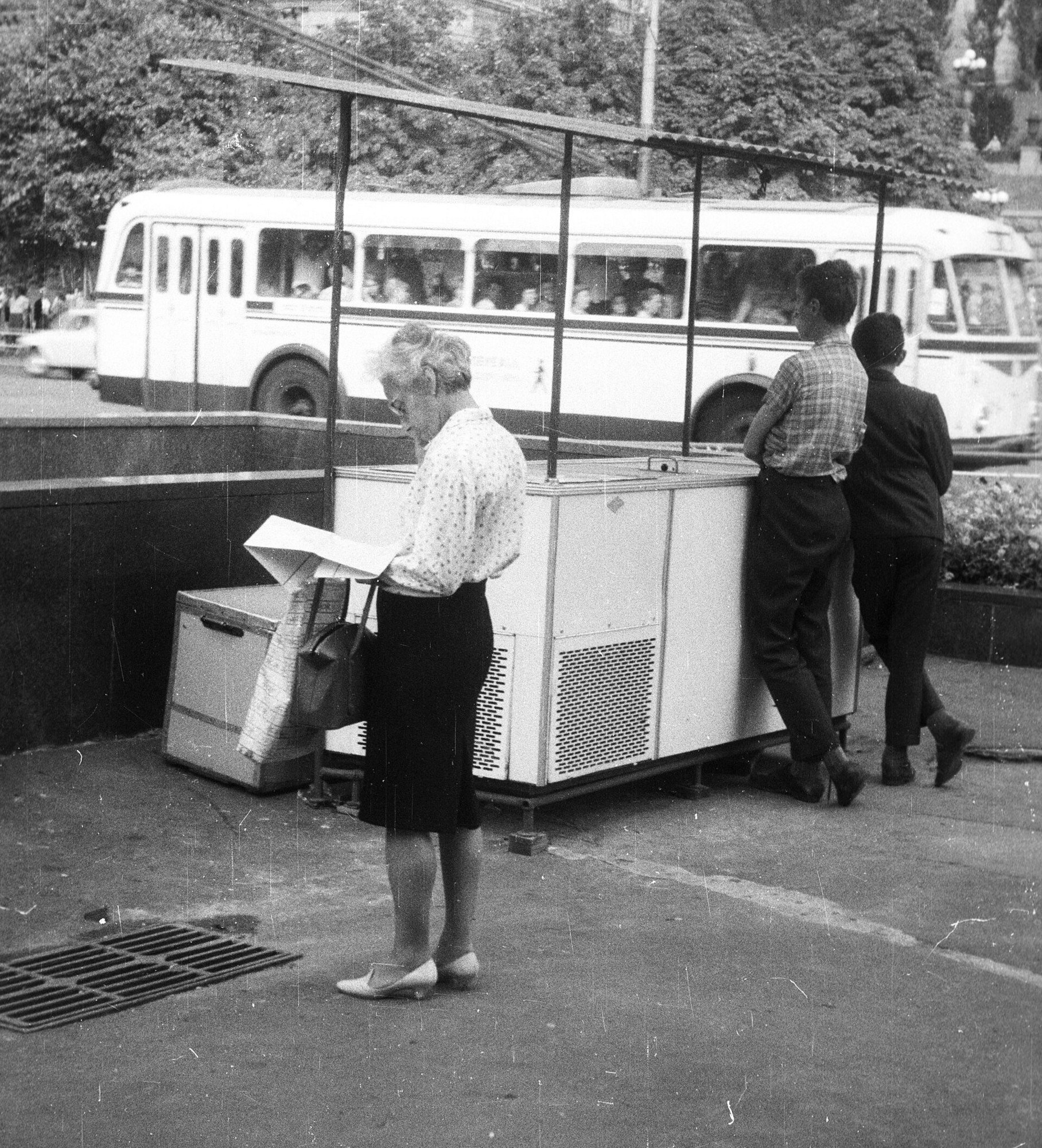
Khreshchatyk at Bohdana Khmelnytskoho StreetIce cream on KhreshchatykAn ice-cream seller with her refrigerated cart at the corner of Khreshchatyk and Bohdana Khmelnytskoho Street, a tour bus behind. Street ice cream was one of the small joys of Soviet Kyiv.Archival photo: невідомий автор, 1968, CC BY-SA 3.0 · Wikimedia Commons -
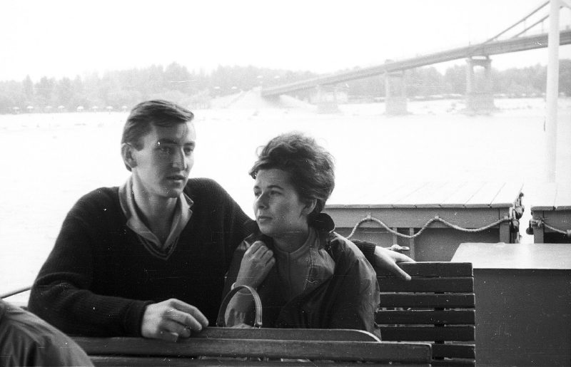
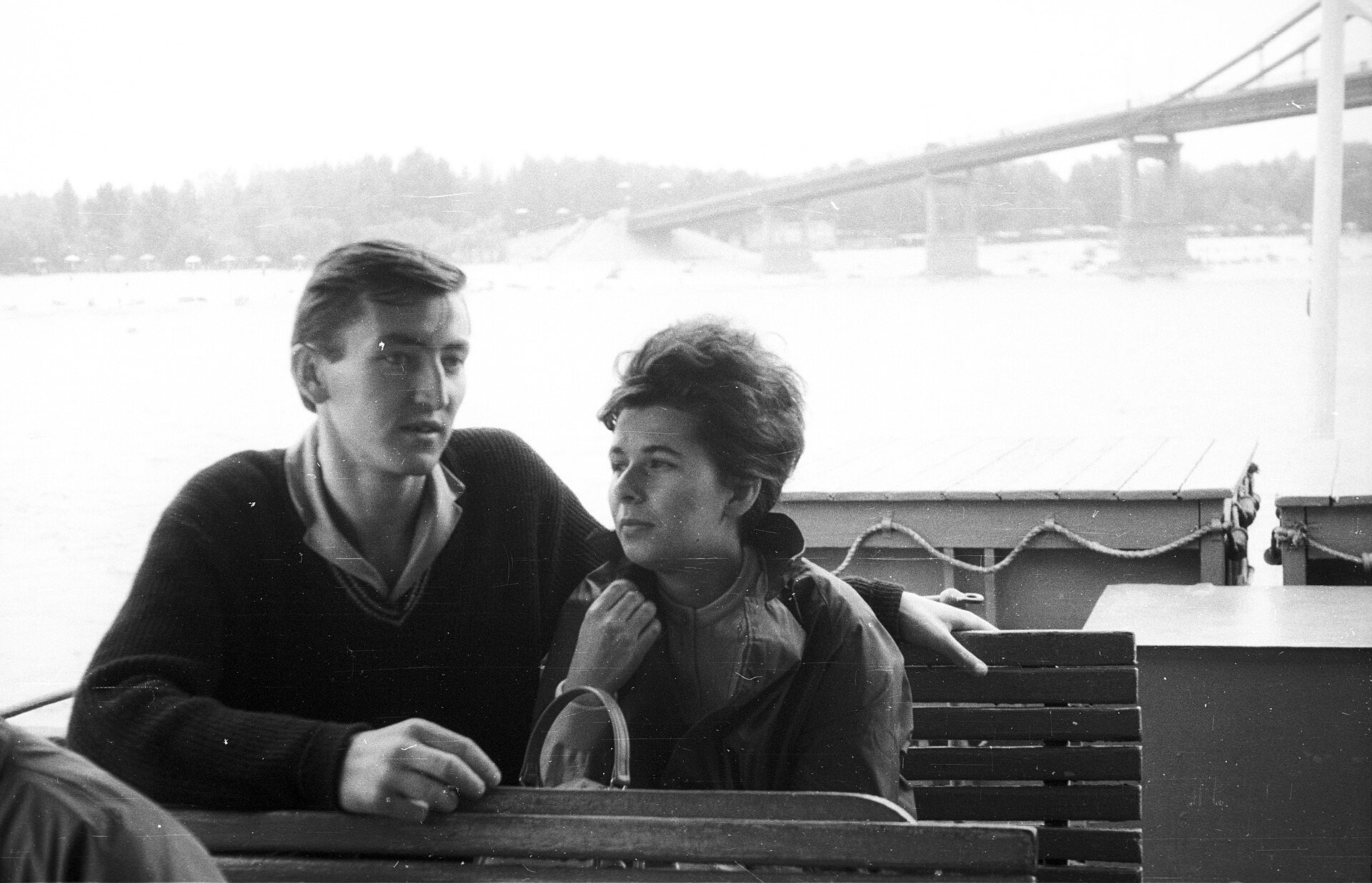
The Dnipro by the Pedestrian BridgeA boat trip on the DniproA couple on a pleasure boat, with the Pedestrian Bridge to Trukhaniv Island behind. River cruises were a favourite summer pastime in Kyiv.Archival photo: невідомий автор, 1968, CC BY-SA 3.0 · Wikimedia Commons -
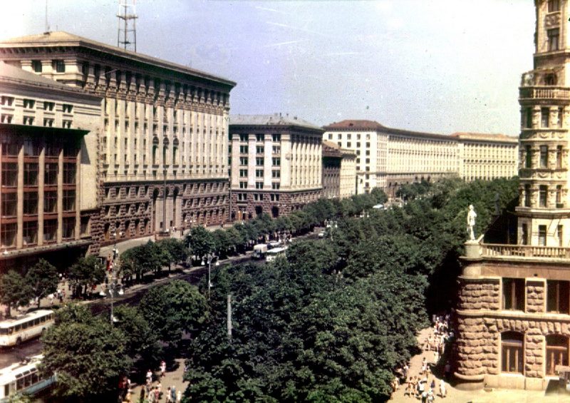
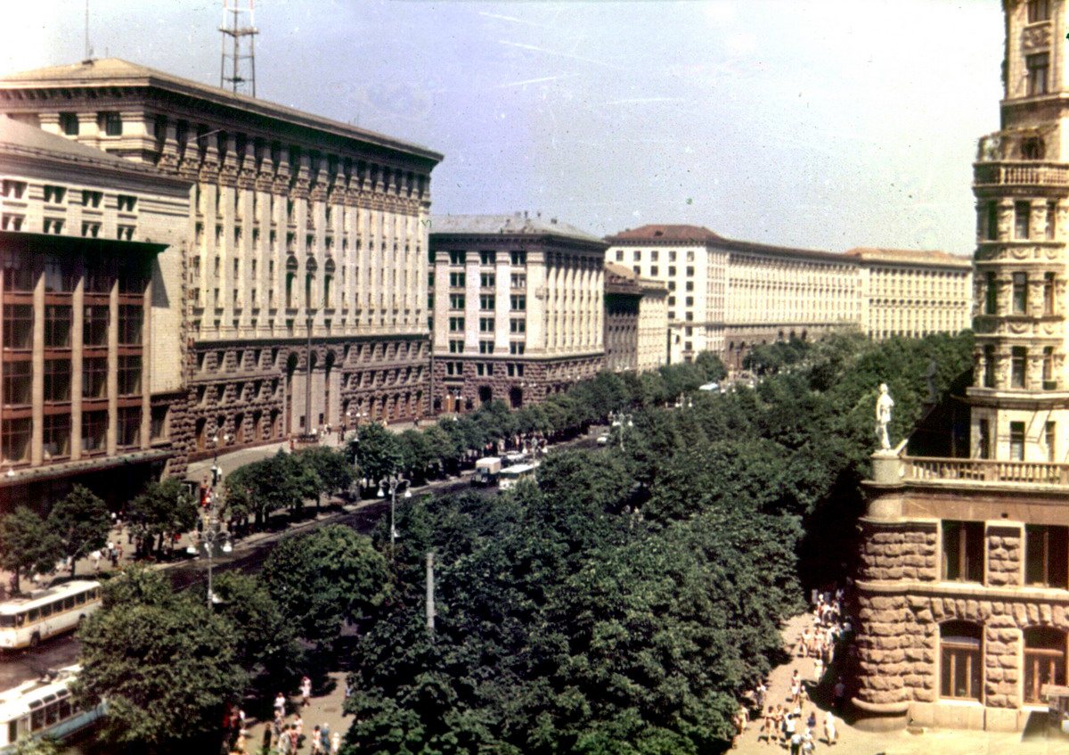
KhreshchatykKhreshchatyk, 1 May 1974Khreshchatyk on 1 May 1974, with its post-war buildings and a broad line of trees along the street.Archival photo: Andris Malygin, 1974, CC BY 3.0 · Wikimedia Commons -
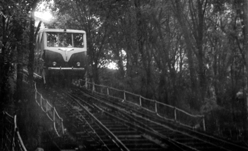
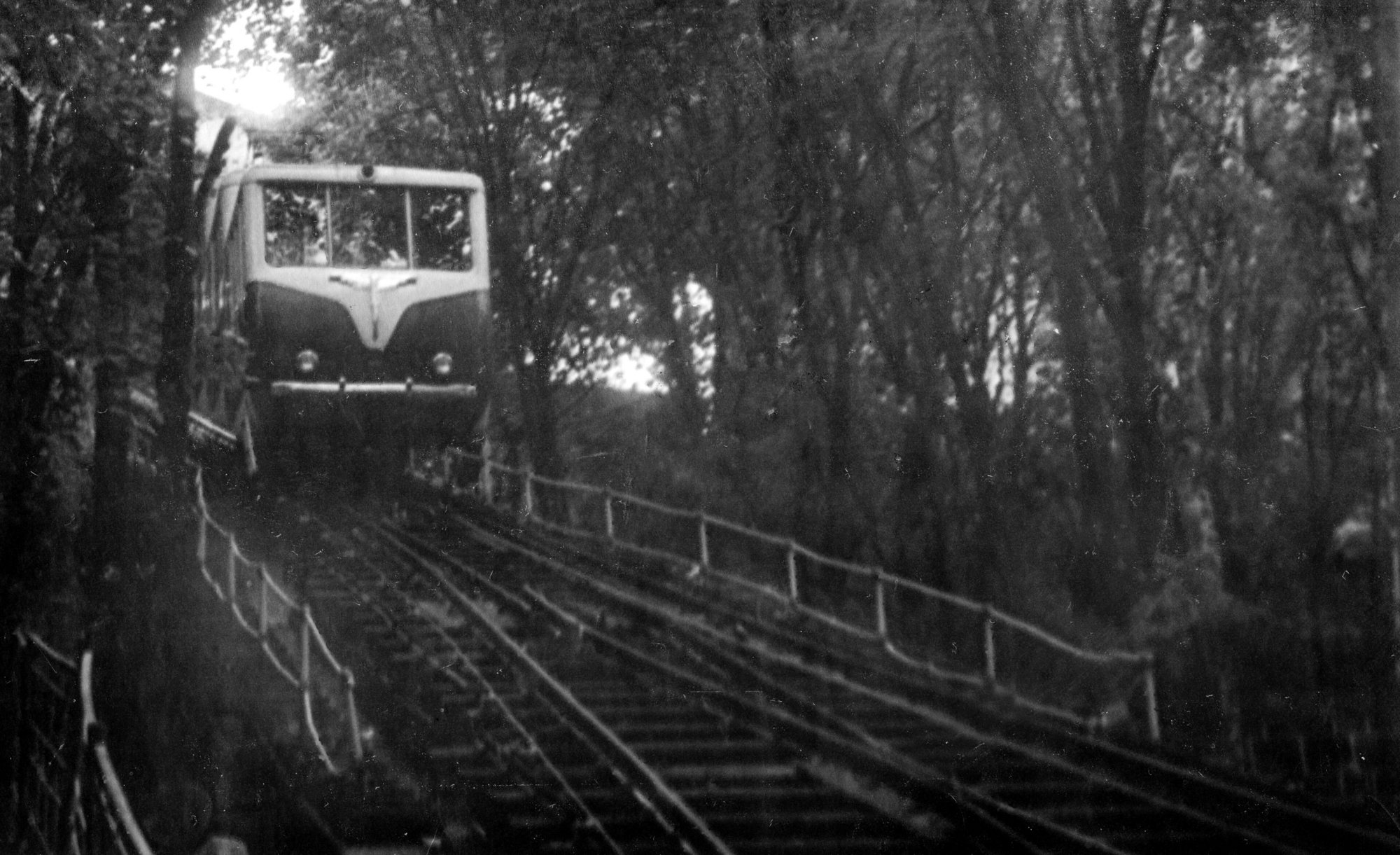
Kyiv FunicularFunicular carA funicular car on the slope of Volodymyrska Hill in October 1978. The funicular was later reconstructed in the 1980s.Archival photo: Сарапулов, 14.10.1978, CC BY-SA 4.0 · Wikimedia Commons -
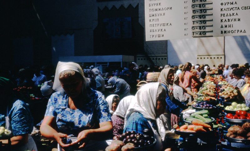
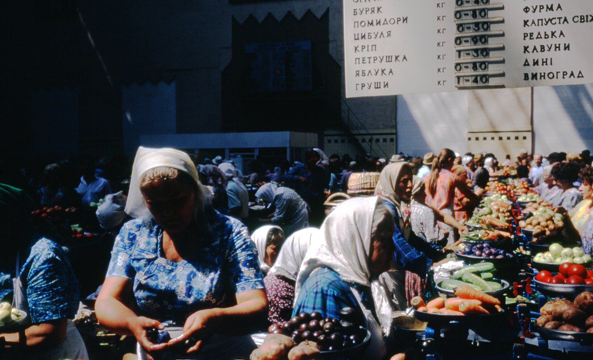
KyivA kolkhoz marketVegetables and fruit from private plots on sale in a Kyiv kolkhoz market hall. Markets were the only place where food could legally be bought at free prices.Archival photo: Томас Тейлор Гаммонд, 1972, CC BY-SA 4.0 · Wikimedia Commons -
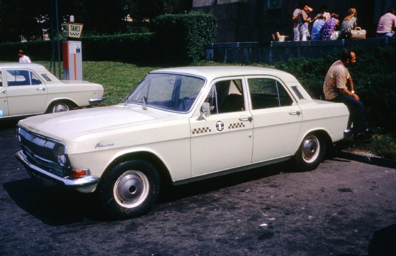
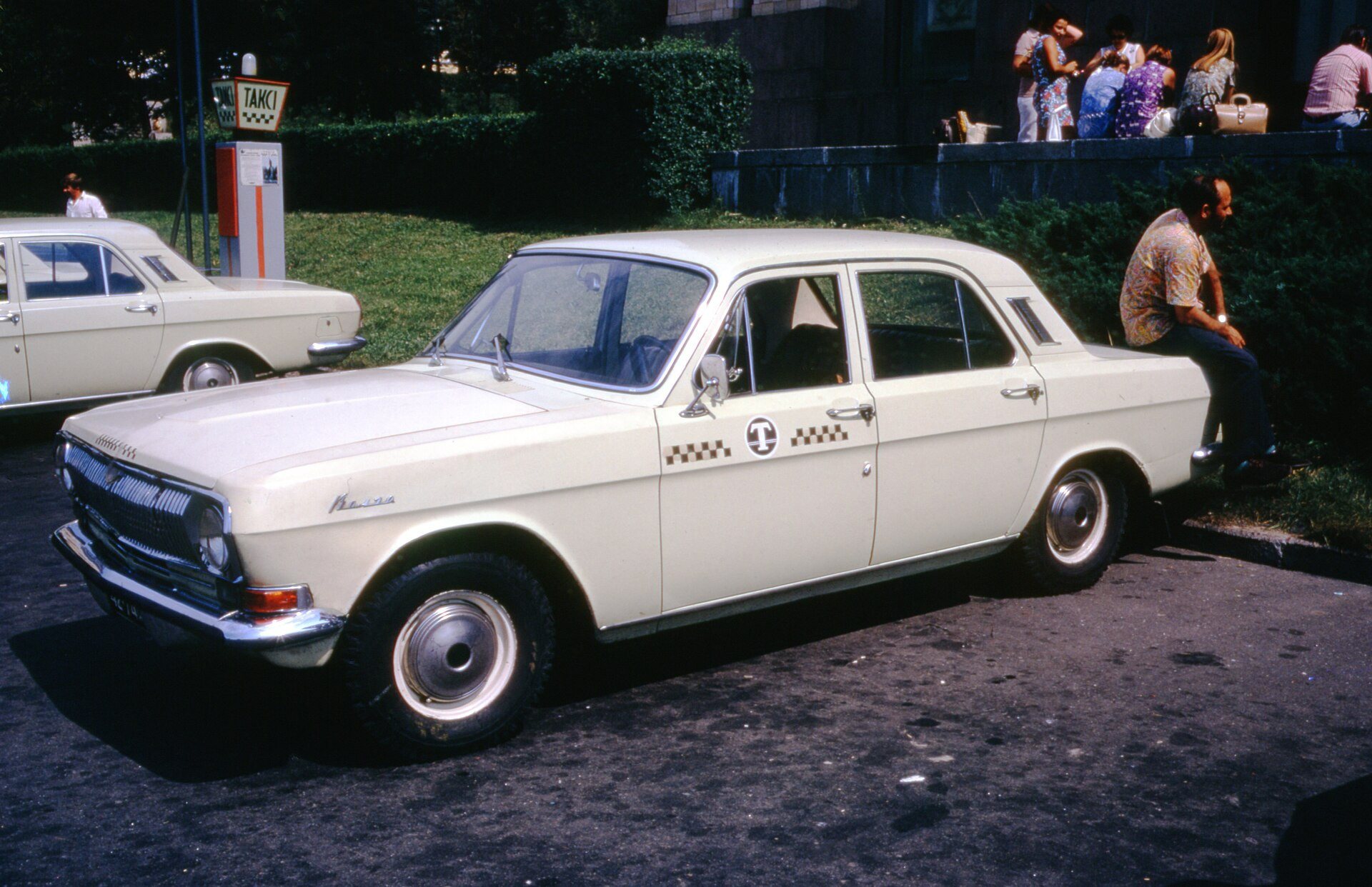
Probably Instytutska Street, by Hotel UkraineA Volga taxiA brand-new GAZ-24 Volga taxi, probably outside the Hotel Moskva (now Hotel Ukraine). In the early 1970s these cars had only just appeared on Kyiv streets.Archival photo: Томас Тейлор Гаммонд, 1972, CC BY-SA 4.0 · Wikimedia Commons -
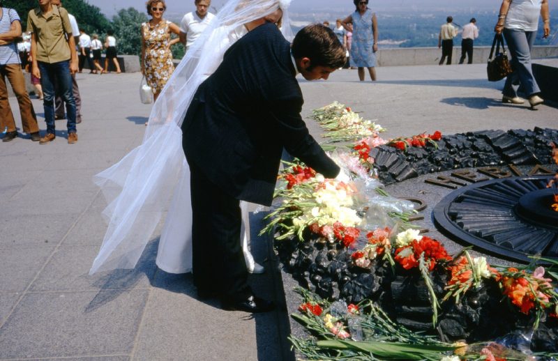
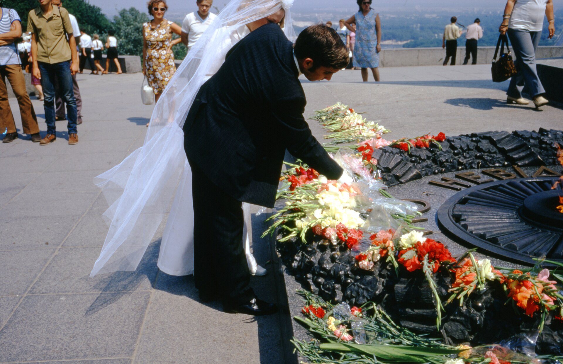
Park of Eternal GloryA wedding at the eternal flameA groom lays flowers at the eternal flame on the Tomb of the Unknown Soldier. Visiting war memorials on the wedding day was an established Soviet tradition.Archival photo: Томас Тейлор Гаммонд, 1975, CC BY-SA 4.0 · Wikimedia Commons -
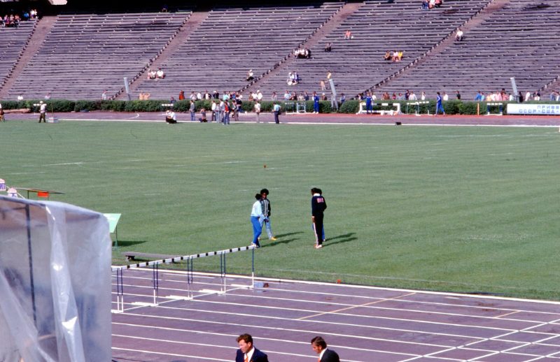
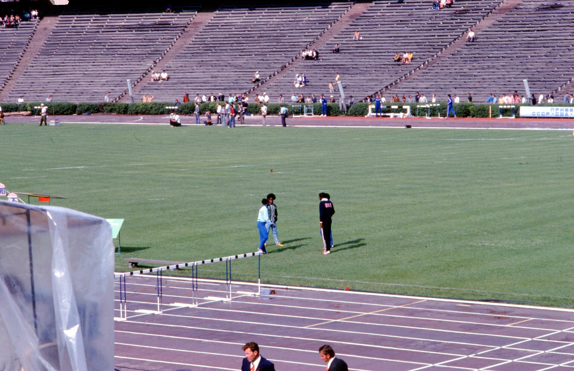
Olimpiyskiy NSC, 55 Velyka Vasylkivska StreetUSSR vs USA athletics meetThe 1975 USSR vs USA athletics meet at Kyiv’s Republican Stadium — today the Olimpiyskiy National Sports Complex, rebuilt for Euro 2012.Archival photo: Томас Тейлор Гаммонд, 1975, CC BY-SA 4.0 · Wikimedia Commons -
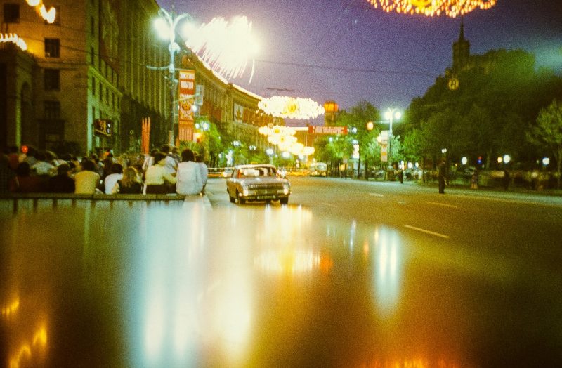
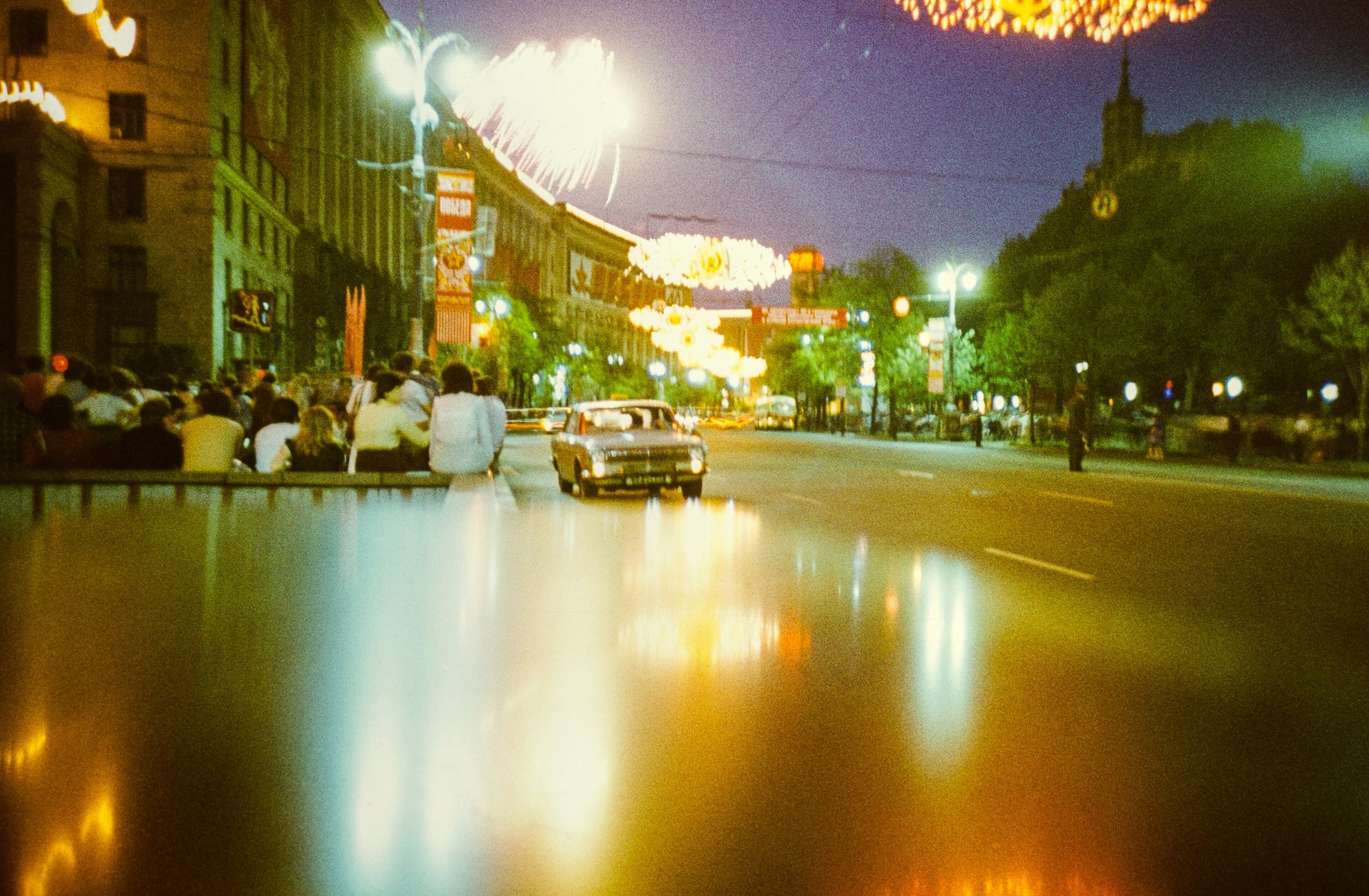
Khreshchatyk (odd-numbered side)Khreshchatyk at nightKhreshchatyk in the evening in the 1980s, with festive lights on the odd-numbered side of the street and wet tarmac.Archival photo: Star61, 1980-ті, CC BY-SA 4.0 · Wikimedia Commons -
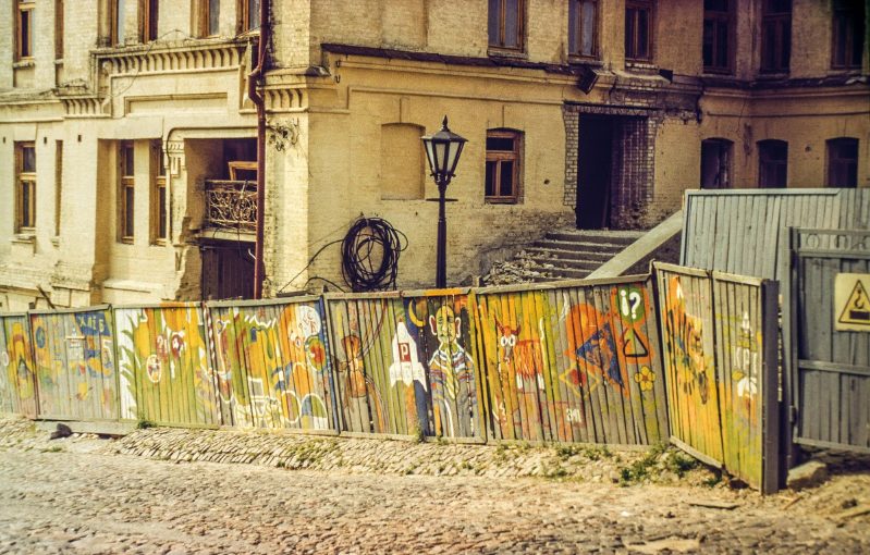
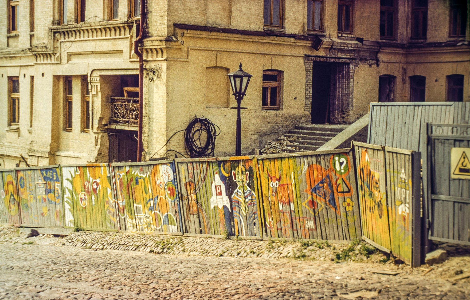
Andriivskyi UzvizAndriivskyi UzvizAndriivskyi Uzviz in the late 1980s: an old house behind a painted fence, a street lamp and cobblestones.Archival photo: Star61, кінець 1980-х, CC BY-SA 4.0 · Wikimedia Commons -
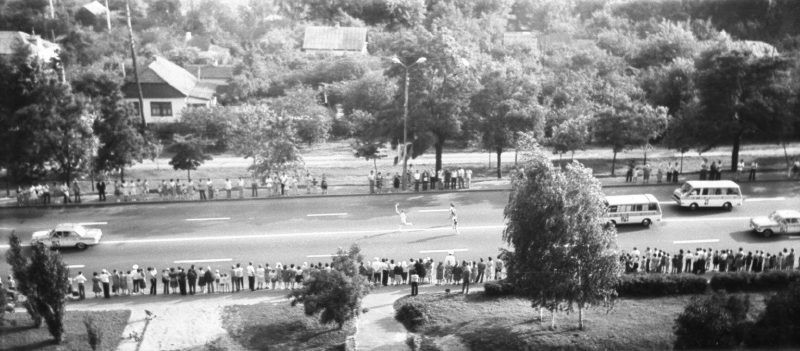
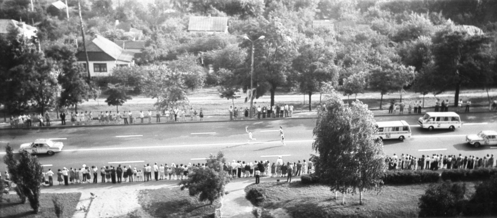
KyivThe Olympic flame in KyivKyiv residents line the road for the 1980 Olympic torch relay, whose route from Greece to Moscow ran through Kyiv. Several Olympic football matches were played at the Republican Stadium.Archival photo: Novodar X, 1980, CC BY 3.0 · Wikimedia Commons -
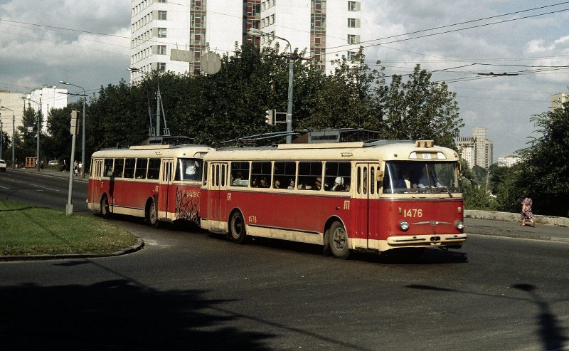
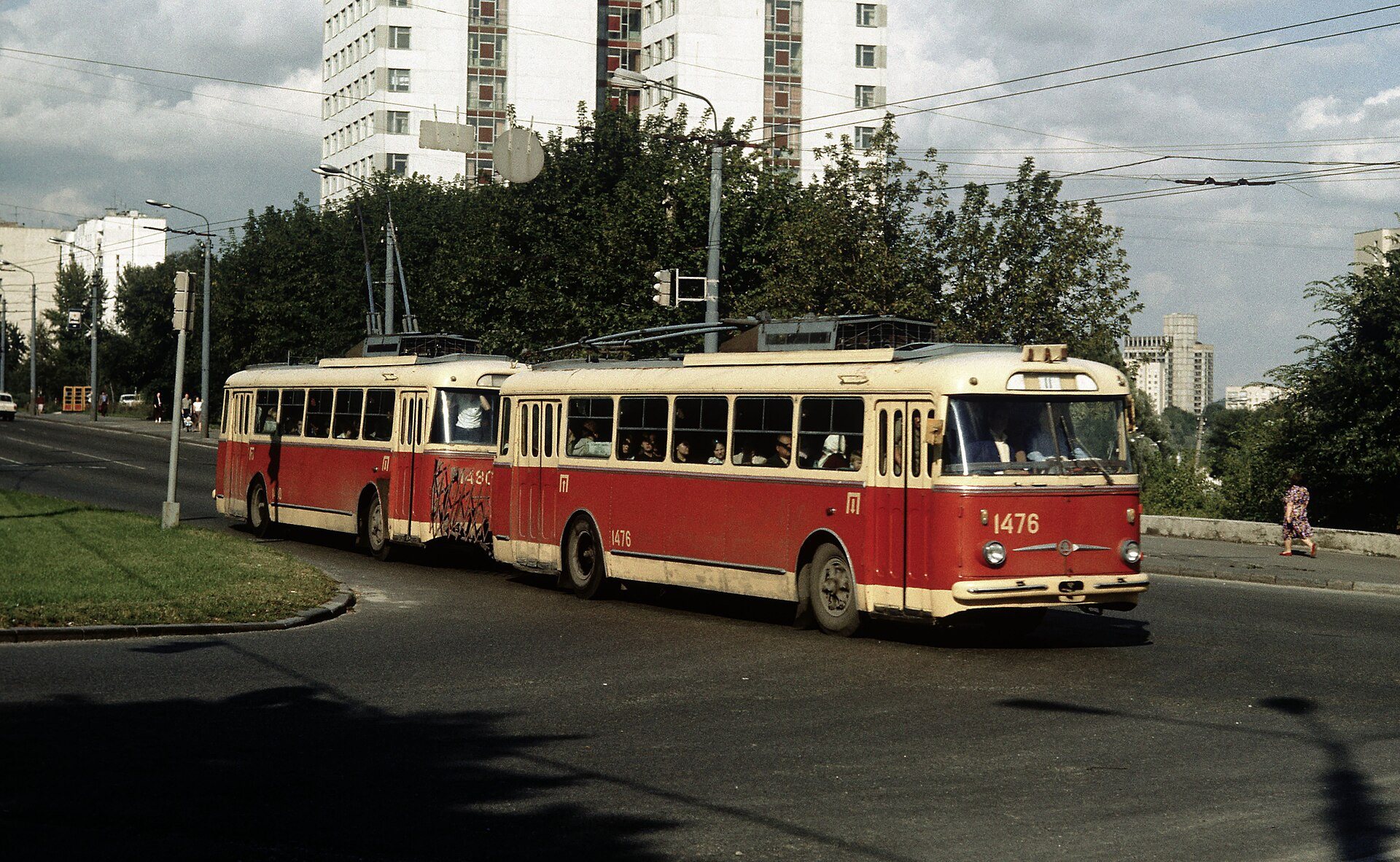
Holosiivskyi AvenueA trolleybus trainTwo coupled Škoda 9Tr trolleybuses on route 11 on what is now Holosiivskyi Avenue. The coupling system was invented by Kyiv engineer Volodymyr Veklych; such trains ran in the city from 1966.Archival photo: Falk2, 1986, CC BY-SA 4.0 · Wikimedia Commons -
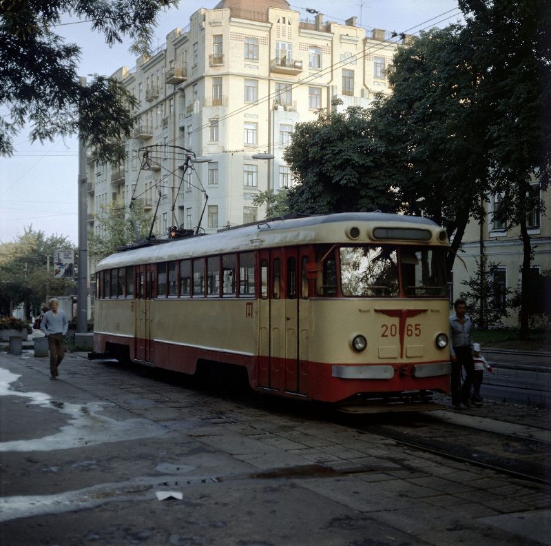
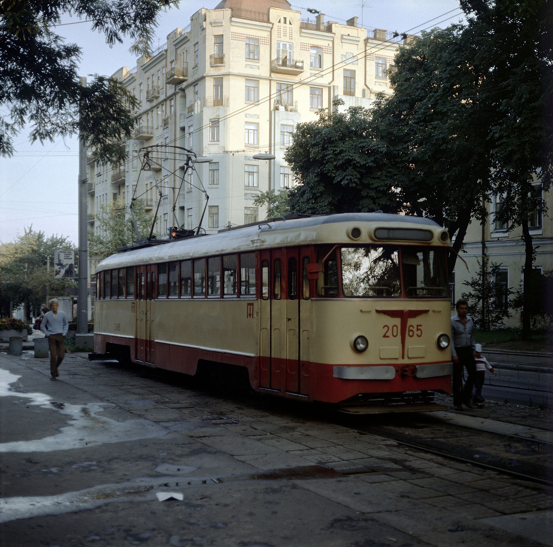
Near Kyiv UniversityTram at the University stopA double-ended tram at the city-centre terminus of tram route 5, Universytet: the dead-end track required cars with cabs at both ends.Archival photo: Falk2, 1986, CC BY-SA 4.0 · Wikimedia Commons -
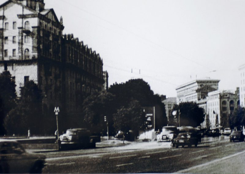
Central KyivAfter Chornobyl1 May 1986, five days after the Chornobyl disaster: streets in central Kyiv are hosed down to wash away radioactive dust. The authorities did not cancel the May Day parade on Khreshchatyk that same day.Archival photo: невідомий автор, 1986, CC BY-SA 2.0 · Wikimedia Commons -
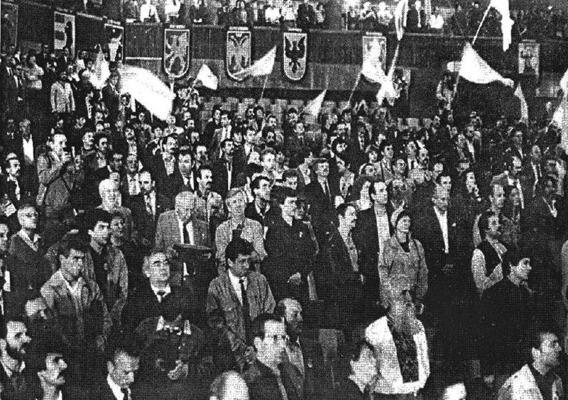
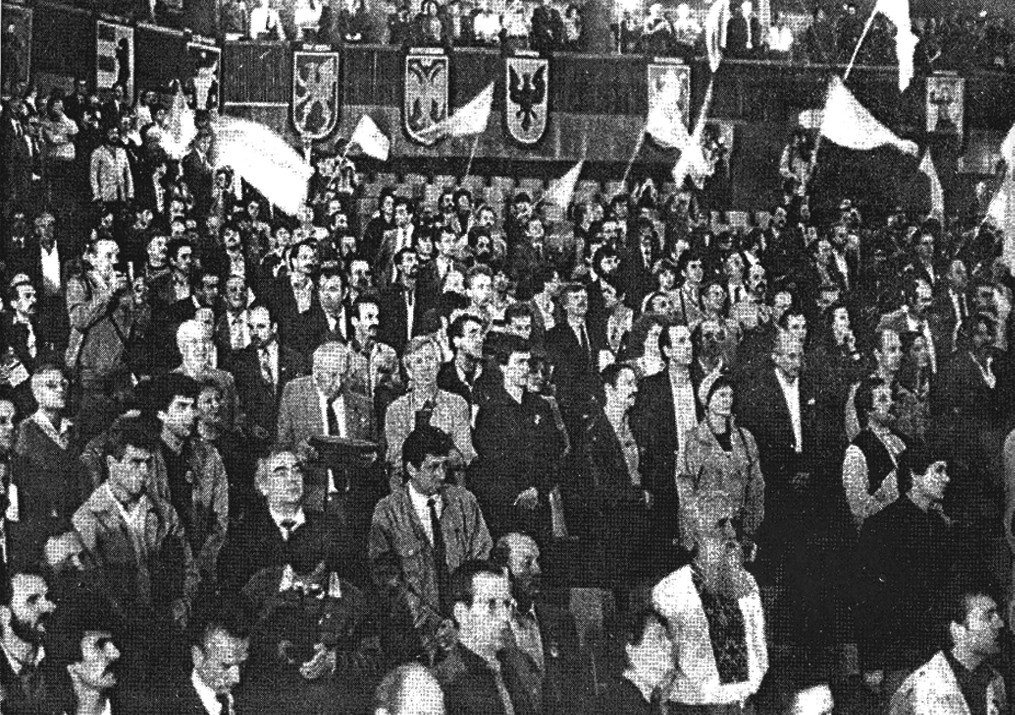
KyivFounding congress of RukhThe opening of the founding congress of the People’s Movement of Ukraine (Rukh) on 8 September 1989, when blue-and-yellow flags were still an act of defiance. Two years later Ukraine declared independence.Archival photo: невідомий автор, 1989, суспільне надбання · Wikimedia Commons -
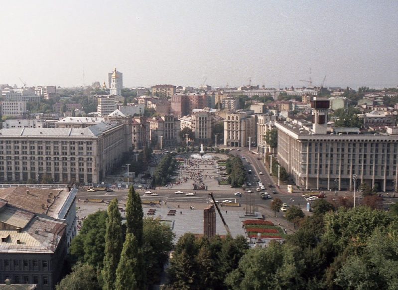
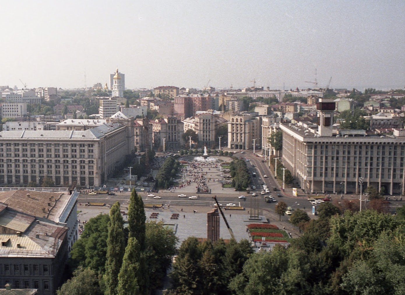
Maidan Nezalezhnosti, seen from Hotel UkraineOctober Revolution Square, 1991September 1991: October Revolution Square seen from the Hotel Moskva. The Lenin monument still stands in the foreground; it was removed the same year, and the square was renamed Maidan Nezalezhnosti.Archival photo: Gouveia2, 1991, CC BY-SA 3.0 · Wikimedia Commons -
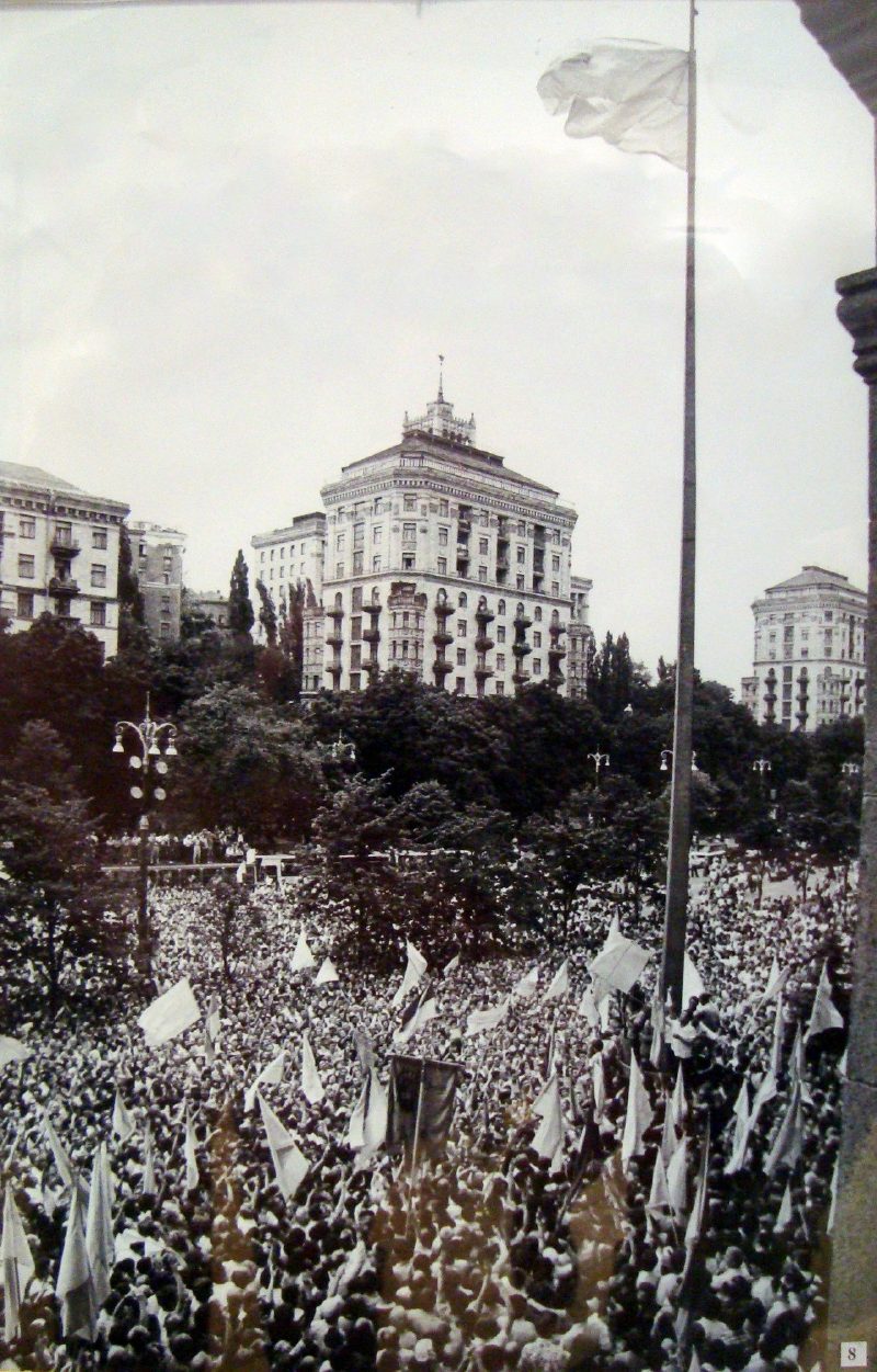
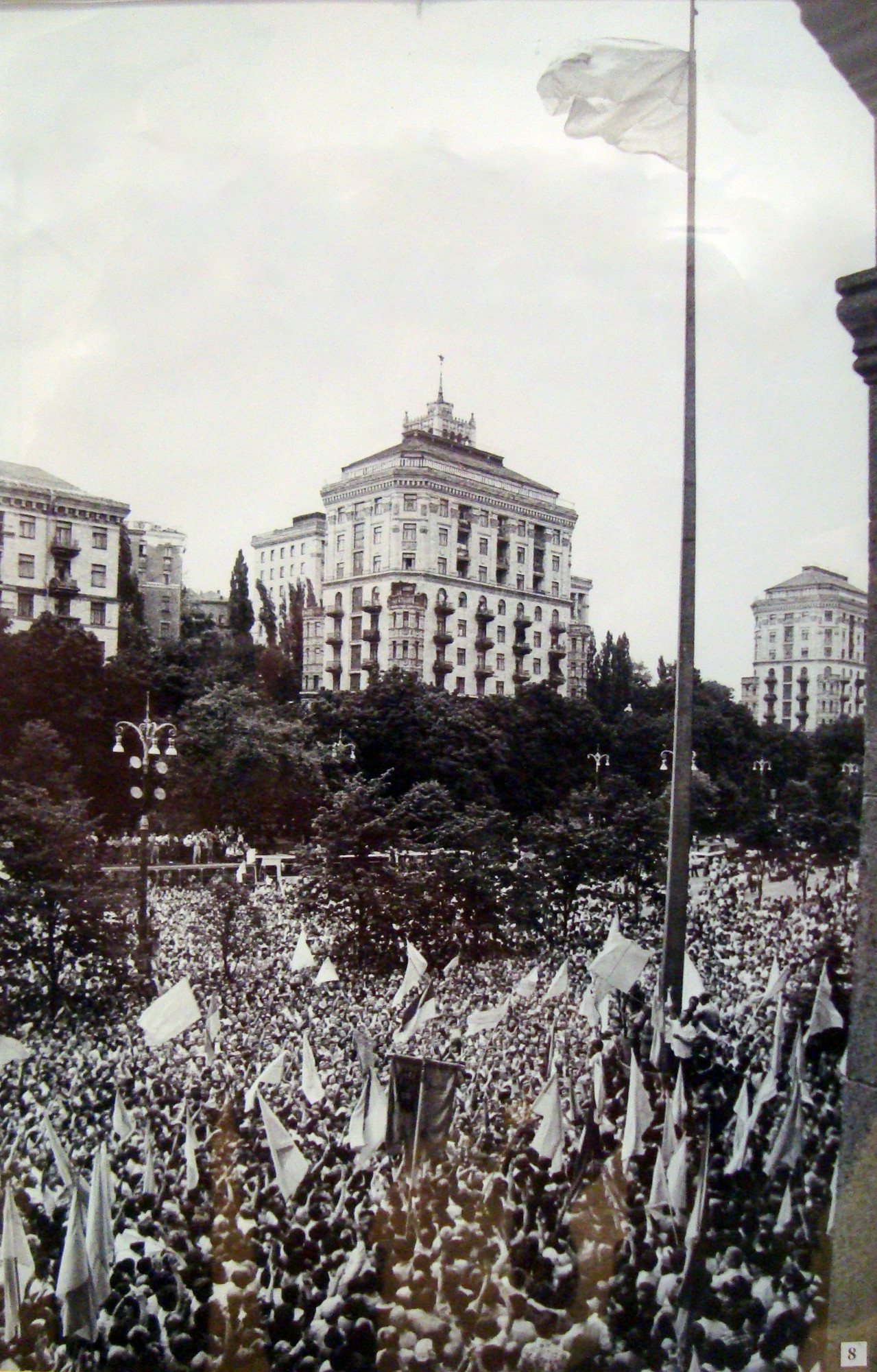
36 Khreshchatyk, Kyiv City CouncilThe blue-and-yellow flag over KhreshchatykOn 24 July 1990 the blue-and-yellow flag was officially raised for the first time outside Kyiv City Council on Khreshchatyk. Crowds filled the street; a year later Ukraine was independent.Archival photo: невідомий автор, 1990, CC BY-SA 3.0 · Wikimedia Commons -
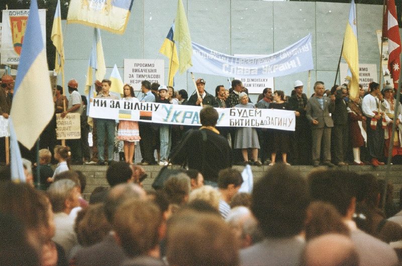
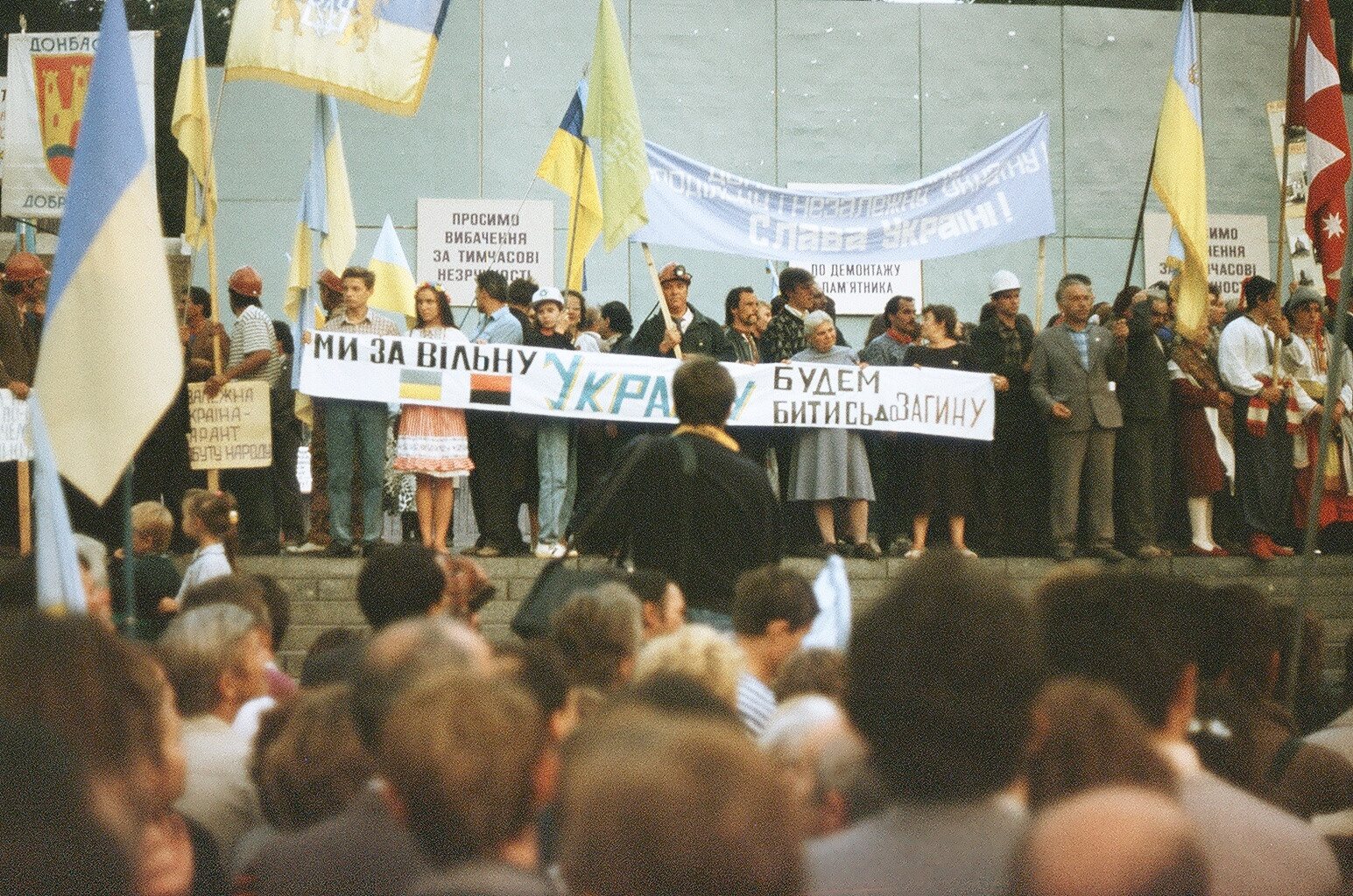
Maidan NezalezhnostiRally for independenceSeptember 1991: a rally for independence on the square, with miners’ helmets and a "Donbas" banner among the flags. Independence was confirmed by the referendum of 1 December 1991.Archival photo: М. Яковенко, В. Білецький, 1991, суспільне надбання · Wikimedia Commons -
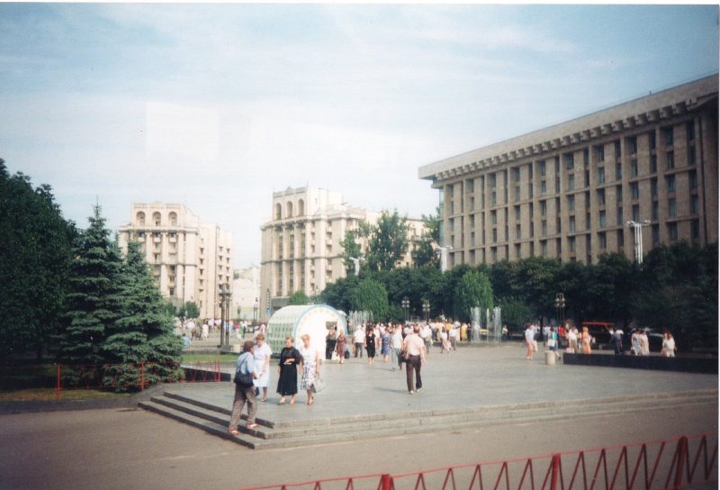
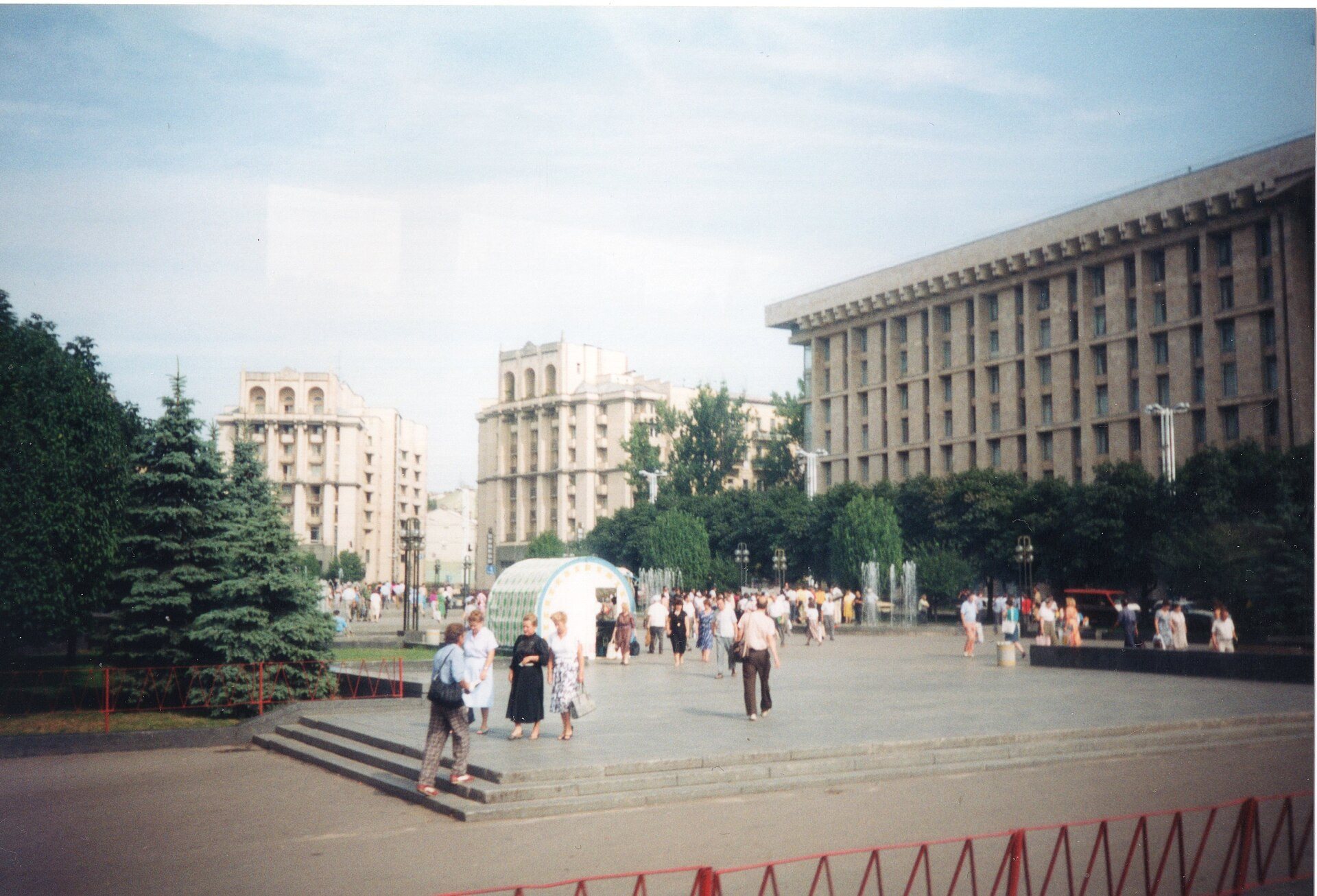
Maidan NezalezhnostiMaidan in the first year of independenceMaidan Nezalezhnosti in 1992, empty where the monument had stood, with the Trade Unions Building on the right. The square took its present form, with the column and underground mall, in 2001.Archival photo: Lankyrider, 1992, CC BY-SA 4.0 · Wikimedia Commons -
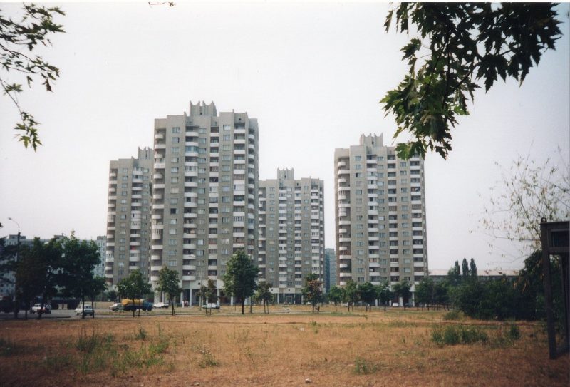
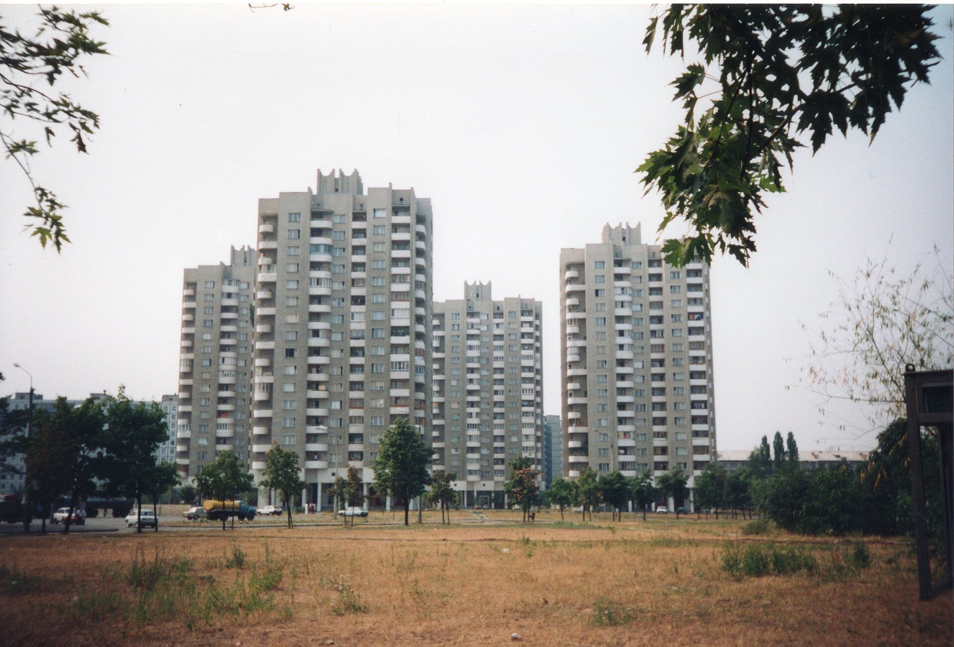
KyivHigh-rise blocksNew high-rise blocks seen from a hotel window by a foreign visitor in 1992. Kyiv built huge panel-housing estates until the late 1980s; in the 1990s construction nearly stopped.Archival photo: Lankyrider, 1992, CC BY-SA 4.0 · Wikimedia Commons -
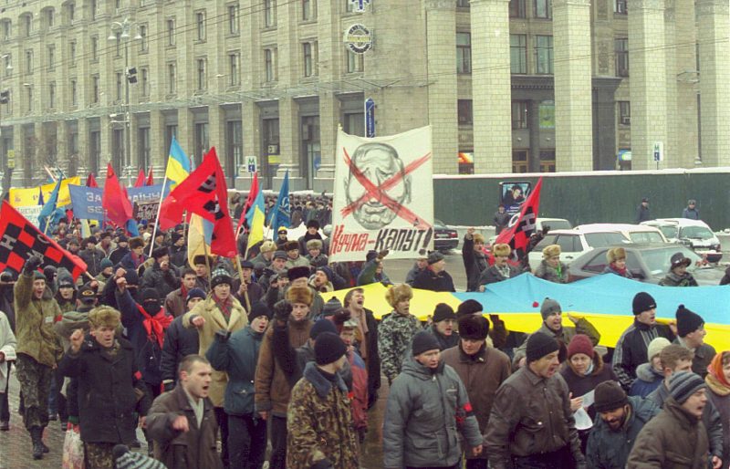
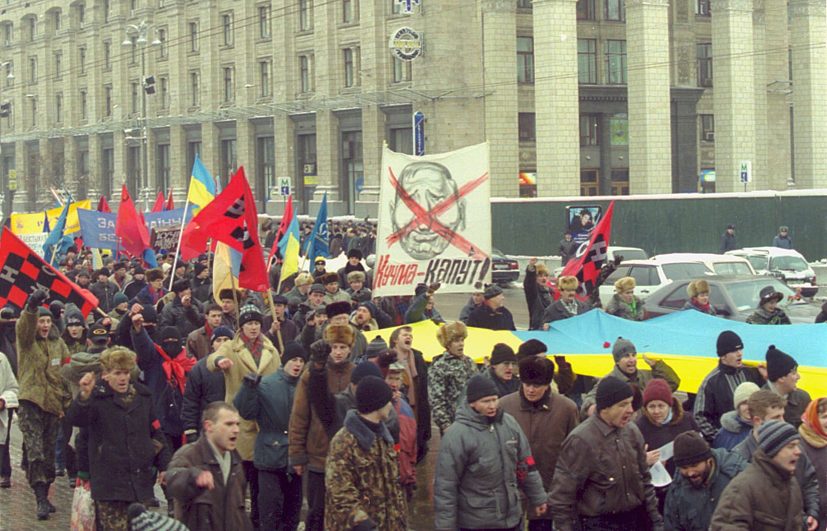
Central Kyiv"Ukraine without Kuchma"A protest on 6 February 2001 during the "Ukraine without Kuchma" campaign, sparked by the "cassette scandal" and the disappearance of journalist Heorhiy Gongadze — the first major opposition movement of independent Ukraine.Archival photo: Майдан-Інформ, 2001, GFDL · Wikimedia Commons -
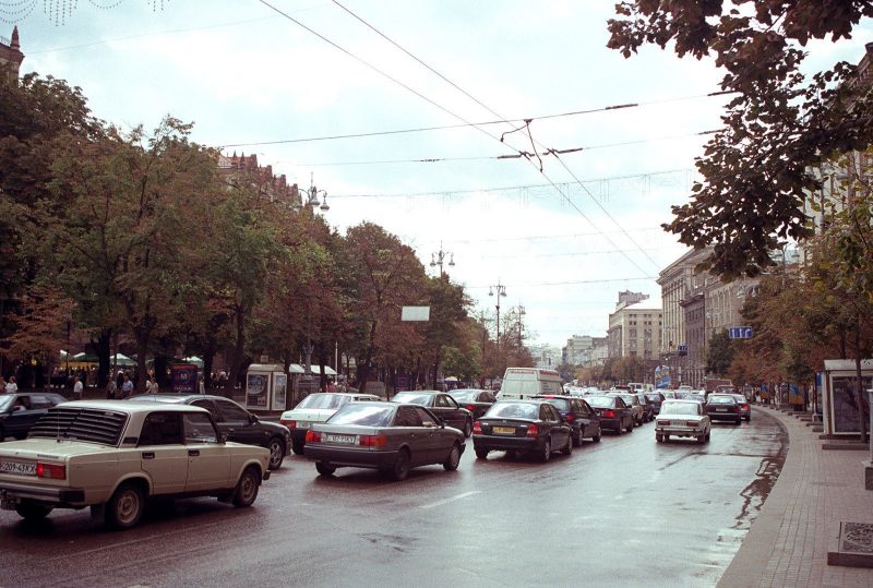
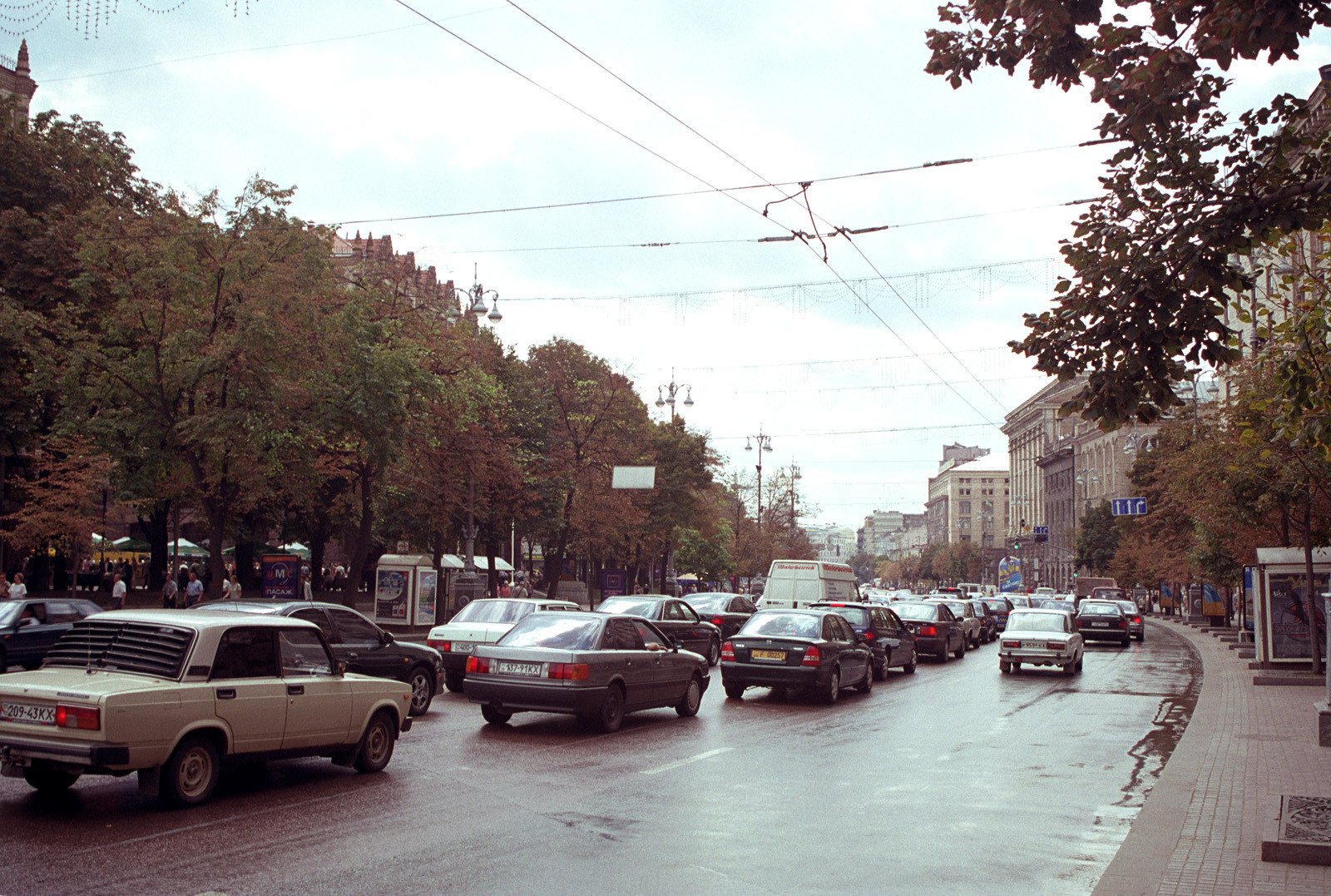
KhreshchatykKhreshchatyk trafficKhreshchatyk in summer 2001: Ladas alongside foreign cars, chestnut trees and trolleybus wires. Since then Khreshchatyk has been closed to cars and given over to pedestrians at weekends and on holidays.Archival photo: Максим Козленко, 2001, CC BY-SA 4.0 · Wikimedia Commons -
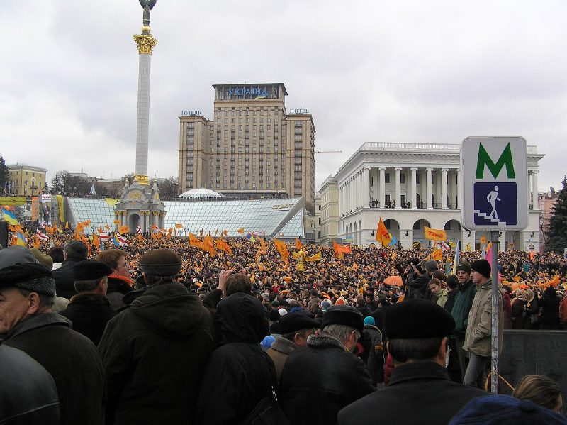
Maidan NezalezhnostiThe first morning of the revolutionThe morning of 22 November 2004, the first day of the Orange Revolution: people gather on the square beneath Hotel Ukraine and the Independence column.Archival photo: Serhiy, 2004, CC BY-SA 3.0 · Wikimedia Commons -
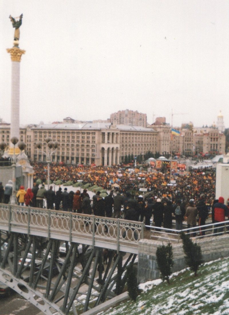
Maidan NezalezhnostiMaidan on 23 November23 November 2004: the square and Khreshchatyk packed with protesters and orange flags. A tent camp soon sprang up along Khreshchatyk.Archival photo: Віктор Полянко, 2004, CC BY-SA 4.0 · Wikimedia Commons -
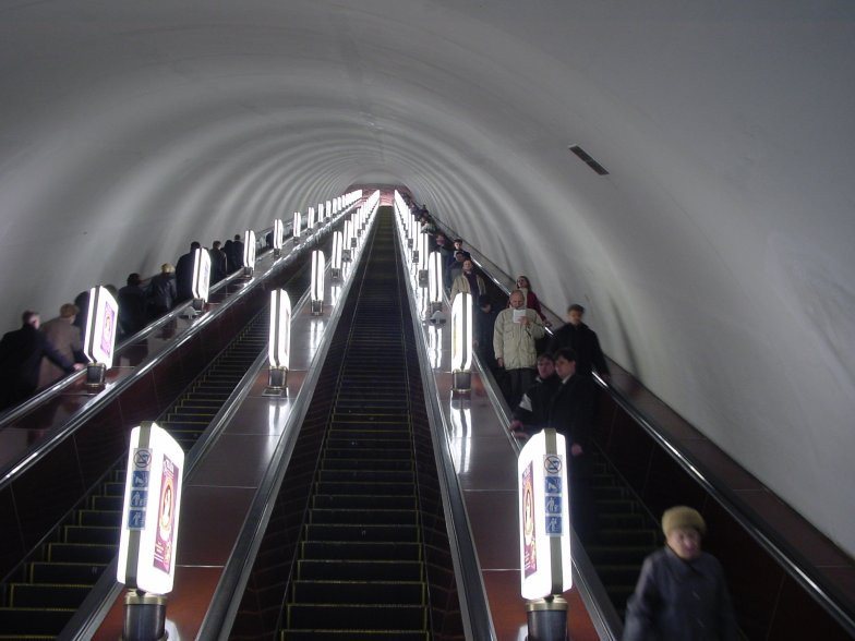
Teatralna metro stationTeatralna escalatorsThe long escalator tunnel of Teatralna metro station (1987). Kyiv’s metro is among the deepest in the world: Arsenalna, the deepest station, lies more than 100 metres underground.Archival photo: Jason Minshull, 2004, CC BY-SA 3.0 · Wikimedia Commons -
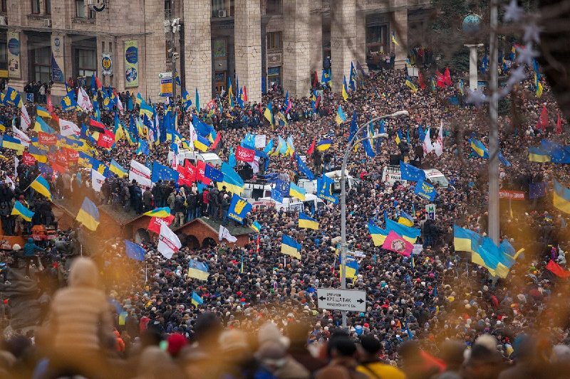
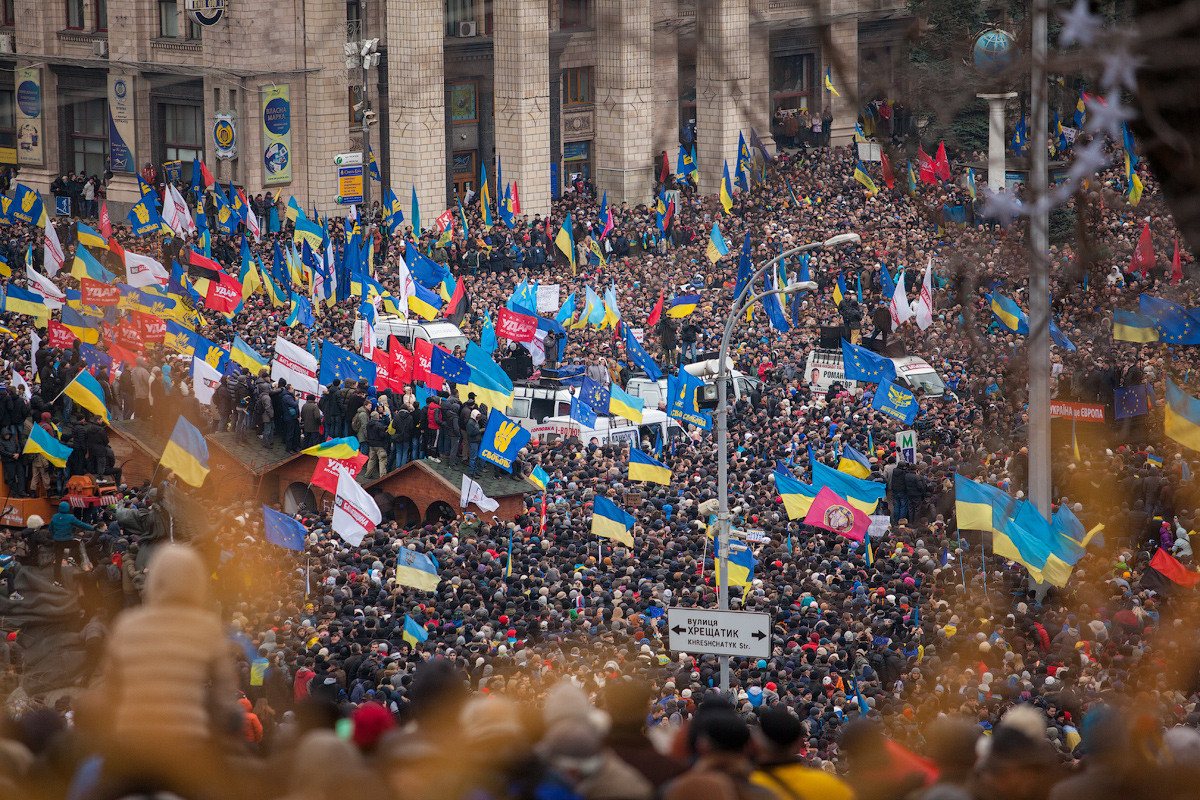
Maidan NezalezhnostiEuromaidan, 1 DecemberOn 1 December 2013, the day after riot police beat students on the square, hundreds of thousands came to the Maidan. The protest against abandoning the EU association agreement grew into the Revolution of Dignity.Archival photo: Nessa Gnatoush, 2013, CC BY 2.0 · Wikimedia Commons -
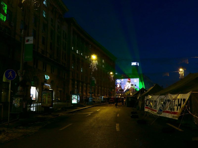
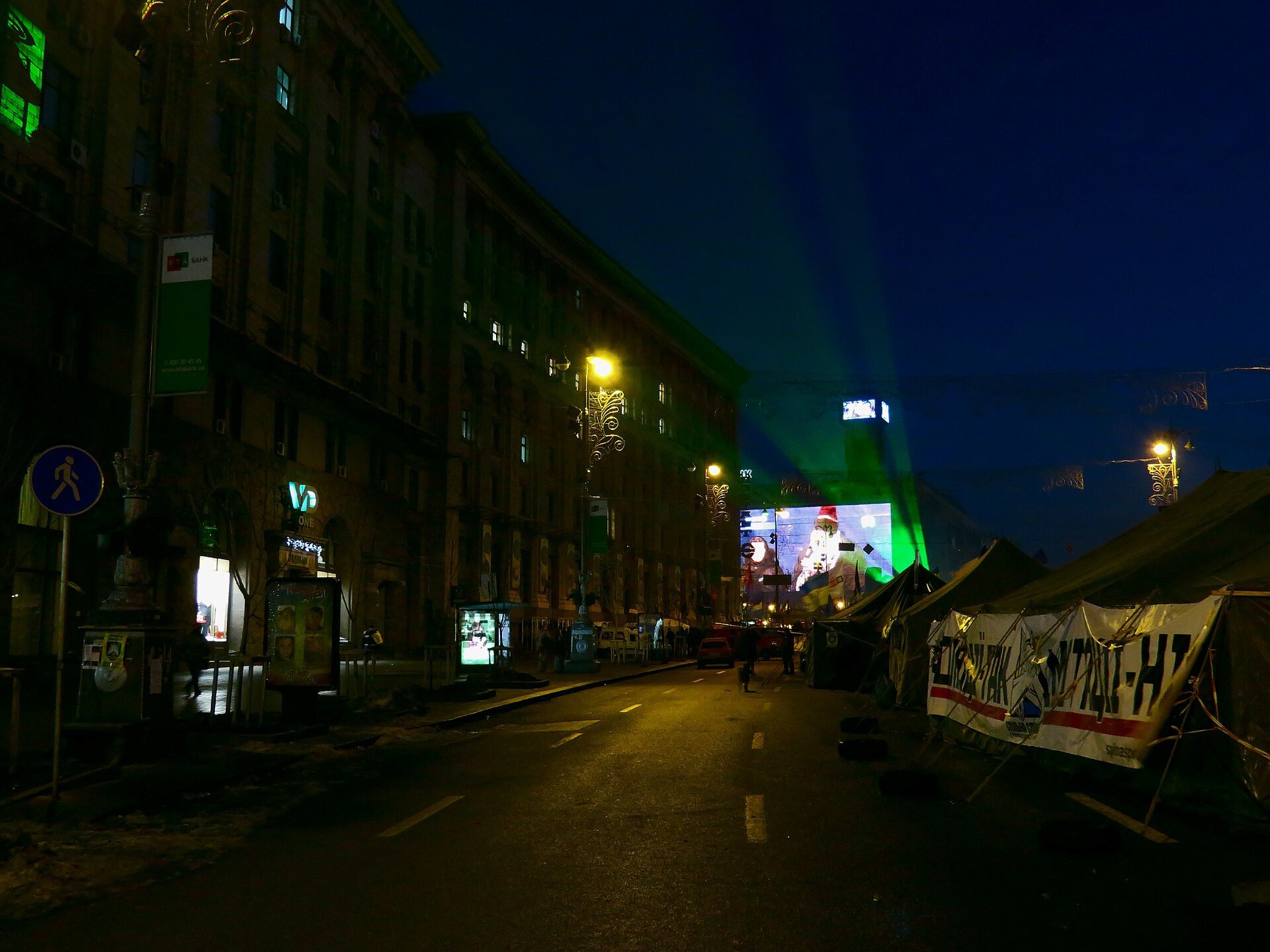
KhreshchatykNight on KhreshchatykBefore dawn on 18 December 2013: barricaded Khreshchatyk, protesters’ tents and a laser beam over the square. The Maidan camp stood all winter.Archival photo: Аимаина хикари, 2013, CC0 · Wikimedia Commons -
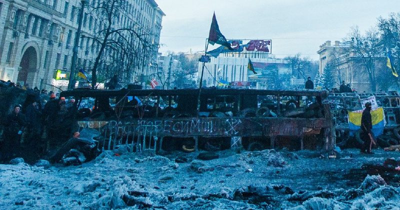
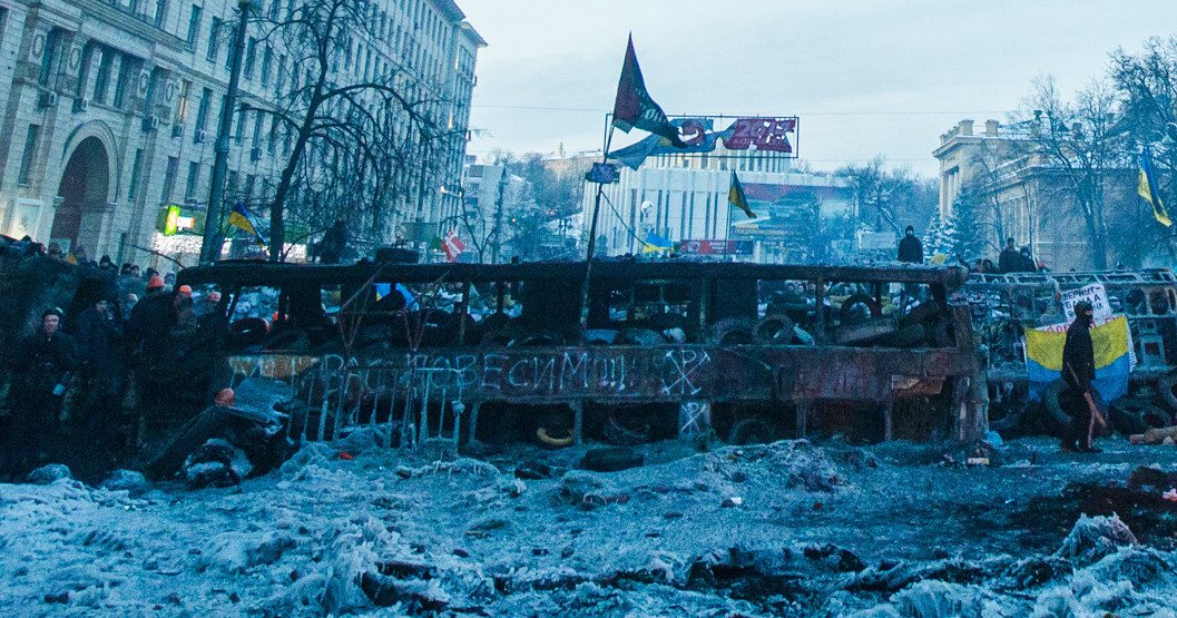
Mykhaila Hrushevskoho StreetBarricade on Hrushevskoho Street26 January 2014: a charred barricade of tyres and snow on Hrushevskoho Street by the Dynamo stadium, scene of clashes between protesters and police since 19 January.Archival photo: Sasha Maksymenko, 2014, CC BY 2.0 · Wikimedia Commons -
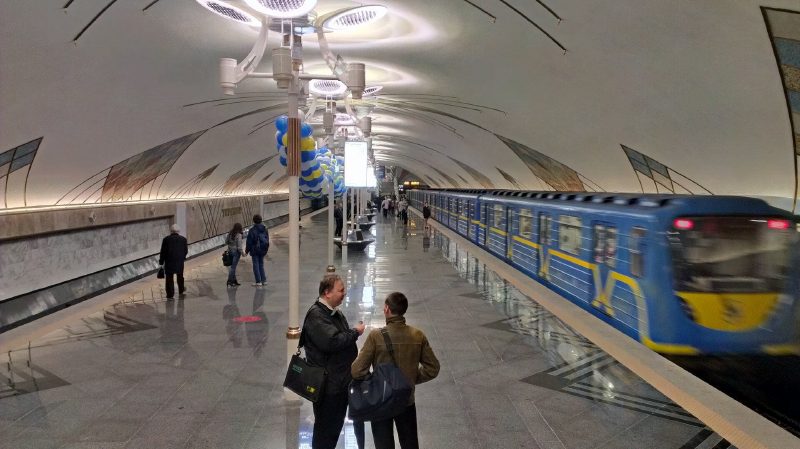
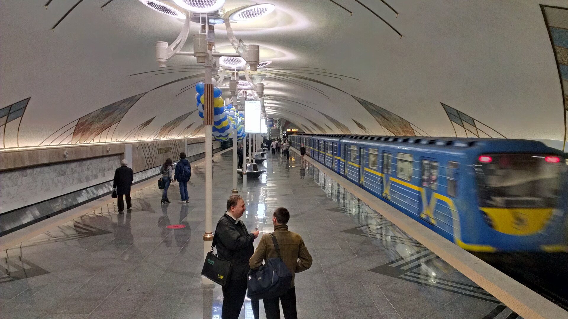
Teremky metro stationTeremky station opensTeremky station on its opening day, 6 November 2013 — the southern terminus of the Obolonsko-Teremkivska line and the last Kyiv metro station opened before the full-scale war.Archival photo: Dimant, 2013, CC BY-SA 3.0 · Wikimedia Commons -
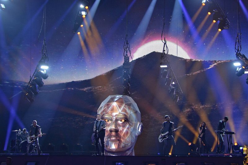
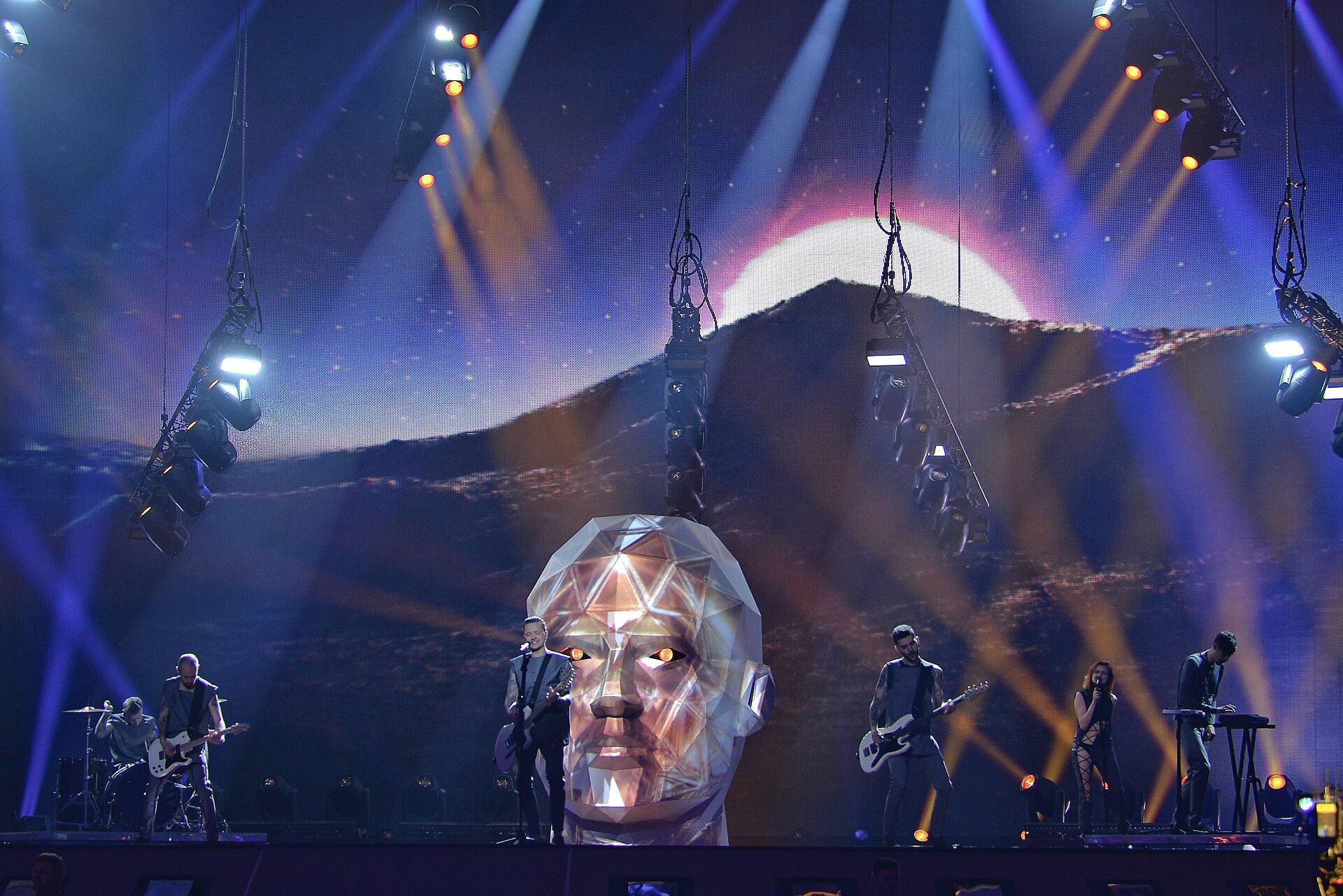
International Exhibition Centre, 15 Brovarskyi AvenueEurovision in KyivO.Torvald perform "Time" at Eurovision 2017 in the International Exhibition Centre. Kyiv hosted the contest for the second time, after Jamala’s victory in 2016.Archival photo: Mykola Swarnyk, 2017, CC BY-SA 3.0 · Wikimedia Commons -
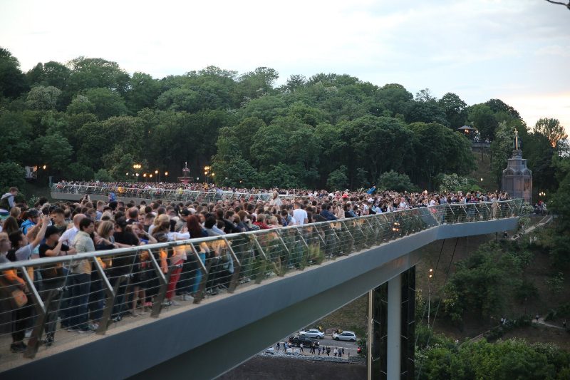
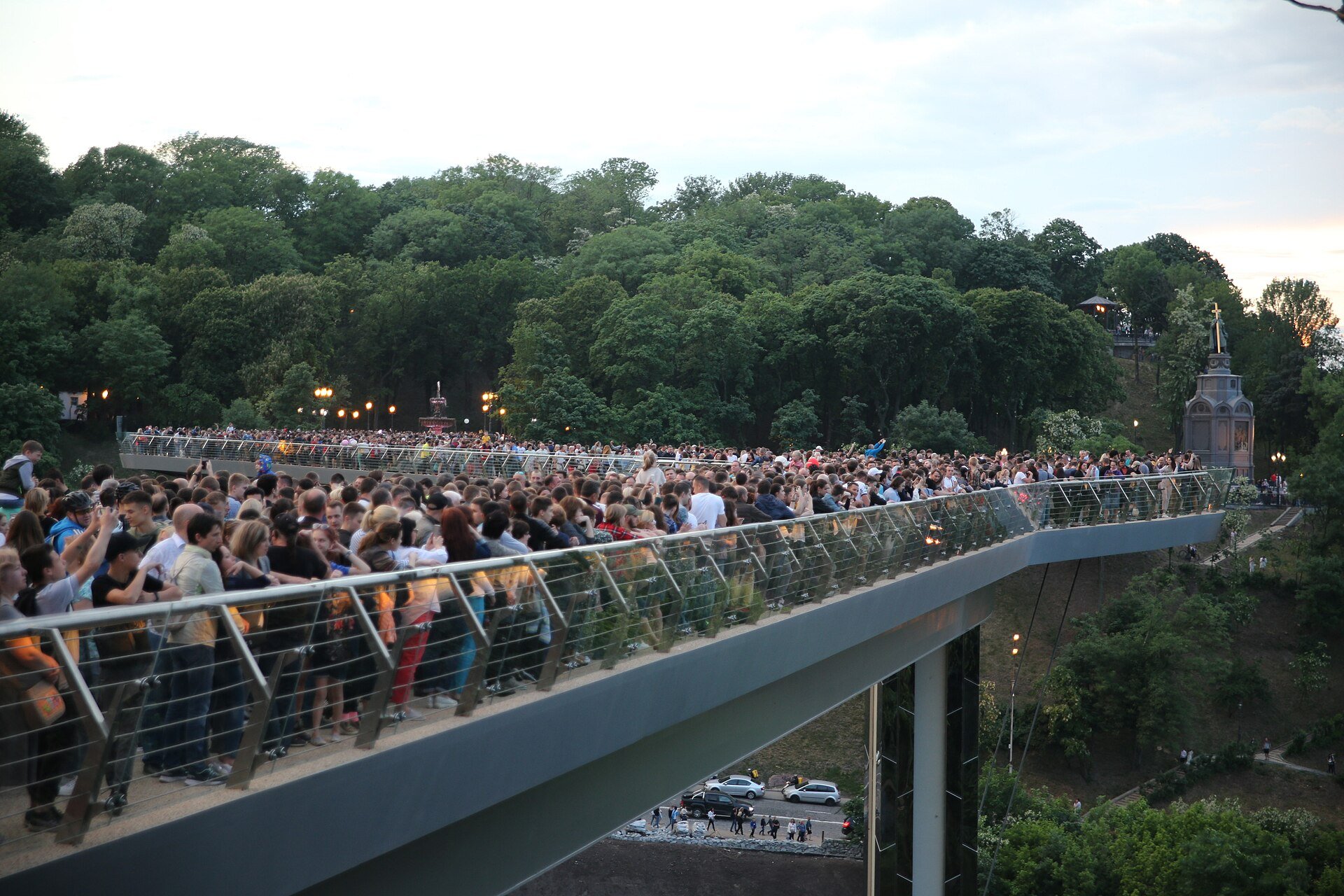
Pedestrian bridge, Khreshchatyi ParkOpening of the glass bridgeOn 25 May 2019 crowds filled the new pedestrian and cycle bridge linking Volodymyrska Hill and Khreshchatyi Park over Volodymyrskyi Uzviz, nicknamed the "glass bridge" for its glass floor panels.Archival photo: Володимир Чеппель, 2019, CC BY 4.0 · Wikimedia Commons -
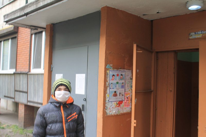
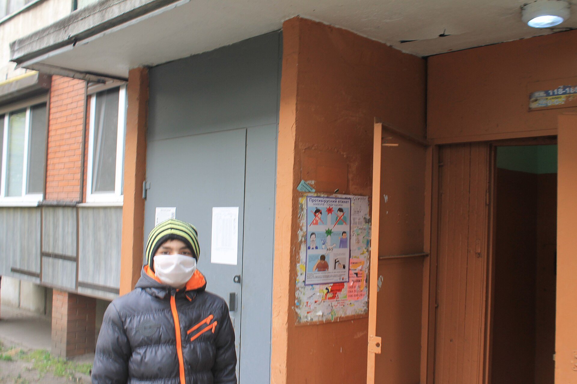
KyivQuarantine 2020April 2020: Kyiv residents in masks during the strict COVID-19 lockdown. The metro was shut for two months, and buses and trams carried only passengers with special passes.Archival photo: A1, 2020, CC BY-SA 4.0 · Wikimedia Commons -
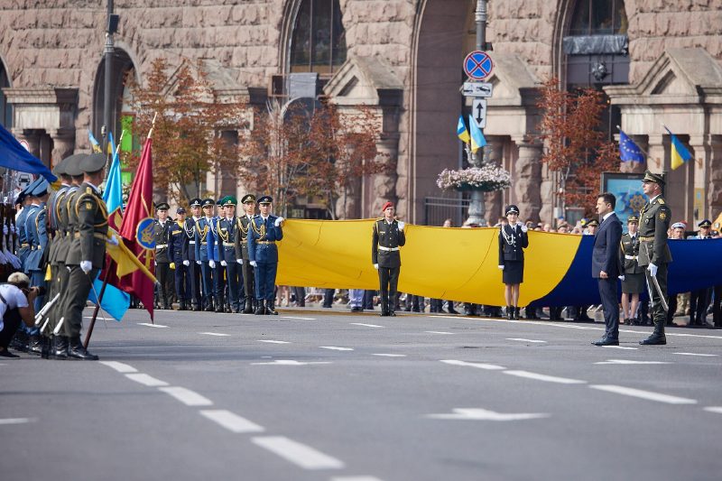
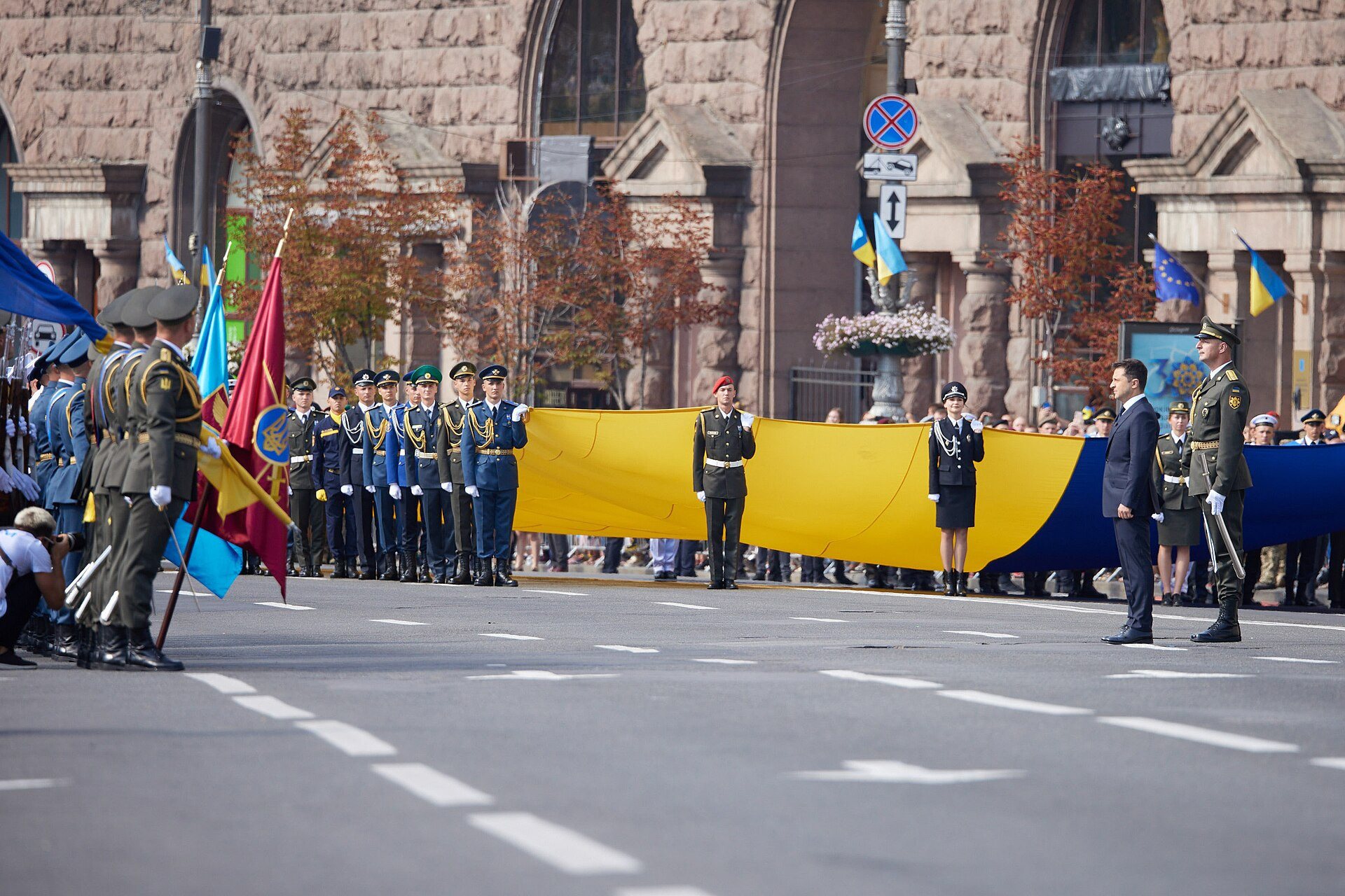
KhreshchatykParade for 30 years of independence24 August 2021: a giant national flag unfurled on Khreshchatyk during the parade for the 30th anniversary of independence, the last parade before the full-scale invasion.Archival photo: Офіс Президента України, 2021, CC BY 4.0 · Wikimedia Commons -
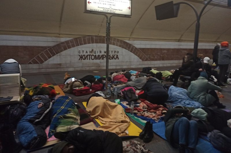
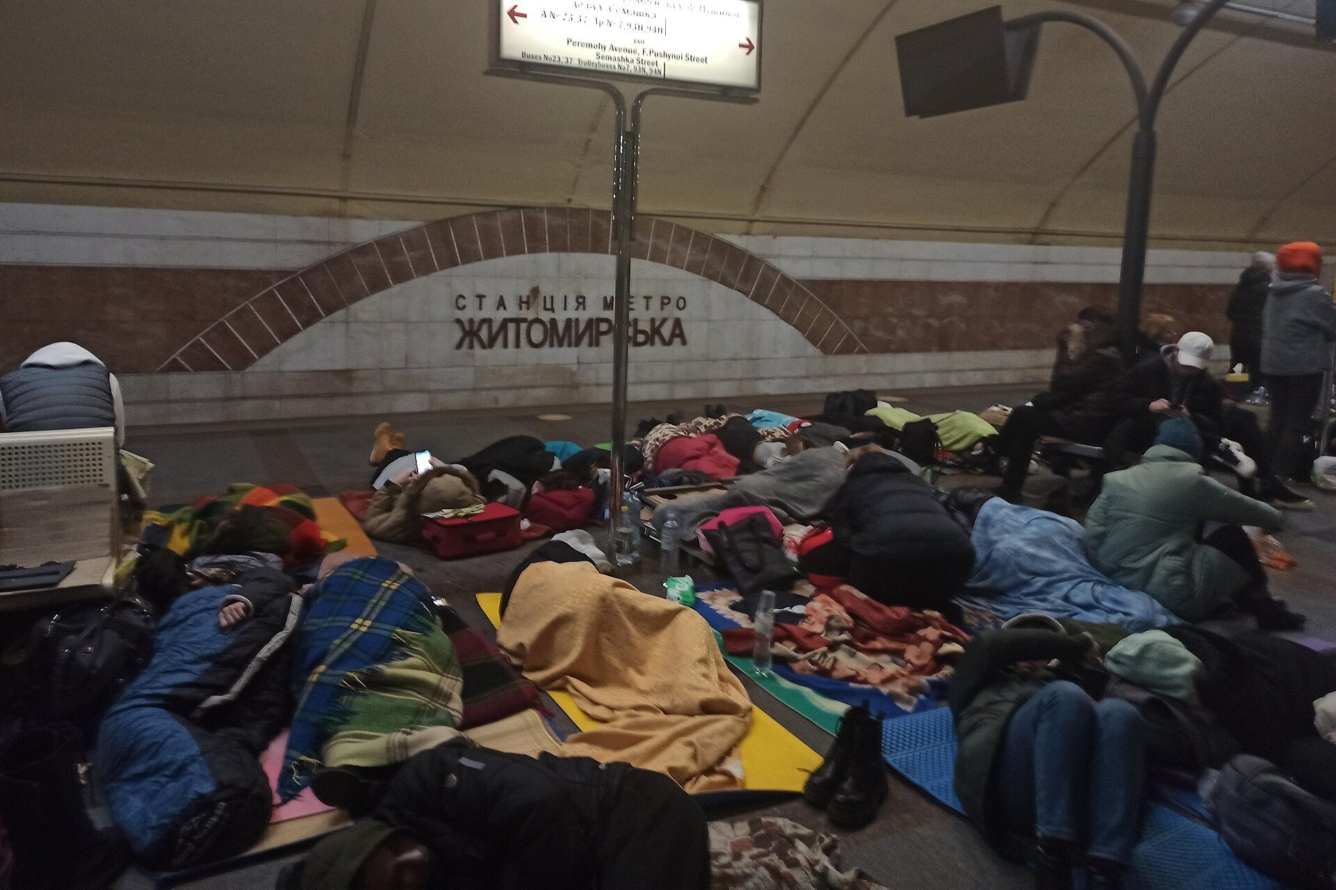
Zhytomyrska metro stationThe metro as a shelter26 February 2022, the third day of the full-scale invasion: people spend the night at Zhytomyrska station. In the first weeks of the war the metro sheltered tens of thousands.Archival photo: Mr.Rosewater, 2022, CC BY-SA 4.0 · Wikimedia Commons -
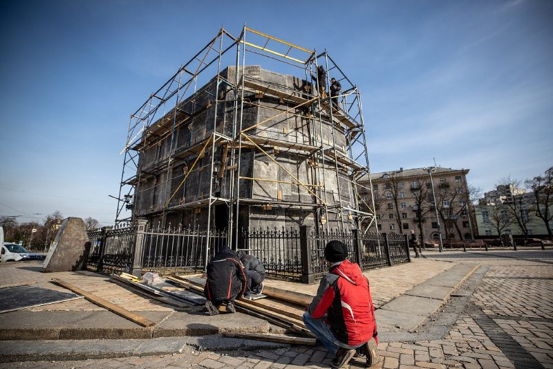
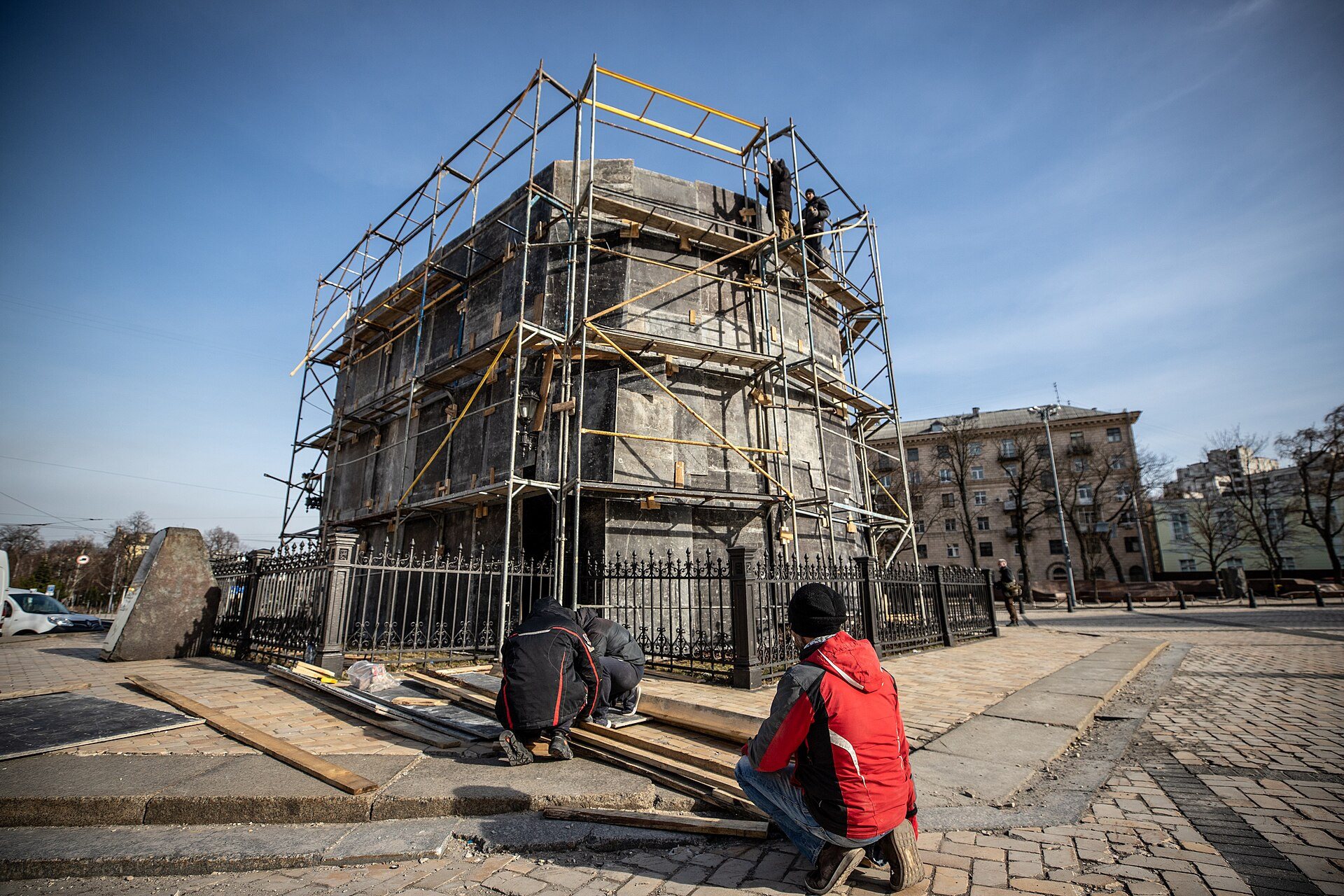
Sofiiska SquareKhmelnytsky under wrapsMarch 2022: the Bohdan Khmelnytsky monument on Sofiiska Square is boxed in with scaffolding and sandbags against blast waves, as dozens of Kyiv monuments were.Archival photo: КМДА, Олексій Самсонов, 2022, CC BY 4.0 · Wikimedia Commons -
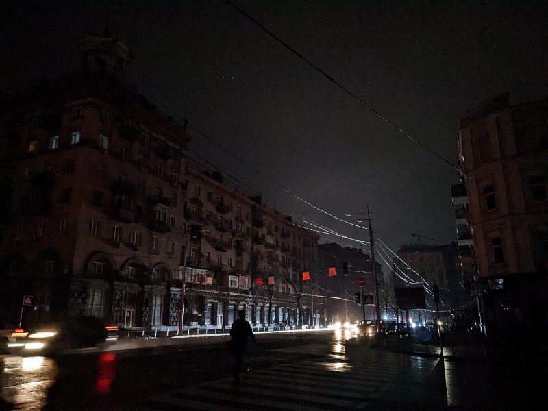
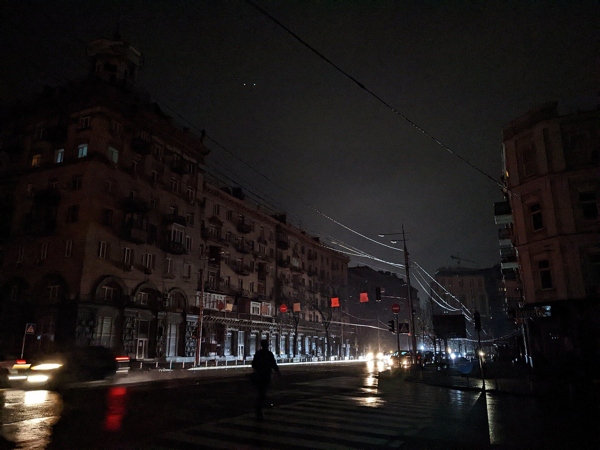
Velyka Vasylkivska StreetBlackout25 November 2022: Velyka Vasylkivska Street with no streetlights or lit windows after massive Russian strikes on the power grid. Kyiv got through that winter with generators, power banks and "invincibility points".Archival photo: Bektour, 2022, CC BY 4.0 · Wikimedia Commons
Have old photos of Kyiv? Send them to [email protected] and we will publish them with credit. Kyiv timeline →