
Archive · then and now
Photo memories
Kyiv in photographs — from the Chain Bridge and horse trams to Euromaidan and the city that held out in 2022. For many of them we found a modern photo taken from the same spot: drag the slider to compare.
Then and now
Drag the divider to compare the old and new photo.
-
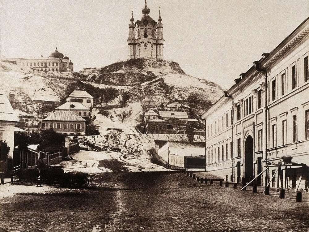
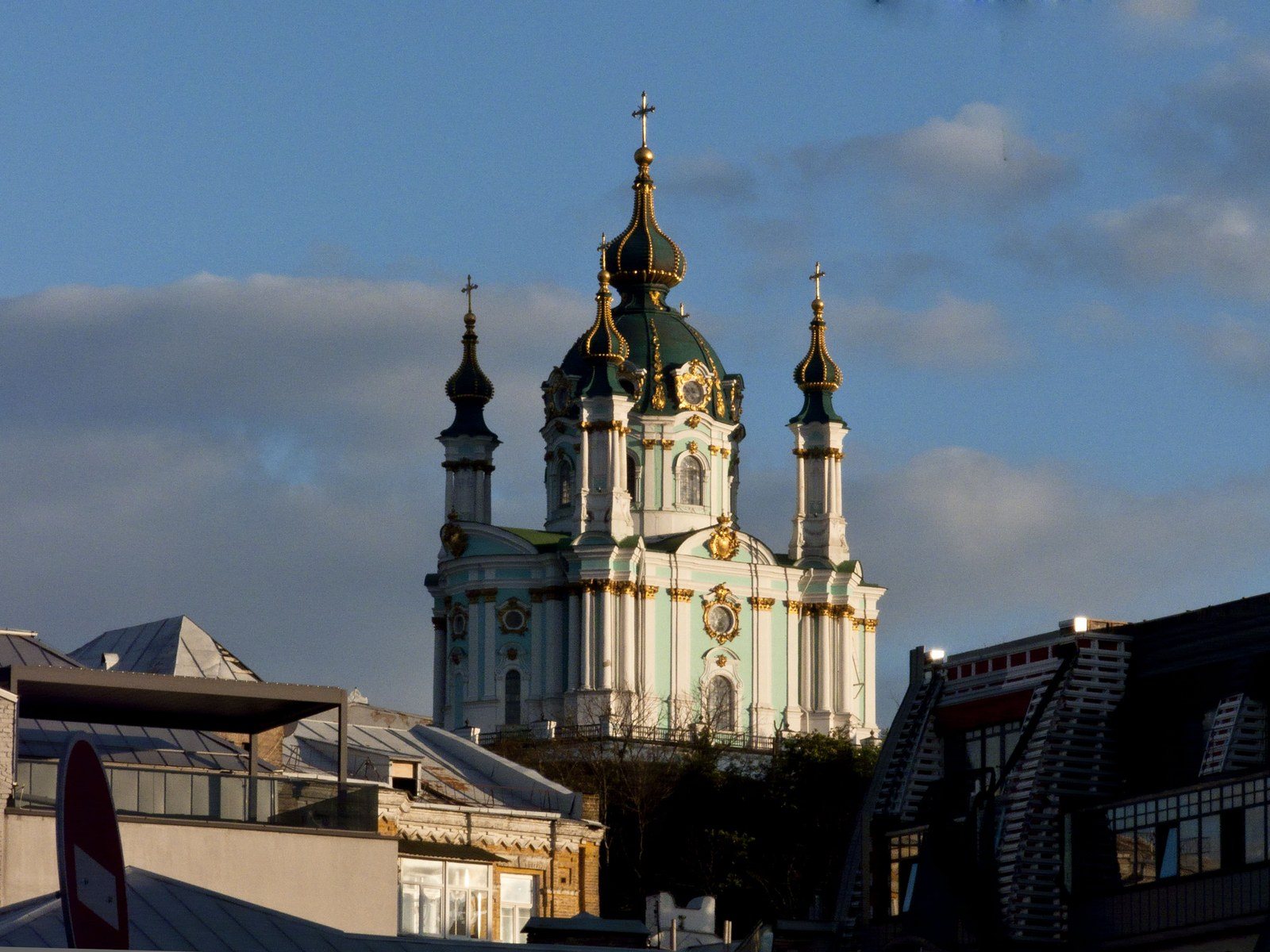
Andriivskyi UzvizSt Andrew's Church by Roger FentonOne of the earliest known photographs of Kyiv: St Andrew's Church above a snowy slope. British photographer Roger Fenton came here in 1852 to document the construction of Charles Vignoles' Chain Bridge. Rastrelli's church still stands, and the lane below it became Andriivskyi Uzviz. On the right, the view from Kontraktova Square in 2026: the slope below the church is now built up, and from Podil it rises above the rooftops.Archival photo: Роджер Фентон, 1852, Public domain · Wikimedia Commons
Modern photo: ОленаСугак, 2026, CC BY-SA 4.0 · Wikimedia Commons -
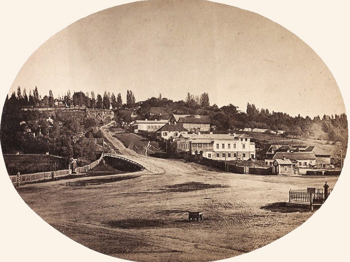
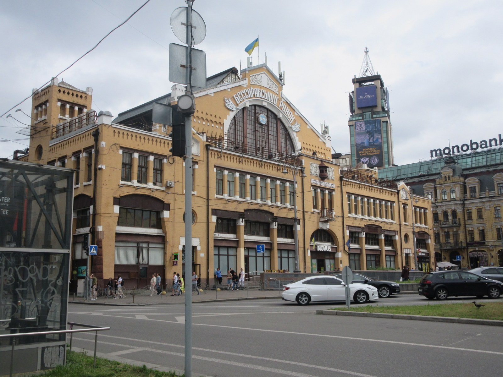
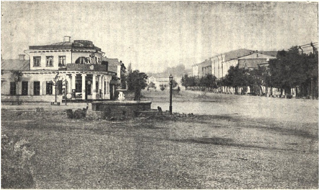
Bessarabska SquareBessarabka before the marketBessarabska Square in the 1860s: a vacant lot at the end of Khreshchatyk, with Krutyi Uzviz and the turn onto Kruhlouniversytetska Street lined with single-storey houses. Half a century later the Bessarabskyi covered market (1912) was built here, and the square became one of the busiest junctions in the city. On the right, the square in 2025 with the Bessarabskyi Market (1910–1912, architect Henryk Gay).Archival photo: невідомий автор, 1860–1870, Public domain · Wikimedia Commons
Modern photo: Віктор Полянко, 2025, CC BY-SA 4.0 · Wikimedia Commons -
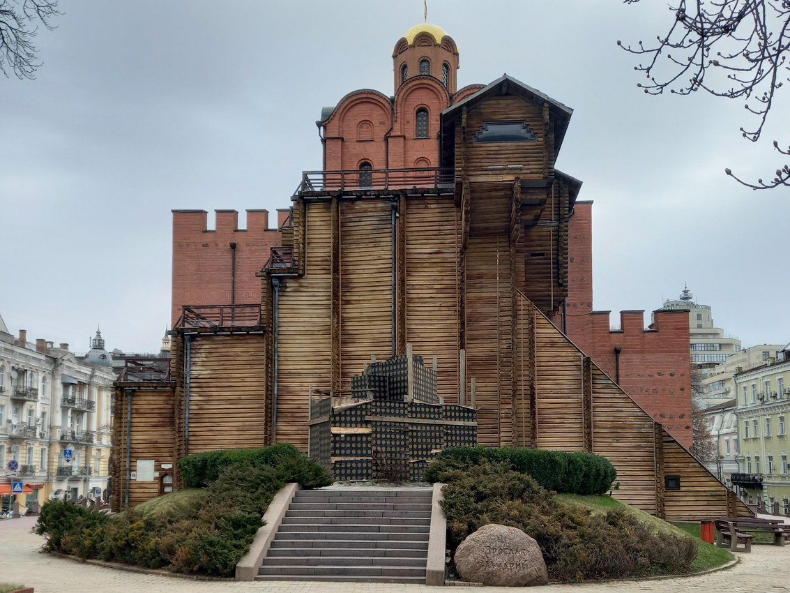
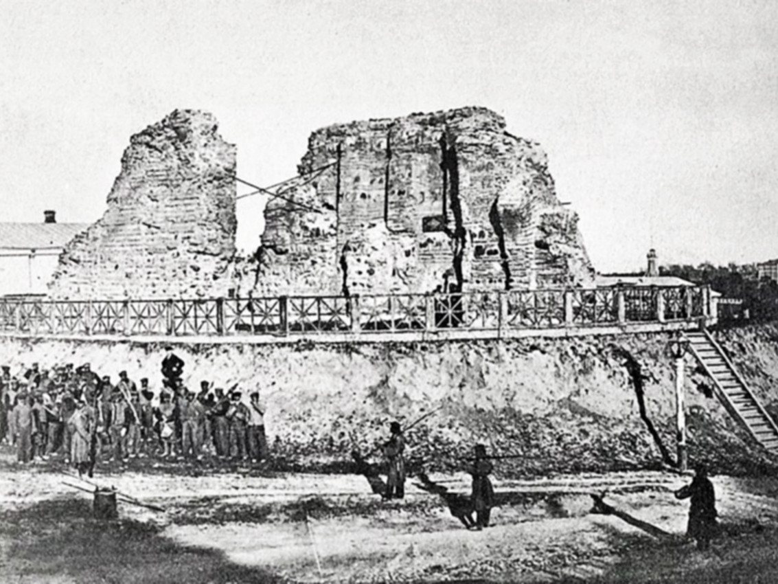
40-A Volodymyrska StreetRuins of the Golden GateThe ruins of the 11th-century Golden Gate: two masonry walls of the old passage on an earthen rampart behind a wooden fence, with a line of convicts drawn up nearby. The remains were cleared and buttressed in the 1830s, and in 1982 a museum pavilion was built over them, recreating the probable look of the gate tower with the Church of the Annunciation.Archival photo: невідомий автор, 1860-ті, CC BY 4.0 · Wikimedia Commons
Modern photo: Liliia2022, 2024, CC BY-SA 4.0 · Wikimedia Commons -
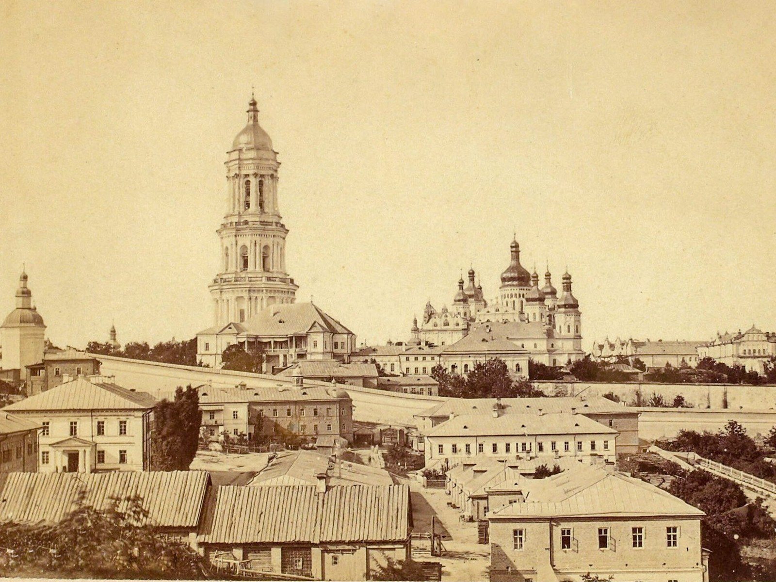
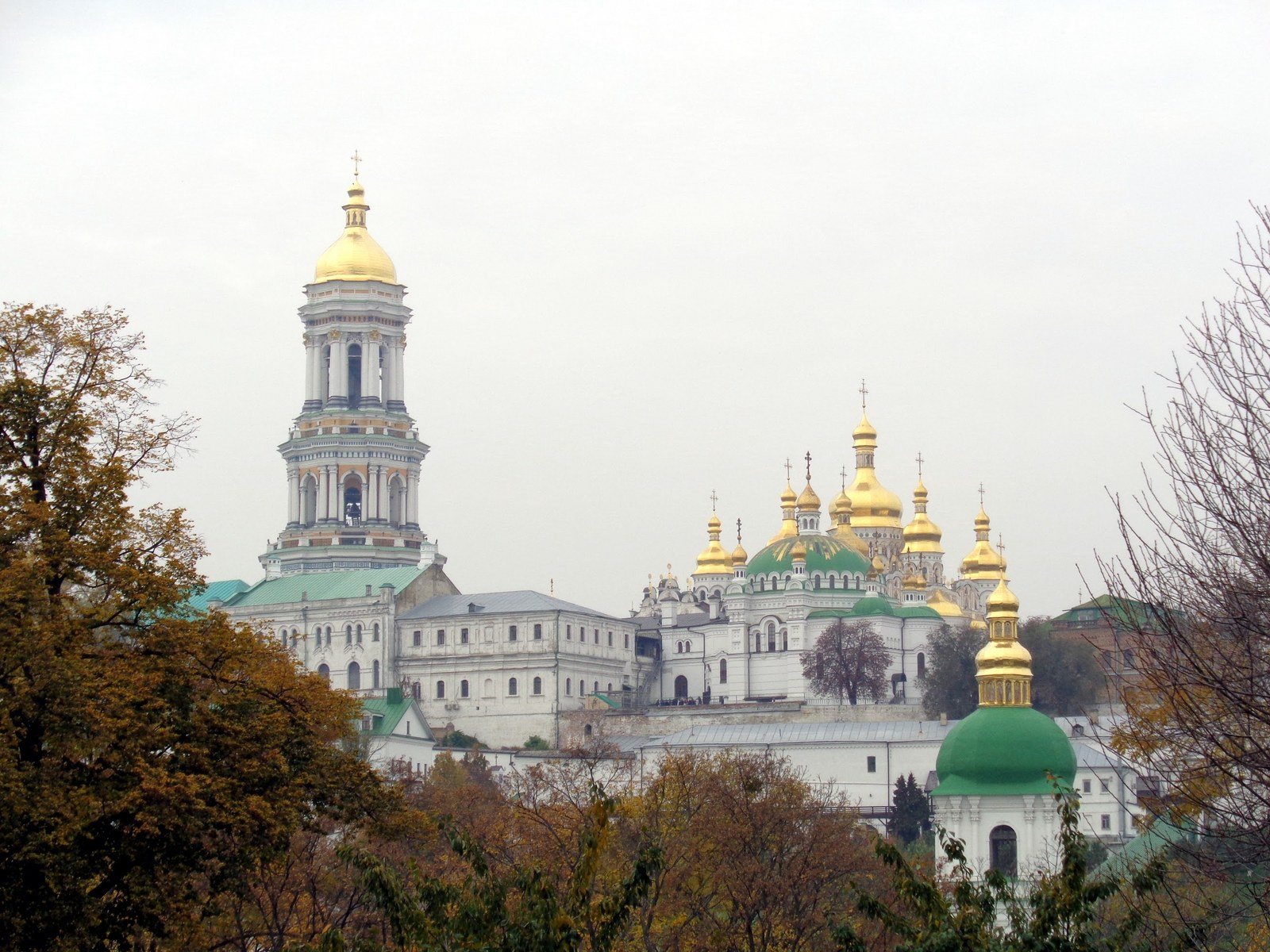
Lavrska Street, PecherskThe Lavra above PecherskThe Kyiv Pechersk Lavra photographed by Yosyp Kordysh: the Great Lavra Bell Tower, the Clock Tower and the domes of the Dormition Cathedral rise above the roofs of Pechersk. The cathedral was blown up on 3 November 1941 and rebuilt in 1998–2000. On the right, the Lavra in 2017: the rebuilt Dormition Cathedral again stands beside the bell tower, and trees have replaced the low Pechersk houses in the foreground.Archival photo: Йосип Кордиш, 1870–1890, Public domain · Wikimedia Commons
Modern photo: SnizhokAM, 2017, CC BY-SA 4.0 · Wikimedia Commons -
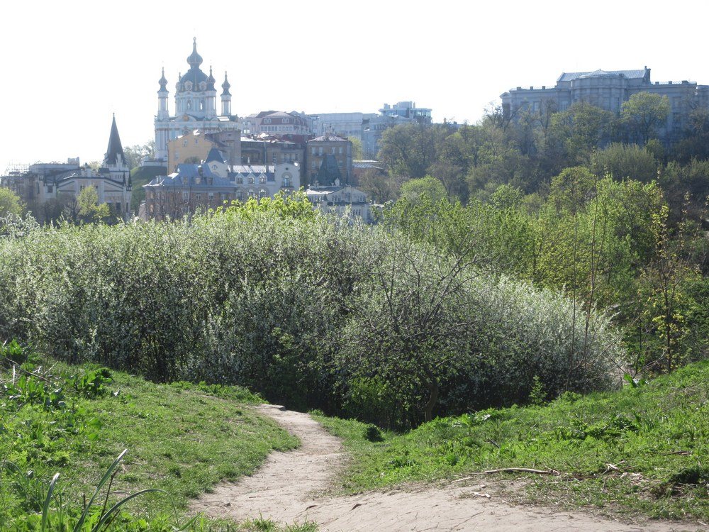
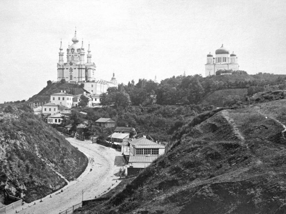
Andriivskyi Uzviz from Castle HillAndriivskyi Uzviz and the Church of the TithesAndriivskyi Uzviz in the 1870s: an unpaved road winds between the slopes of Andriivska and Castle Hills, with Rastrelli's St Andrew's Church above and Vasily Stasov's Church of the Tithes (1842) on the right. The Church of the Tithes was demolished in 1928; the National Museum of the History of Ukraine now stands beside its foundations, and from Castle Hill the descent itself is hidden by trees.Archival photo: невідомий автор, 1870-ті, Public domain · Wikimedia Commons
Modern photo: Віктор Полянко, 2024, CC BY-SA 4.0 · Wikimedia Commons -
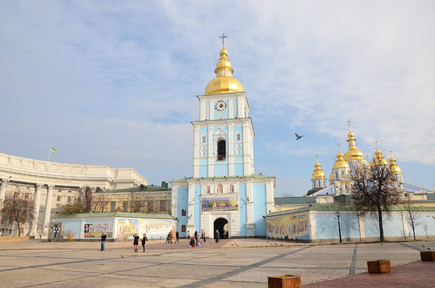
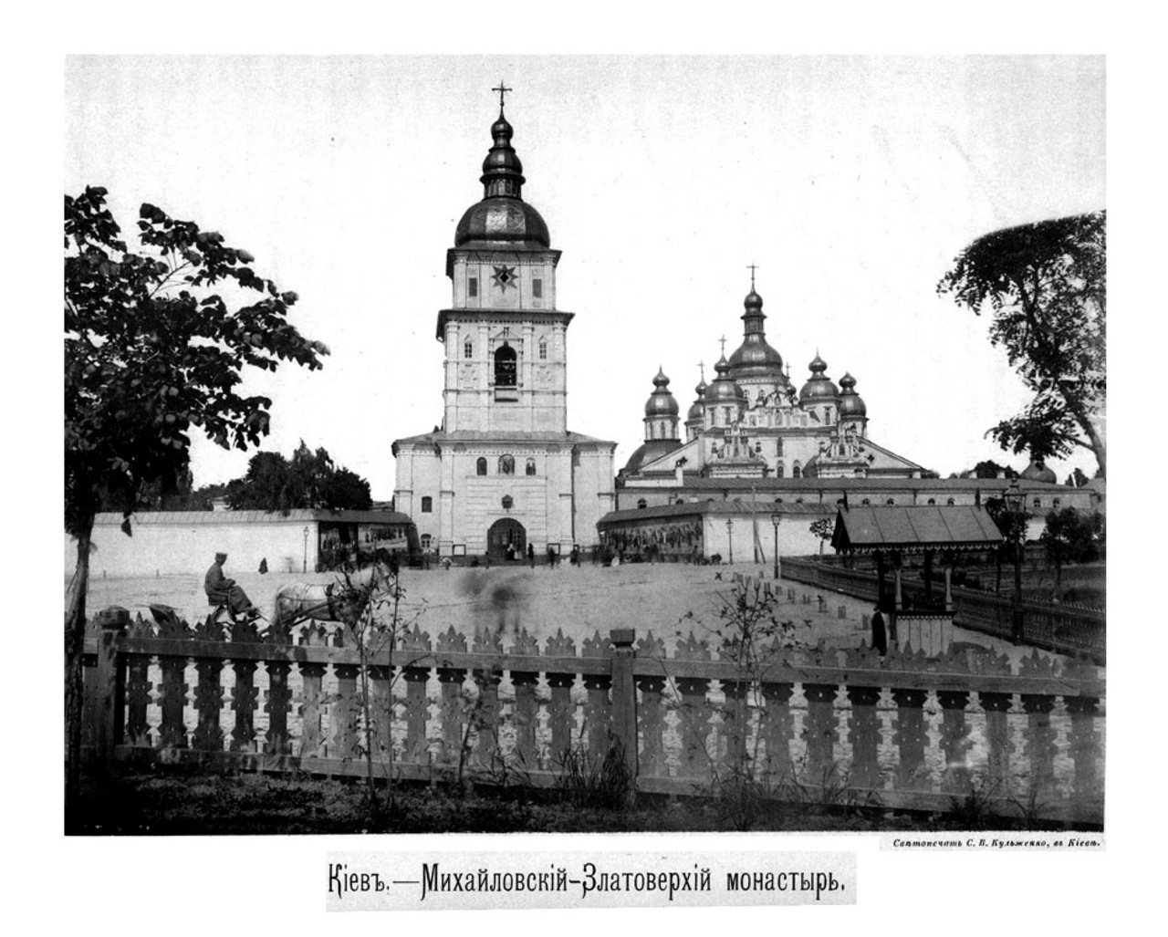
Mykhailivska SquareSt Michael's Golden-Domed before demolitionThe bell tower and cathedral of St Michael's Golden-Domed Monastery, photographed by Stefan Kulzhenko in 1888. The monastery was destroyed in the 1930s; the bell tower and cathedral were rebuilt in the late 1990s and early 2000s.Archival photo: С. В. Кульженко, 1888, Public domain · Wikimedia Commons
Modern photo: Andrey Butko, 2013, CC BY-SA 3.0 · Wikimedia Commons -
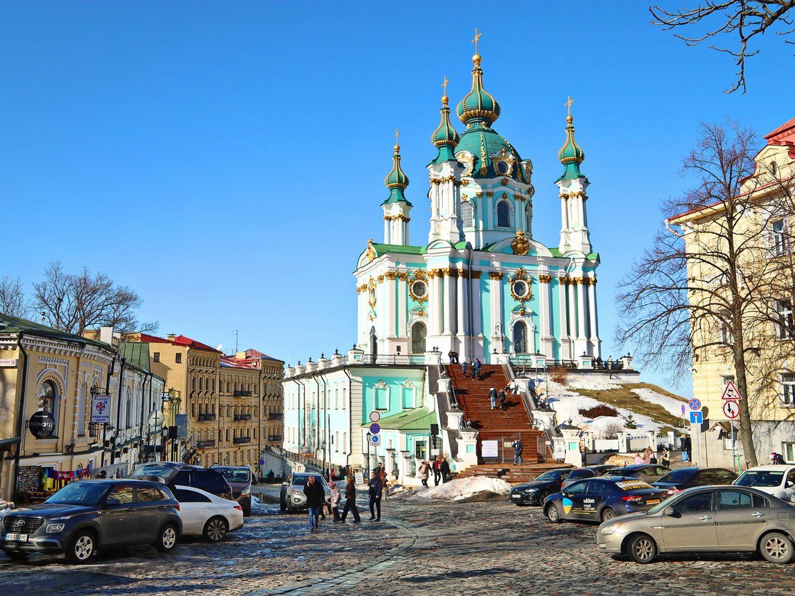
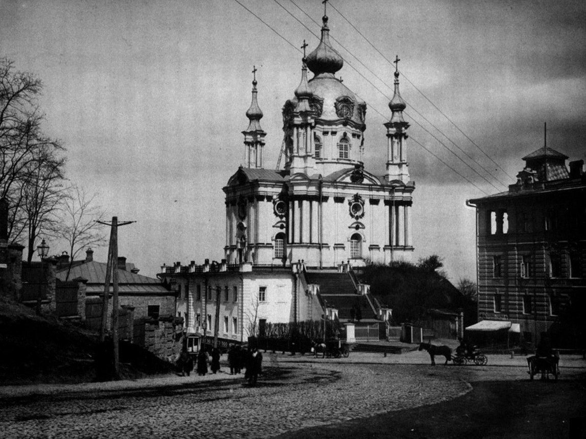
Andriivska Street / Andriivskyi UzvizSt Andrew's ChurchSt Andrew's Church, built in 1747–1762 to a design by Bartolomeo Rastrelli, in Stefan Kulzhenko's 1888 photograph. Cobbles, wooden poles and cabbies defined this part of town; today the church marks the top of Andriivskyi Uzviz, one of Kyiv's most visited streets.Archival photo: С. В. Кульженко, 1888, Public domain · Wikimedia Commons
Modern photo: Oleksandr Malyon, 2026, CC BY-SA 4.0 · Wikimedia Commons -
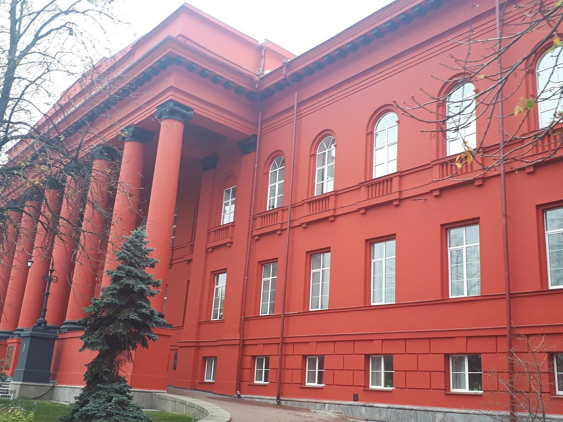
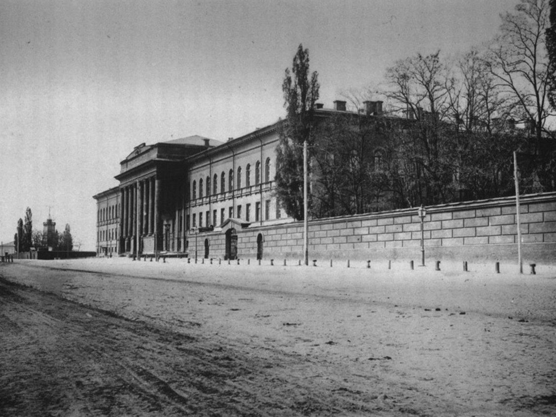
60 Volodymyrska StreetSt Volodymyr UniversityThe main building of St Volodymyr University (architect Vikentii Beretti, 1837–1843), seen from Volodymyrska Street in 1888, when the street was still unpaved and a high wall ran along the building. Today it is the Red Building of Taras Shevchenko National University of Kyiv.Archival photo: С. В. Кульженко, 1888, Public domain · Wikimedia Commons
Modern photo: Olga Loboda 0806, 2019, CC BY-SA 4.0 · Wikimedia Commons -
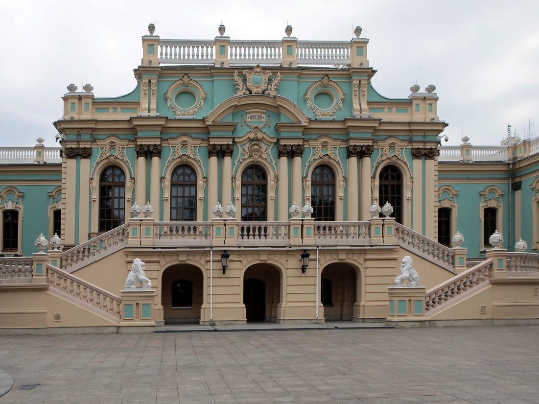
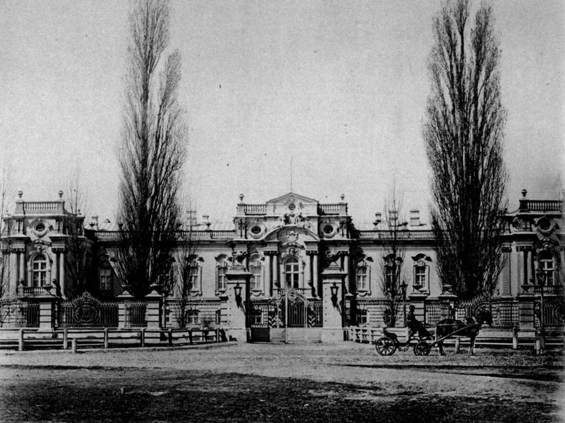
5a Mykhaila Hrushevskoho StreetThe Tsar's PalaceThe Tsar's (Mariinskyi) Palace, built in the 1740s–1750s to a design by Bartolomeo Rastrelli and restored in 1870 after a fire, photographed by Stefan Kulzhenko in 1888. It was named Mariinskyi after Empress Maria Alexandrovna. Today it is the ceremonial residence of the President of Ukraine.Archival photo: С. В. Кульженко, 1888, Public domain · Wikimedia Commons
Modern photo: Волтарс, 2025, CC BY-SA 4.0 · Wikimedia Commons -
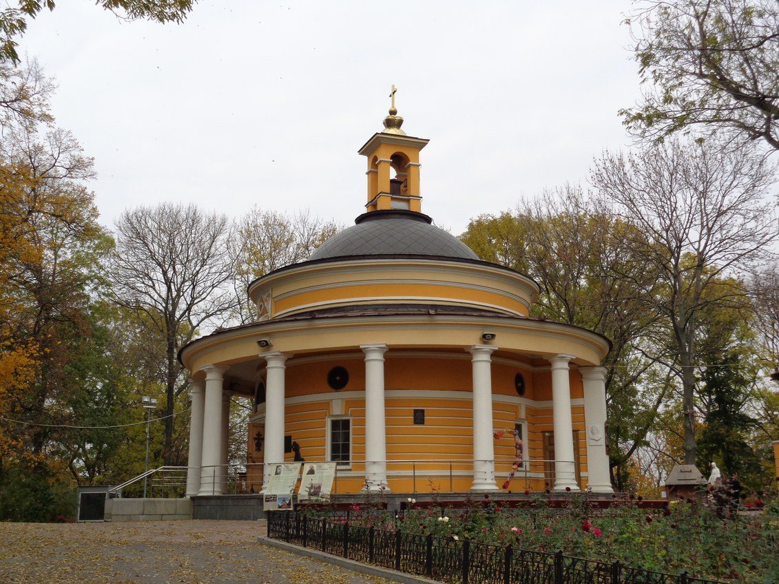
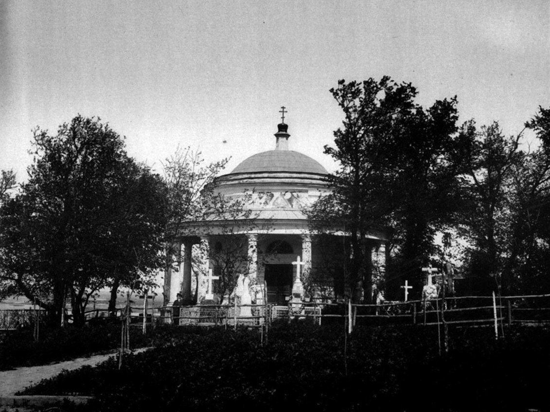
Askold's Grave ParkAskold's GraveThe rotunda church of St Nicholas at Askold's Grave (architect Andrii Melenskyi, 1810) among the crosses of the cemetery that existed here until the 1930s. In Soviet times the rotunda served as a pavilion; since the 1990s it has again been a church.Archival photo: С. В. Кульженко, 1888, Public domain · Wikimedia Commons
Modern photo: SnizhokAM, 2017, CC BY-SA 4.0 · Wikimedia Commons -
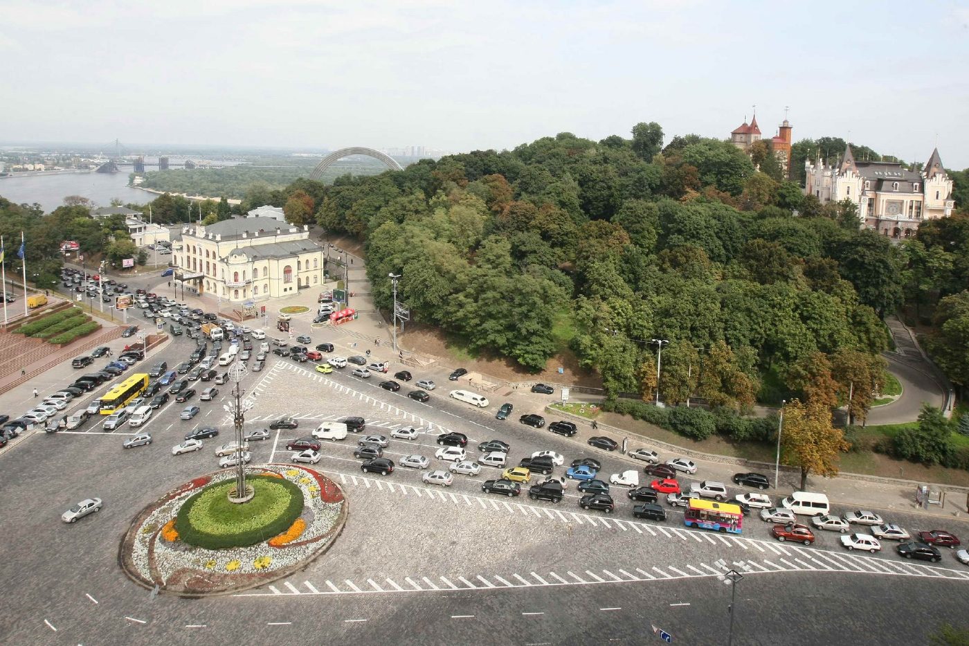
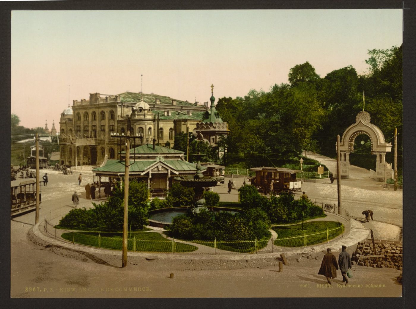
European Square, 2 Volodymyrskyi UzvizMerchants' Assembly and Tsarska SquareThe Merchants' Assembly building (now the National Philharmonic) and the entrance arch of the Merchants' Garden on an 1890s photochrom. Today this is European Square with a roundabout, and the hillside park is part of Volodymyrska Hill.Archival photo: невідомий автор, бл. 1890–1900, Public domain · Wikimedia Commons
Modern photo: Волтарс, 2009, CC BY-SA 4.0 · Wikimedia Commons -
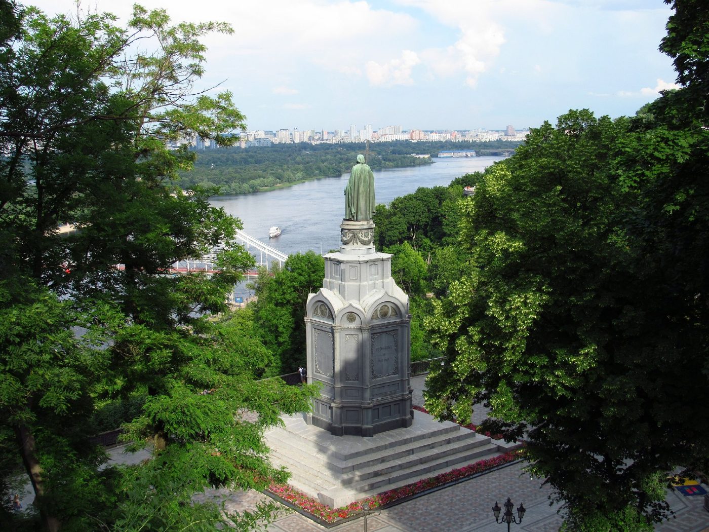
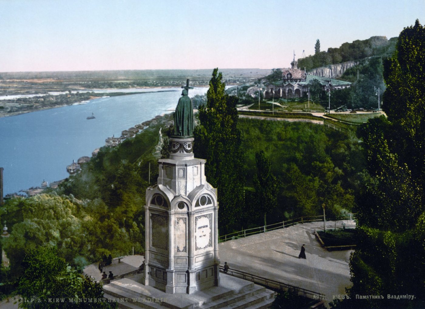
Volodymyrska HillVolodymyr Monument above the DniproThe monument to Prince Volodymyr (1853) on Volodymyrska Hill overlooking the Dnipro, on an 1890s photochrom. The monument still stands in the same place; high-rise districts are now visible on the Dnipro's left bank.Archival photo: невідомий автор, бл. 1890–1905, Public domain · Wikimedia Commons
Modern photo: Константинъ, 2021, CC BY-SA 4.0 · Wikimedia Commons -
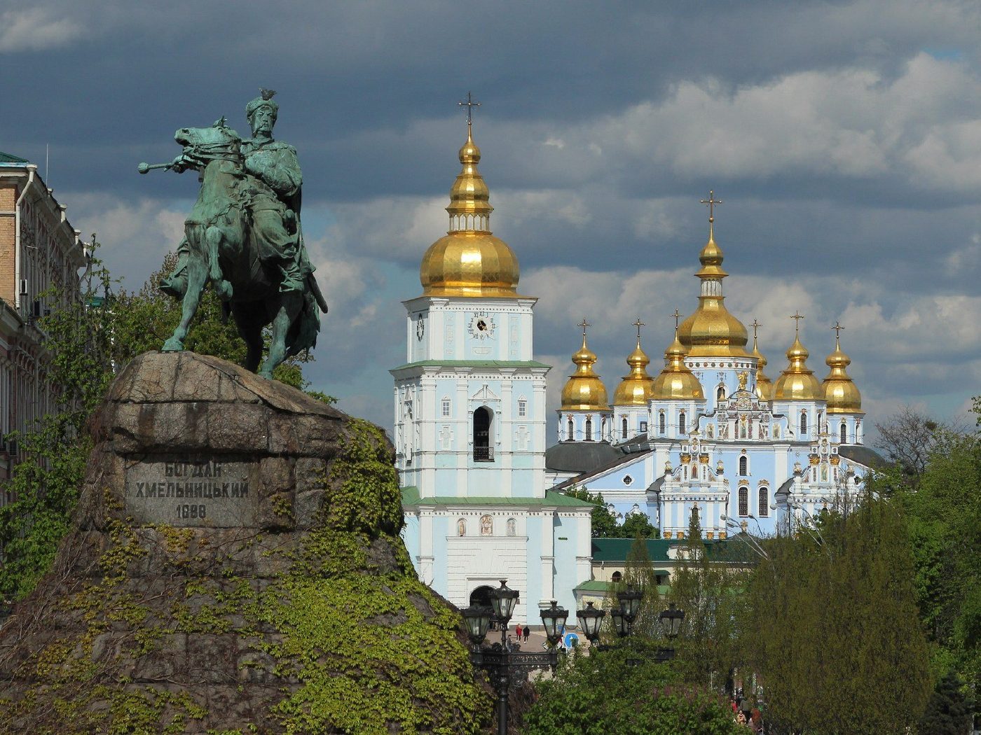
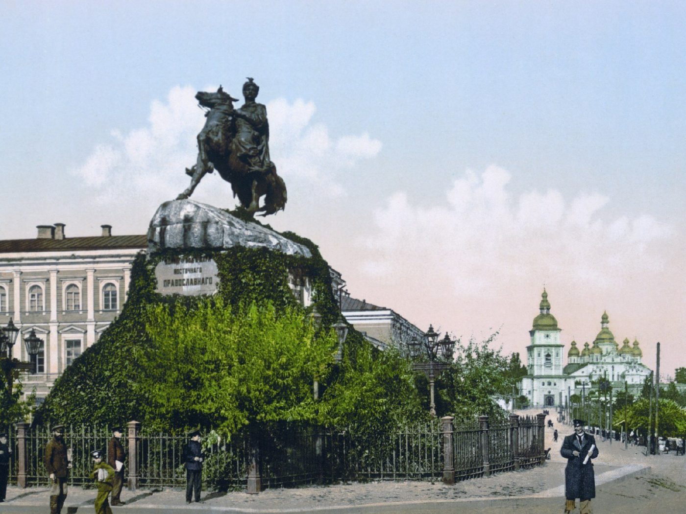
Sofiiska SquareBohdan Khmelnytsky MonumentMikhail Mikeshin's monument to Bohdan Khmelnytsky, unveiled in 1888, in an 1890s photochrom. In the background on the right is St Michael's Golden-Domed Cathedral, destroyed in the 1930s and rebuilt in the 1990s. The monument remains one of the symbols of Kyiv.Archival photo: невідомий автор, бл. 1890–1905, Public domain · Wikimedia Commons
Modern photo: Didkov, 2021, CC BY-SA 4.0 · Wikimedia Commons -
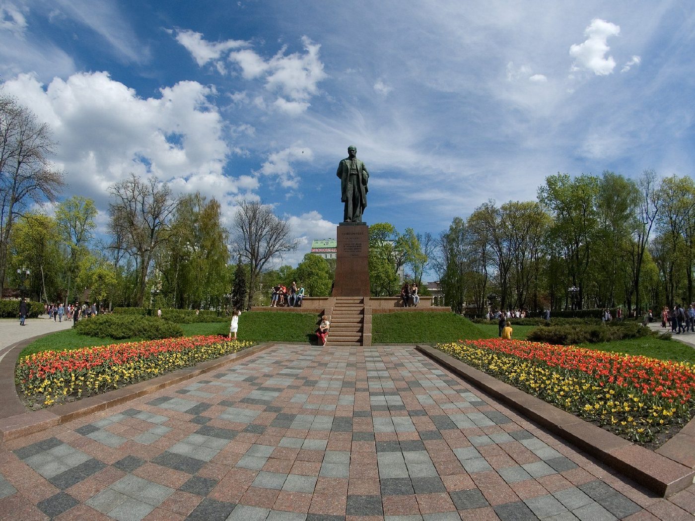
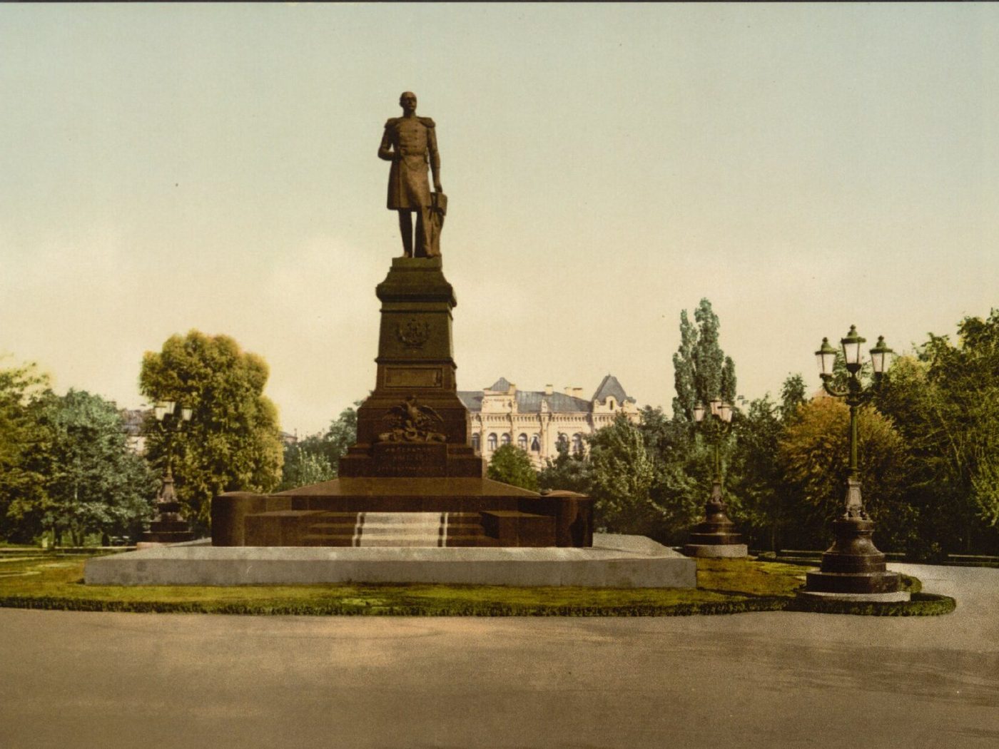
Shevchenko ParkMonument to Nicholas IThe monument to Emperor Nicholas I opposite St Volodymyr University, unveiled in 1896. It was dismantled in 1920, and in 1939 a monument to Taras Shevchenko was erected on the same spot in the square, now Shevchenko Park.Archival photo: невідомий автор LCCN 2001697435, бл. 1896–1900, Public domain · Wikimedia Commons
Modern photo: SergKh78, 2016, CC BY-SA 4.0 · Wikimedia Commons -
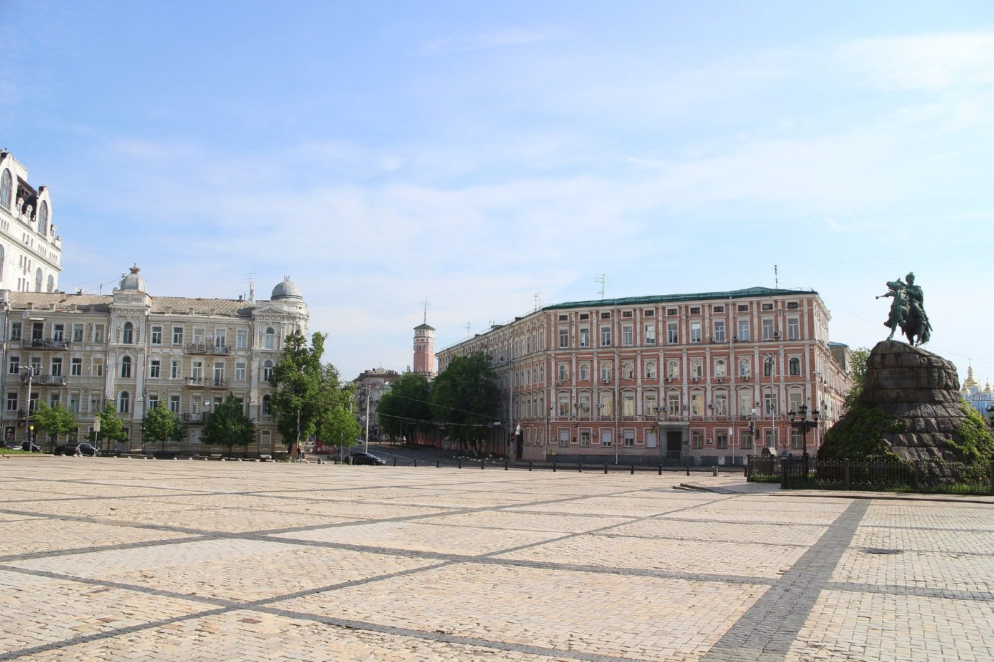
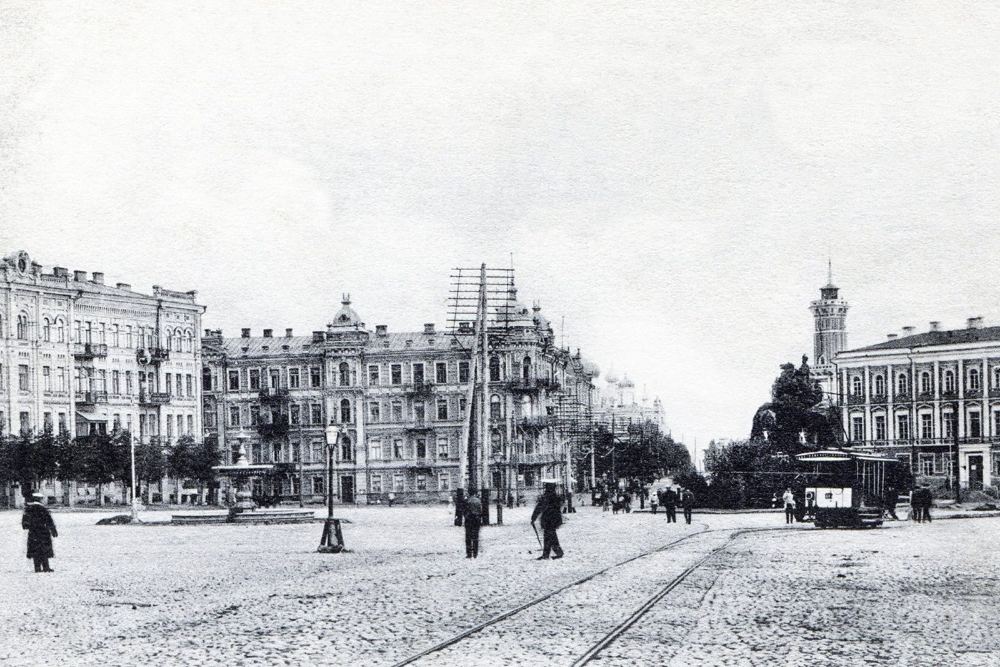
Sofiiska SquareSofiiska SquareSofiiska Square on a 1900s postcard, with the Bohdan Khmelnytsky monument on the right and tram tracks across the square. The monument still stands in the same place; the square is now paved and the tracks are gone.Archival photo: невідомий автор, 1900-ті, Public domain · Wikimedia Commons
Modern photo: Suicasmo, 2019, CC BY-SA 4.0 · Wikimedia Commons -
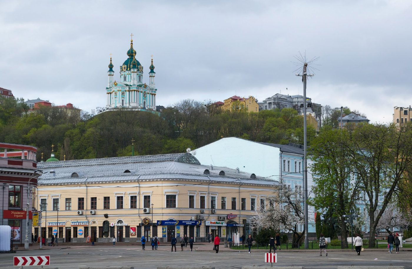
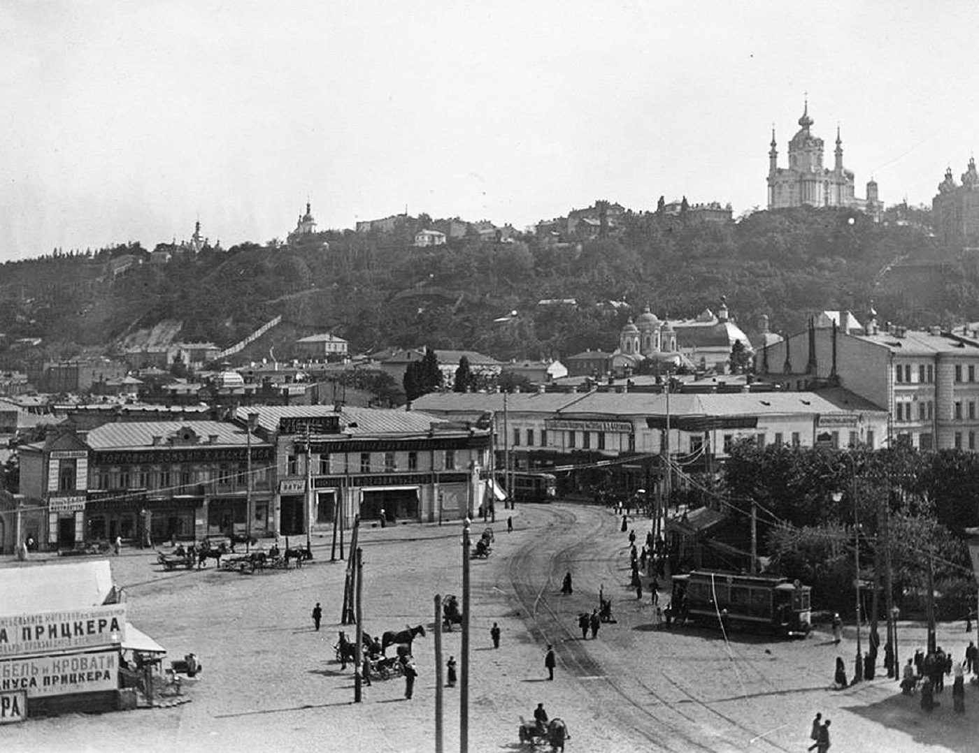
Kontraktova Square, PodilKontraktova SquareKontraktova Square in Podil in the early 20th century, with a tram, horse cabs, shops and St Andrew's Church on the hill. In the modern photo St Andrew's Church rises above the Hostynnyi Dvir arcade.Archival photo: невідомий автор, 1900-ті, Public domain · Wikimedia Commons
Modern photo: Lystopad, 2018, CC BY-SA 4.0 · Wikimedia Commons -
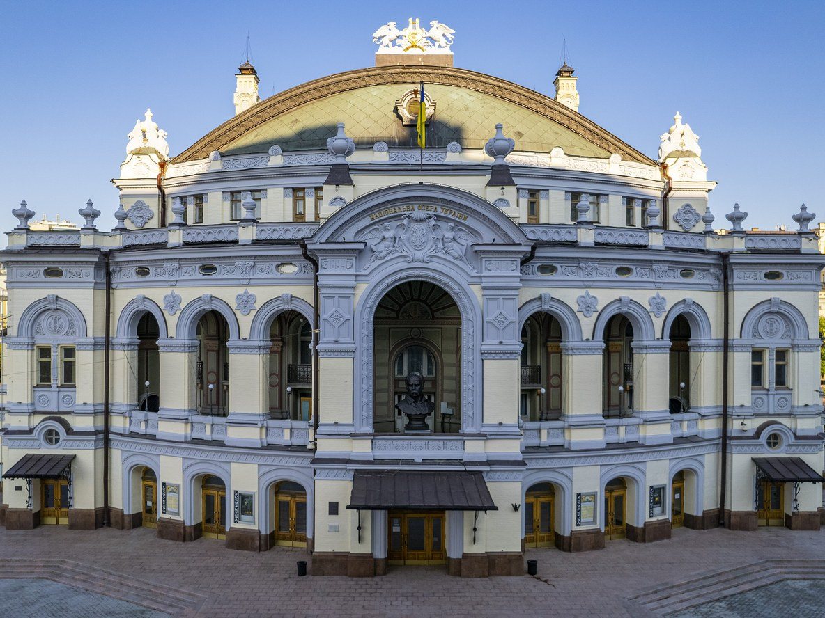
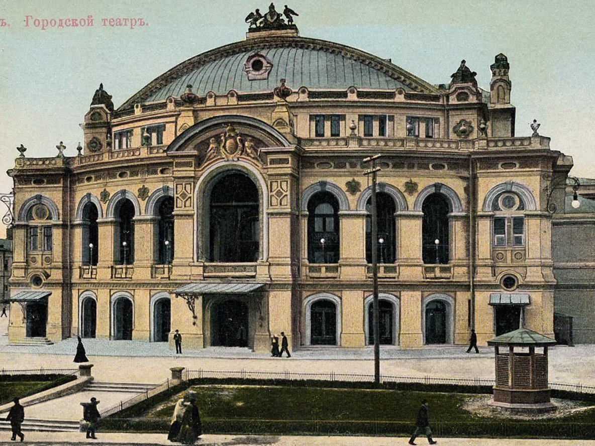
50 Volodymyrska StreetThe City TheatreThe City Theatre, built in 1897–1901 to a design by Viktor Schröter on the site of the old theatre that burned down in 1896. This postcard by the Swedish publisher Granbergs shows the building when it was still new. Today it houses the National Opera of Ukraine.Archival photo: невідомий автор, поч. 1900-х, Public domain · Wikimedia Commons
Modern photo: KyivMax, 2021, CC BY-SA 4.0 · Wikimedia Commons -
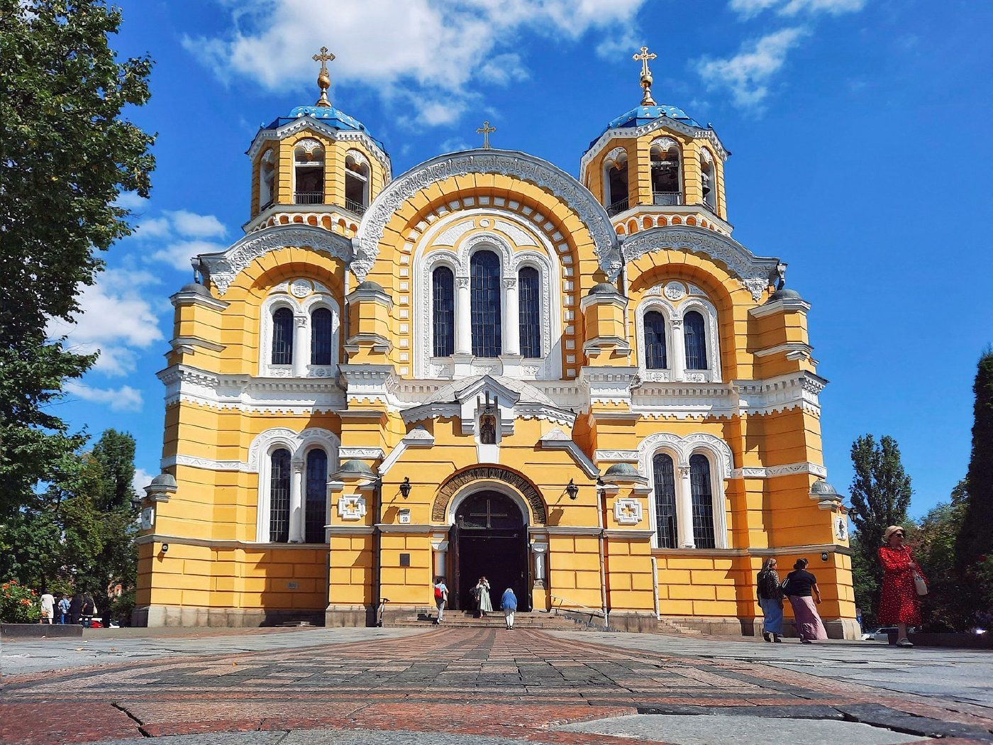
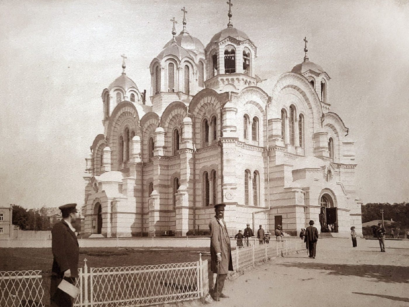
20 Tarasa Shevchenka BoulevardSt Volodymyr's CathedralSt Volodymyr's Cathedral (built 1862–1882, consecrated 1896) soon after the completion of its murals by Viktor Vasnetsov, Mikhail Nesterov and Mikhail Vrubel. In front is a low fence and an empty forecourt; today Tarasa Shevchenka Boulevard runs past with its traffic.Archival photo: невідомий автор, 1895–1910, Public domain · Wikimedia Commons
Modern photo: Taras Zolotavin, 2023, CC BY-SA 4.0 · Wikimedia Commons -
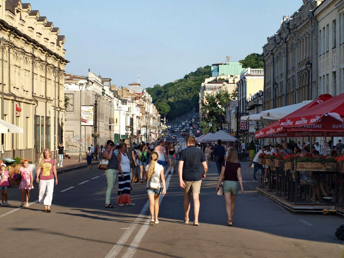
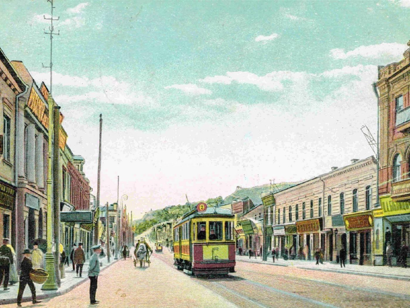
Petra Sahaidachnoho Street, PodilA tram on Oleksandrivska StreetPodil's Oleksandrivska Street (now Petra Sahaidachnoho Street) on a 1905 postcard: a tram, shop signs, No. 20/2 on the left and No. 37 on the right. It is still Podil's main shopping street, although trams no longer run along it.Archival photo: невідомий автор, 1905, Public domain · Wikimedia Commons
Modern photo: Mitte27, 2019, CC BY-SA 4.0 · Wikimedia Commons -
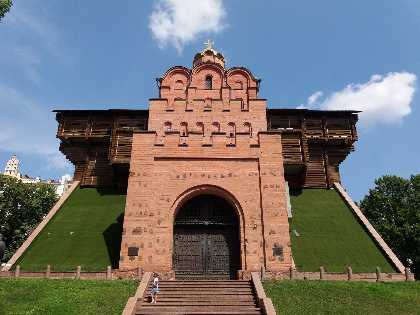
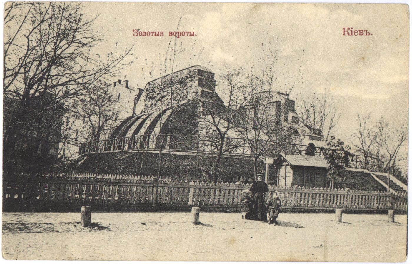
40-A Volodymyrska StreetGolden Gate before reconstructionThe ruins of the 11th-century Golden Gate behind a fence, on a 1910 postcard. In 1982 a pavilion recreating the look of the old gate was built over the ruins.Archival photo: невідомий видавець, 1910, Public domain · Wikimedia Commons
Modern photo: Kon v ant, 2019, CC BY-SA 4.0 · Wikimedia Commons -
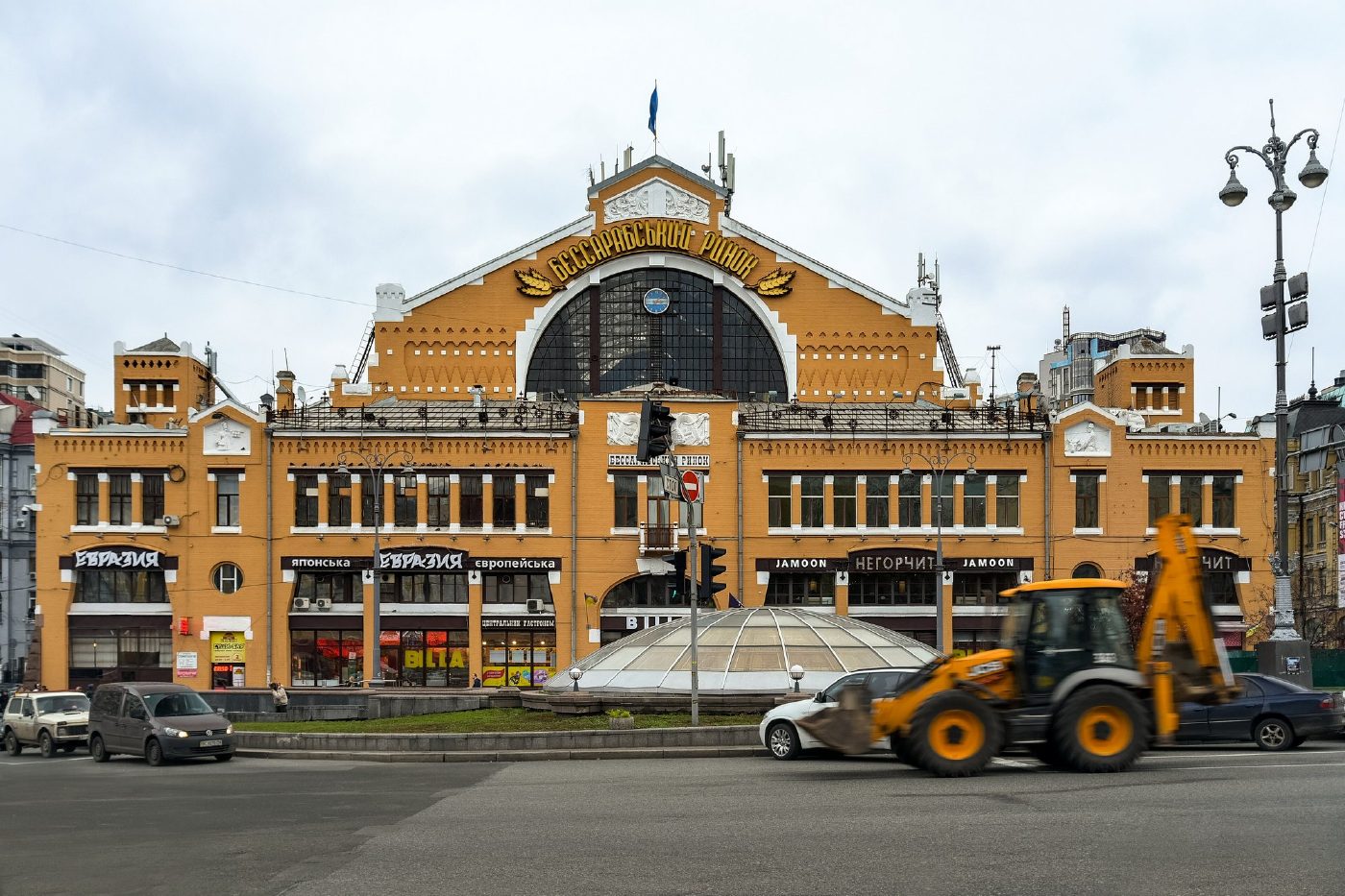
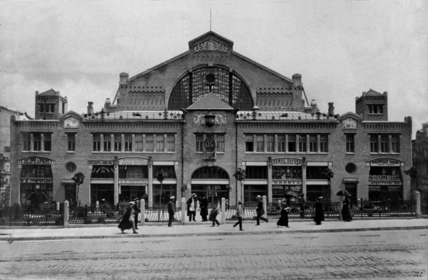
2 Bessarabska SquareBessarabskyi Covered MarketThe Bessarabskyi covered market, photographed before 1917. The building survives, and the square in front of it is now a busy junction at the start of Khreshchatyk.Archival photo: невідомий автор, до 1917, Public domain · Wikimedia Commons
Modern photo: Jorge Franganillo, 2017, CC BY 2.0 · Wikimedia Commons -
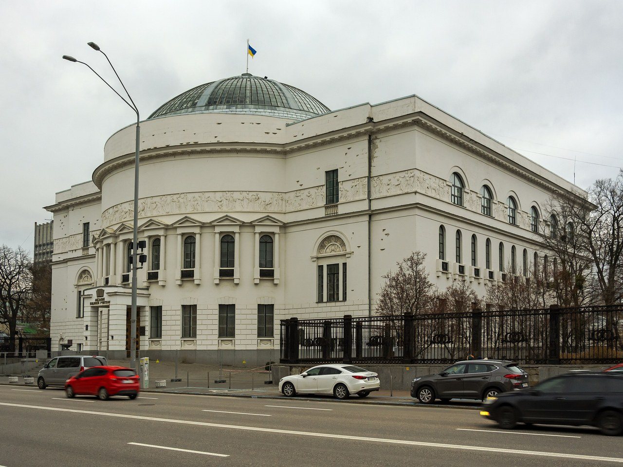
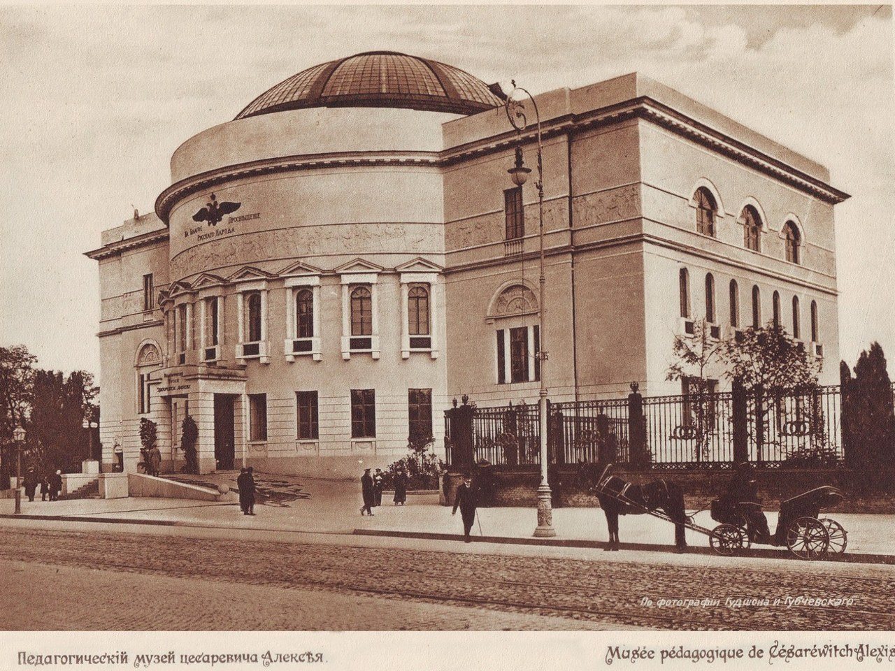
57 Volodymyrska StreetThe Pedagogical MuseumThe Tsarevich Alexei Pedagogical Museum (1909–1911, architect Pavlo Aloshyn) in its opening year. In 1917–1918 it was the seat of the Ukrainian Central Rada, which proclaimed the Ukrainian People's Republic. Today it is the Teacher's House, with a museum of the Ukrainian Revolution.Archival photo: Гудшон і Губчевський, 1911, Public domain · Wikimedia Commons
Modern photo: Сергій Венцеславський, 2021, CC BY-SA 4.0 · Wikimedia Commons -
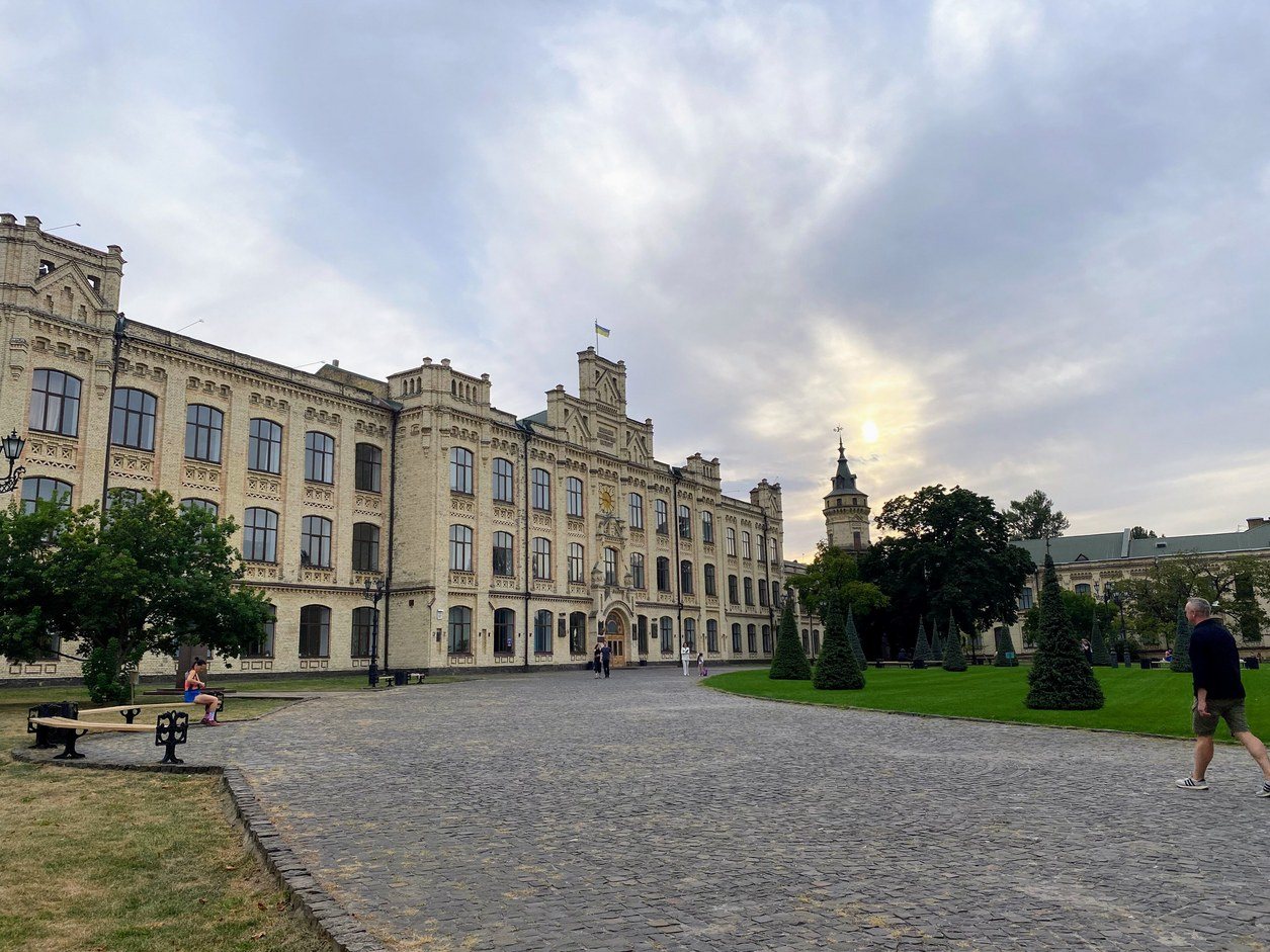
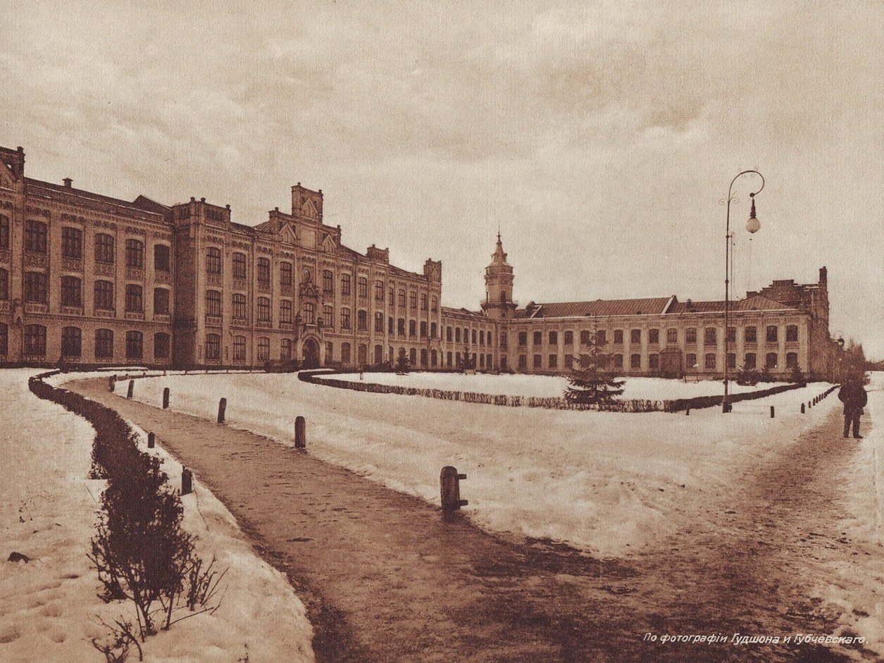
37 Beresteiskyi AvenueThe Polytechnic InstituteThe main building of the Emperor Alexander II Kyiv Polytechnic Institute, founded in 1898, in winter 1911. It then stood among fields on the edge of town; today it is the Igor Sikorsky Kyiv Polytechnic Institute, one of Ukraine's largest technical universities.Archival photo: Гудшон і Губчевський, 1911, Public domain · Wikimedia Commons
Modern photo: Мандрівниця, 2024, CC BY-SA 4.0 · Wikimedia Commons




From the archive
-
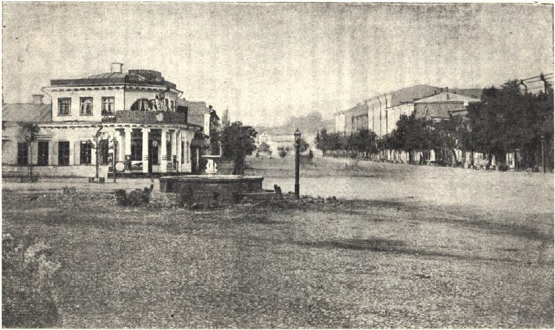
European SquareKhreshchatyk from the Tsar's GardenA photograph by Yosyp Kordysh, one of Kyiv's first photographers: the view from the Tsar's Garden towards today's European Square and the start of Khreshchatyk. The "Ivan" fountain still stands here before its 1871 rebuilding, surrounded by low manor-style houses. Today the site is occupied by the Ukrainian House, the Dnipro Hotel and a metro exit.Archival photo: Йосип Кордиш, поч. 1870-х, Public domain · Wikimedia Commons -
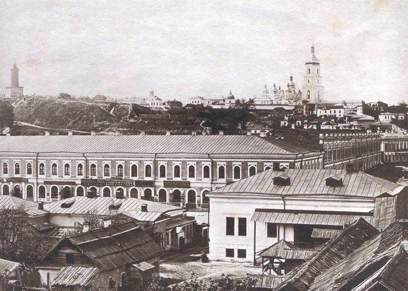
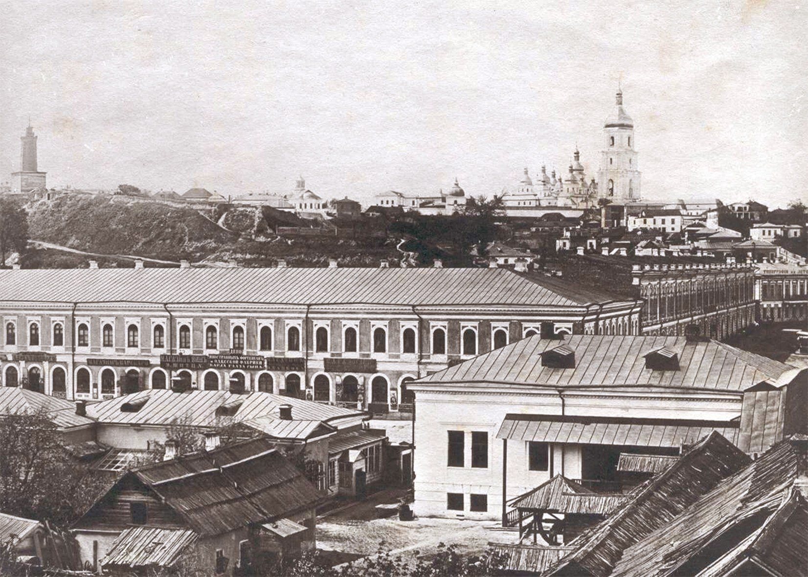
KhreshchatykTwo-storey KhreshchatykKhreshchatyk around 1870: in the foreground is the long Eisman building with its shops (No. 20 in the old numbering), and behind it the slopes of the Old Town with monastery domes and bell towers. The main street was only just being built up; the Eisman house, later enlarged, was destroyed in autumn 1941.Archival photo: невідомий автор, 1870, Public domain · Wikimedia Commons -
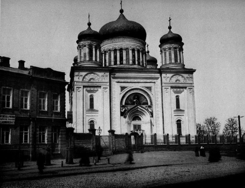
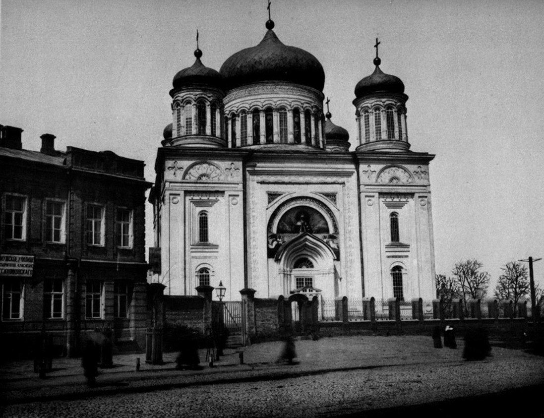
Desiatynna StreetThe Stasov Church of the TithesThis church was built in 1828–1842 to a design by Vasily Stasov, on the site of the Church of the Tithes, the first stone church of Rus, which was destroyed in 1240. It was dismantled in 1928. Today only the stone-marked foundations of the ancient church can be seen on Starokyivska Hill.Archival photo: С. В. Кульженко, 1888, Public domain · Wikimedia Commons -
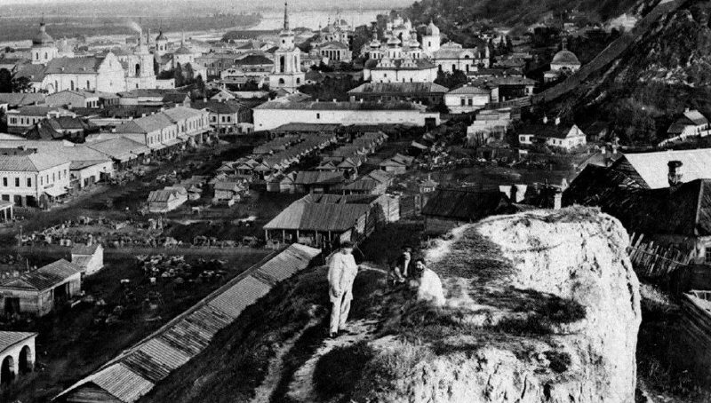
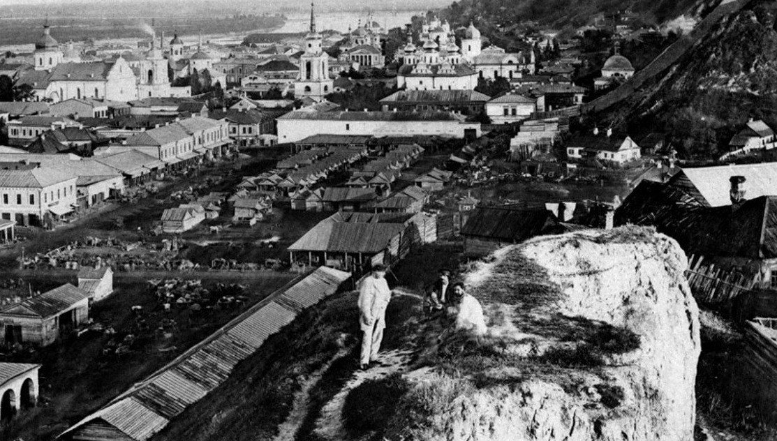
Verkhnii Val Street, PodilZhytnii MarketZhytnii Market in Podil seen from the surrounding hills: rows of shops and stalls, Podil churches and the Dnipro beyond, and St Andrew's Church on the hill to the right. Trade still goes on here: the site is occupied by the Zhytnii Market, whose building dates from 1980.Archival photo: С. В. Кульженко, 1888, Public domain · Wikimedia Commons -
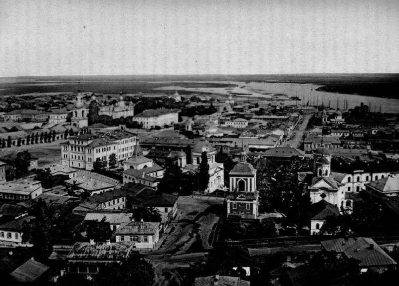
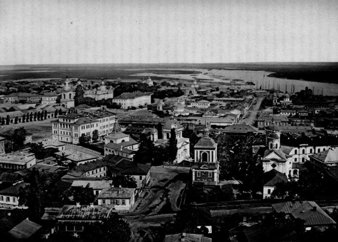
PodilPodil from St Andrew'sA panorama of Podil from the porch of St Andrew's Church. Kulzhenko captioned the Third Gymnasium and the churches of St Nicholas the Good and the Protection; on the horizon are the Dnipro and the floodplain meadows of the left bank, with no housing estates yet.Archival photo: С. В. Кульженко, 1888, Public domain · Wikimedia Commons -
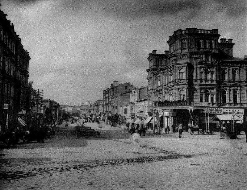
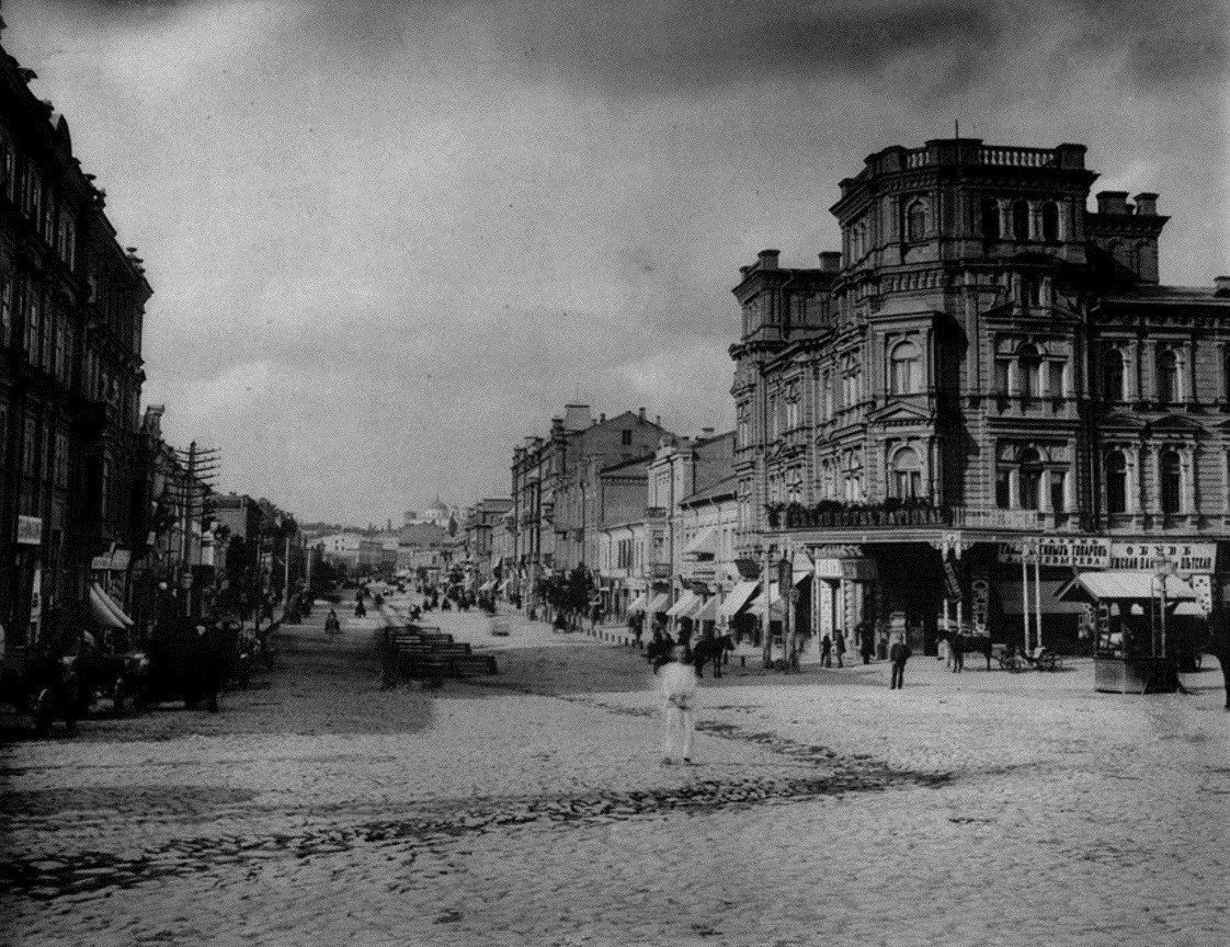
KhreshchatykKhreshchatyk in 1888Khreshchatyk in the late 1880s, still without trams (the electric tram arrived in Kyiv in 1892), with horse-drawn carriages and the first multi-storey apartment buildings. Almost all of the street's buildings of that time perished in 1941, and Khreshchatyk was rebuilt after the war.Archival photo: С. В. Кульженко, 1888, Public domain · Wikimedia Commons -
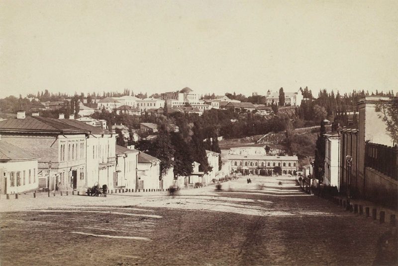
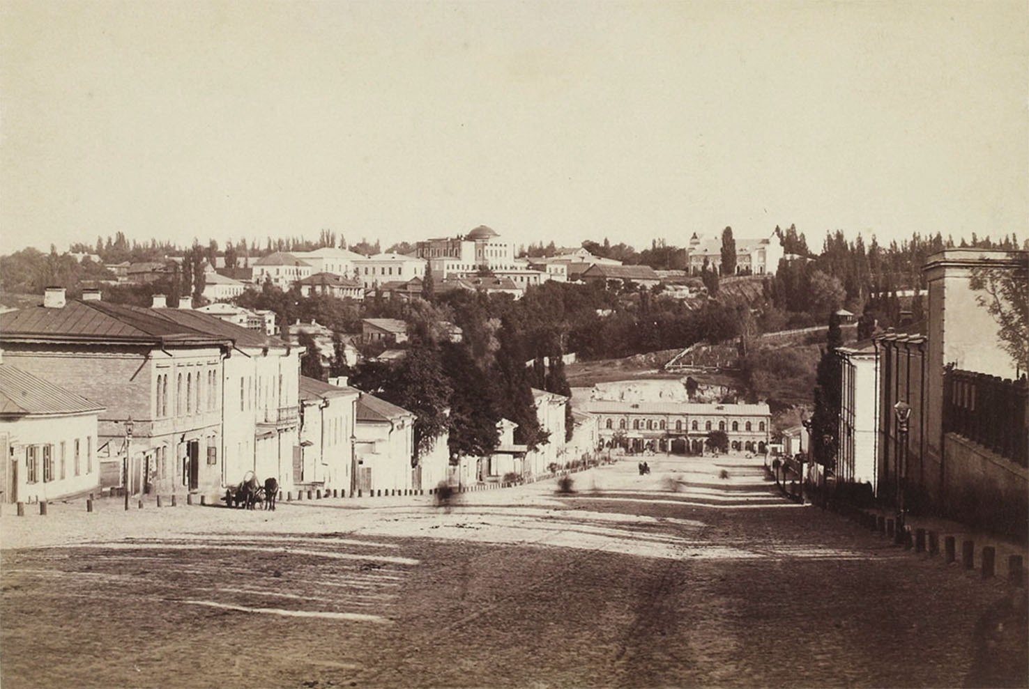
Bohdana Khmelnytskoho StreetLypky and Fundukleivska StreetA panorama of Lypky and today's Bohdana Khmelnytskoho Street (then Fundukleivska) photographed by Yosyp Kordysh in 1886. The street was just being built up with two- and three-storey houses, while the manors of aristocratic Lypky already stood on the hill.Archival photo: Йосип Кордиш, 1886, Public domain · Wikimedia Commons -
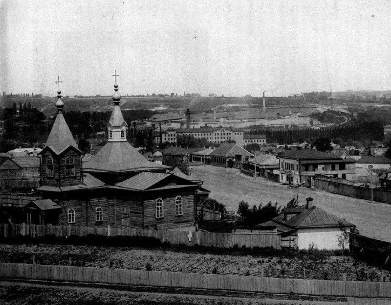
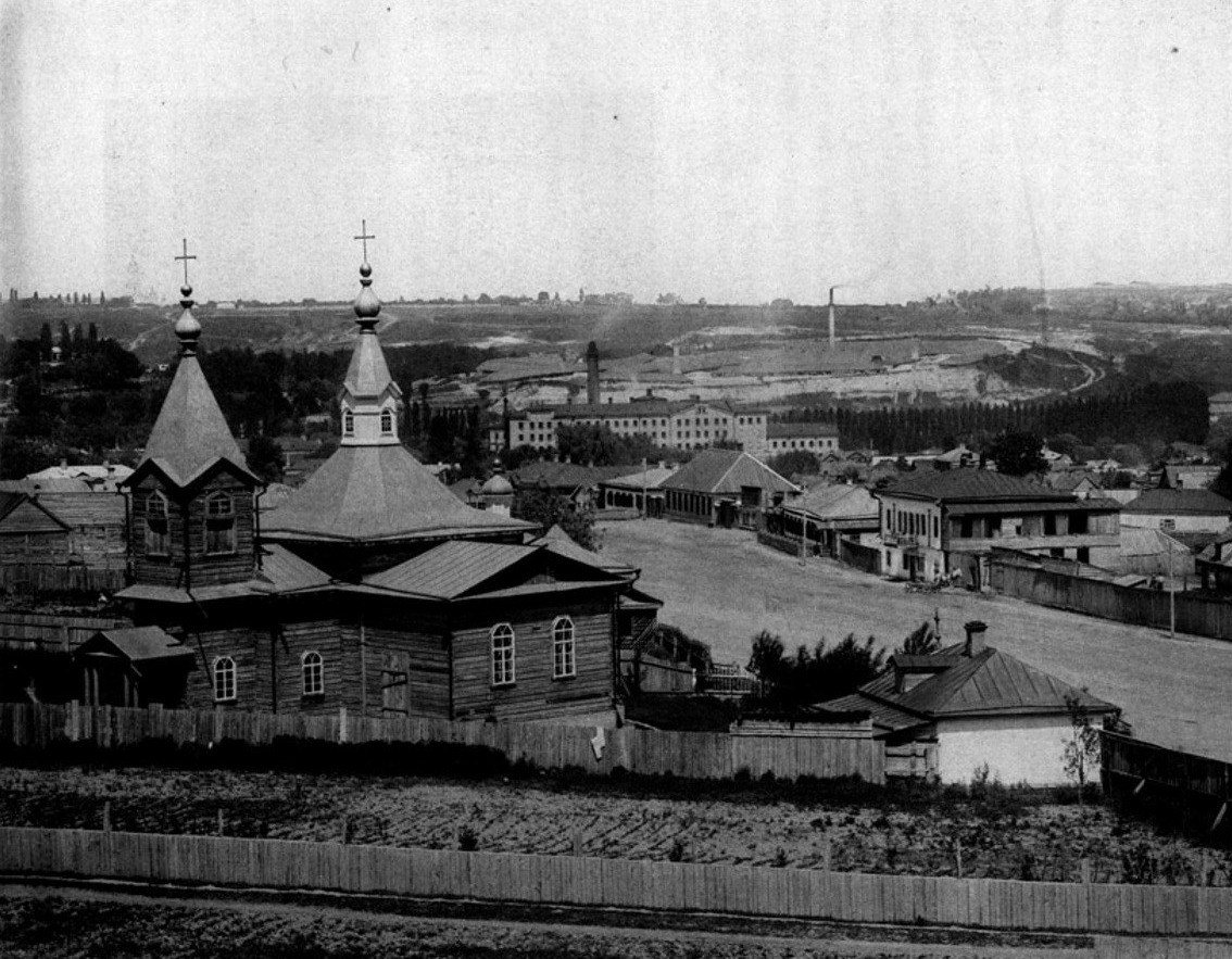
Demiivka, Holosiivskyi DistrictDemiivka suburbDemiivka in 1888, a suburb outside the city limits of the time, with a wooden church, fences and single-storey cottages. It was later incorporated into Kyiv; today it is home to Holosiivskyi Avenue, Demiivska metro station and residential blocks.Archival photo: С. В. Кульженко, 1888, Public domain · Wikimedia Commons -
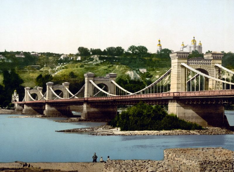
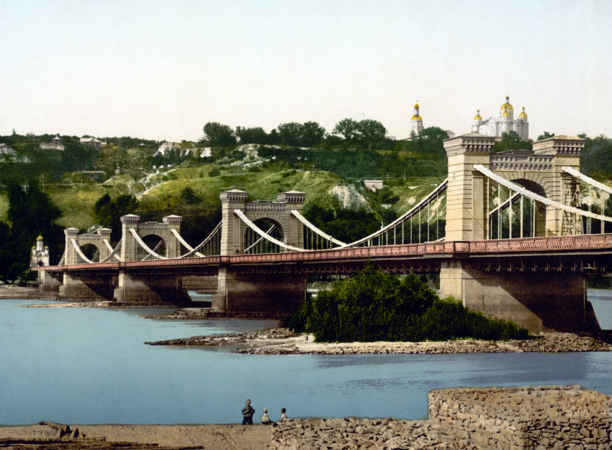
Dnipro River below Volodymyrska HillNicholas Chain BridgeThe chain bridge across the Dnipro, opened in 1853, on an 1890s photochrom print. It was blown up in 1920; the Metro Bridge now stands roughly on the same spot.Archival photo: невідомий автор, бл. 1890–1900, Public domain · Wikimedia Commons -
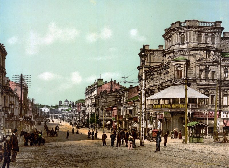
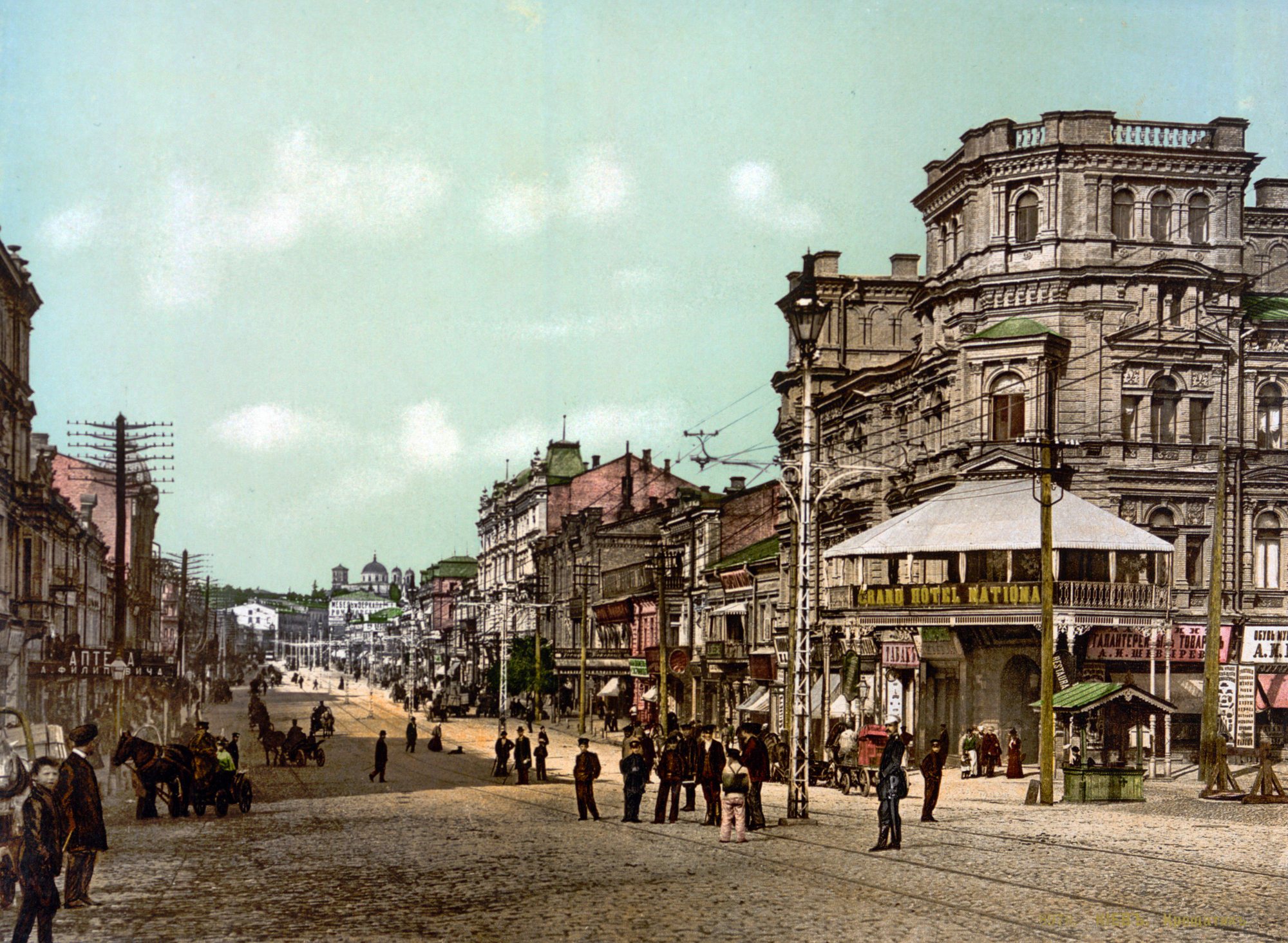
Khreshchatyk, near Bessarabska SquareKhreshchatyk and the Grand Hotel NationalKhreshchatyk on an 1897 postcard: the Grand Hotel National on the right, horse cabs on the cobbles and utility poles and wires above the street.Archival photo: невідомий автор, 1897, Public domain · Wikimedia Commons -
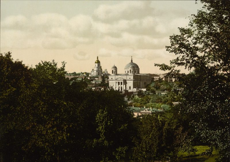
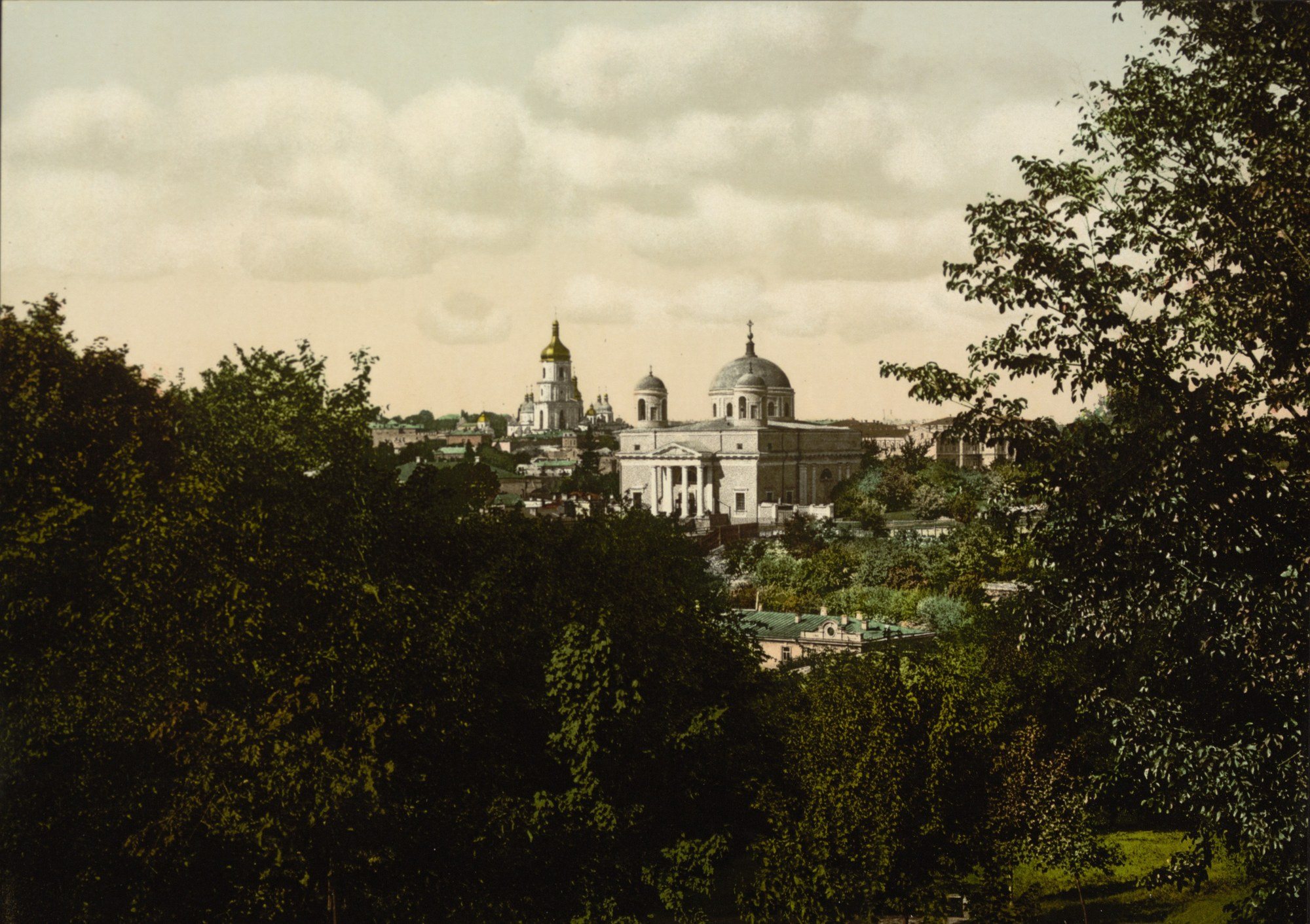
17 Kostolna StreetSt Alexander's ChurchThe Roman Catholic Church of St Alexander (1817–1842) above green slopes in an 1890s photochrom. Kyiv's oldest Catholic church was closed in the 1930s and turned into a planetarium; it was returned to the parish in the 1990s.Archival photo: невідомий автор LCCN 2001697420, бл. 1890–1900, Public domain · Wikimedia Commons -
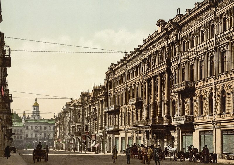
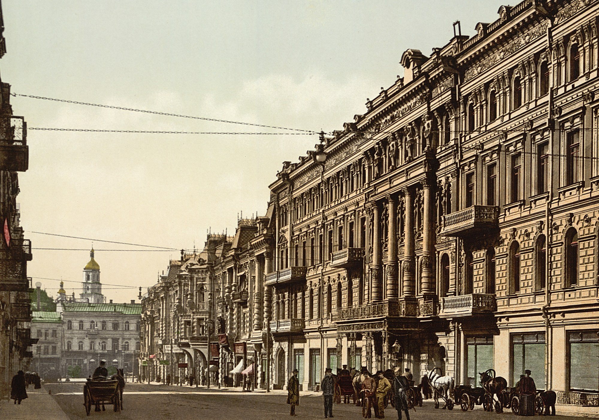
Arkhitektora Horodetskoho StreetNikolaievska Street and the ContinentalNikolaievska Street (now Arkhitektora Horodetskoho Street), laid out in the 1890s, with the fashionable Continental Hotel, where the city's wealthiest visitors stayed. The hotel burned down in September 1941; the National Music Academy of Ukraine now stands on its site.Archival photo: невідомий автор LCCN 2001697432, бл. 1900, Public domain · Wikimedia Commons -
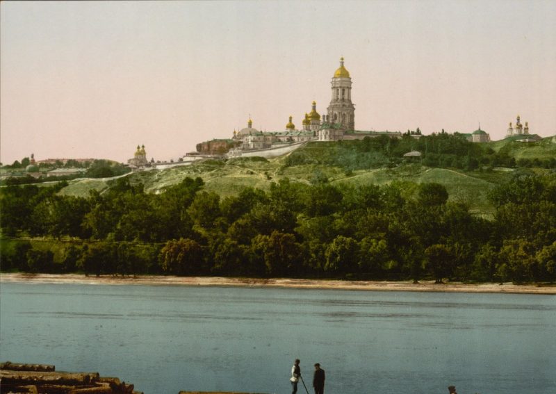
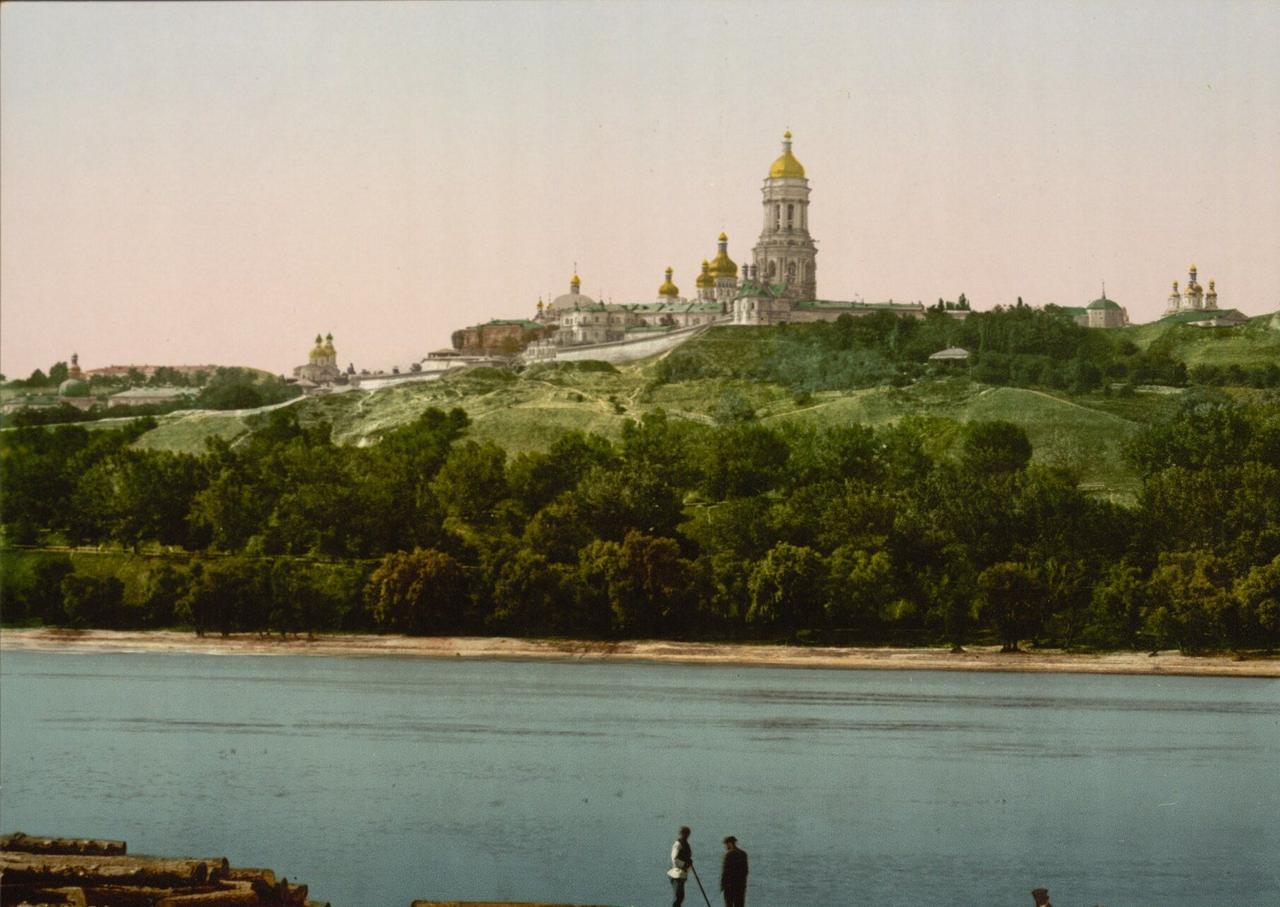
The Dnipro by PecherskThe Lavra from the DniproThe Kyiv Pechersk Lavra on the green bluffs of the right bank, as passengers on Dnipro steamers saw it. Above the trees rise the Great Lavra Bell Tower and the domes of the Dormition Cathedral. Today the Paton Bridge crosses this view and the slopes are parkland.Archival photo: невідомий автор LCCN 2001697428, бл. 1890–1900, Public domain · Wikimedia Commons -
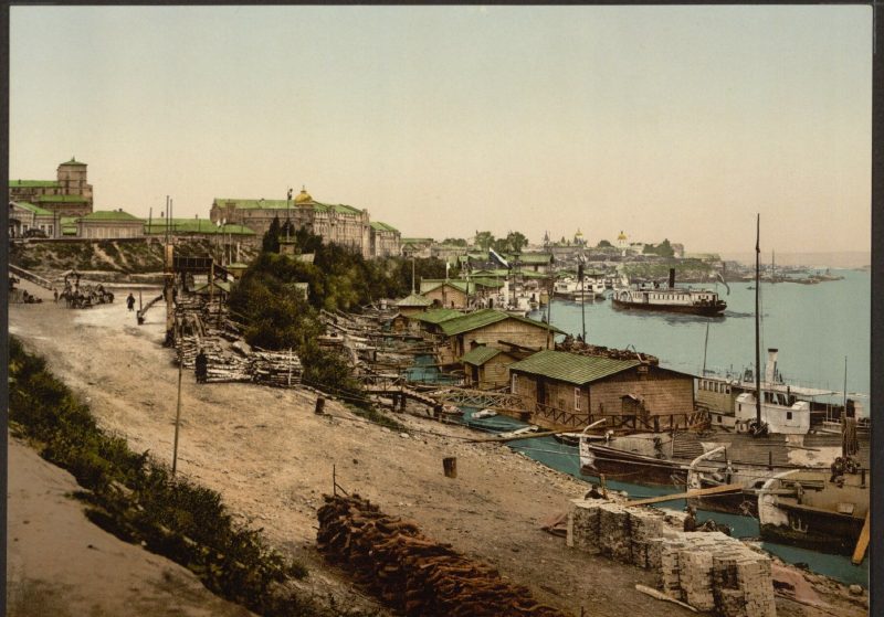
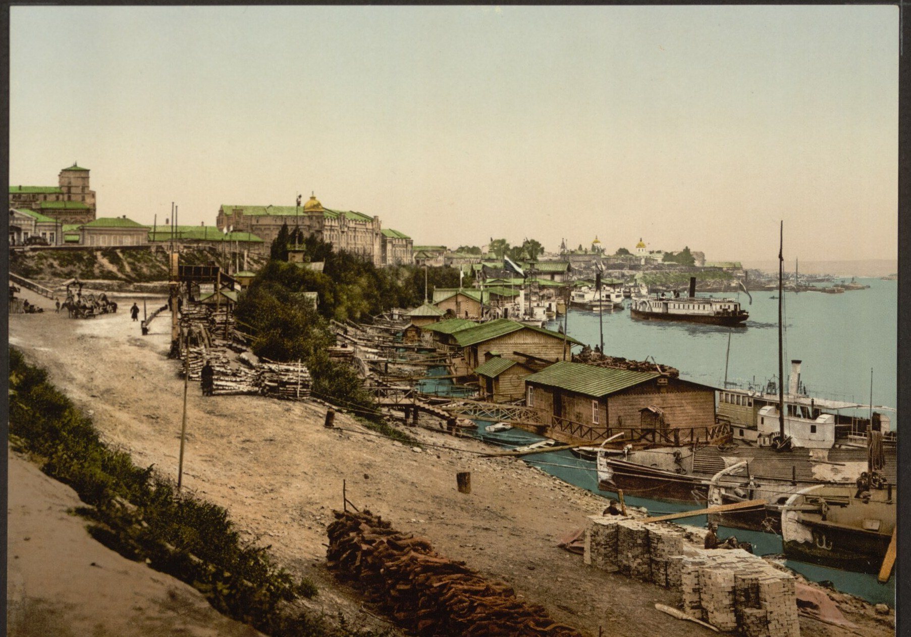
Naberezhne Highway, PodilPiers on the DniproThe riverside near Podil at the end of the 19th century: landing stages, barges, steamers and stacks of firewood on the sandy bank. The Dnipro was then the city's main trade route. Today this is the area of Poshtova Square, the river terminal and a wide embankment.Archival photo: невідомий автор LCCN 2001697440, бл. 1890–1900, Public domain · Wikimedia Commons -
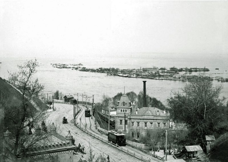
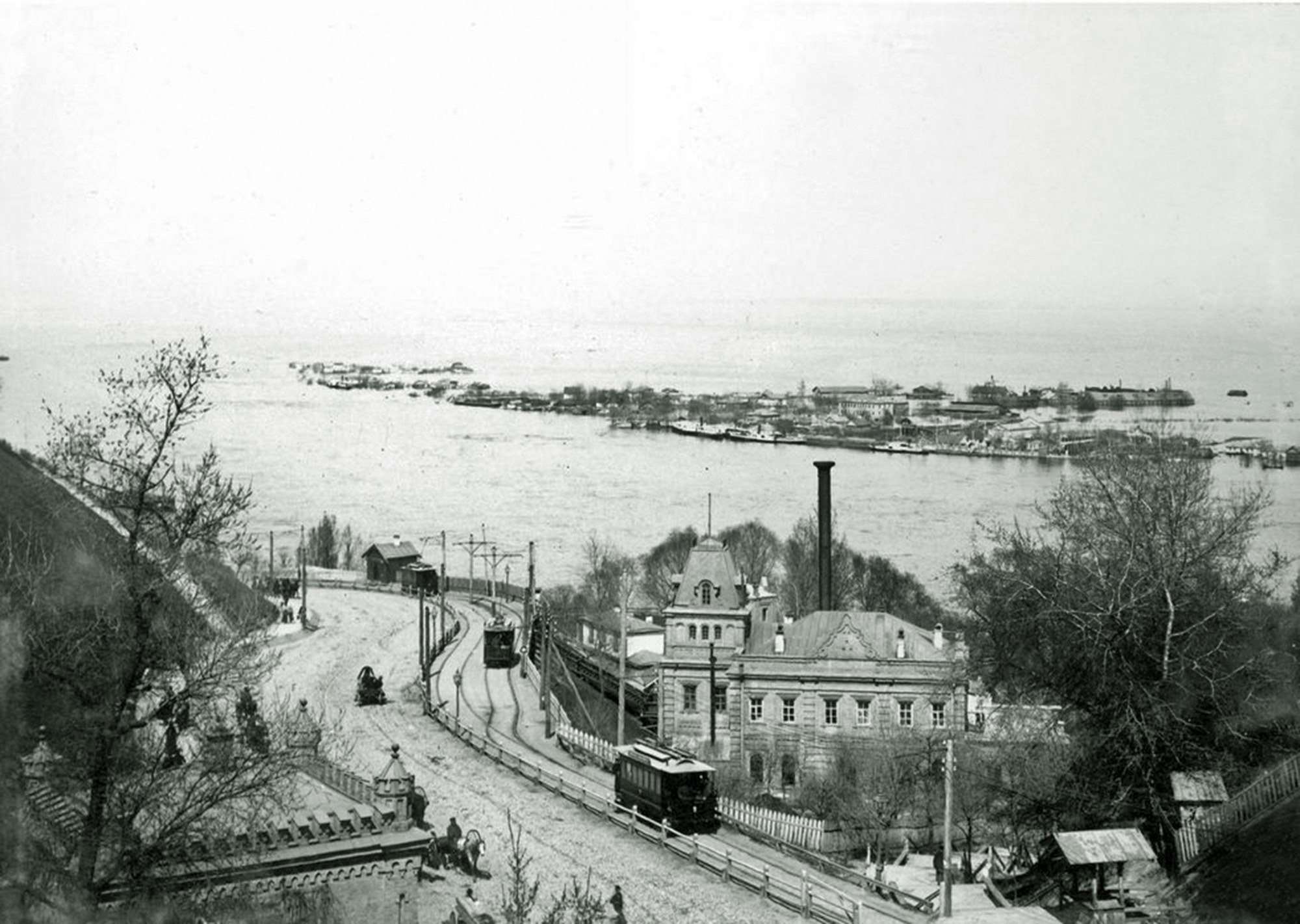
Volodymyrskyi UzvizA tram on the descentOleksandrivskyi (now Volodymyrskyi) Uzviz in 1895: a tram heads down to Podil past the filter house of the city waterworks. Ukraine's first electric tram began running here in 1892. Across the Dnipro, Trukhaniv Island lies under the spring flood.Archival photo: невідомий автор, 1895, Public domain · Wikimedia Commons -
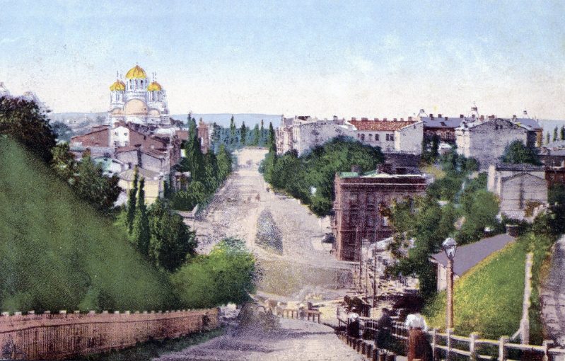
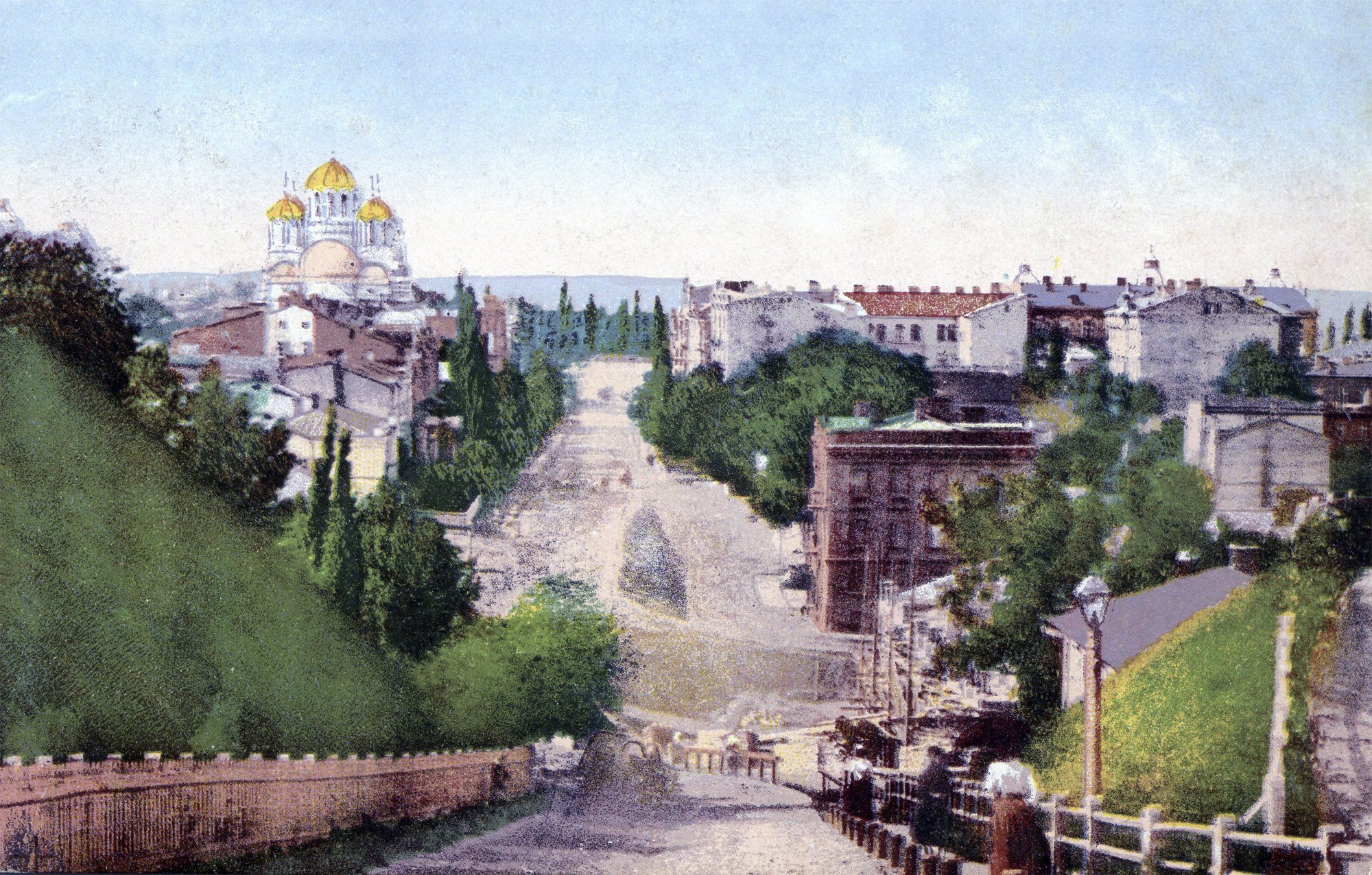
Ivana Franka StreetNesterivska StreetNesterivska Street (now Ivana Franka Street) runs down into the Afanasiivskyi ravine, with St Volodymyr's Cathedral, consecrated in 1896, at the top. This postcard by August Richter's publishing house shows a district not yet fully built up: steep slopes, fences and new apartment houses.Archival photo: невідомий автор, 1899, Public domain · Wikimedia Commons -
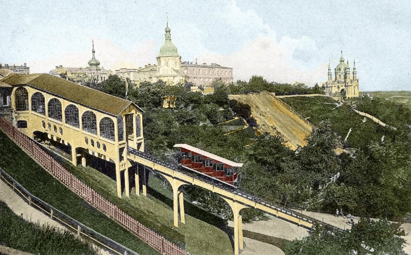
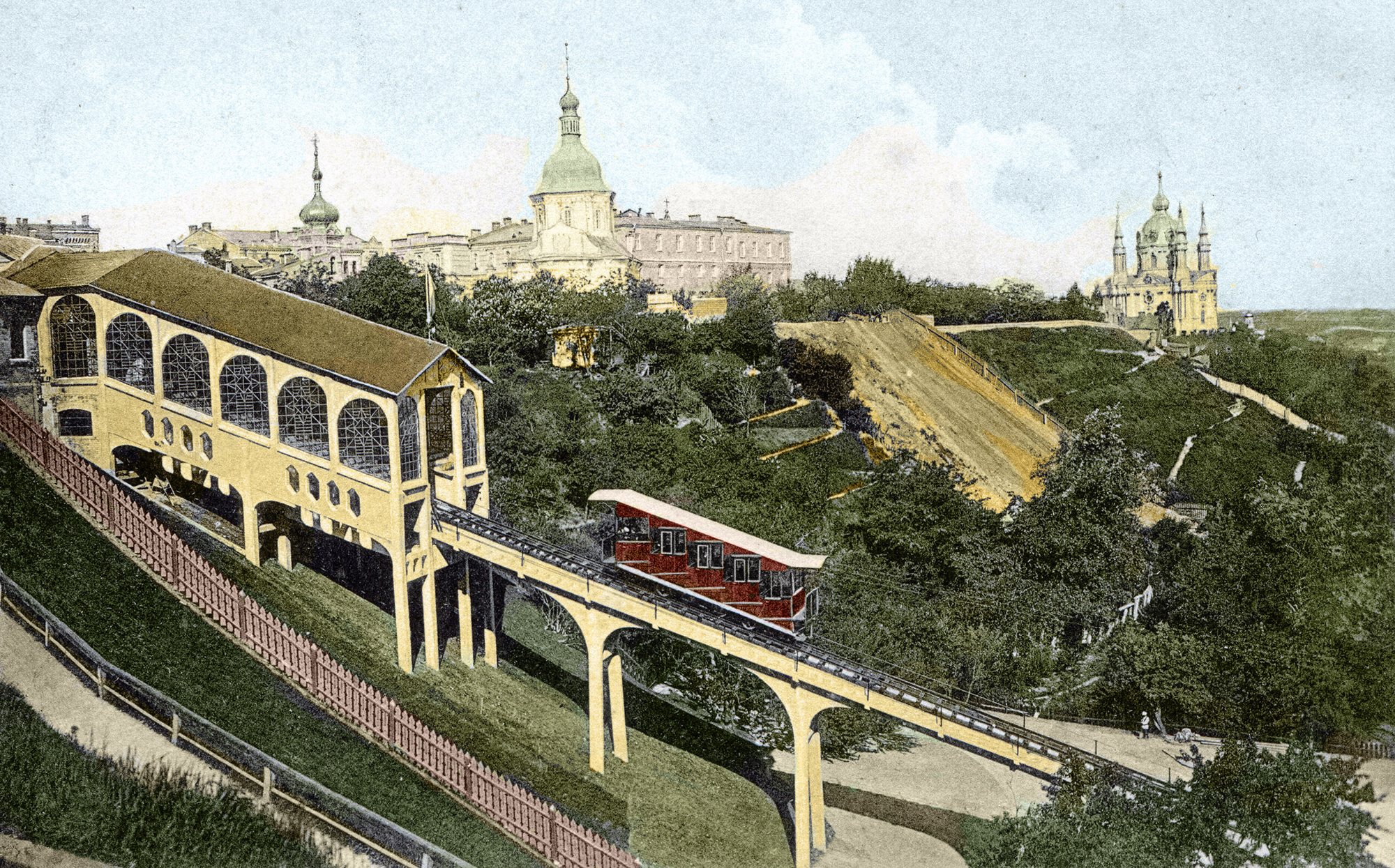
Volodymyrska Hill to Poshtova SquareThe funicular in its opening yearThe Mykhailivskyi mechanical lift (funicular), photographed by Dmytro Markov in 1905, the year it opened. At the top is the Church of the Three Saints, demolished in the 1930s, and St Andrew's Church is on the right.Archival photo: Дмитро Марков, 1905, Public domain · Wikimedia Commons -
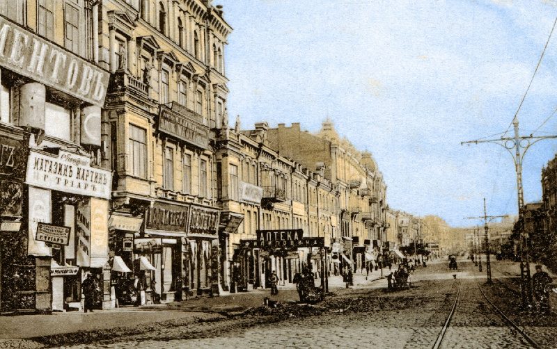
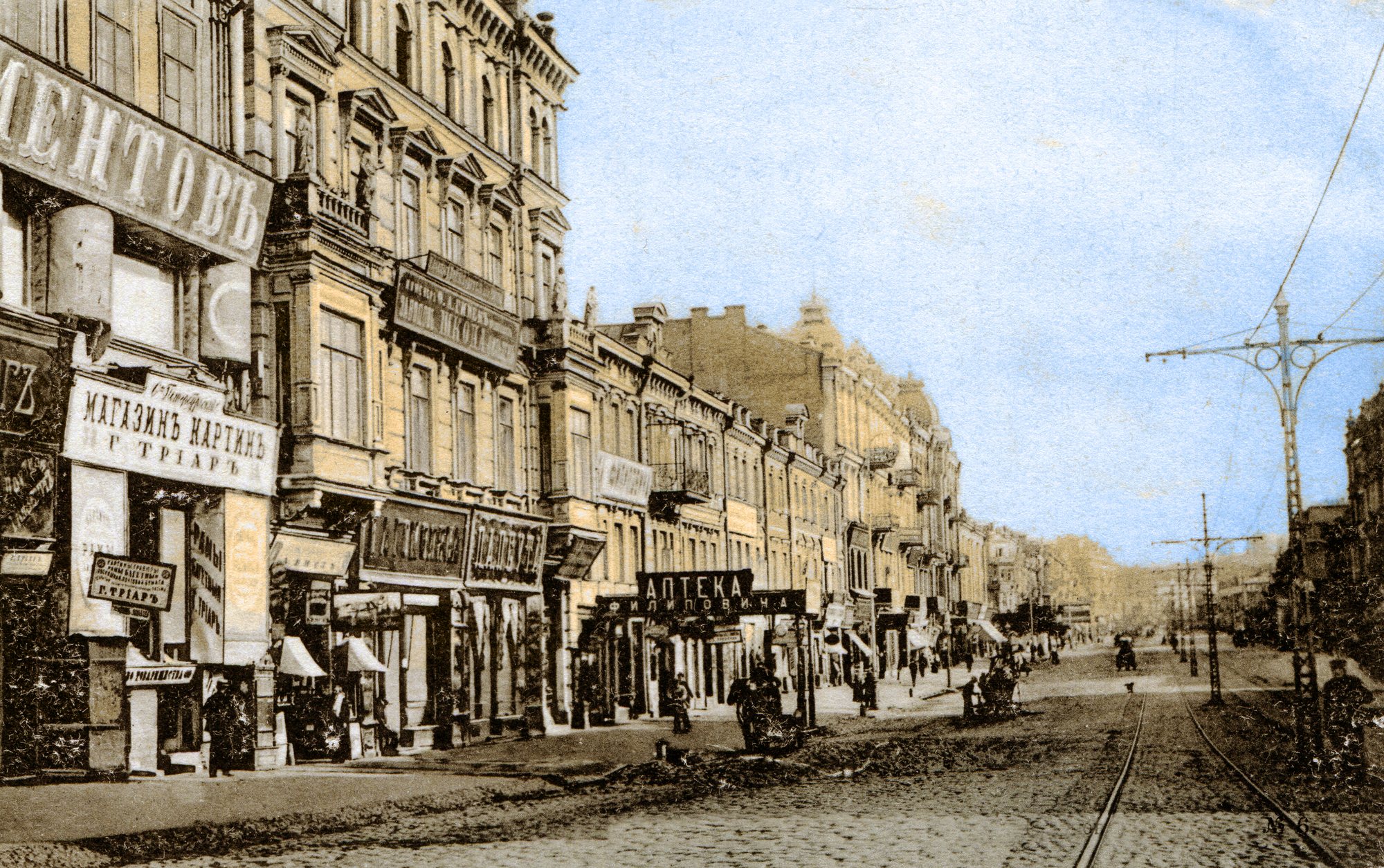
KhreshchatykKhreshchatyk with tramsKhreshchatyk at the beginning of the 20th century: shop signs, tram tracks, overhead line poles and cobbles. On the left are Nos. 50, 48 and 46 in the numbering of the time. Within a few years the street would be paved with asphalt and built up even more densely.Archival photo: невідомий автор, 1900–1905, Public domain · Wikimedia Commons -
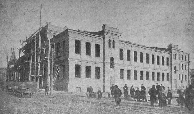
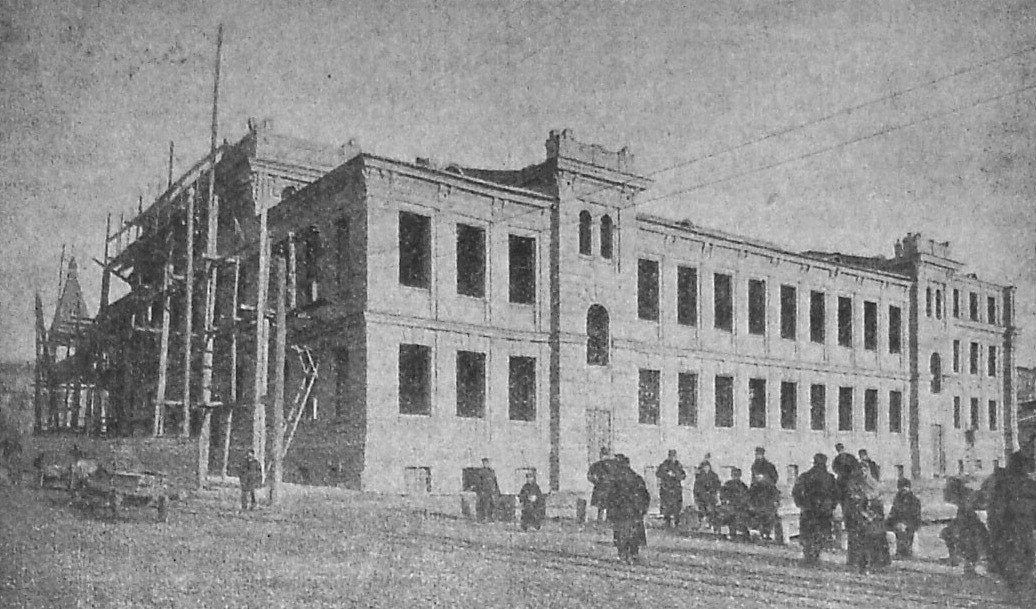
53/3 Velyka Vasylkivska StreetBuilding the Trinity People's HouseFebruary 1902: the Trinity People's House under construction on Velyka Vasylkivska Street, a cultural centre with a theatre hall, library and tea room for less well-off townspeople. Various theatres later used the building; today it is home to the Kyiv National Academic Operetta Theatre.Archival photo: невідомий автор, 1902, Public domain · Wikimedia Commons -
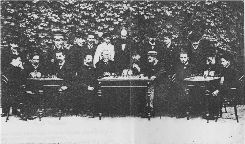
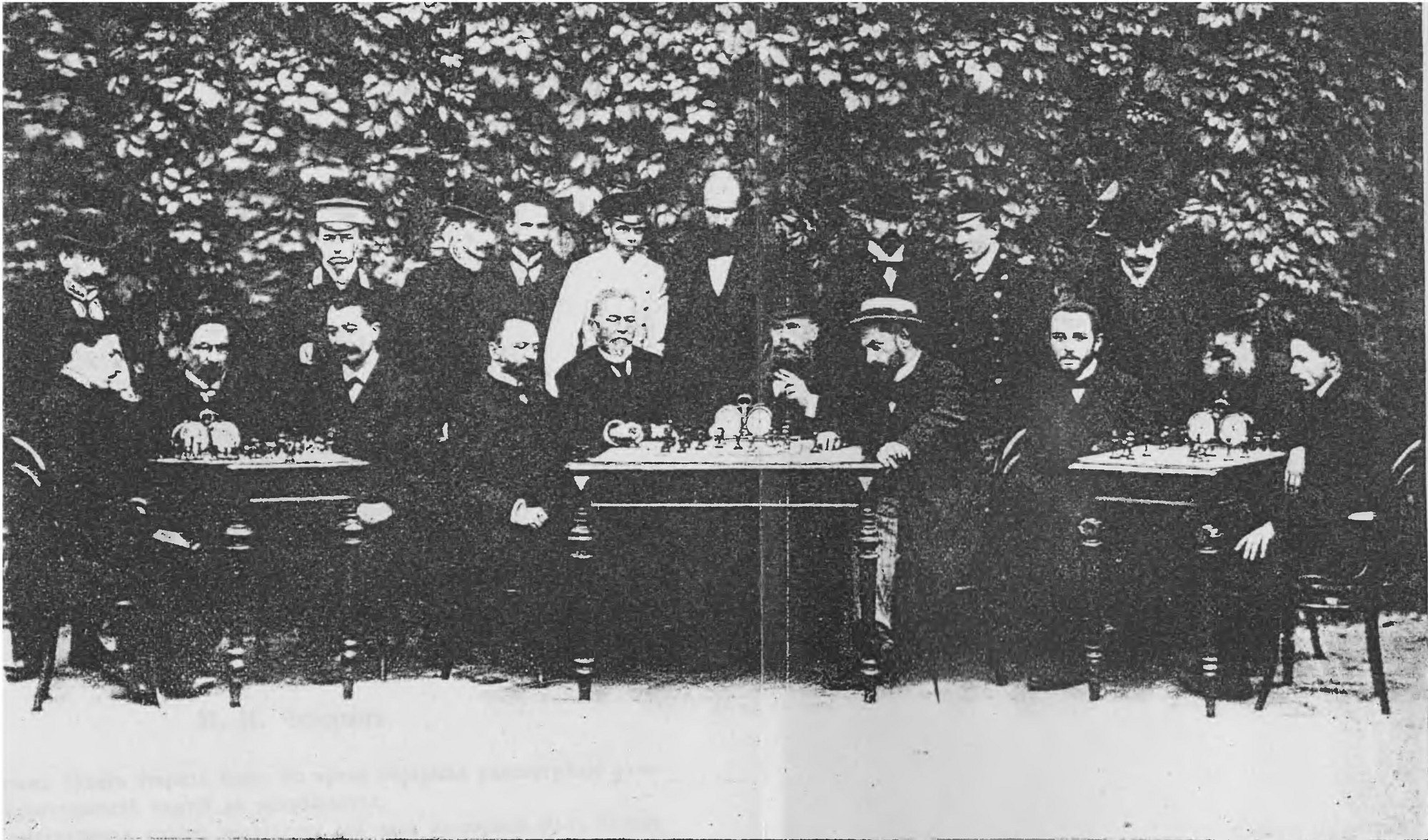
KyivChess tournament in KyivPlayers at the Third All-Russian Chess Tournament, held in Kyiv in September 1903. It was won by Mikhail Chigorin, the strongest player in the empire at the time.Archival photo: І. Н. Афанасьєва, 1903, Public domain · Wikimedia Commons -
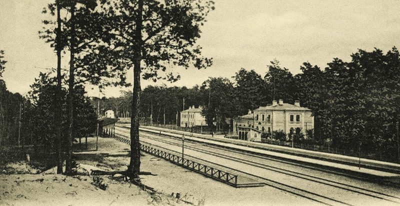
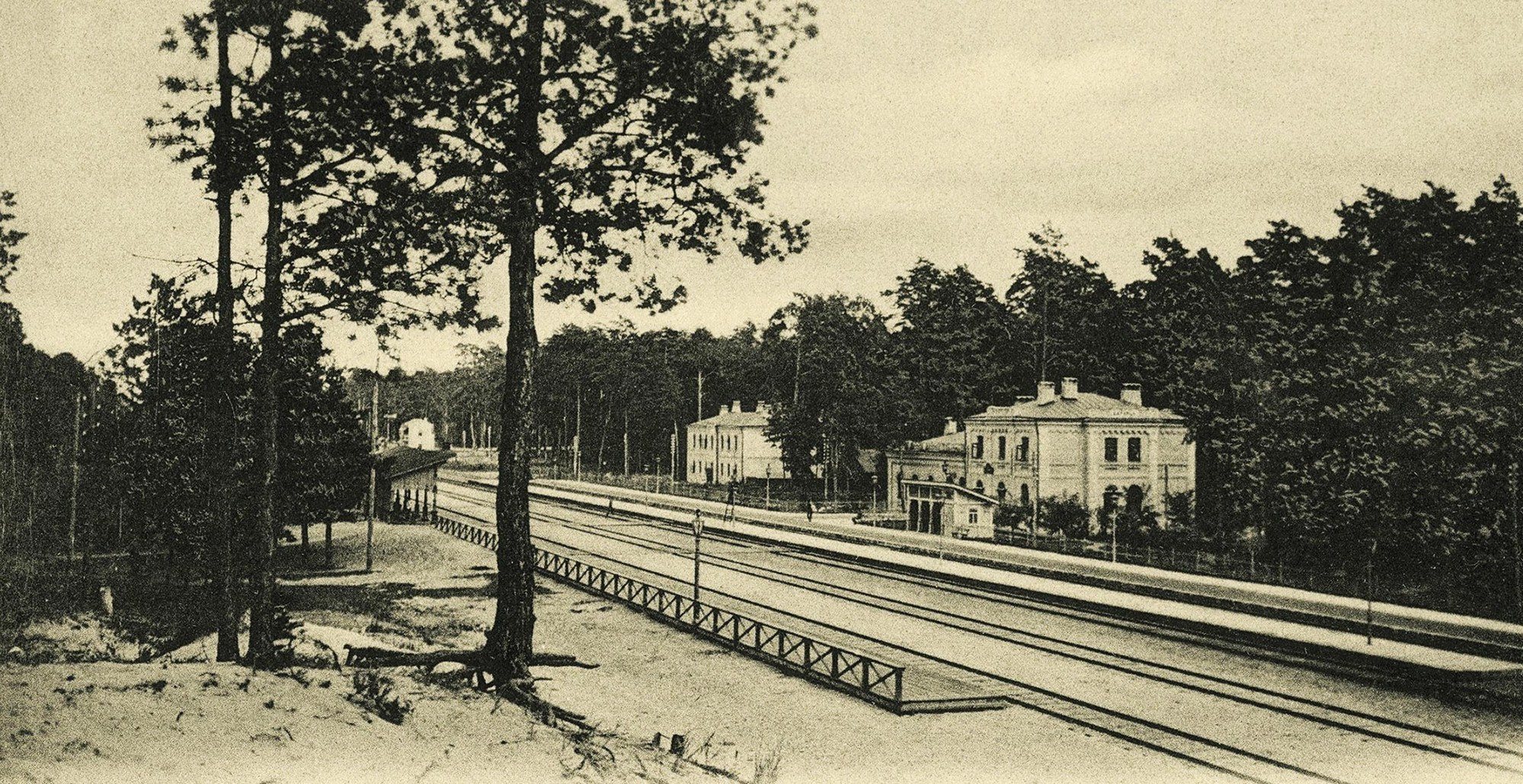
Darnytsia, left bankDachas in DarnytsiaThe railway station and dachas in the pine woods of Darnytsia on a 1904 postcard by photographer Dmytro Markov. The left bank was then a summer retreat for Kyivans; today Darnytsia is a large district of factories, housing estates and a railway hub.Archival photo: Дмитро Марков, 1904, Public domain · Wikimedia Commons -
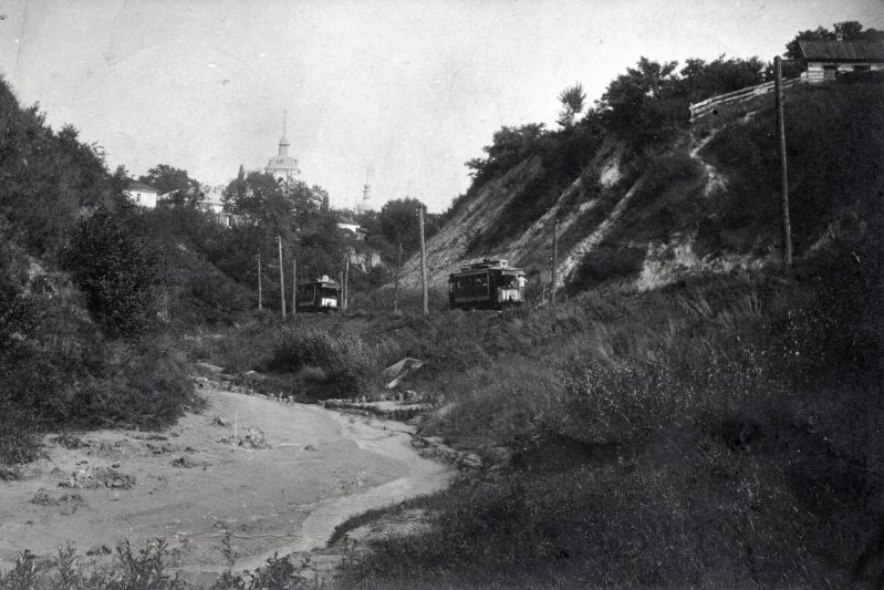
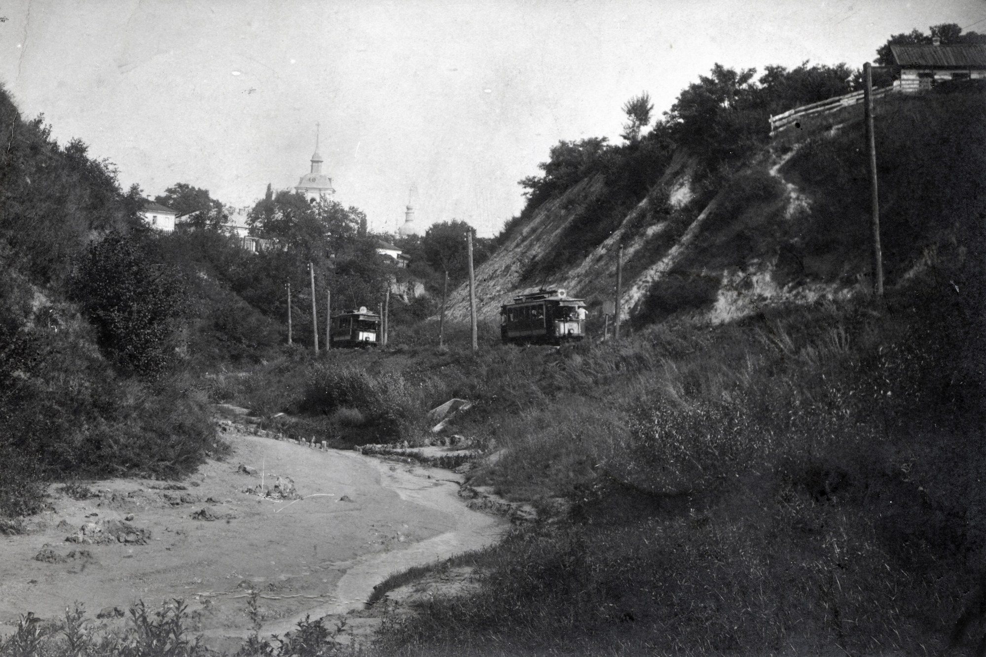
LukianivkaTram in LukianivkaTrams among the ravines of Lukianivka in Dmytro Markov's 1908 photograph. Kyiv was one of the first cities in the Russian Empire to get electric trams, and by the early 20th century the lines linked the centre with outlying suburbs.Archival photo: Дмитро Марков, 1908, Public domain · Wikimedia Commons -
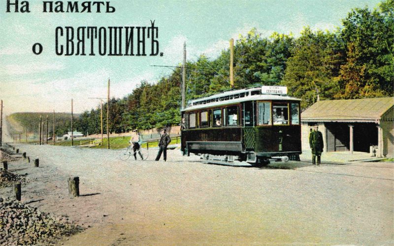
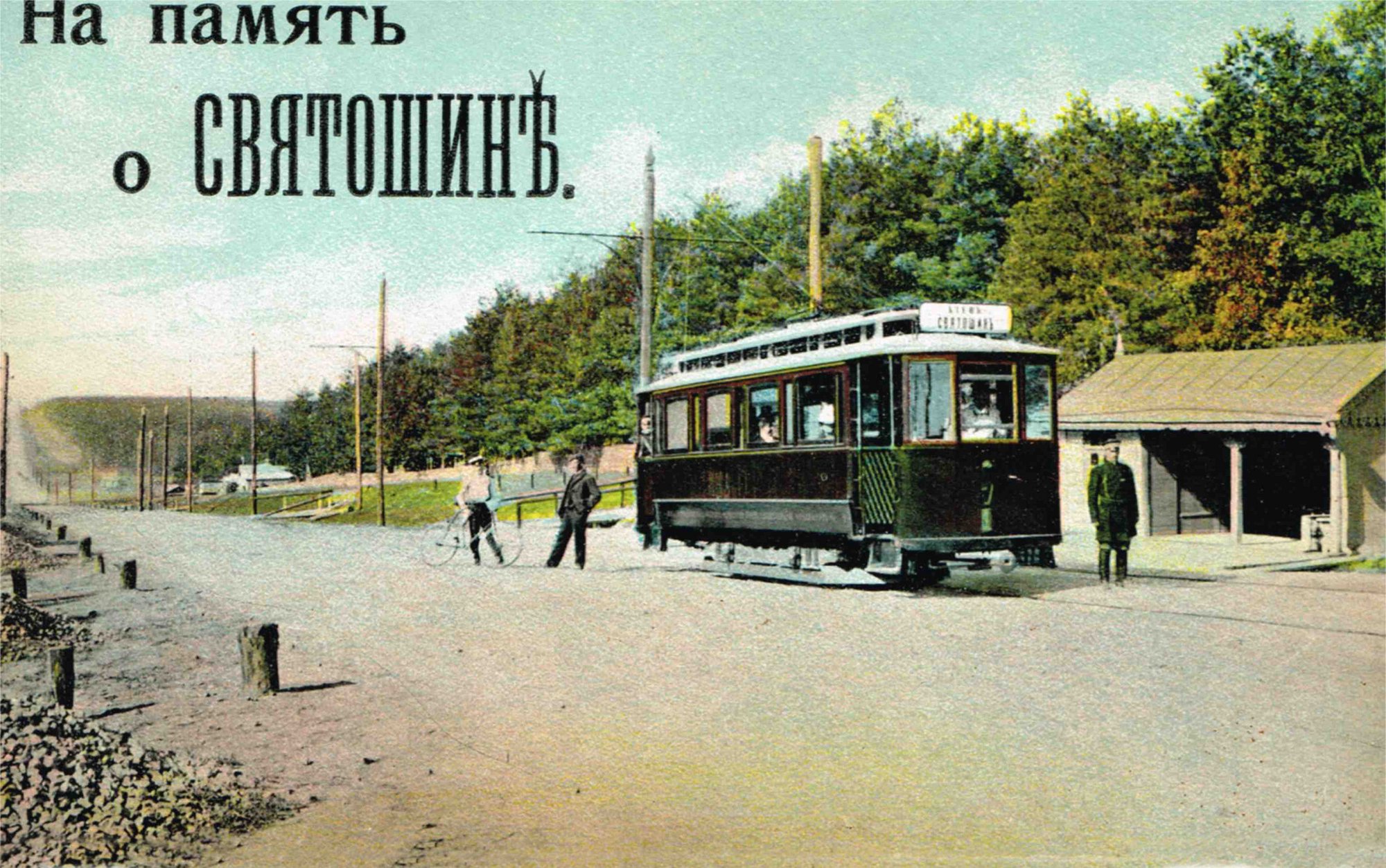
SviatoshynTram in SviatoshynThe Sviatoshyn tram on a 1912 postcard by Dmytro Markov: a tramcar at a stop in Sviatoshyn, then a dacha suburb of Kyiv.Archival photo: Дмитро Марков, 1912, Public domain · Wikimedia Commons -
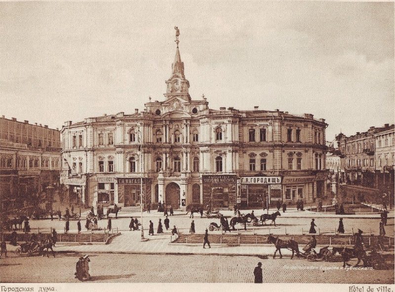
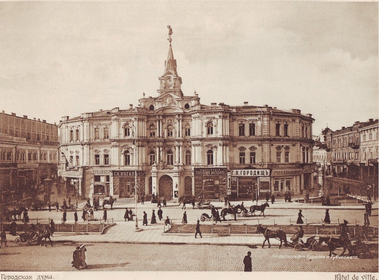
Maidan NezalezhnostiThe City DumaThe City Duma building (1876–1878, architect Oleksandr Schille), with a figure of Archangel Michael on its spire, stood on Duma Square, today's Maidan Nezalezhnosti. It was destroyed during the Second World War and the ruins were cleared. Archangel Michael returned to the Maidan in 2001, atop the Liadski Gate.Archival photo: Гудшон і Губчевський, 1911, Public domain · Wikimedia Commons -
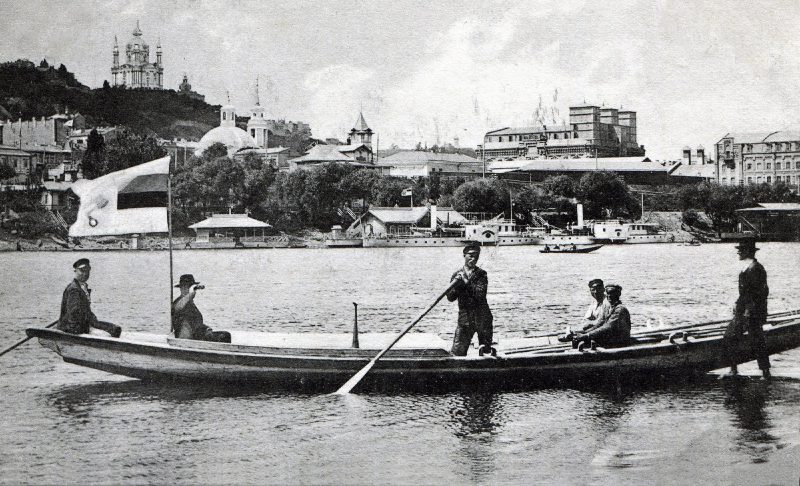
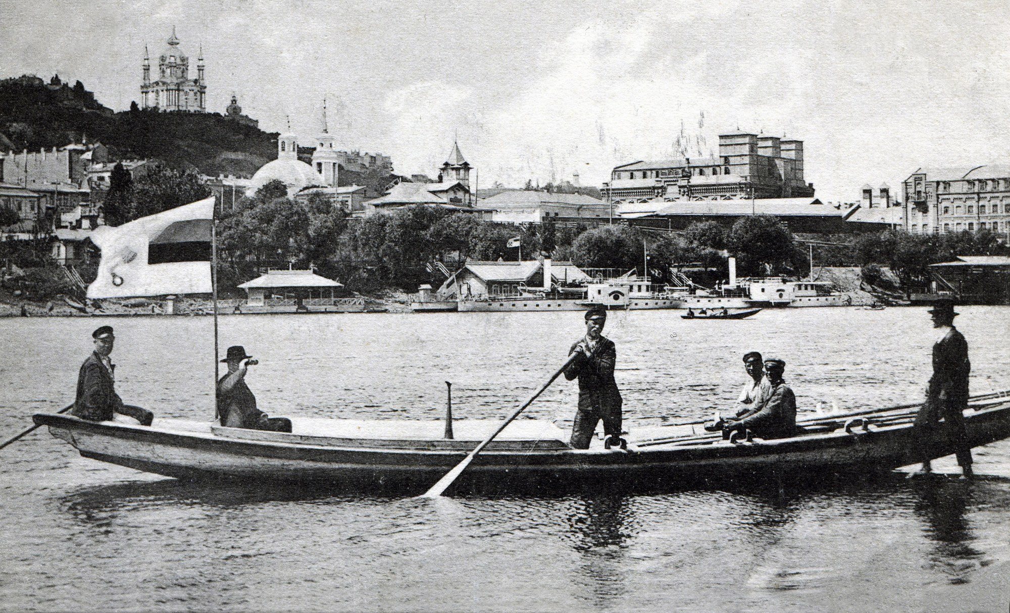
Trukhaniv IslandA boat off Trukhaniv IslandThe view from Trukhaniv Island to Podil: a boat with passengers, steamers at the piers and St Andrew's Church on the hill. The island then had its own settlement, which was burned down during the war; today Trukhaniv is a park with beaches in the middle of the city.Archival photo: невідомий автор, 1912, Public domain · Wikimedia Commons -
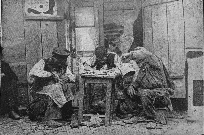
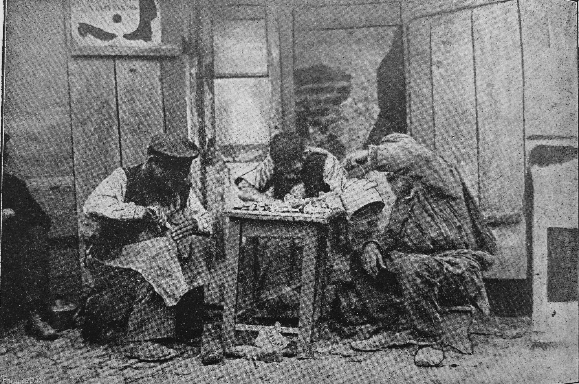
KyivStreet cobblersJewish street cobblers at work, a photograph from the Czech magazine Rudé květy, 1913. Craftsmen with a stool and a toolbox were a familiar sight on Kyiv's streets, especially in Podil and near the markets.Archival photo: невідомий автор, 1913, Public domain · Wikimedia Commons
Have old photos of Kyiv? Send them to [email protected] and we will publish them with credit. Kyiv timeline →