
Archive · then and now
Photo memories
Kyiv in photographs — from the Chain Bridge and horse trams to Euromaidan and the city that held out in 2022. For many of them we found a modern photo taken from the same spot: drag the slider to compare.
Then and now
Drag the divider to compare the old and new photo.
-
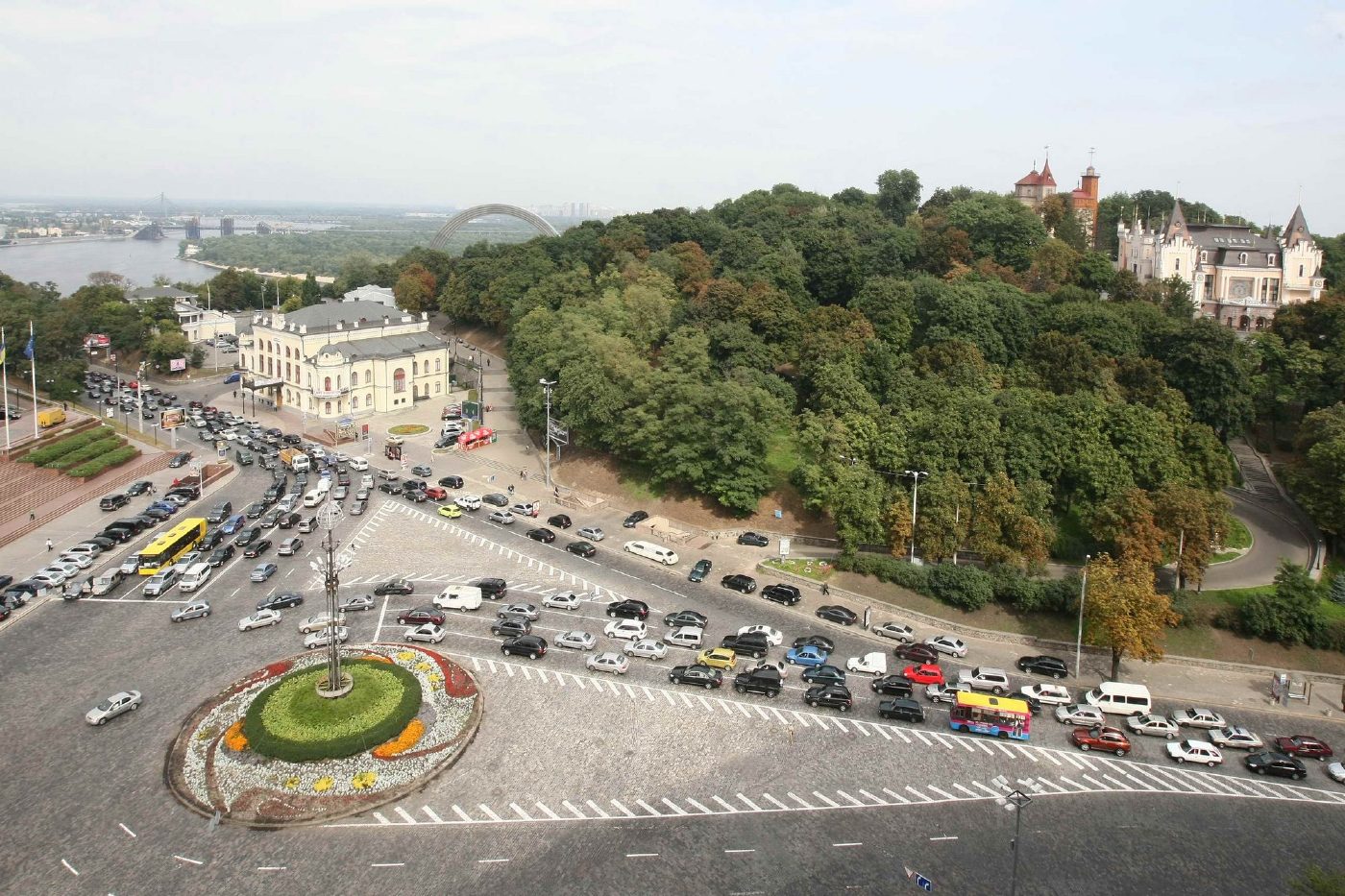
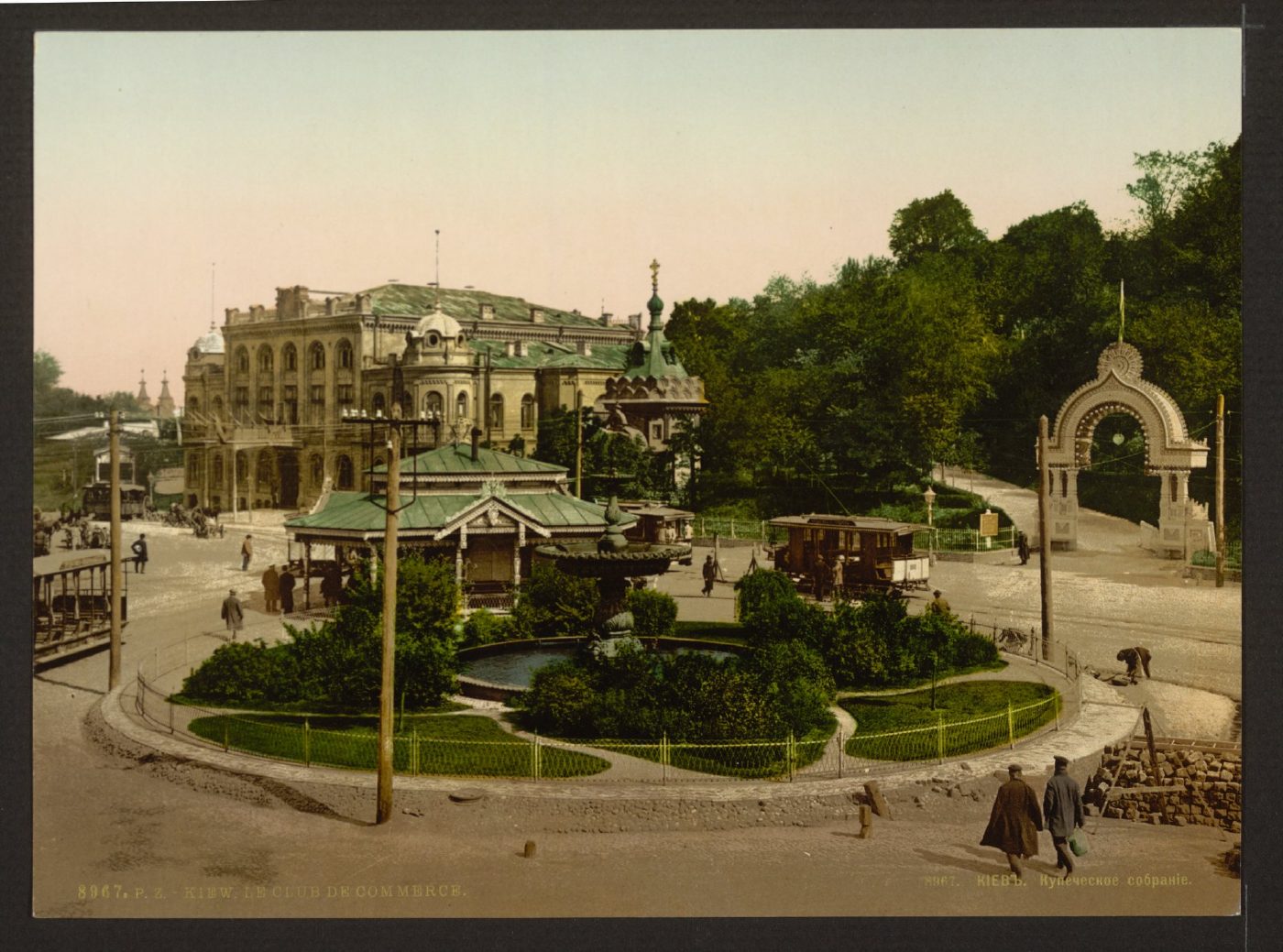
European Square, 2 Volodymyrskyi UzvizMerchants' Assembly and Tsarska SquareThe Merchants' Assembly building (now the National Philharmonic) and the entrance arch of the Merchants' Garden on an 1890s photochrom. Today this is European Square with a roundabout, and the hillside park is part of Volodymyrska Hill.Archival photo: невідомий автор, бл. 1890–1900, Public domain · Wikimedia Commons
Modern photo: Волтарс, 2009, CC BY-SA 4.0 · Wikimedia Commons -
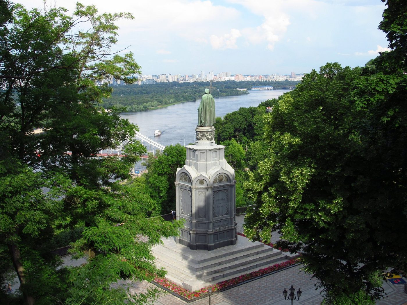
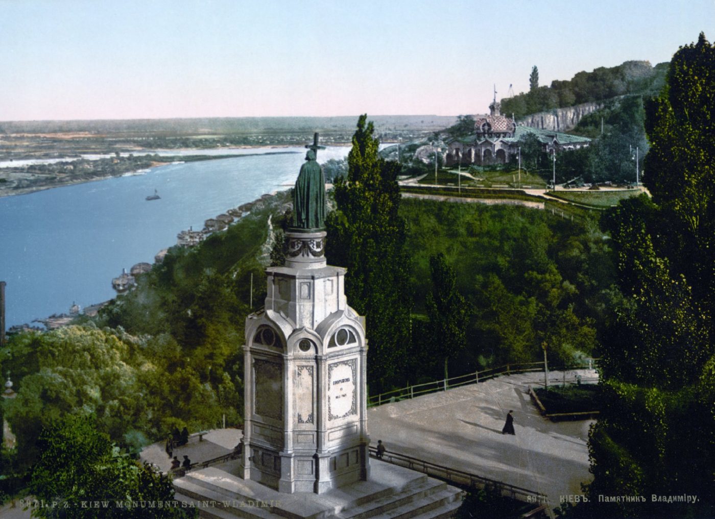
Volodymyrska HillVolodymyr Monument above the DniproThe monument to Prince Volodymyr (1853) on Volodymyrska Hill overlooking the Dnipro, on an 1890s photochrom. The monument still stands in the same place; high-rise districts are now visible on the Dnipro's left bank.Archival photo: невідомий автор, бл. 1890–1905, Public domain · Wikimedia Commons
Modern photo: Константинъ, 2021, CC BY-SA 4.0 · Wikimedia Commons -
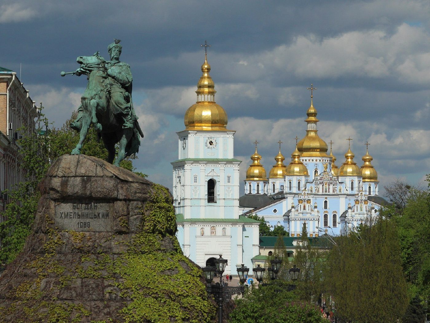
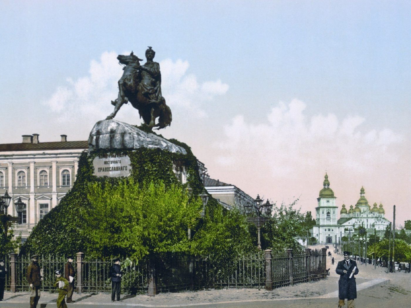
Sofiiska SquareBohdan Khmelnytsky MonumentMikhail Mikeshin's monument to Bohdan Khmelnytsky, unveiled in 1888, in an 1890s photochrom. In the background on the right is St Michael's Golden-Domed Cathedral, destroyed in the 1930s and rebuilt in the 1990s. The monument remains one of the symbols of Kyiv.Archival photo: невідомий автор, бл. 1890–1905, Public domain · Wikimedia Commons
Modern photo: Didkov, 2021, CC BY-SA 4.0 · Wikimedia Commons -
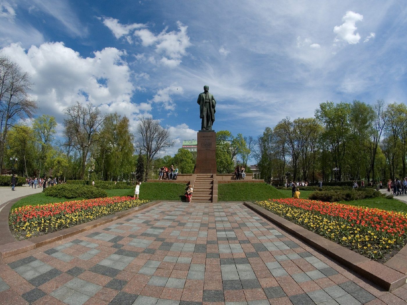
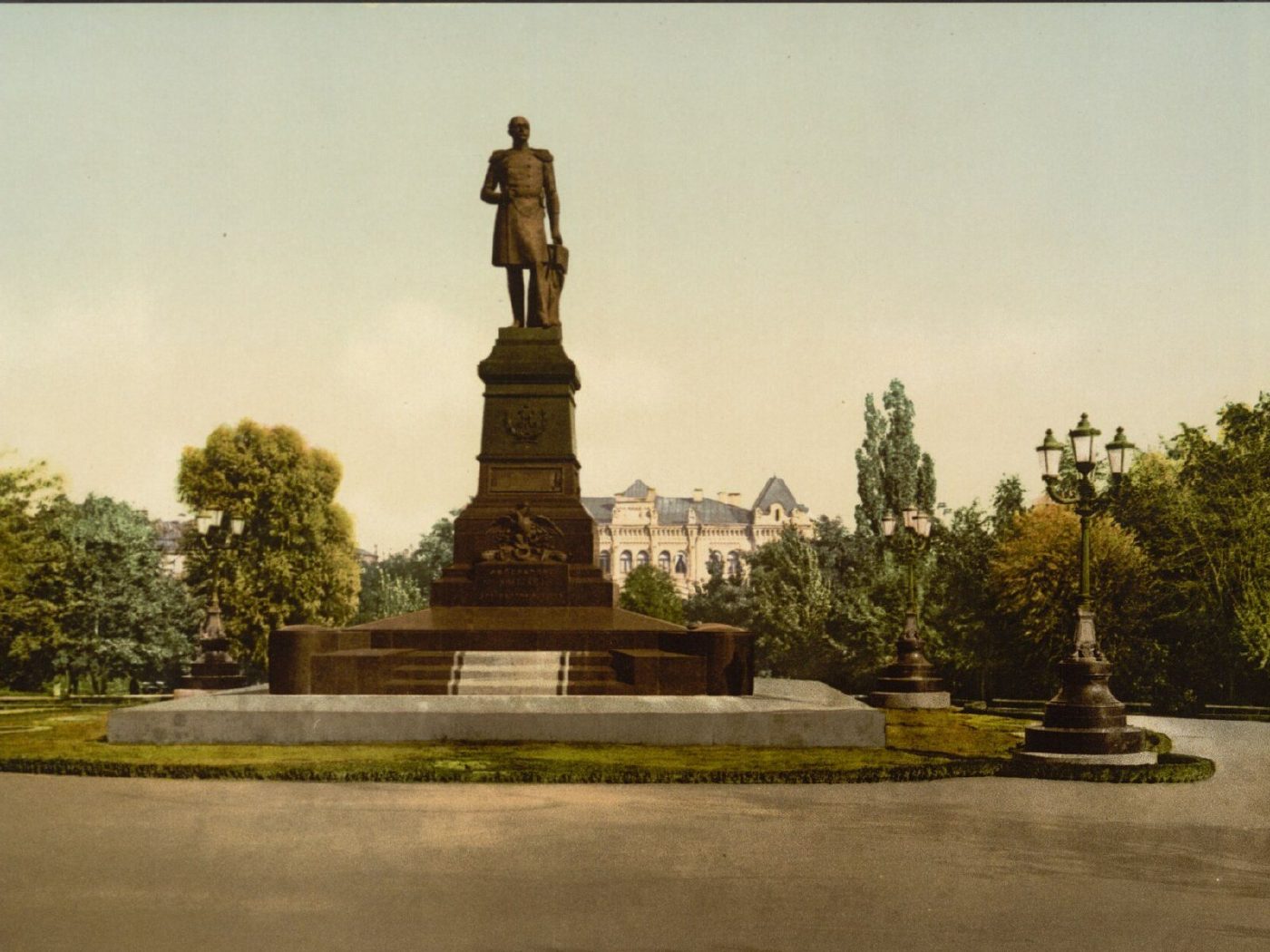
Shevchenko ParkMonument to Nicholas IThe monument to Emperor Nicholas I opposite St Volodymyr University, unveiled in 1896. It was dismantled in 1920, and in 1939 a monument to Taras Shevchenko was erected on the same spot in the square, now Shevchenko Park.Archival photo: невідомий автор LCCN 2001697435, бл. 1896–1900, Public domain · Wikimedia Commons
Modern photo: SergKh78, 2016, CC BY-SA 4.0 · Wikimedia Commons


From the archive
-
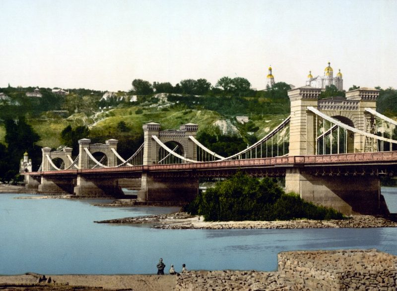
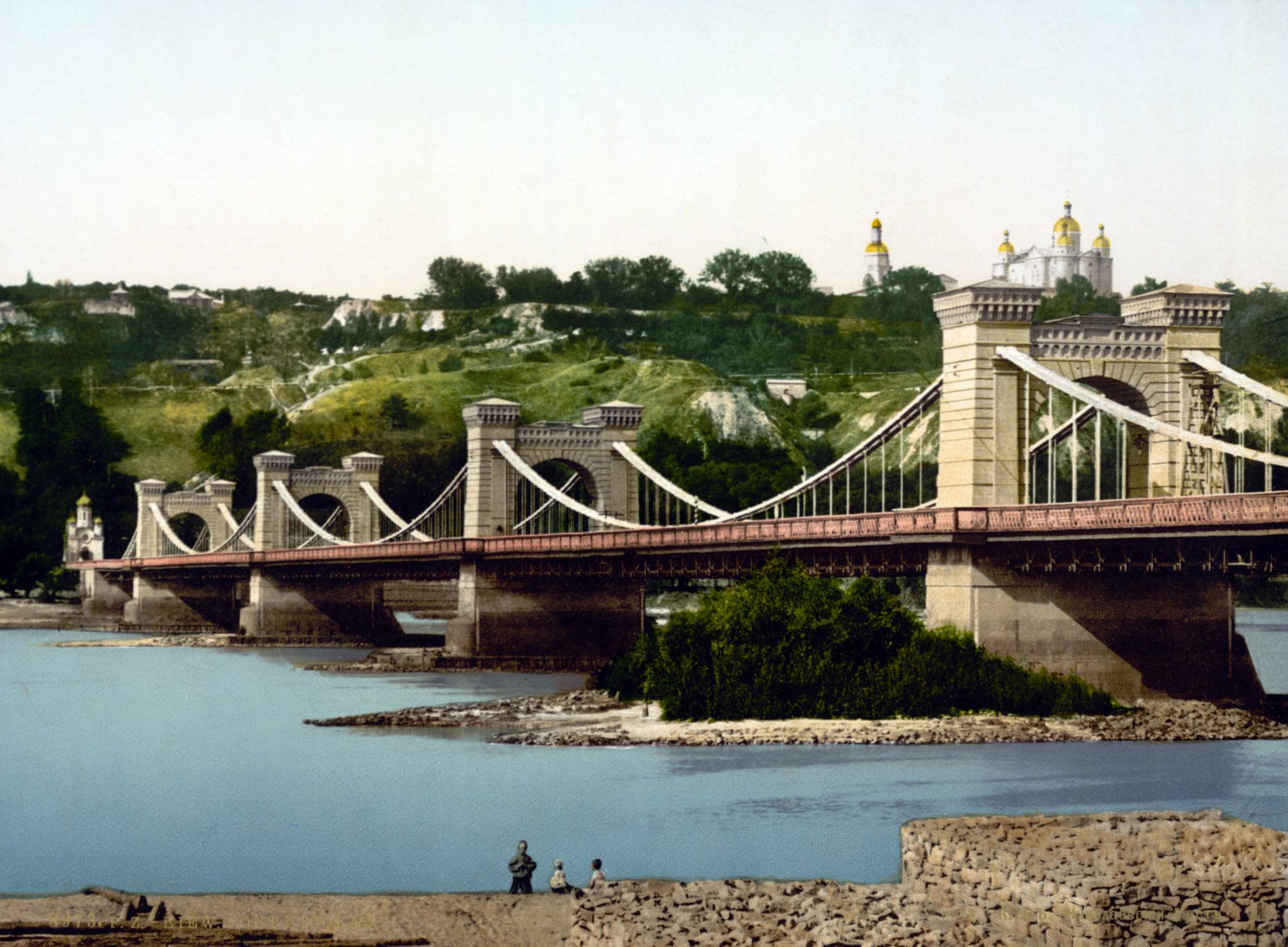
Dnipro River below Volodymyrska HillNicholas Chain BridgeThe chain bridge across the Dnipro, opened in 1853, on an 1890s photochrom print. It was blown up in 1920; the Metro Bridge now stands roughly on the same spot.Archival photo: невідомий автор, бл. 1890–1900, Public domain · Wikimedia Commons -
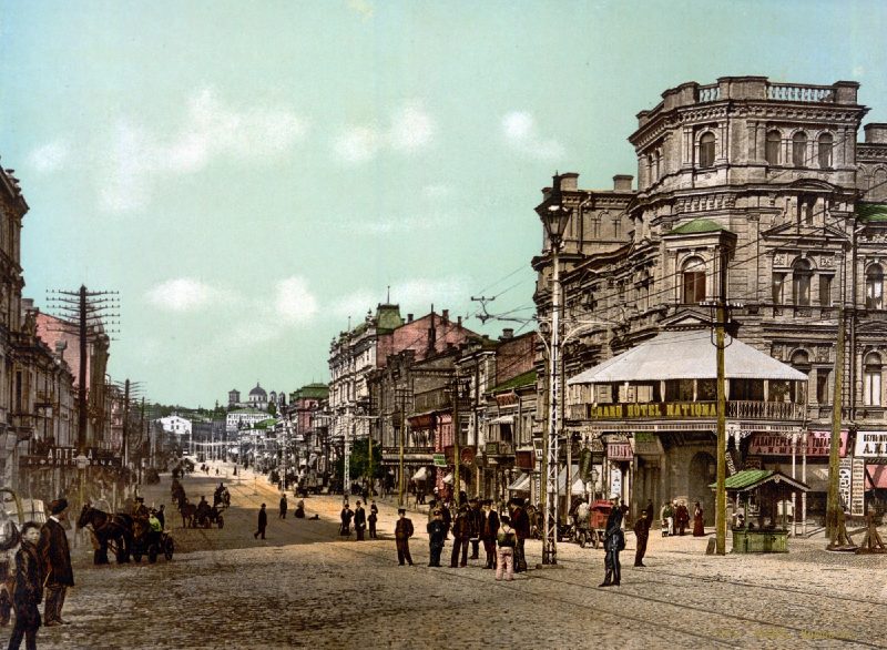
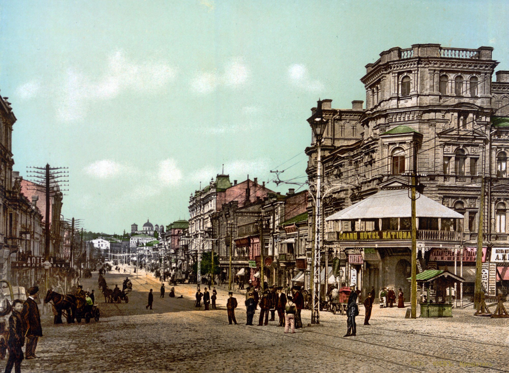
Khreshchatyk, near Bessarabska SquareKhreshchatyk and the Grand Hotel NationalKhreshchatyk on an 1897 postcard: the Grand Hotel National on the right, horse cabs on the cobbles and utility poles and wires above the street.Archival photo: невідомий автор, 1897, Public domain · Wikimedia Commons -
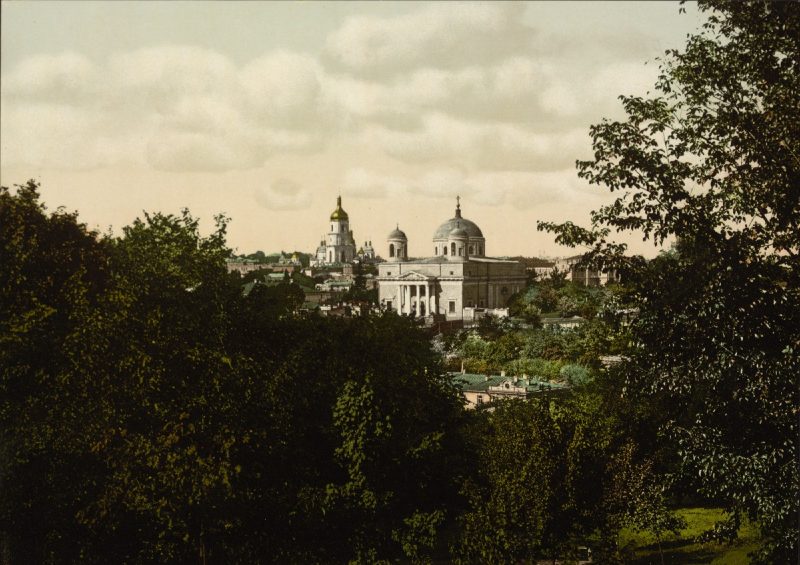
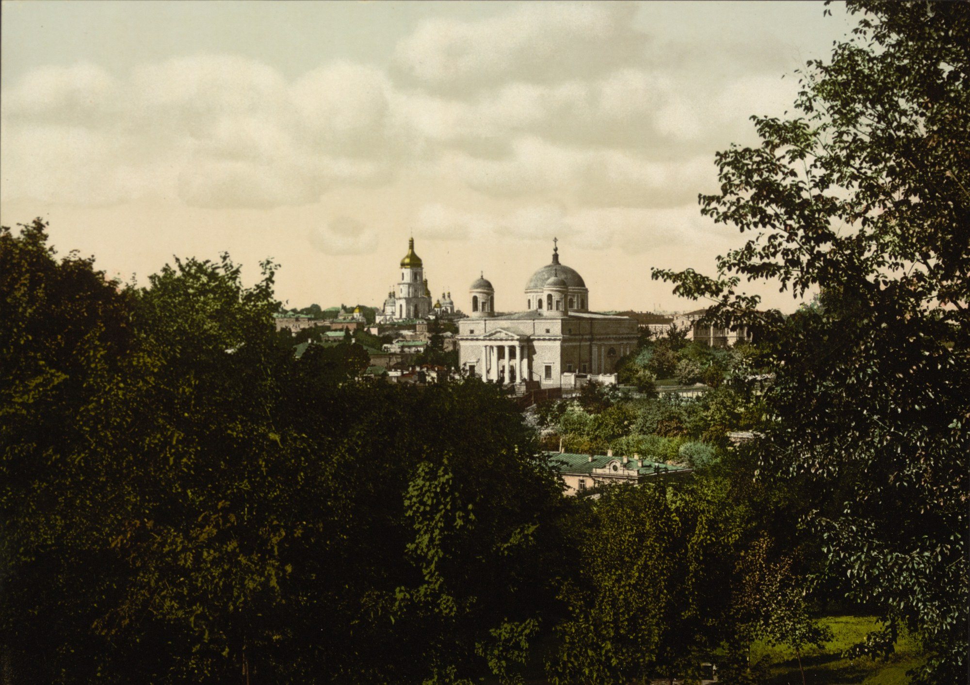
17 Kostolna StreetSt Alexander's ChurchThe Roman Catholic Church of St Alexander (1817–1842) above green slopes in an 1890s photochrom. Kyiv's oldest Catholic church was closed in the 1930s and turned into a planetarium; it was returned to the parish in the 1990s.Archival photo: невідомий автор LCCN 2001697420, бл. 1890–1900, Public domain · Wikimedia Commons -
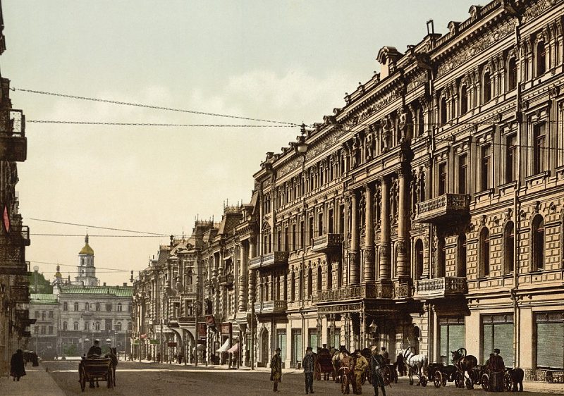
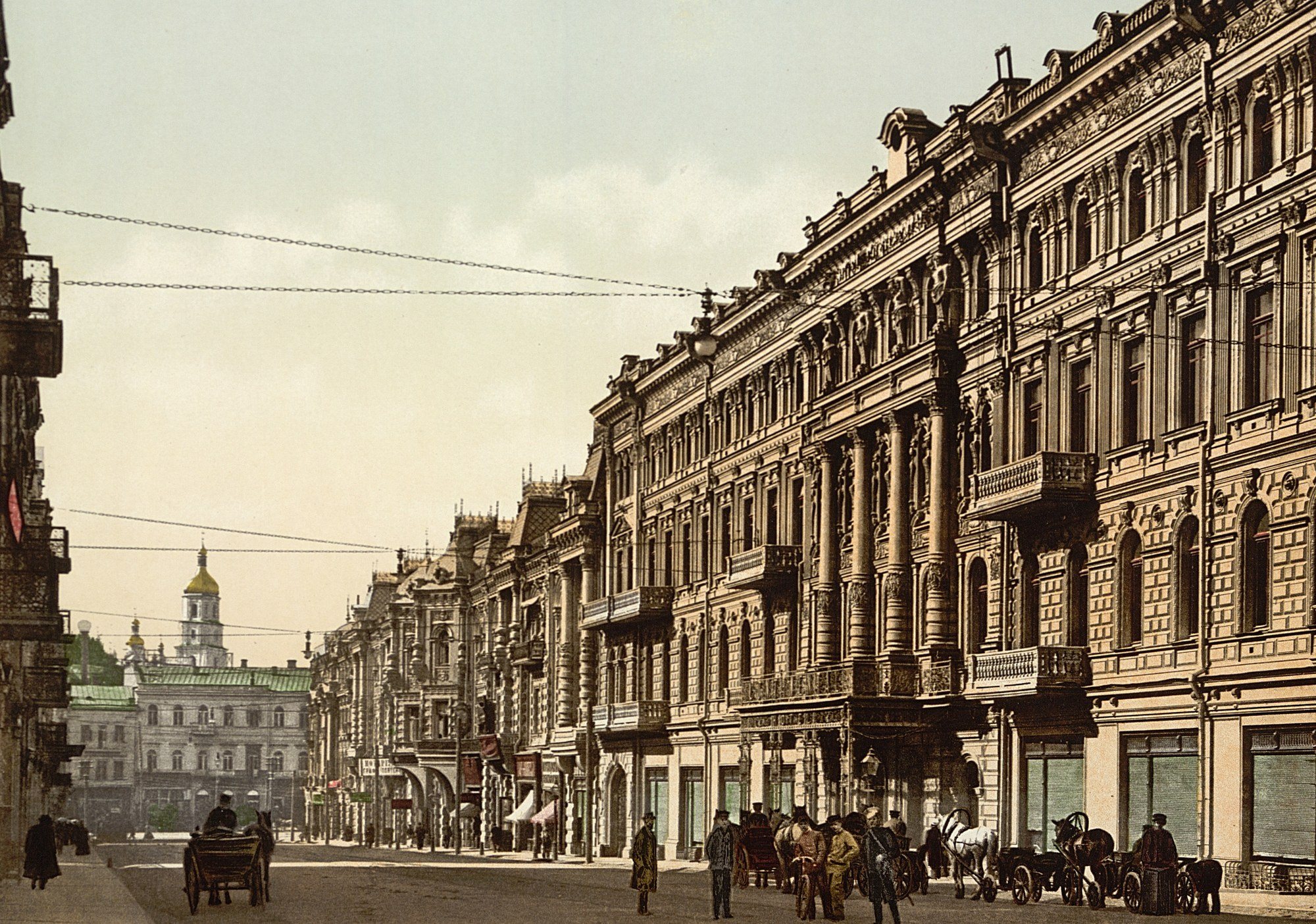
Arkhitektora Horodetskoho StreetNikolaievska Street and the ContinentalNikolaievska Street (now Arkhitektora Horodetskoho Street), laid out in the 1890s, with the fashionable Continental Hotel, where the city's wealthiest visitors stayed. The hotel burned down in September 1941; the National Music Academy of Ukraine now stands on its site.Archival photo: невідомий автор LCCN 2001697432, бл. 1900, Public domain · Wikimedia Commons -
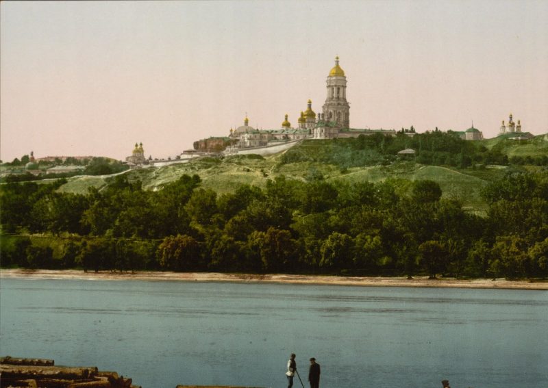
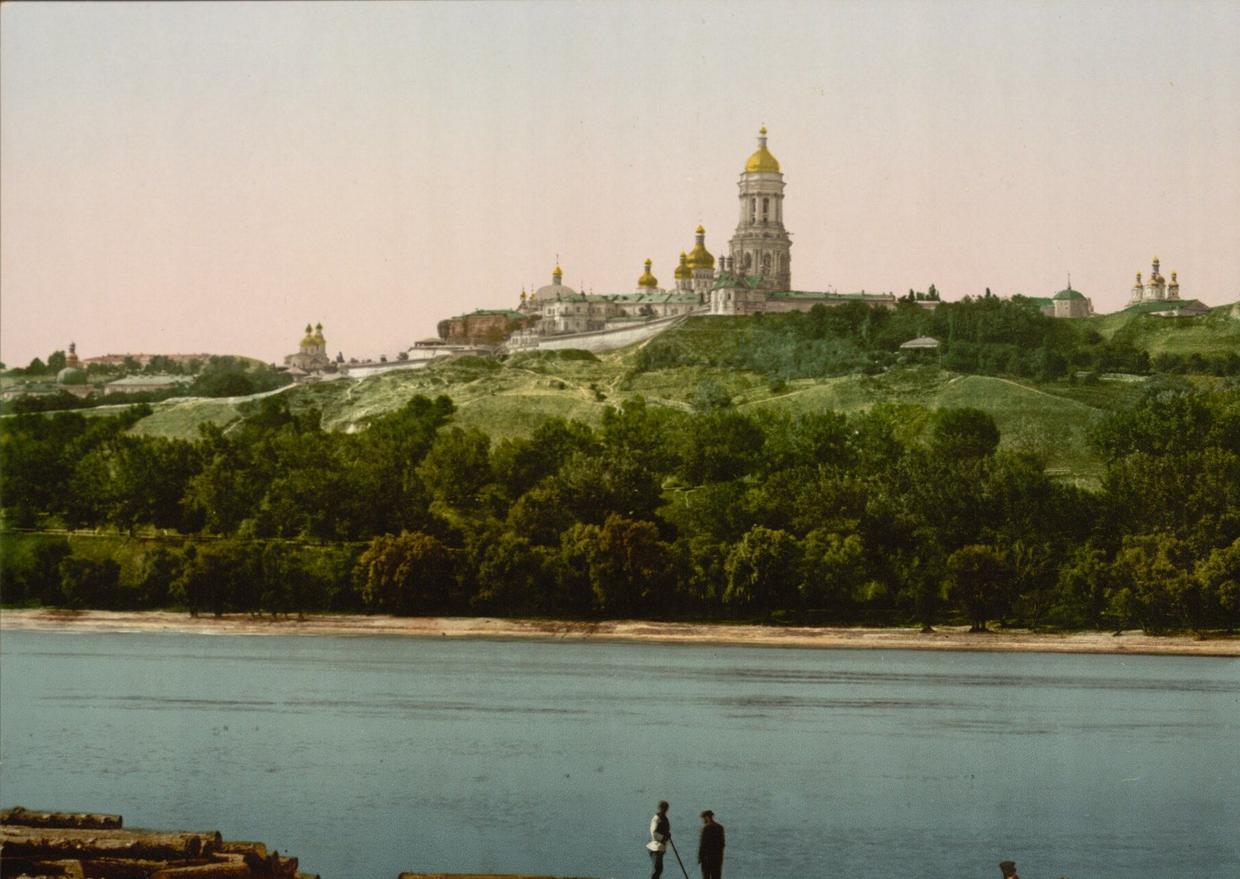
The Dnipro by PecherskThe Lavra from the DniproThe Kyiv Pechersk Lavra on the green bluffs of the right bank, as passengers on Dnipro steamers saw it. Above the trees rise the Great Lavra Bell Tower and the domes of the Dormition Cathedral. Today the Paton Bridge crosses this view and the slopes are parkland.Archival photo: невідомий автор LCCN 2001697428, бл. 1890–1900, Public domain · Wikimedia Commons -
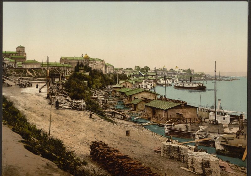
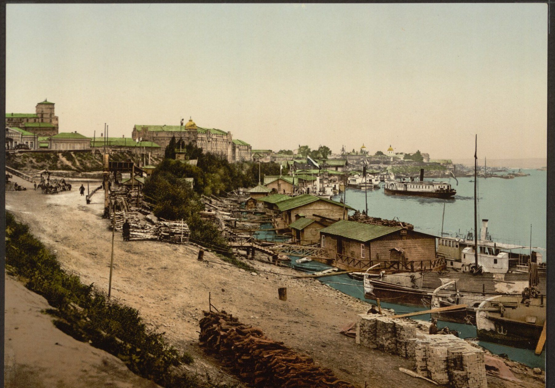
Naberezhne Highway, PodilPiers on the DniproThe riverside near Podil at the end of the 19th century: landing stages, barges, steamers and stacks of firewood on the sandy bank. The Dnipro was then the city's main trade route. Today this is the area of Poshtova Square, the river terminal and a wide embankment.Archival photo: невідомий автор LCCN 2001697440, бл. 1890–1900, Public domain · Wikimedia Commons -
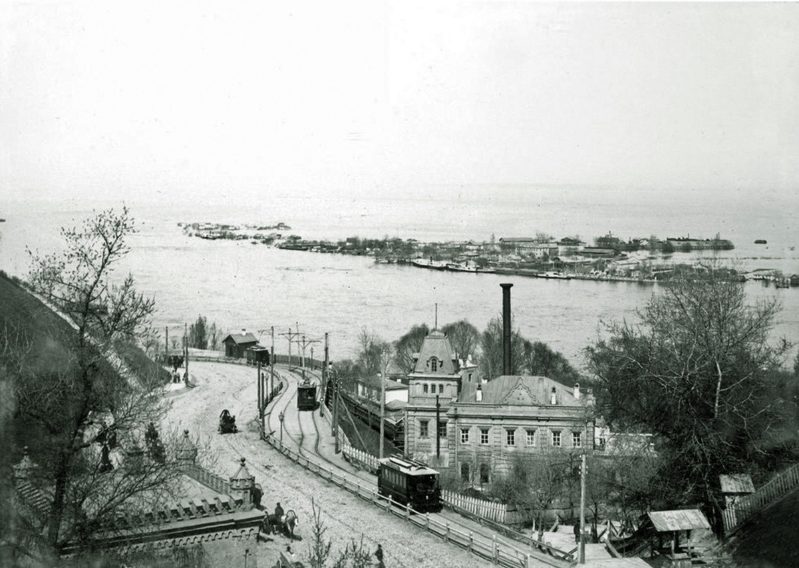
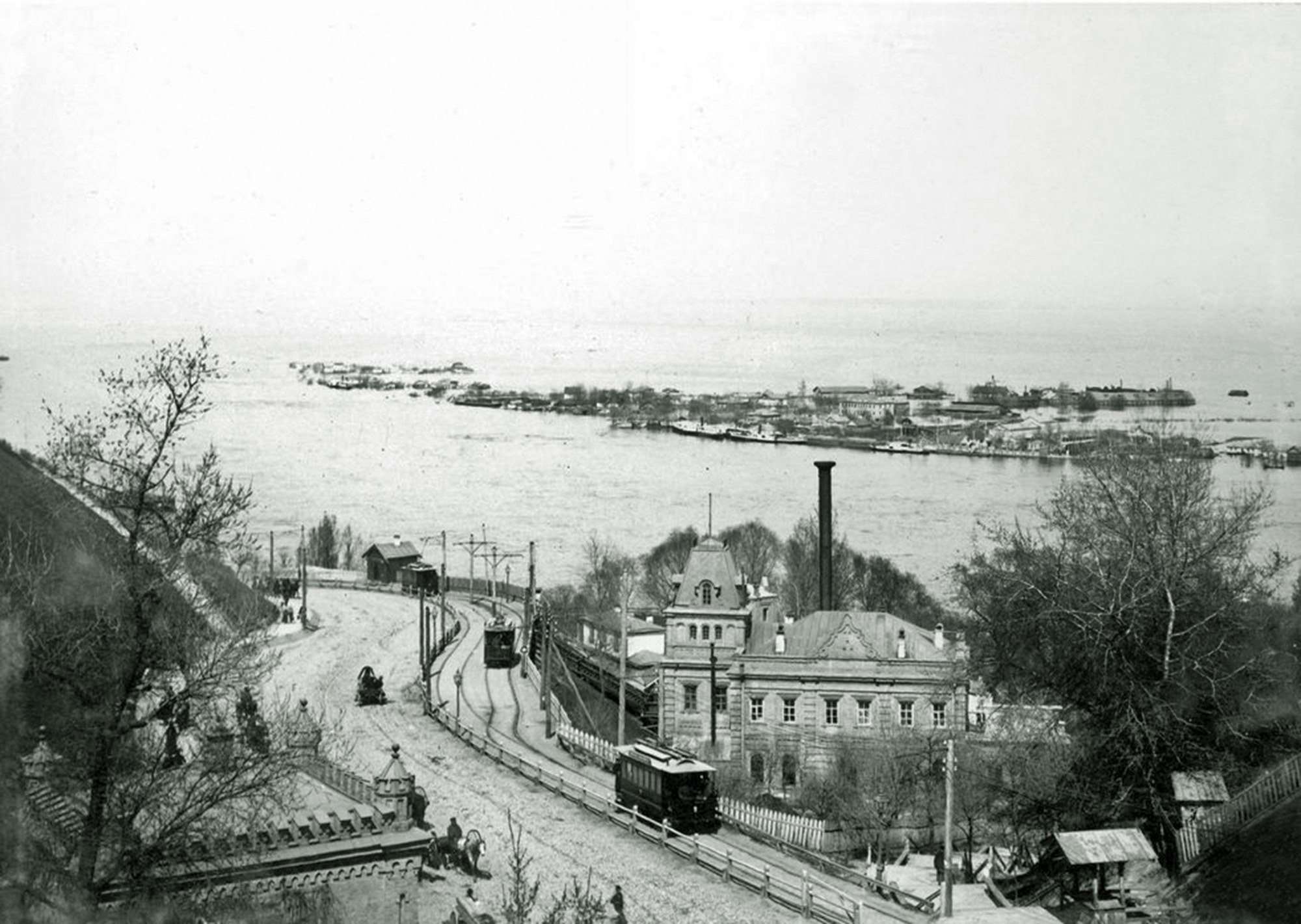
Volodymyrskyi UzvizA tram on the descentOleksandrivskyi (now Volodymyrskyi) Uzviz in 1895: a tram heads down to Podil past the filter house of the city waterworks. Ukraine's first electric tram began running here in 1892. Across the Dnipro, Trukhaniv Island lies under the spring flood.Archival photo: невідомий автор, 1895, Public domain · Wikimedia Commons -
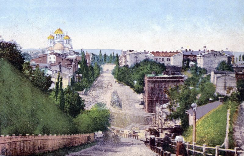
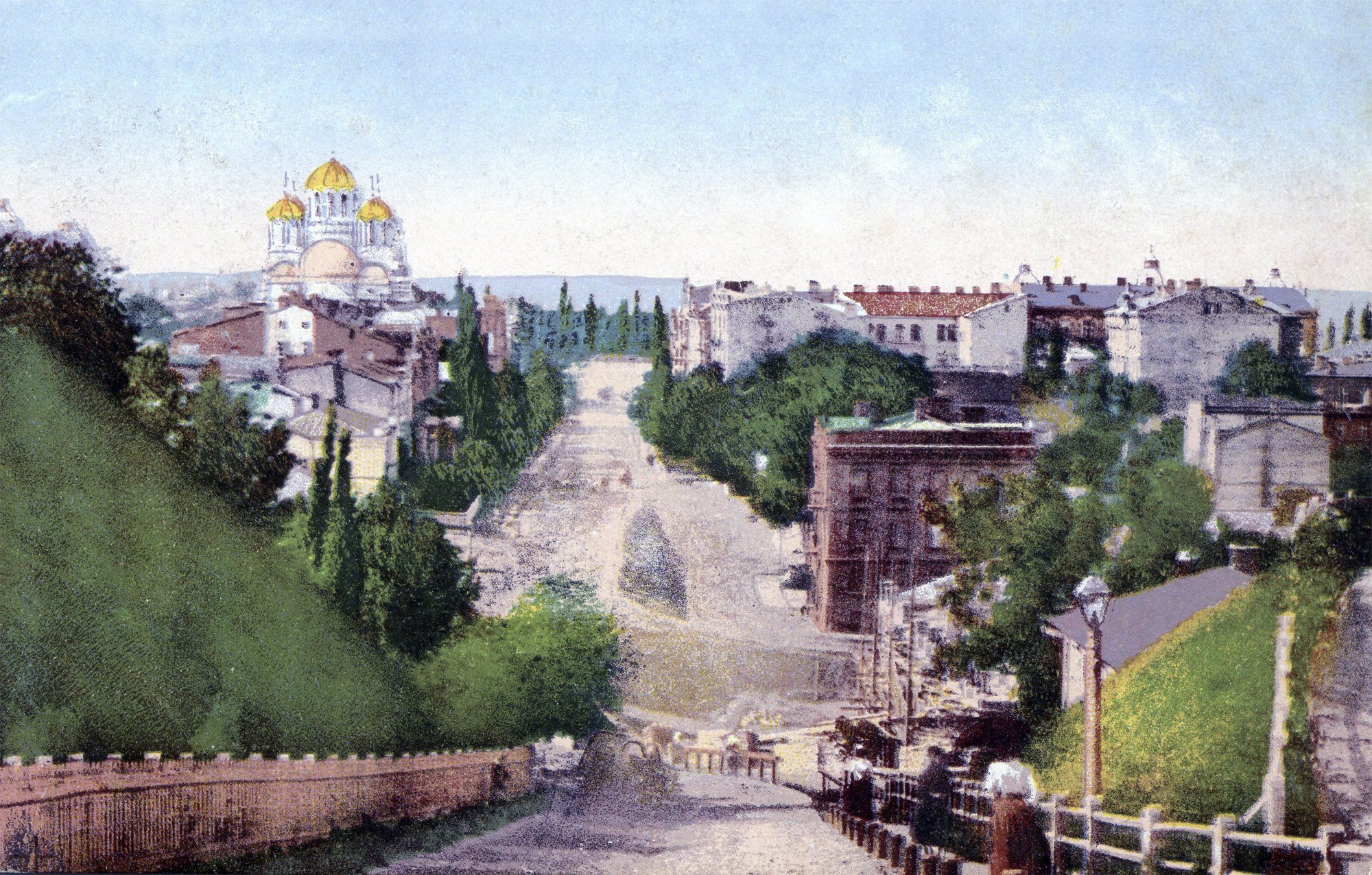
Ivana Franka StreetNesterivska StreetNesterivska Street (now Ivana Franka Street) runs down into the Afanasiivskyi ravine, with St Volodymyr's Cathedral, consecrated in 1896, at the top. This postcard by August Richter's publishing house shows a district not yet fully built up: steep slopes, fences and new apartment houses.Archival photo: невідомий автор, 1899, Public domain · Wikimedia Commons
Have old photos of Kyiv? Send them to [email protected] and we will publish them with credit. Kyiv timeline →